Overall Setup
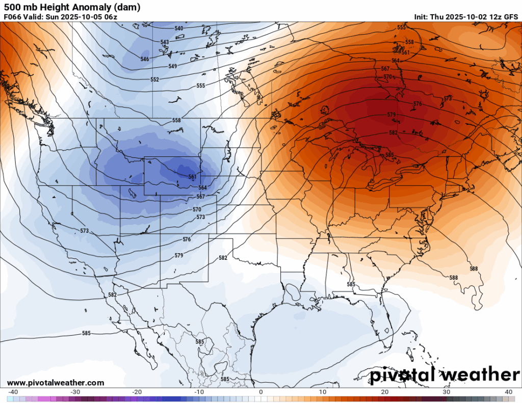
Right now we are under an area of ridging, which is keeping the weather quiet and rain-free. By Sunday, we start to feel an influence from a trough of low pressure which has been parked just off the Gulf coast. That is when we could see some rain in the forecast as well as a return of some muggy humidity.
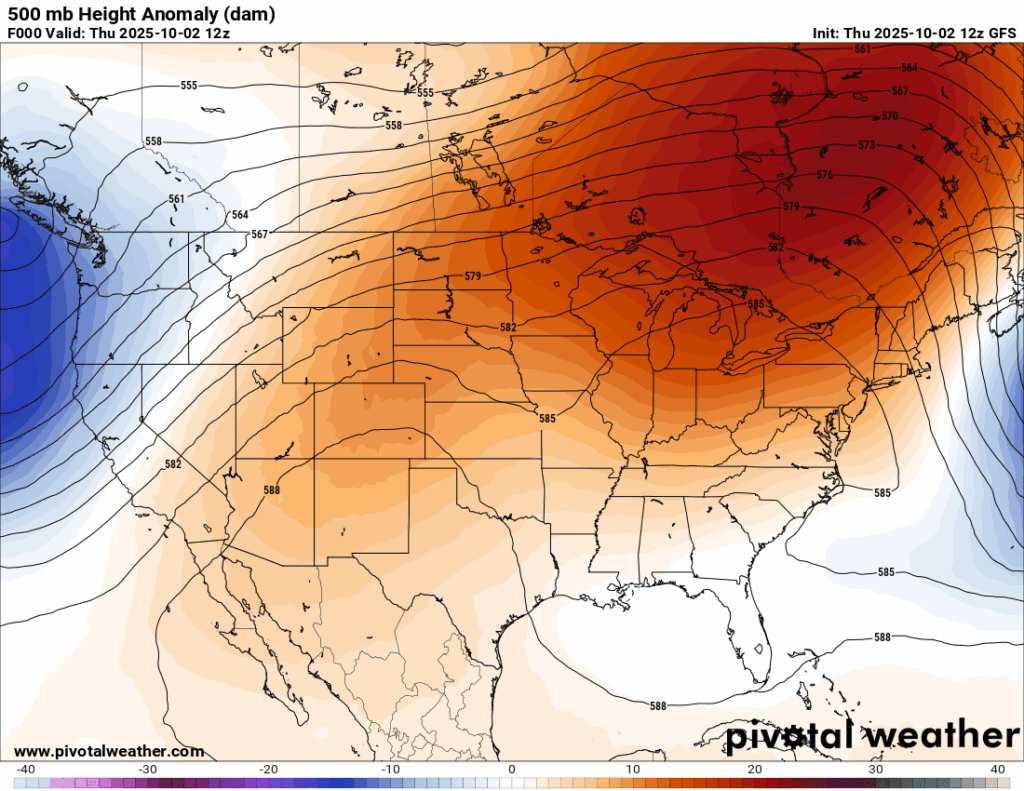
For tomorrow, conditions will be likely dry for not just us, but most of everyone in the eastern US, whom of which are under the huge ridge of high pressure. This persistent ridging that we have been seeing is responsible for the lack of rain and above average temperatures we have been seeing. We’ll see a little break on Sunday/Monday with temperatures closer to average with some rain, but the heat and dryness is expected to return thereafter.

Tonight’s Forecast
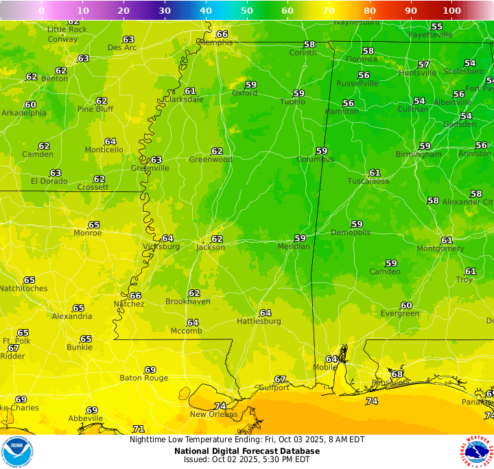
Low temperatures tonight will vary by location, with central/southern MS getting into the low 60s and maybe some high 50s, and southwestern MS and most of LA sitting in the upper 60s. New Orleans stays pretty mild, as usual, sitting in the lower 70s. A quick passing shower is possible for those very close to the coast earlier in the evening, otherwise a quiet night is expected.
Tomorrow’s Forecast
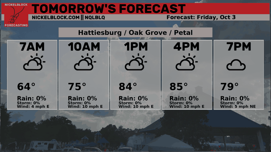
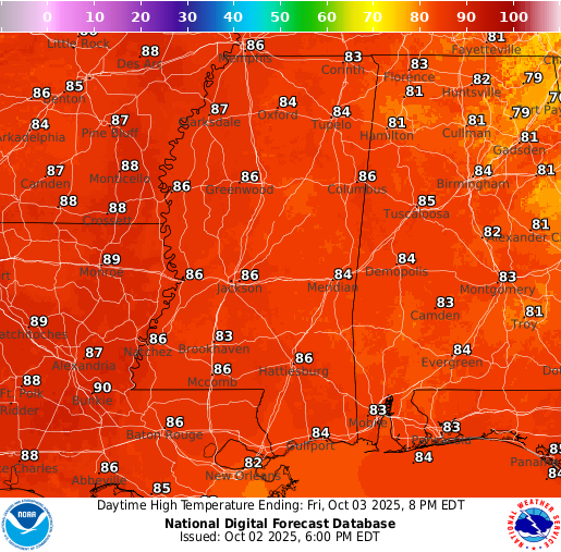
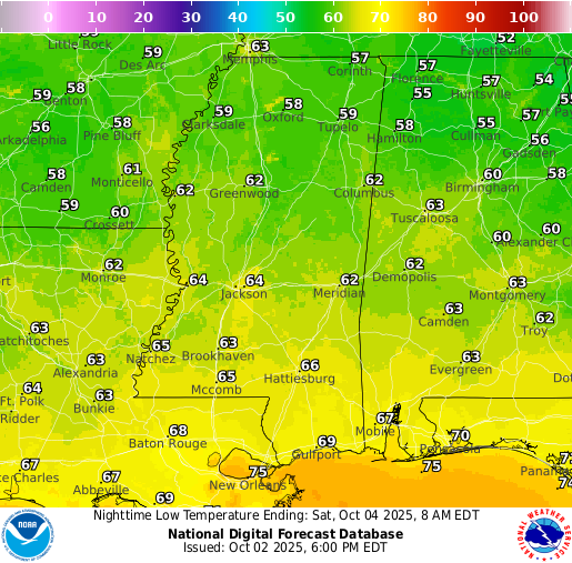
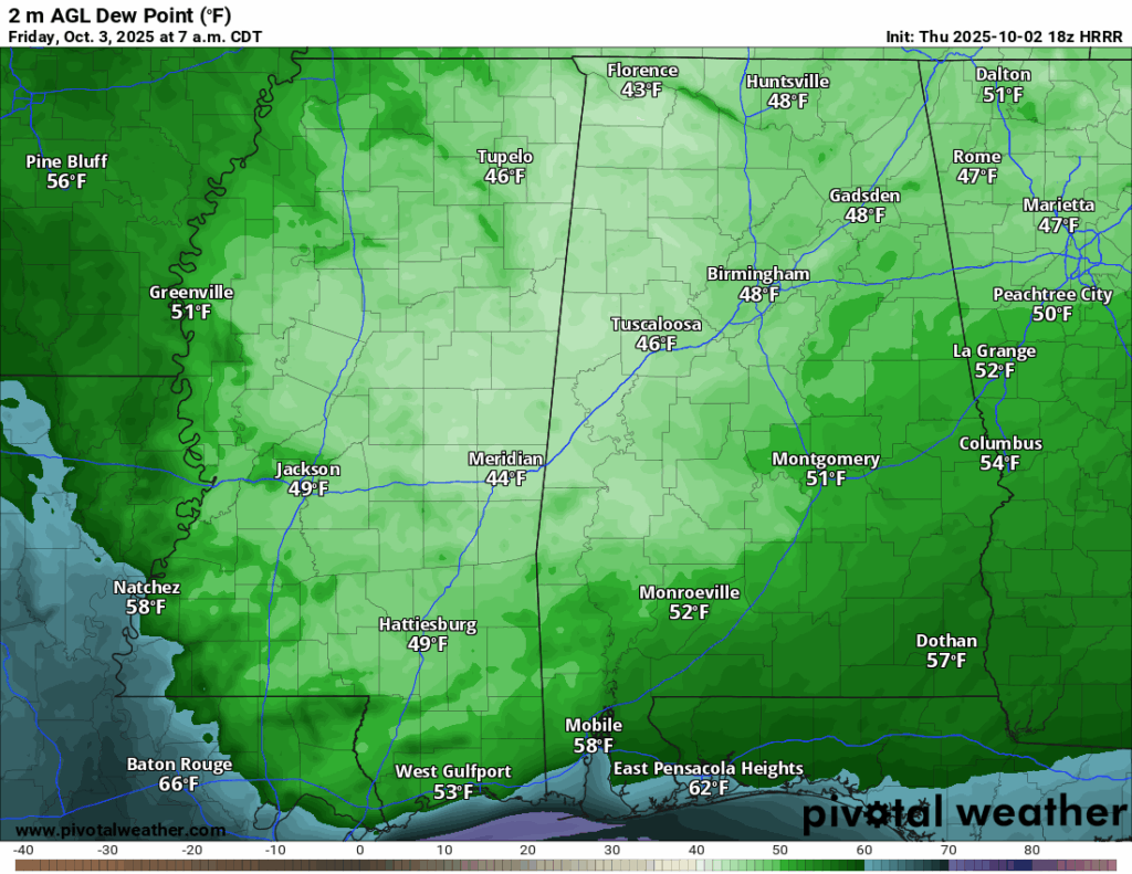
Friday will be another quiet day, with highs in the low-to-mid 80s and overnight lows similar to tonight’s. Early tomorrow morning, dew points will drop into the 40s! We’re under a very dry air mass that will feel refreshing on the way to work. We’ll stay on the less humid side of the front through Saturday, so conditions remain comfortable. Expect a sunny start to the day, with clouds gradually increasing and skies turning mostly cloudy by evening
Weekend Forecast (Sat & Sun)
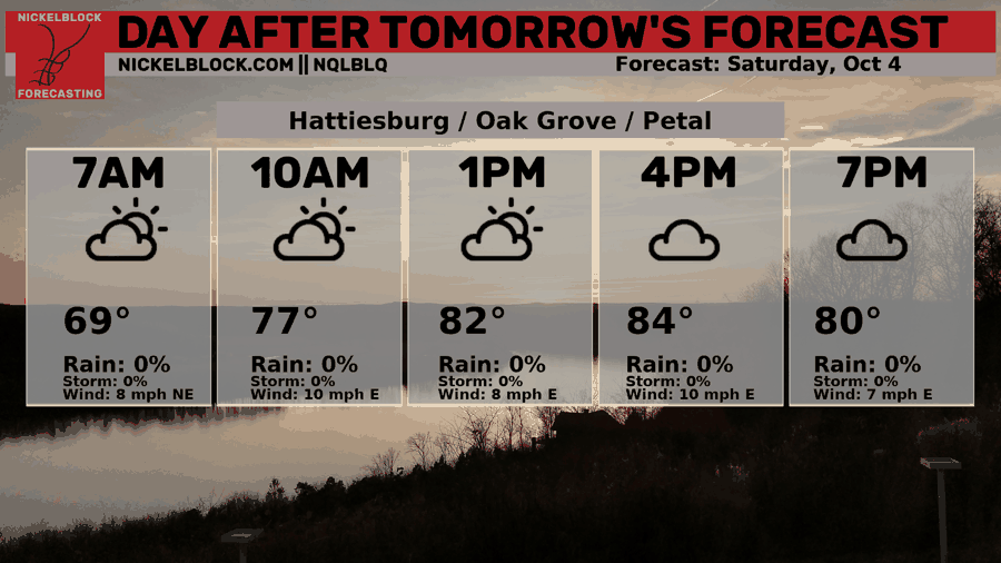

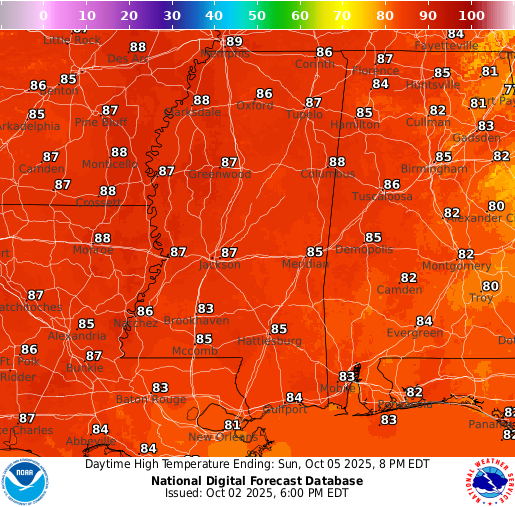
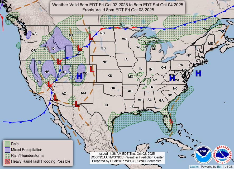
Saturday will be warm and mostly sunny, with highs in the mid-80s and humidity starting to creep back in. Clouds will build late in the day, and by Saturday night an isolated shower or two can’t be ruled out. On Sunday, the front pushes onshore and moisture increases, leading to scattered showers and a few storms developing through the afternoon. It will feel more humid again, with highs holding in the low-to-mid 80s.
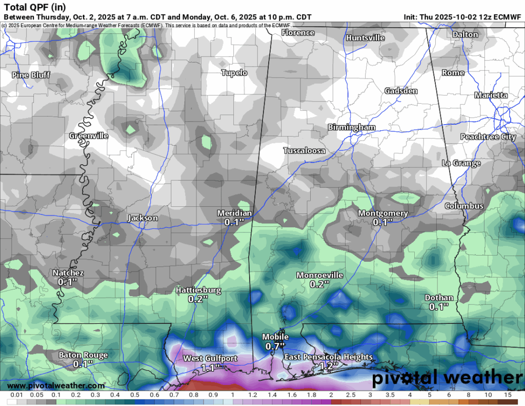
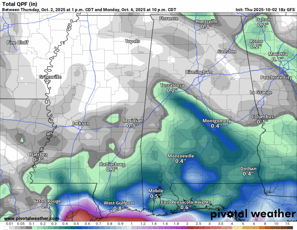
As you can see, both the Euro and GFS (as well as the WPC) are going for a light rain event, with more accumulation closer to the coast. A few tenths of an inch are expected for the mainland and up to an inch or two closer to the coast. Not enough rain as we would like, but certainly something!
Extended Local Outlook
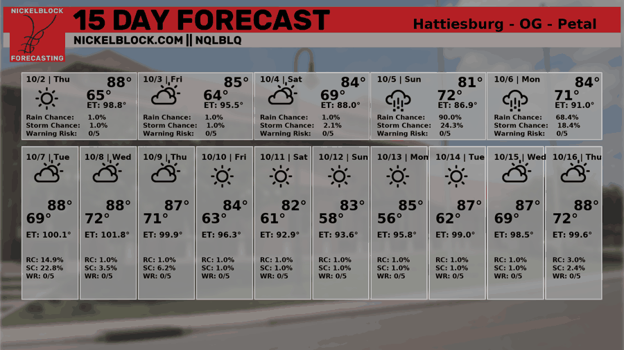
We could see some leftover rain on Tuesday, which would be more isolated than Sunday and Monday’s rain. After that, we are looking at much of the same that we’ve been seeing the past few weeks – above average temperatures and near/below average rainfall.

Latest Tropical Update
Atlantic:
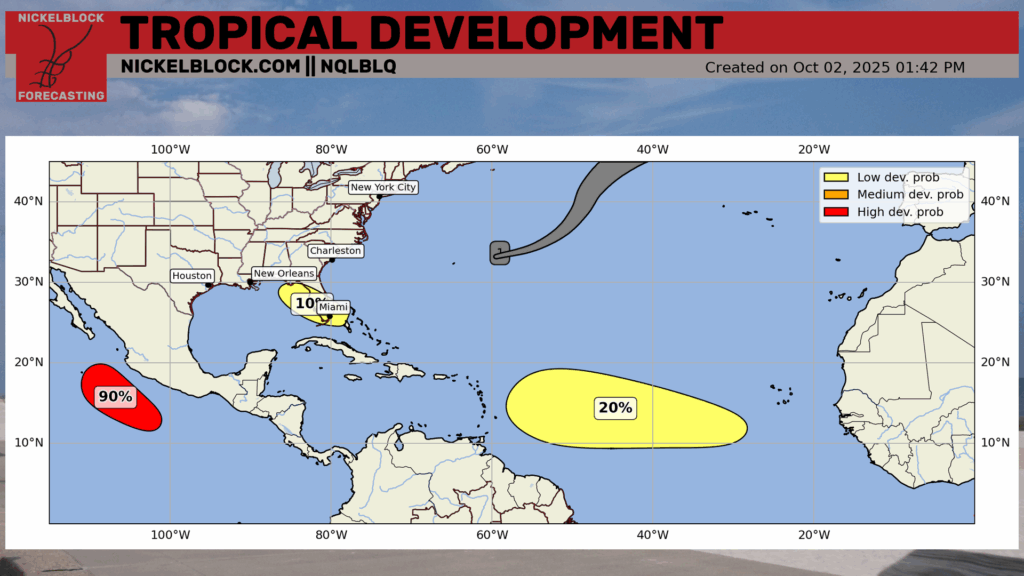
Hurricane Imelda struck Bermuda as a Category 2 Hurricane yesterday and is now off into the open Atlantic. There are two areas to watch highlighted by the NHC in the Atlantic. One of those is over Florida into the northeastern Gulf, which has only a 10 percent chance of developing into something tropical. This is the low pressure that I mentioned in the forecast along the stationary boundary over the northern Gulf. I’m not expecting this to develop, and if it does it’s not looking to be anything to worry about aside from some beneficial rain!
The second area to watch is located off of Africa with a 20 percent chance of development in the next 7 days and there’s a zero percent chance in the next 2 days. This one is something that is worth watching, as the ensembles keep its track into the northern Caribbean. Those systems that track more south into the Carribean have a history of continuing west and then into the Gulf, but right now they show a turn out into the open Atlantic. We will be watching this closely throughout the week!
Eastern/Central Pacific:
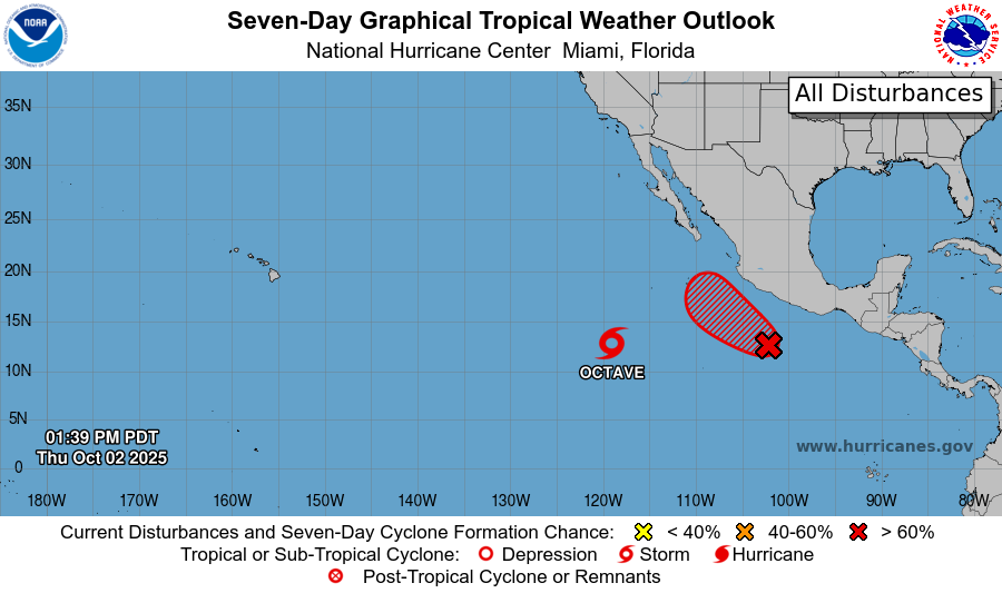
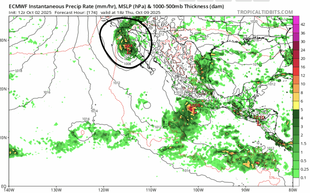
In the Eastern Pacific, we still have Tropical Storm Octave swirling around itself, affecting just the fish! The area to watch off of the coast of Mexico has a fairly good chance of developing into a tropical system within the week (90 percent chance). This one the coast of Baja California needs to watch closely, as models bring this system right into the coast, and then it’s moisture into the southeast US thereafter.
REGIONAL DAY TO DAY FORECAST
Tonight: Mostly clear with lows in the mid 60s. East-northeast winds 5 to 10 mph.
Friday: Sunny with highs in the mid 80s. East-northeast winds around 10 mph, gusting up to 20 mph.
Friday Night: Mostly cloudy with lows in the mid 60s. East-northeast winds around 5 mph.
Saturday: Partly sunny with highs in the mid 80s. East winds 10 to 15 mph, with gusts as high as 20 mph.
Saturday Night: Mostly cloudy with lows in the upper 60s. A stray shower is possible. Chance of rain 20 percent.
Sunday: Mostly cloudy with highs in the mid 80s. Scattered showers throughout the day. East winds 10 to 15 mph, with gusts as high as 20 mph. Chance of rain 60 percent.
Sunday Night: Mostly cloudy with lows in the upper 60s. A few lingering showers are possible. East-northeast winds 5 to 10 mph, with gusts as high as 20 mph. Chance of rain 20 percent.
Monday: Partly sunny with highs in the mid 80s. A few showers are possible. East-northeast winds 5 to 10 mph. Chance of rain 30 percent.
Monday Night: Partly cloudy with lows in the upper 60s. East-northeast winds around 5 mph, becoming calm.
Tuesday: Mostly sunny with highs in the upper 80s. An isolated shower cannot be ruled out. Chance of rain 20 percent.
Tuesday Night: Partly cloudy with lows around 70.
Wednesday: Mostly sunny with highs near 89. A stray shower is possible. Chance of rain 20 percent.
Wednesday Night: Partly cloudy with lows in the upper 60s.
Thursday: Sunny with highs in the upper 80s.


