Overall Setup
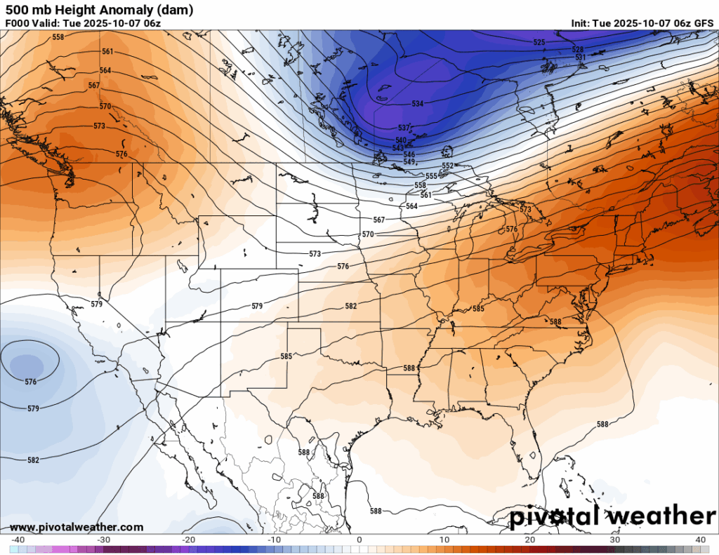

Looking at the 500 mb height anomalies, we can see from the orange colors that we are still under an area of ridging, which is responsible for the above normal temperatures and muggy humidity we have been seeing. A cold front will sit to our north for a few days. Below the front is the same hot/humid airmass we currently see now, but above it is a slightly cooler and less humid airmass that could make it’s way down to our region by Friday into the weekend.

Tonight’s Forecast
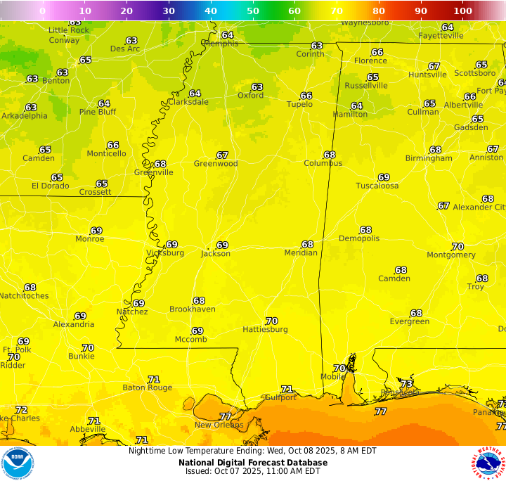
Tonight’s low temperatures are a bit mild in the low 70s for most, with New Orleans sitting at 77! After a few scattered showers or thunderstorms roll through in the late evening, the rest of the night should be rain free. Some patchy fog is possible after 9 or 10 pm through the overnight and into the morning hours as the dew point temperature and the actual temperature become the same, so be sure to take extra caution if you will be driving overnight or for the AM commute.
Tomorrow’s Forecast
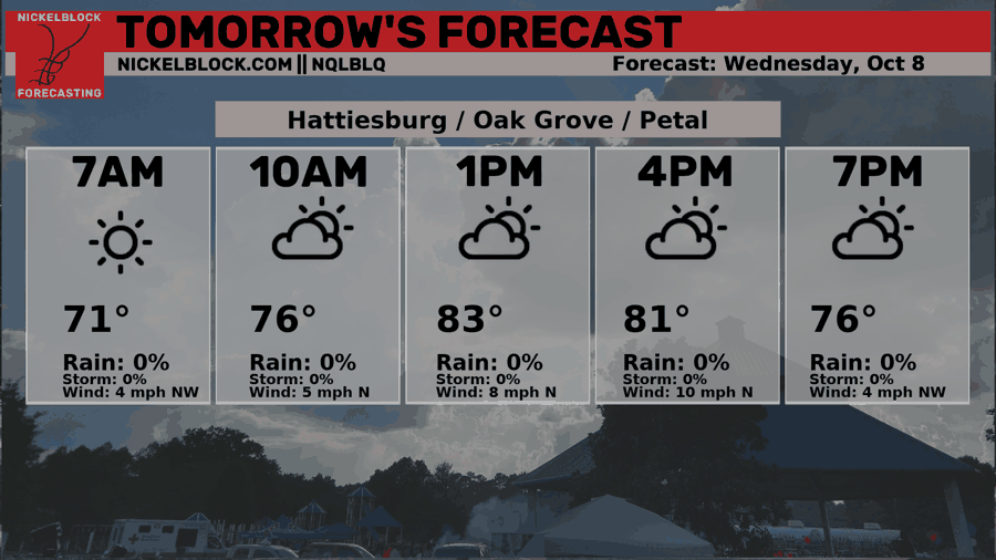
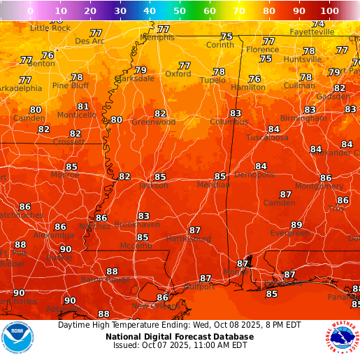
After that fog burns up an hour or two after sunrise, we are left with some partly to mostly cloudy conditions throughout the day with high temperatures sitting in the mid-to-high 80s. Humidity will still be a nuisance for tomorrow with dew points sitting in the 70s. Because of that humidity and the presence of a surface trough to our east, we could see some pop-up afternoon thunderstorms, but models are fairly conservative with rainfall, so most areas will likely stay dry.
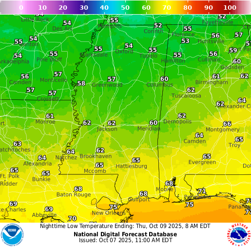
Thursday’s Forecast
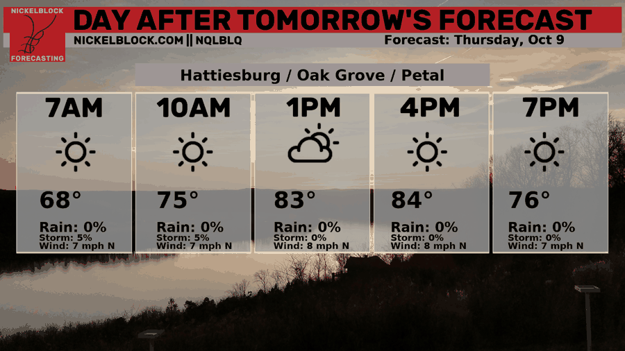
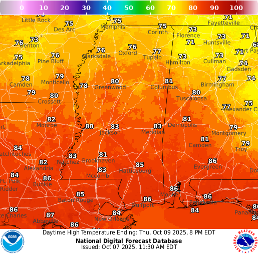
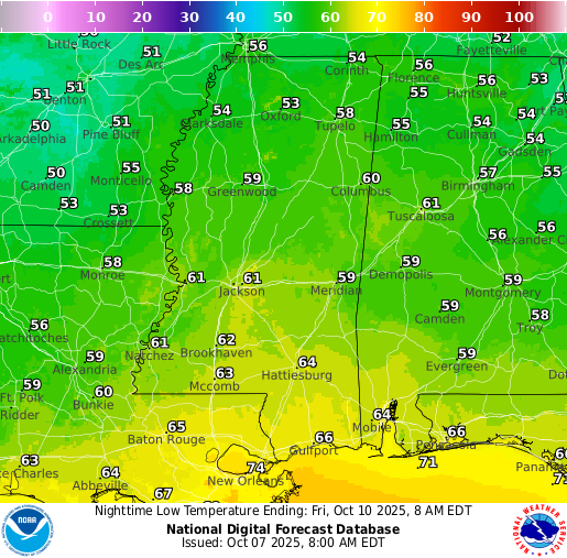
We make a little more progress in “cooling down” our temperatures on Thursday, with a high temperature in the low-to-mid 80s. Again, humidity will still feel high, however, the front will start to slide down into our area by Thursday night into Friday which will bring down the humidity a bit as well as allow our overnight lows to drop into the low 60s and even 50s for those further north!
Extended Local Outlook
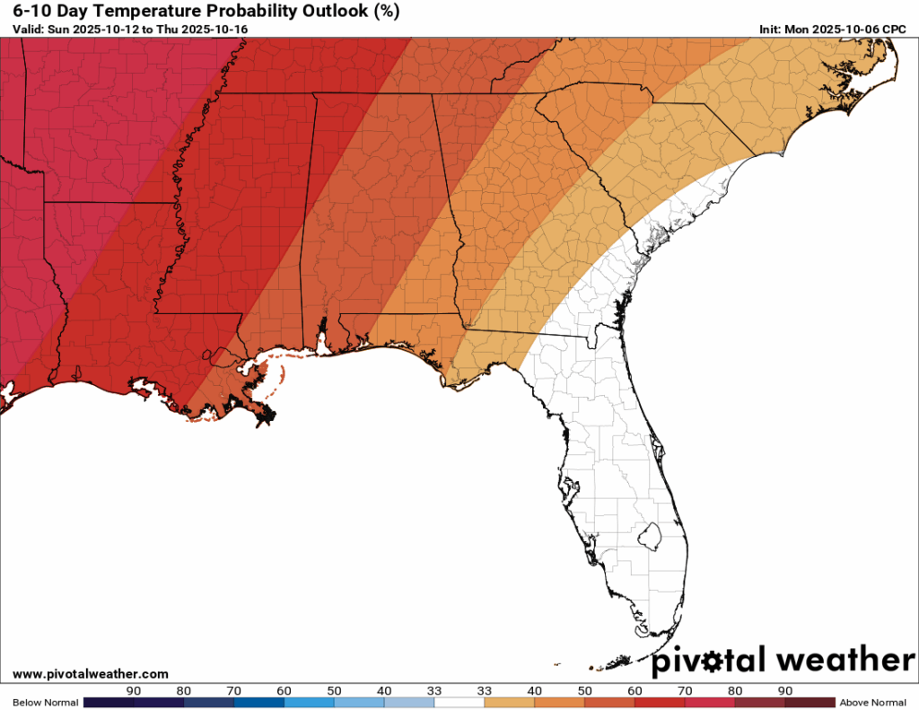
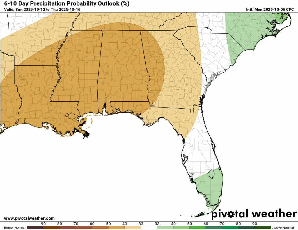
After the very slight “cooldown”, the CPC has us back into above normal temperatures for the 6-10 day time frame AND the 8-14 day timeframe as well. I wish I had better news for those who desperately want it to feel like October out there. Unfortunately, our area is also under a medium-high probability of below normal rainfall in the 6-10 day timeframe, as well as the 8-14 day timeframe. Why is that? – ridging in the upper level pattern will dominate the first half of October.

Latest Tropical Update
Atlantic:
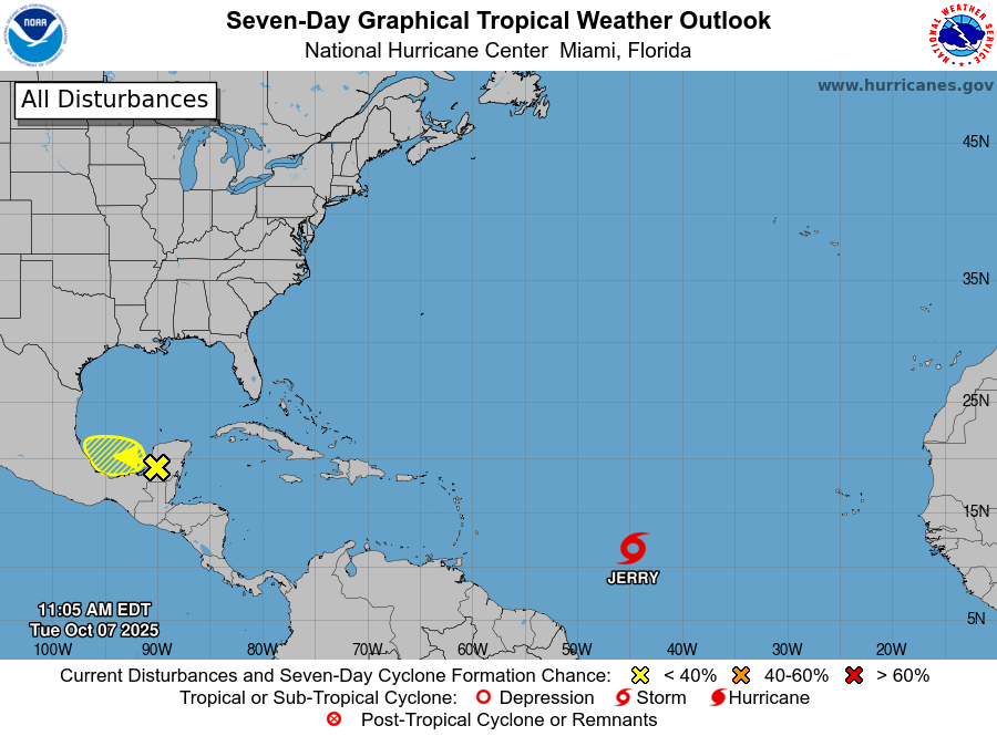
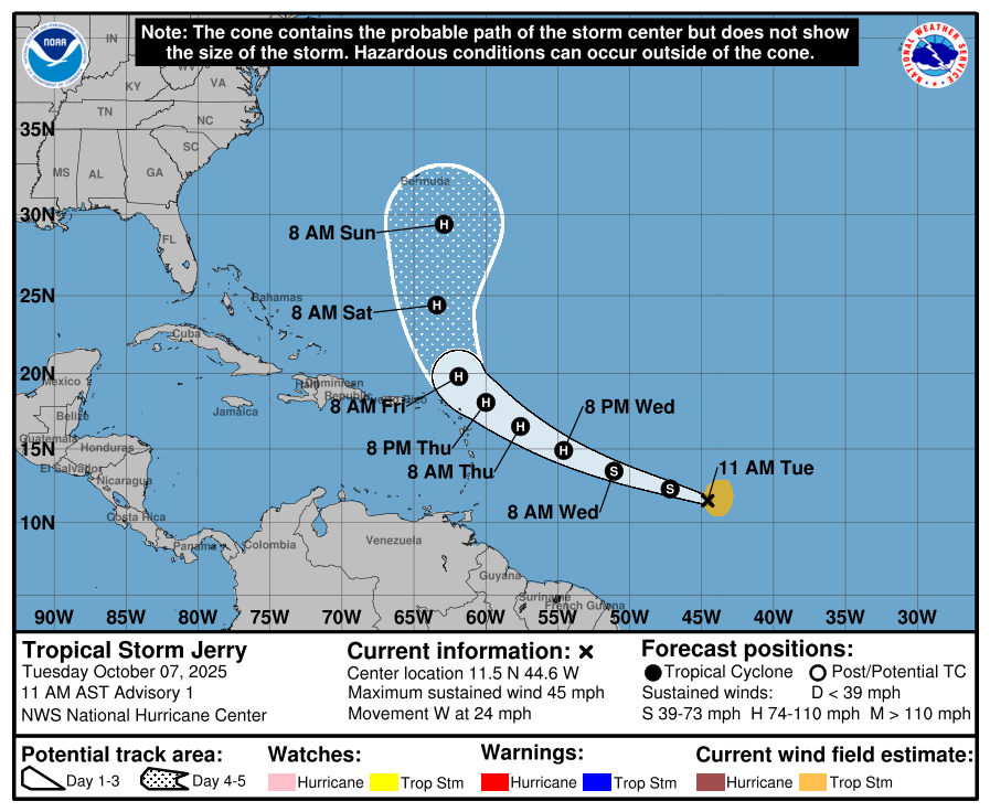
Newly named Tropical Storm Jerry has been announced in the Tropical Atlantic with development into a Hurricane in the forecast by as early as tomorrow evening. The system will make a track very close to the northern Leeward Islands, which will likely feel some impacts as it passes by. After it makes a turn to the north, it is forecast to track close to Bermuda, which just took a hefty impact from Imedla last week.
The yellow area to watch that we can see in the southwest Gulf has a low 10 percent chance of development. Models do not show anything to worry about with this, so we dont’ see any concern for our region.
Eastern/Central Pacific:
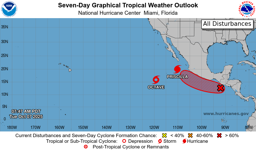
The Eastern Pacifc is becoming more active with now 3 areas we are watching. Tropical Storm Octave has been talked about the past few forecasts I’ve written. It has been swirling around itself for at least a week now, but is finally expected to weaken into a Depression by Thursday.
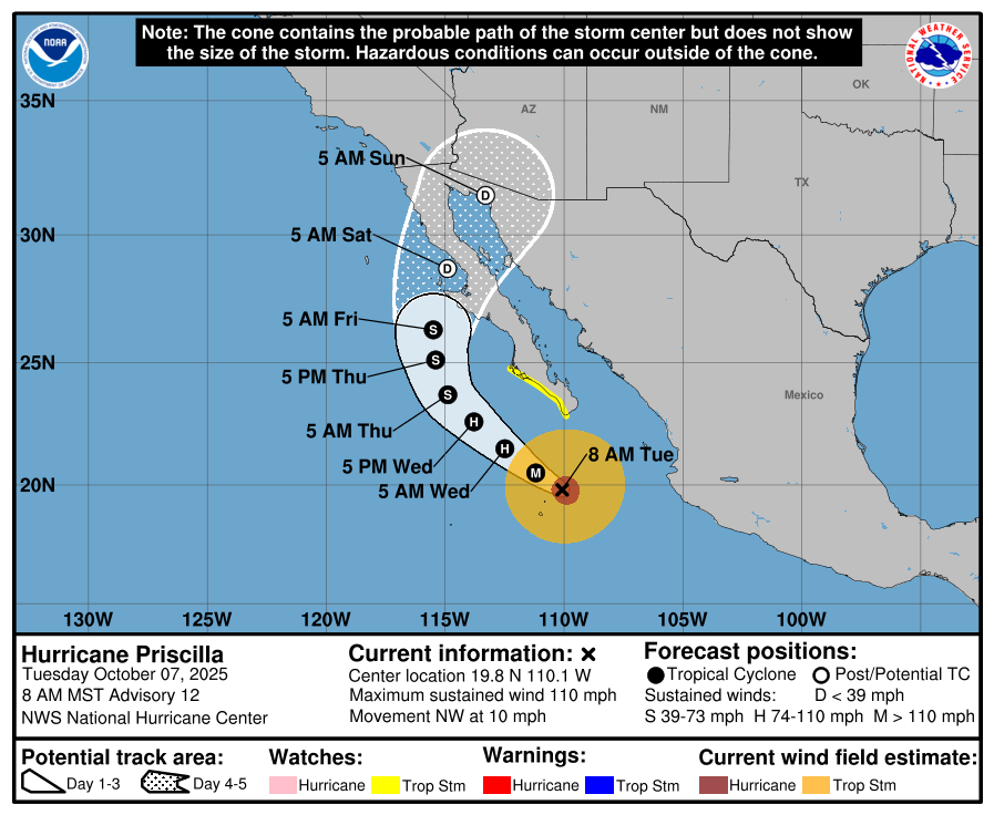
Hurricane Priscilla is essentially a Major Hurricane at this point, with winds just 1mph below the Cat 3 threshold. The NHC says that tropical storm conditions are possible along the Baja California Sur Pacific coastline through tomorrow. Thankfully, it is expected to weaken into a Tropical Storm by the time it makes a landfall on Friday morning into the Sur. Priscilla’s remnant moisture is expected to move into the desert southwest, which could cause some flash flooding in the region.
An area to watch just behind Priscilla has a very high chance of development, and models currently take a tropical system with a similar path into the Sur after development.
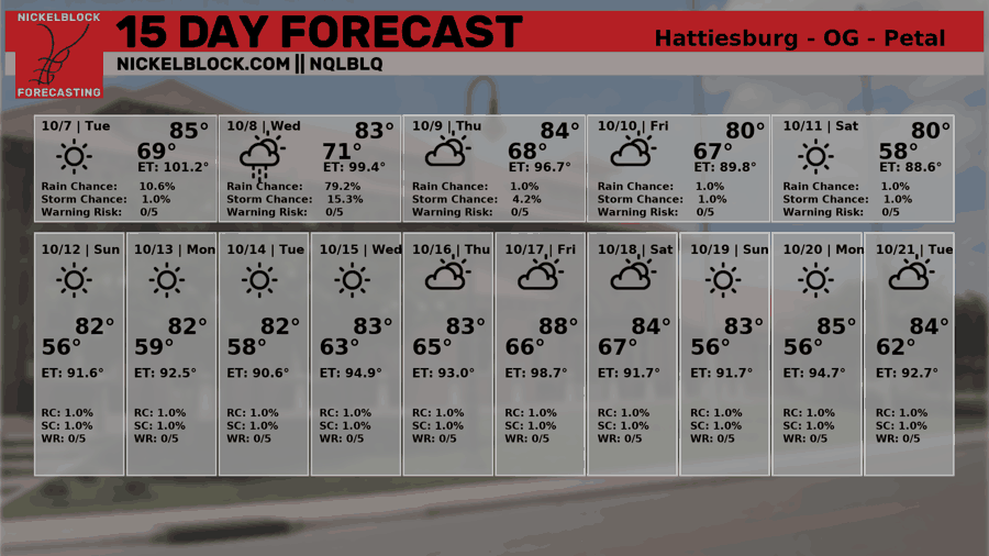
REGIONAL DAY TO DAY FORECAST
Tonight: A few light showers are possible before 8 PM, followed by patchy fog after 9 PM. Otherwise, skies will be mostly cloudy with lows around 70. Calm winds. Chance of rain 20 percent.
Wednesday: A few isolated showers or thunderstorms may develop after 1 PM, but most of the day will be partly sunny and dry. Highs near 87 with light north winds increasing to 5 to 10 mph in the morning. Chance of rain 20 percent.
Wednesday Night: Partly cloudy with lows in the mid 60s. North winds 5 to 10 mph.
Thursday: Sunny with highs near 85. North-northeast winds around 10 mph, with gusts up to 20 mph.
Thursday Night: Partly cloudy with lows in the mid 60s. Northeast winds 5 to 10 mph.
Friday: Mostly sunny with highs near 80. Northeast winds around 10 mph, with gusts up to 20 mph.
Friday Night: Mostly clear and cooler, with lows around 59. Northeast winds 5 to 10 mph.
Saturday: Sunny with highs near 83. Northeast winds 5 to 10 mph.
Saturday Night: Mostly clear with lows around 57.
Sunday: Sunny and pleasant with highs near 85.
Sunday Night: Clear skies with lows around 58.
Columbus Day (Monday): Sunny with highs near 86.


