Overall Setup
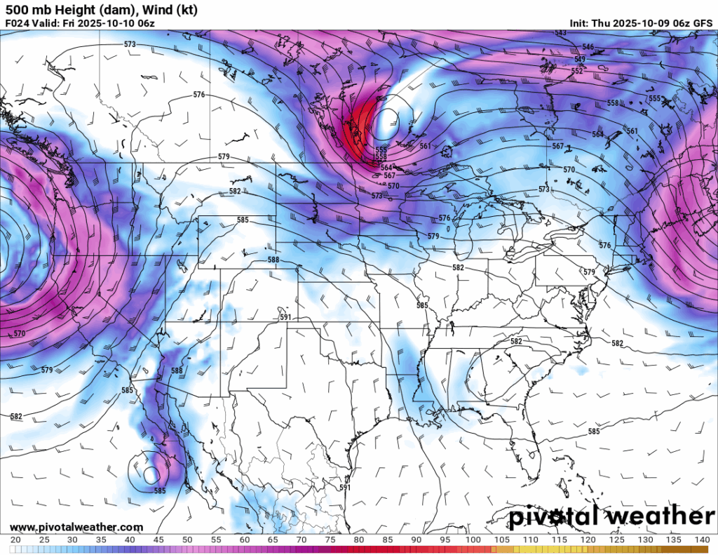
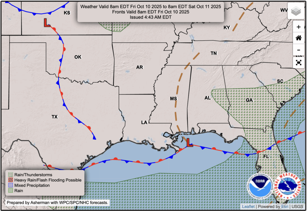
As you may have seen in Noah’s forecast last night, there is a strong ridge at 500 mb over Texas and states to it’s north. This ridging has redirected the airflow for our region to a more northerly flow, which is why temperatures reached only the lower 80s today and why they will stay that way for a few days, until the direction of the flow eventually shifts. We are also on the slightly cooler and drier side of a stationary front as well.

Tonight’s Forecast
Lows tonight are forecast to drop to the high 50s and low 60s in the mainland, and low 70s by the shore. There’s a very small chance at a quick shower up until midnight, but a quiet night with clear skies is to be expected.
Tomorrow’s Forecast: Friday, October 10
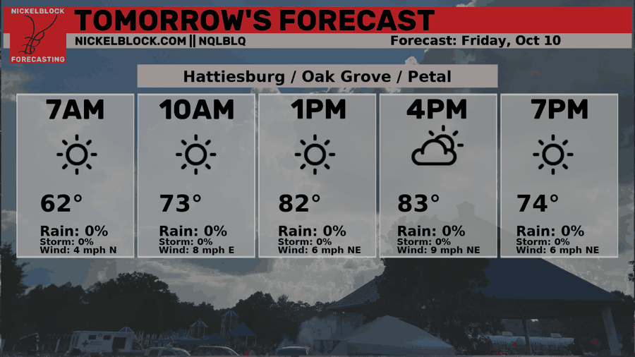
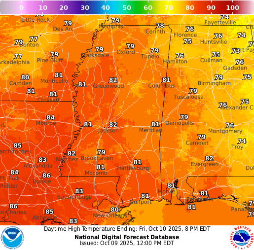
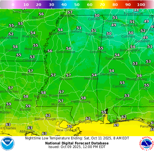
Highs will reach the lower 80s again tomorrow under mostly clear skies, making for another pleasant and comfortable day. Dew points continue to drop, keeping the air dry and the humidity low. No rain is expected, so it’s a great way to start your weekend. Plenty of sunshine and comfortable weather all around! Due to the lower humidity and clear skies, low temperatures tomorrow night into Saturday morning will drop to the 50s for most!
Weekend Forecast: Saturday October 11 & Sunday October 12
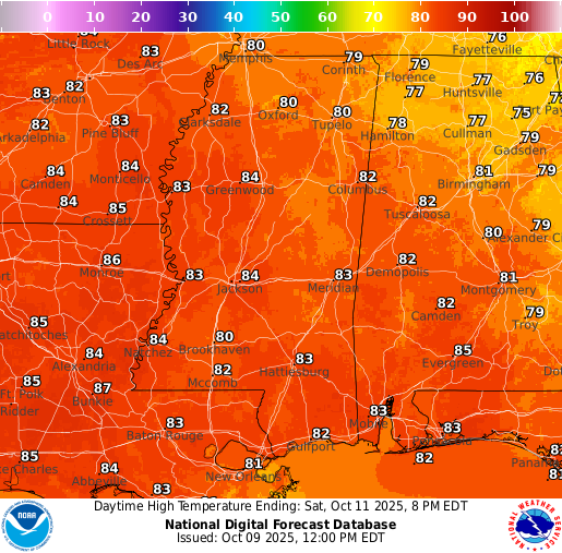
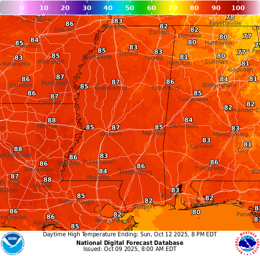
If you liked the weather the past few days, you’re in luck because the same pattern continues into the weekend. Clear skies, low humidity, and highs in the lower 80s will make for another great couple of days outside. I think the high temperature forecast shown by the NWS for Sunday is a little too high for reality, so I would expect, again, lower 80s instead of upper 80s.
Extended Local Outlook
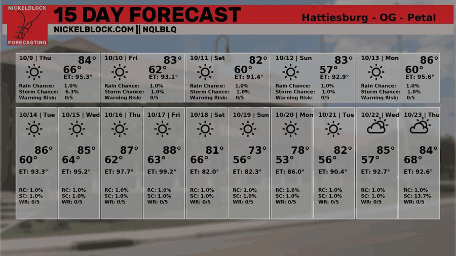
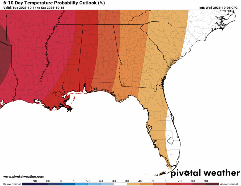
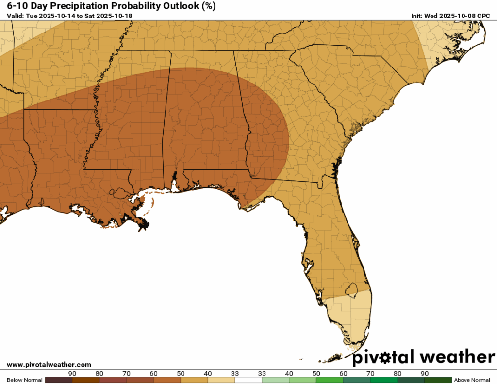
This dry pattern looks to stick around for quite a while, likely at least the next two weeks. The NQLBOT 15-day forecast chart shows no rain in sight, and the traditional weather models back that up, keeping our region dry for the foreseeable future. The extended outlook also calls for above-normal temperatures during this stretch, so expect plenty of sunshine, warm afternoons, and little change day to day.

Latest Tropical Update
Atlantic:
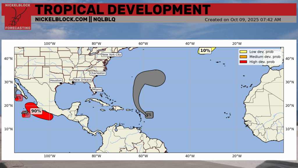
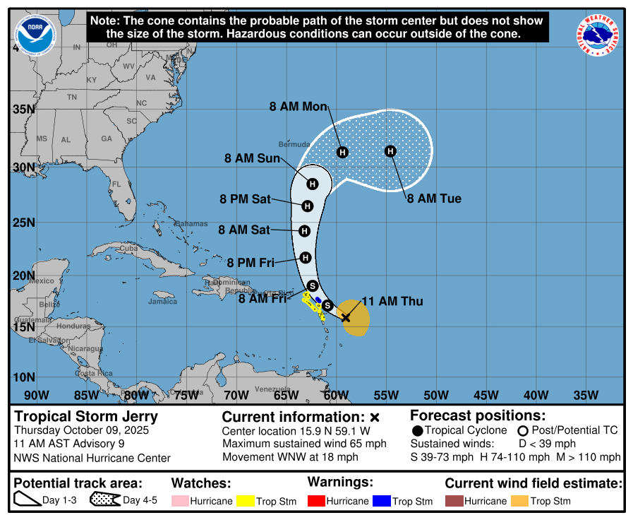
Good news – there are no areas to watch for tropical development in the Gulf or out in the open Atlantic, aside from a small 10 percent area highlighted well in the northeast Atlantic. Tropical Storm Jerry will have some impacts on the Leeward Islands and possibly Bermuda this week, but nothing for the mainland US.
Eastern/Central Pacific:
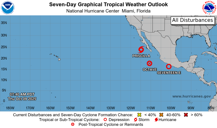
We have 3 systems forming a train in the Eastern Pacific. Priscilla is still expected to weaken into a tropical depression by the time it makes landfall in the central/northern Baja Sur. Its moisture, though, will cause some serious flash flooding concerns in the southwest US. Octave has officially diminished, finally. Seventeen-E has recently been named earlier today and will track a similar path to Priscilla.
REGIONAL DAY TO DAY FORECAST
Tonight: Mostly clear with lows in the lower 60s. North winds 5 to 10 mph.
Friday: Mostly sunny with highs in the lower 80s. East-northeast winds 5 to 10 mph, with gusts up to 20 mph.
Friday Night: Mostly clear with lows in the upper 50s. Northeast winds around 5 mph.
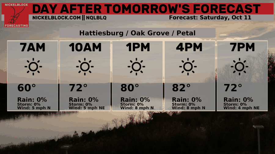
Saturday: Sunny with highs in the lower 80s. Northeast winds 5 to 10 mph.
Saturday Night: Clear with lows in the mid 50s. North-northeast winds around 5 mph, becoming calm in the evening.
Sunday: Sunny with highs in the mid 80s. Calm winds becoming east around 5 mph in the afternoon.
Sunday Night: Clear with lows in the upper 50s. Calm winds.
Columbus Day (Monday): Sunny with highs in the mid 80s. Calm winds becoming east around 5 mph in the afternoon.
Monday Night: Clear with lows in the upper 50s.
Tuesday: Sunny with highs in the mid 80s.
Tuesday Night: Clear with lows in the mid 60s.
Wednesday: Sunny with highs in the mid 80s.


