Overall Setup
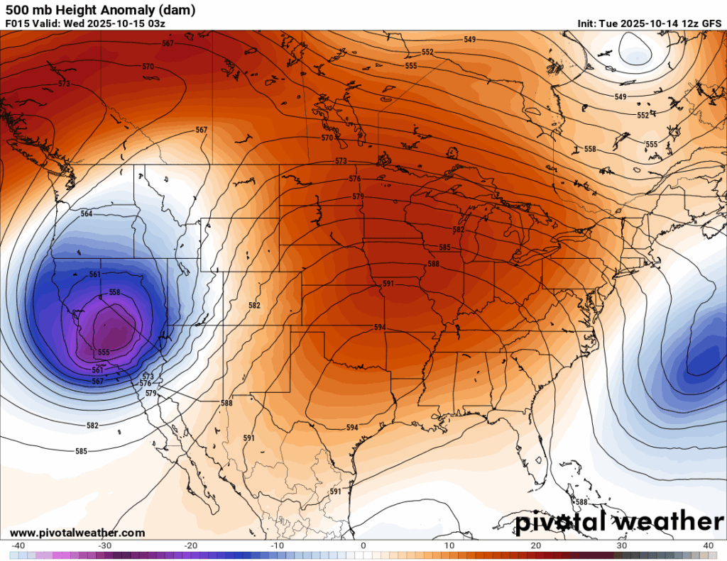
The forecast for the next few days is looking to be rather warm and dry. Temperatures are sitting above average, just below 90 during the days due to the intense ridge that could be seen in the 500 mb height anomalies. Our mornings will continue to be nice with temperatures in the 50s and 60s with relatively comfortable humidity. We aren’t expecting any frontal systems to influence rain until Saturday and Sunday, when we could see some severe thunderstorms and temperatures drop back into the lower 80s.

Tonight’s Forecast
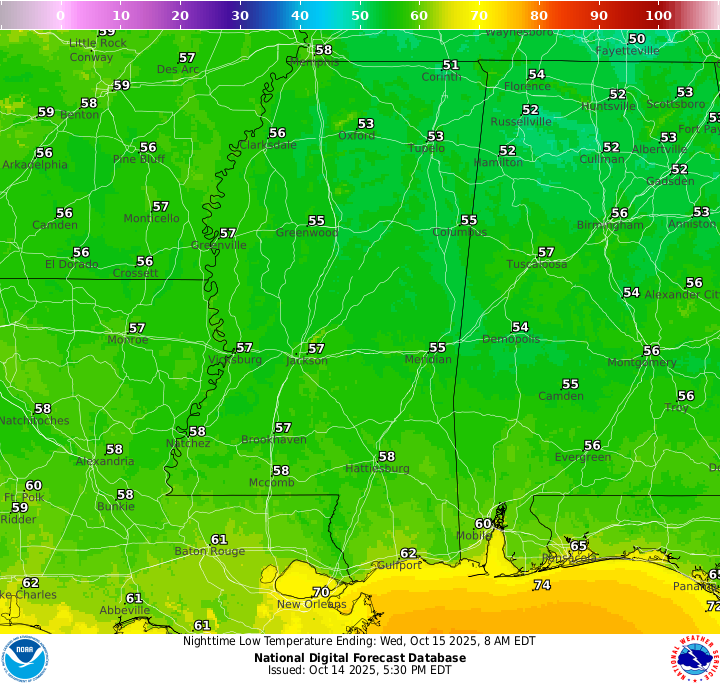
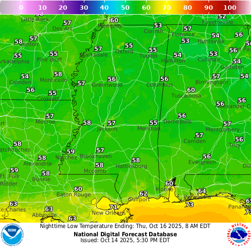
Tonight there will be clear skies with lows in the high 50s. A nice night ahead with no weather impacts!
Tomorrow’s Forecast: Wednesday, October 15
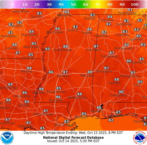
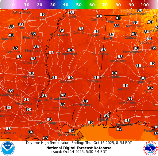
Temperatures tomorrow will be a bit warmer than today, topping out around 88 to 89 for most areas. Humidity will remain fairly comfortable, so it won’t feel too extreme. Skies will stay clear with no rain and very little cloud cover.
Thursday’s Forecast: October 16
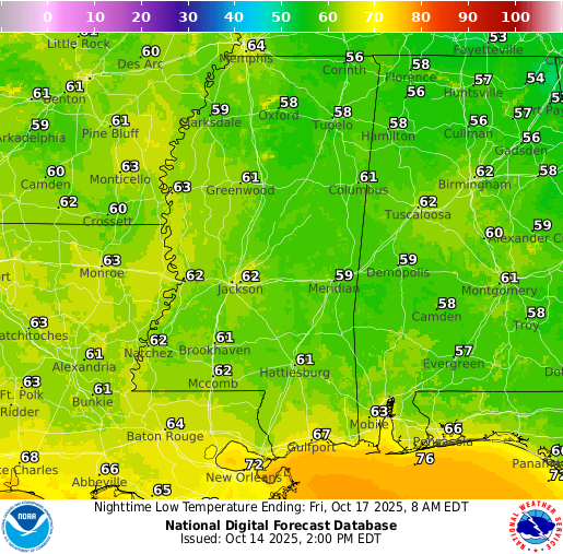
A similar forecast in in the books for Thursday – clear skies, no rain, and highs in the upper 80s.
Extended Local Outlook
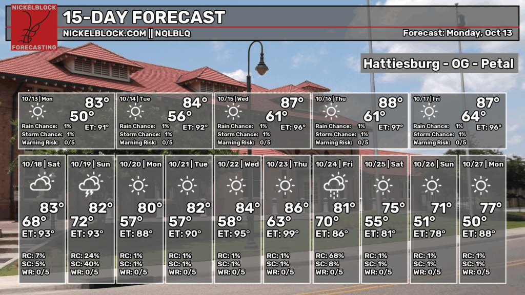
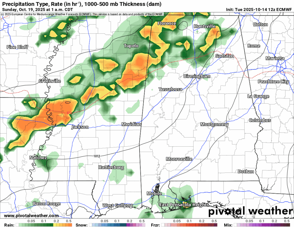
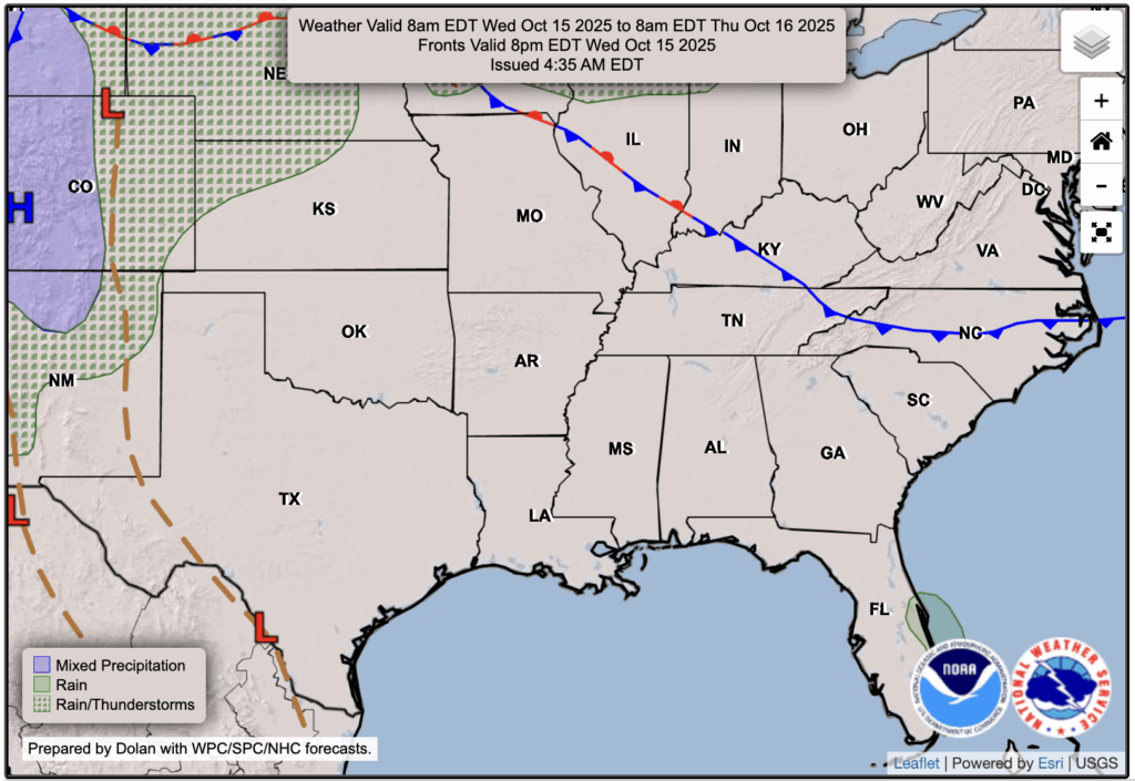
Our next chance for rain arrives late Saturday night into Sunday morning. As some of you may have seen, the Storm Prediction Center has highlighted parts of our northwestern viewing area for potential severe weather this weekend. Conditions will become favorable for heavy thunderstorms, bringing the typical threats of gusty winds, hail, and even a low-end tornado risk. While the greatest potential looks to be farther north, closer to Arkansas and northwestern Mississippi, it’s still something we’ll want to keep an eye on.
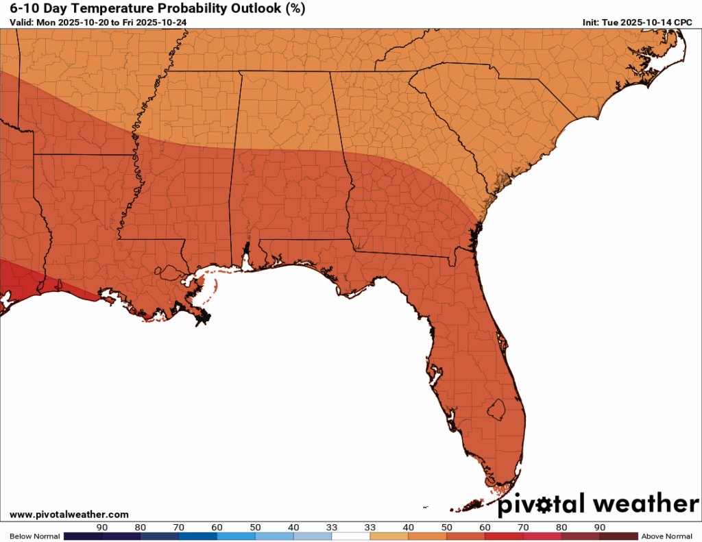
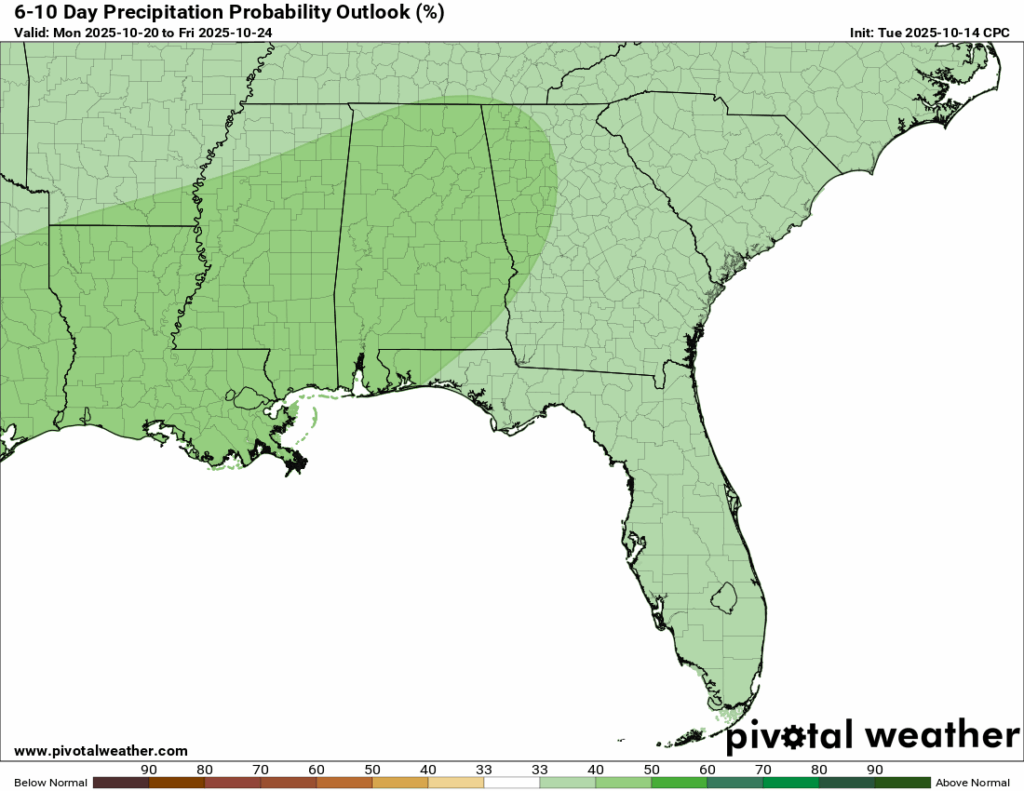
Temperatures through October 24th are expected to stay above normal, with highs continuing to hover in the mid-to-high 80s. It’s not until around the 25th that we might finally see some 70s returning to the forecast. Because of this weekend’s rain potential, our region should technically register above normal rainfall for the 6-10 day outlook period, but after that, conditions look dry once again.

Latest Tropical Update
Atlantic:
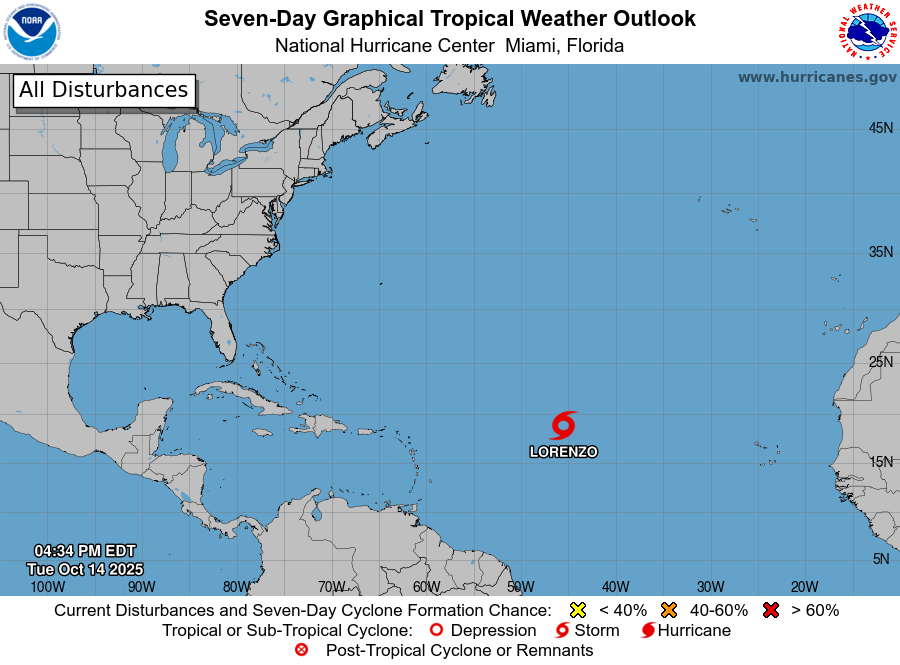
Tropical Storm Lorenzo is a classic fish storm and will turn out to sea over the next few days, so there’s nothing to worry about. We’re also keeping an eye on the Caribbean, where recent convection has been active and could eventually lead to some development. For now, though, there’s nothing of concern.
Eastern/Central Pacific:
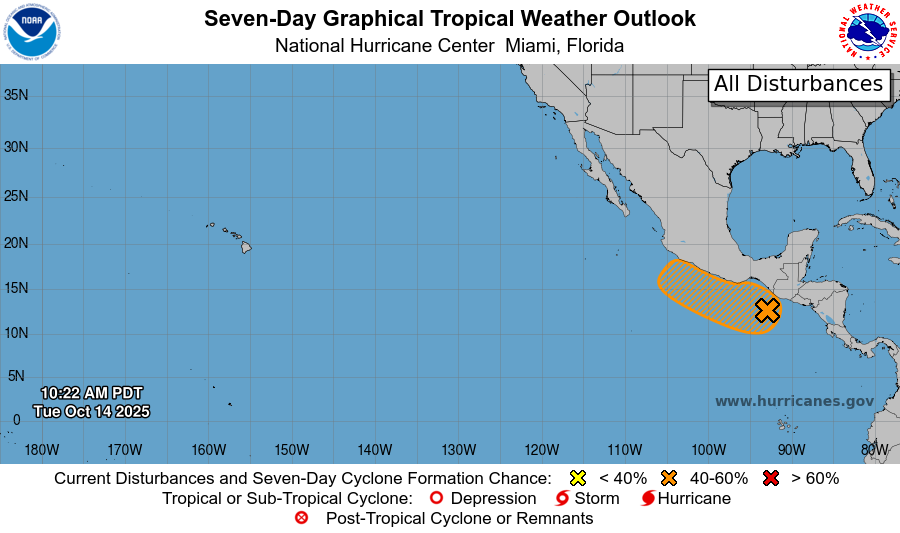
The Eastern Pacific finally has no named storms after back-to-back systems over the past few weeks. All that is left is an area to watch off the western coast of Mexico, which has a medium chance of development in the next week or so.
REGIONAL DAY TO DAY FORECAST
Tonight: Clear with lows in the upper 50s. North winds around 5 mph, becoming calm in the evening.
Wednesday: Sunny with highs in the upper 80s. North winds around 5 mph, becoming east in the afternoon.
Wednesday Night: Clear with lows in the upper 50s. Calm winds.
Thursday: Sunny with highs in the upper 80s. Calm winds becoming east around 5 mph in the afternoon.
Thursday Night: Mostly clear with lows around 60. Calm winds.
Friday: Mostly sunny with highs in the upper 80s. Light east-southeast winds becoming south-southeast 5 to 10 mph in the morning.
Friday Night: Mostly clear with lows in the mid 60s. South-southeast winds 5 to 10 mph, becoming light after midnight.
Saturday: Mostly sunny with highs in the mid 80s. South winds 5 to 10 mph, with gusts up to 20 mph.
Saturday Night: A 50 percent chance of showers and thunderstorms, mainly after 1 a.m. Partly cloudy with lows in the upper 60s. South winds 5 to 10 mph, with gusts up to 20 mph.
Sunday: A 50 percent chance of showers, mainly before 3 p.m. Mostly sunny with highs in the mid 80s.
Sunday Night: Mostly clear with lows in the upper 50s.
Monday: Sunny with highs in the lower 80s.
Monday Night: Mostly clear with lows in the upper 50s.
Tuesday: Sunny with highs in the mid 80s.


