It’s still going to be warm and dry for the next several days as we’re still under a large high pressure dome over the eastern US. This ridge will gradually move east as an incoming low pressure system pushes it like a cartoon scene transition towards the Atlantic. What can we expect from the incoming system? Let’s take a look.

Tonight and Tomorrow
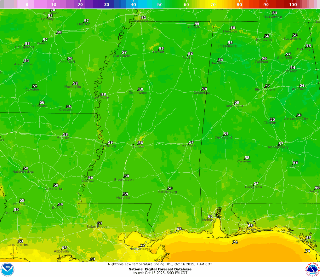
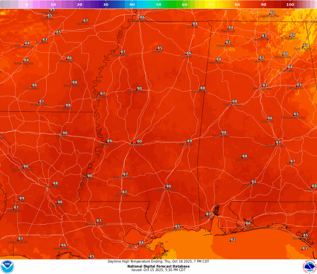
Tonight will be another pleasant one with lows in the upper 50s. Expect a warm day with temperatures topping out around 90 in Hattiesburg and the upper 80s around much of south Mississippi, Louisiana, and Alabama.
Tomorrow Night into Friday
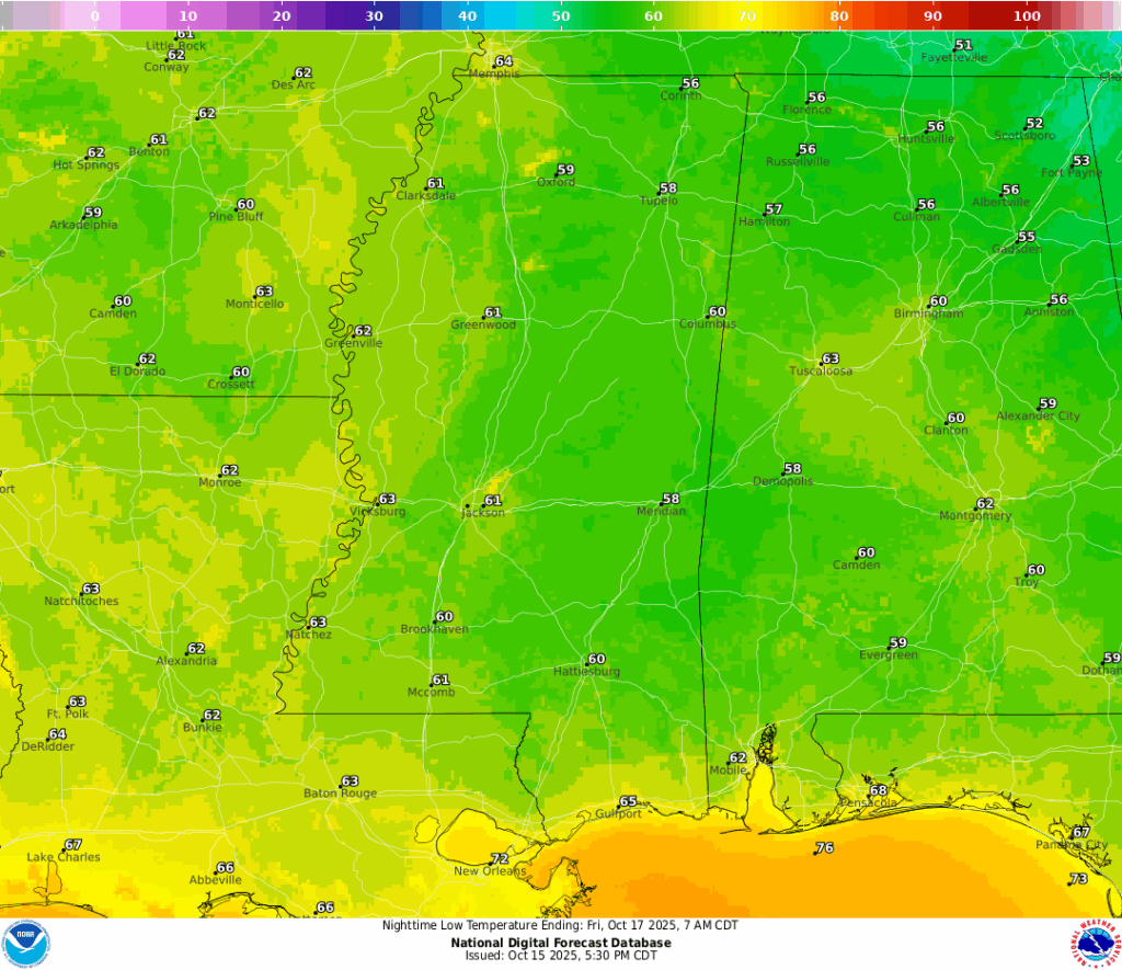
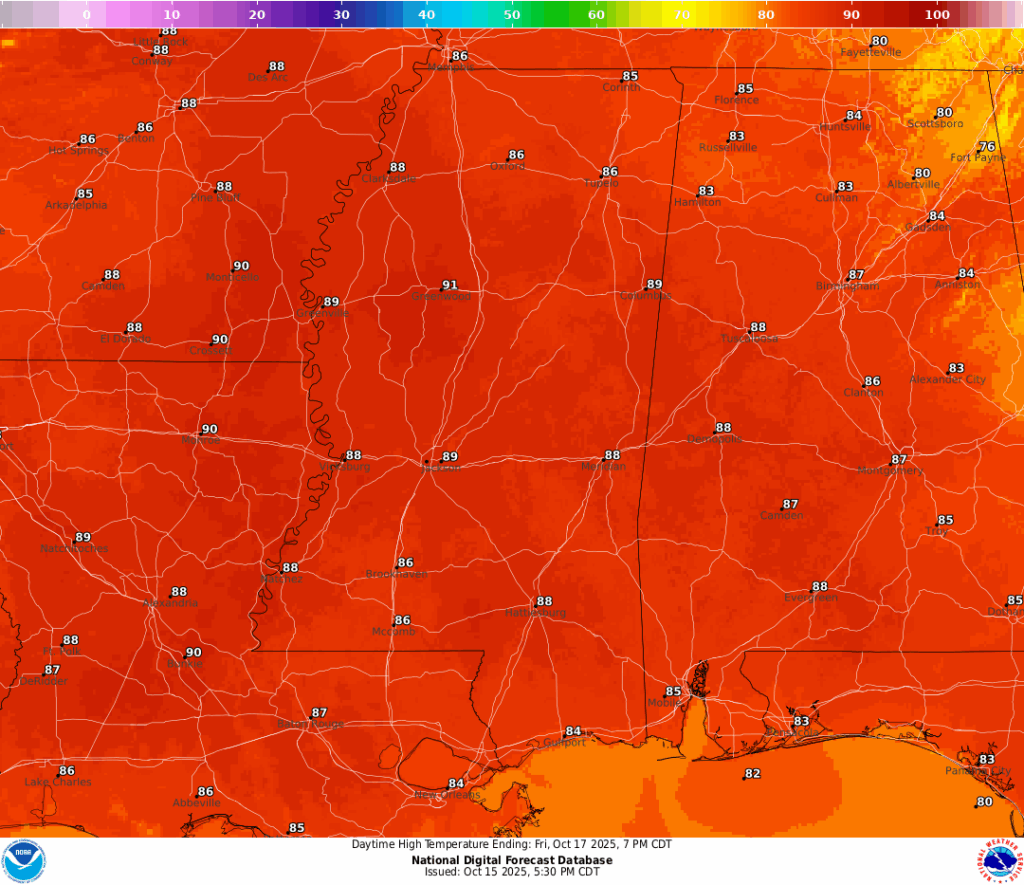
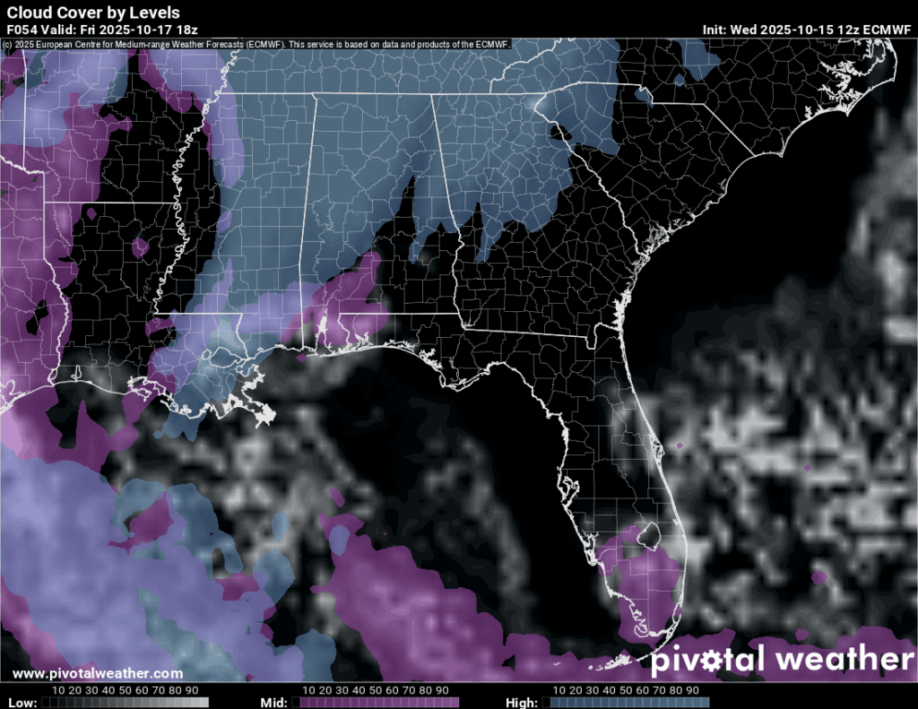
Friday will start off fairly cool with lows around 60 and eventually reach the upper 80s across the area. Expect some upper and mid level clouds across much of Mississippi and Alabama. The overnight low into Saturday will fall into the mid 60s, so a little warmer than what we’ve been used to as of late.
Saturday into Sunday
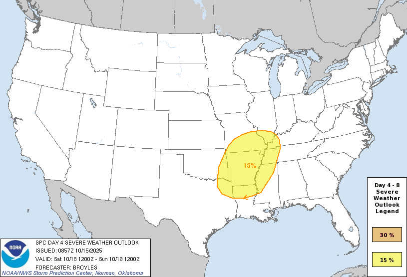
More clouds will roll in Saturday indicating the incoming front. For the most part, we’ll stay dry until the early morning hours on Sunday. The severe risk is still relegated to the mid-Mississippi River Valley along with most of Arkansas and the Delta. Models are showing most of the severe weather to unfold there before the MCS devolves and moves into our neck of the woods. So far, the severe threat remains fairly low, but this could change depending on whether the MCS has a good environment to sustain it.
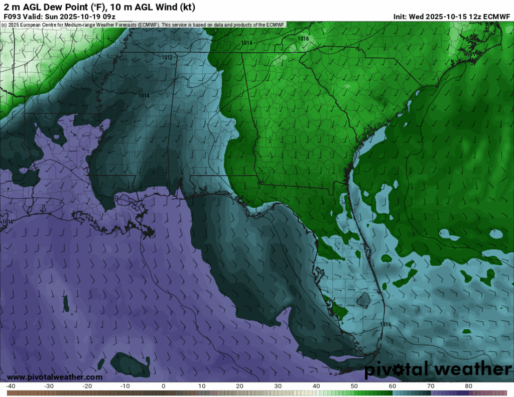
Dewpoints look okay with some reaching the upper 60s, but other factors such as instability and helicity are on the low side. Thunderstorms and even some gusty winds aren’t out of the picture right now for much of Mississippi and Louisiana, but we’ll have to wait and see if models pick up on a more favorable environment.
After the storm moves out Sunday, expect highs in the low to mid 80s and lows in the low 50s. A pretty good end to the weekend with some cooler north winds to add to it.


