Overall Setup
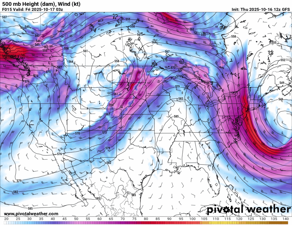
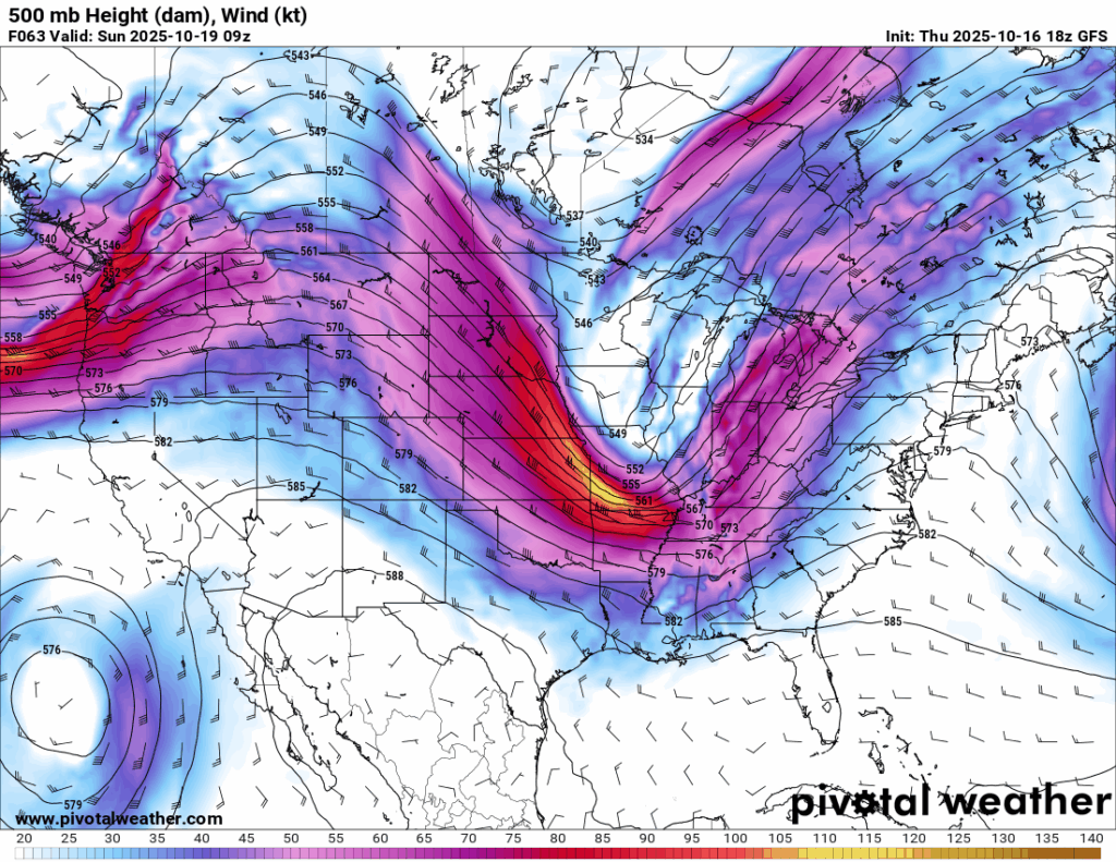
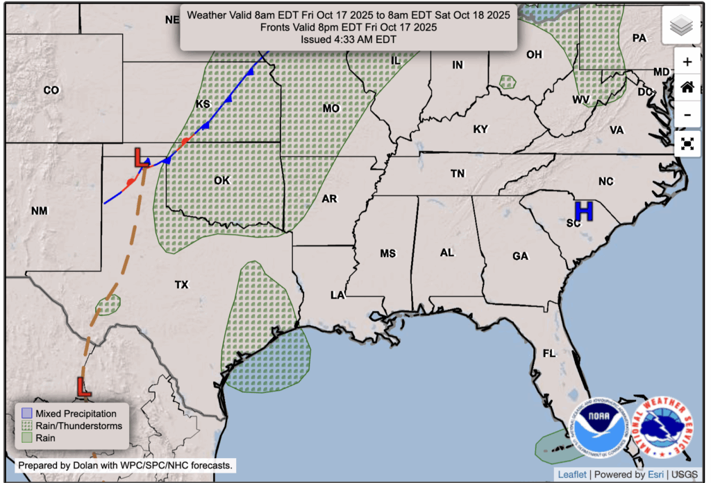
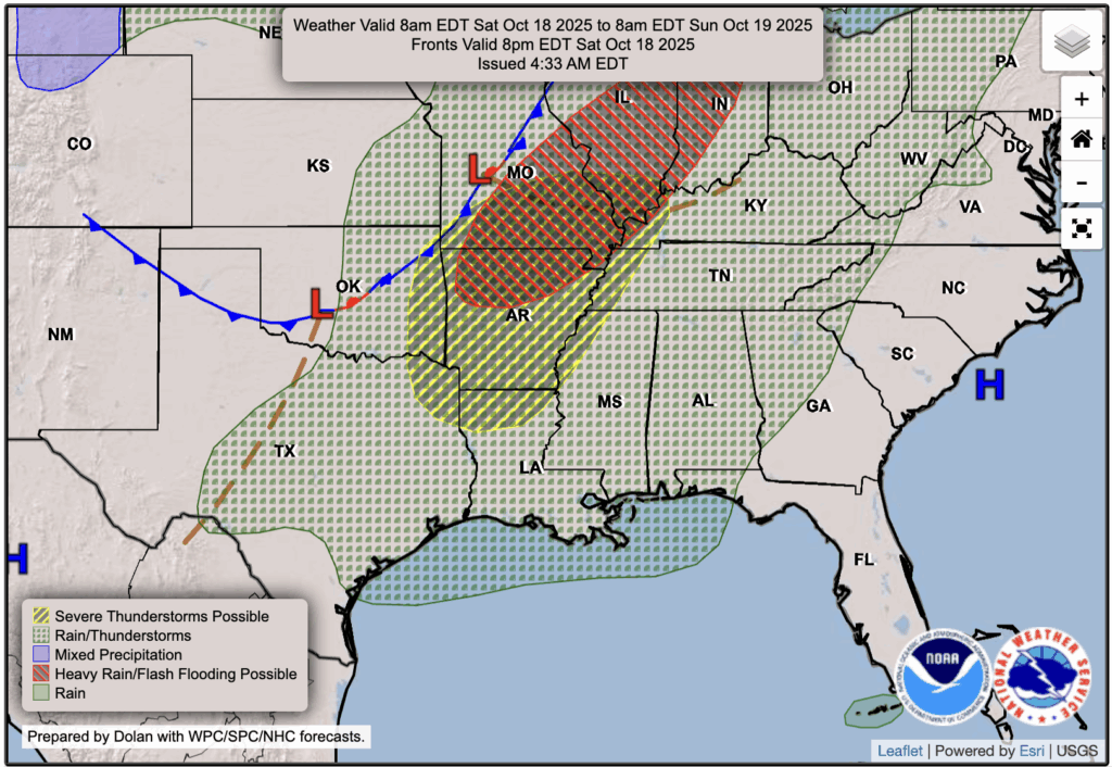
As you can see, we remain under a ridge through at least Friday, keeping things warm and quiet. By the weekend, an upper-level low is expected to develop and shift east, bringing the potential for severe weather to parts of our northwestern viewing area. The greatest threat for large hail, damaging winds, and tornadoes looks to be across Arkansas and possibly into extreme north Louisiana and northwest Mississippi. Most of the southern Pine Belt should be spared from the worst of it, though a Marginal Risk (Level 1 of 5) does extend into our area. Timing still looks to be late Saturday night into Sunday, but there’s some uncertainty on the exact setup. Regardless of how it plays out, we’ll gladly take any rain we can get.

Tonight’s Forecast
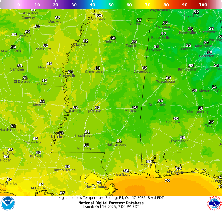
Mostly clear skies are in the forecast tonight, with some increased clouds by 4AM, then becoming clear once again in the morning. Temperatures will drop to the lower 60s and winds will remain calm.
Tomorrow’s Forecast: Friday, October 17
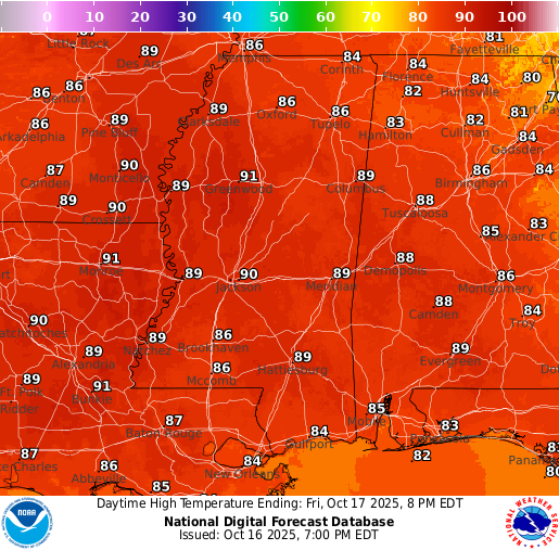
Mostly sunny skies are expected again tomorrow. We did reach 91 today at the Hattiesburg-Laurel Regional Airport, and temperatures should be similar for your Friday, but maybe slightly lower. Unfortunately, we will see the dew points rise into the 60s again out ahead of the frontal system that will bring us rain on Saturday night and Sunday morning. You’ll likely notice the increased humidity later in the day on Friday, and this will stick around until later on Sunday when the front pushes through.
Weekend Forecast: Saturday, October 18 & Sunday, October 19
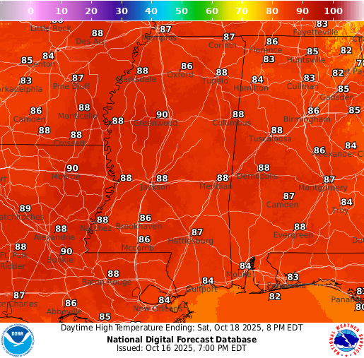
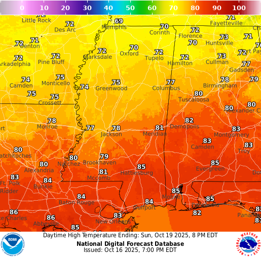
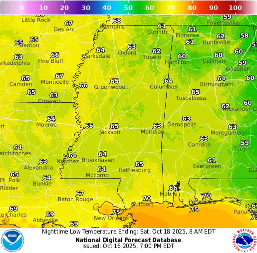
A similar temperature is expected for Saturday in the upper 80s and high humidity. You can see where the front will get to by mid-afternoon on Sunday in the temperature map, showing a sharp contrast between 70s and 80s for the highs. As for the rain, some showers or thunderstorms are possible out ahead of the main event during the evening hours on Saturday, but most of the storms will come through by 10pm or midnight and last until around sunrise. As of now, most storms are not expected to be severe, but a few could produce gusty winds, hail, and perhaps an isolated tornado. More details are to come over the weekend.
Extended Local Outlook
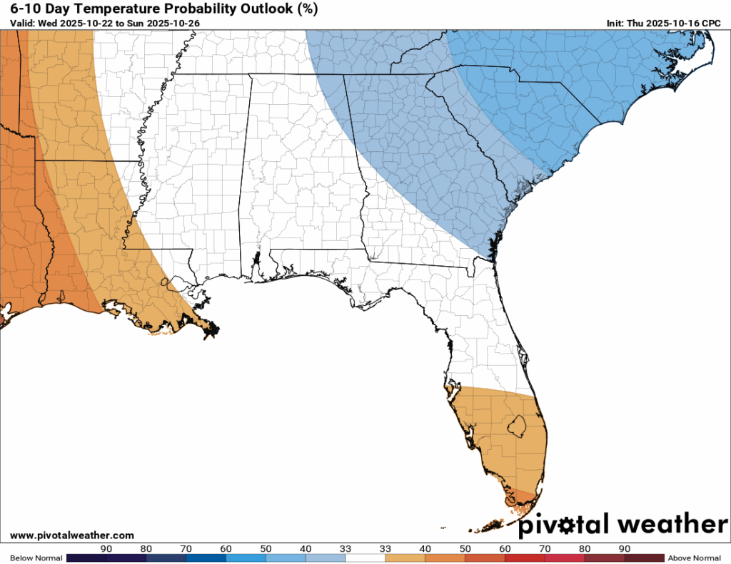
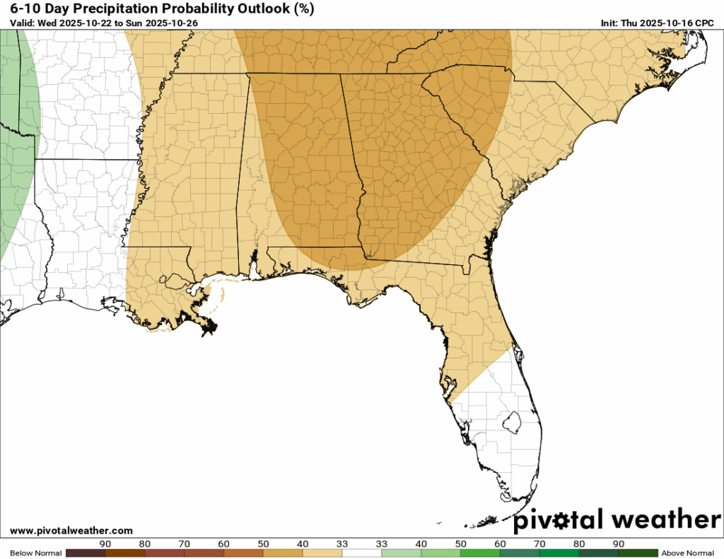
Looking ahead, we finally are looking near-average for temperatures in the 6-10 day timeframe. That means temperatures closer to the high 70s and low 80s! However, we are back to below normal rainfall after our weekend rain event.

Latest Tropical Update
Atlantic:
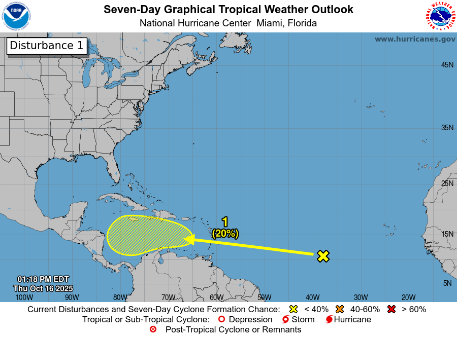
The NHC has highlighted an area of potential development within the next 7 days in the Atlantic. A tropical wave over the central tropical Atlantic could develop as it travels into the southern Caribbean into the yellow hatched area. As of now, there is only a 30 percent chance of development, but it’s something to keep our eyes on. The models have shown some crazy outputs in the 300+ hour range (as usual) if you are curious to check them out.
Eastern/Central Pacific:
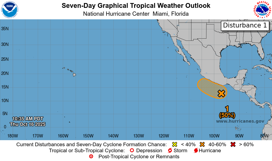
The same setup as the one I showed on Tuesday exists in the Eastern Pacific – an area to watch off of the western coast of Mexico with a 50 percent chance of development. Nothing else to watch at the current moment.
REGIONAL DAY TO DAY FORECAST
Tonight: Mostly clear with lows in the lower 60s. Calm winds.
Friday: Mostly sunny with highs in the upper 80s. Calm winds becoming south around 5 mph in the afternoon.
Friday Night: Mostly clear with lows in the mid 60s. South winds around 5 mph, becoming calm in the evening.
Saturday: Mostly sunny with highs in the mid 80s. Light southeast winds becoming south 5 to 10 mph in the morning. Winds could gust up to 20 mph.
Saturday Night: Scattered showers and thunderstorms developing overnight, mainly after 1 a.m. Partly cloudy with lows in the upper 60s. South winds 5 to 10 mph, with gusts up to 20 mph. Chance of rain 60 percent.
Sunday: Scattered showers and thunderstorms early, tapering off by afternoon. Mostly sunny with highs in the mid 80s. West-southwest winds 5 to 10 mph, becoming north-northwest later in the day. Chance of rain 60 percent.
Sunday Night: Mostly clear with lows in the mid 50s. North winds around 5 mph.
Monday: Sunny with highs in the lower to mid 80s. Northeast winds around 5 mph, becoming south-southeast in the afternoon.
Monday Night: Mostly clear with lows around 60. South-southeast winds around 5 mph, becoming calm overnight.
Tuesday: A 30 percent chance of showers during the afternoon. Mostly sunny with highs in the mid 80s.
Tuesday Night: Mostly clear with lows in the mid 50s.
Wednesday: Sunny with highs in the upper 70s.
Wednesday Night: Mostly clear with lows around 50.
Thursday: Sunny with highs around 80.


