It was a very pleasant day outside today! Temperatures reached just around 80 for the day and no clouds in the sky and a cool morning on top of that! We’ll continue that trend after the next cold front passes through tomorrow, which means a chance of rain tomorrow. Let’s take a look.

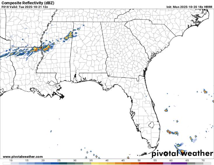
Tonight, the wind will shift to the south and temperatures will fall into the mid 50s. Some patchy fog is also possible. Tomorrow will be a bit warmer as a weak warm front moves through the area with temperatures in the mid 80s. During the afternoon, some isolated to scattered showers are possible across much of central and south MS/LA. Expect these to move through during the mid afternoon and roll through fairly quickly, if at all. Overnight, the temperature will fall back into the low 50s with north winds.
The north winds will prevail for Wednesday leaving us cooler and drier. Wednesday will have highs in the upper 70s and lows in the upper 40s. Yeah, upper 40s. I might just grab my flannel for the evening. Thursday will be slightly warmer with a high in the low 80s and a low around 50. Winds will shift to the east and eventually the southeast as an amoeba of high pressure hovers over us from Canada.
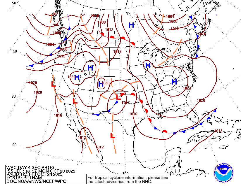
Friday berths the incoming low pressure system from the southwestern US. This system is a bit of a weaker one so far, but could mean rain over the weekend. Considering the high pressure system’s hold over much of the eastern US, it’ll stall out the front meaning we’ll likely have rain for a couple of days. For Friday, however, it’ll just be a bit warmer. Temperatures will be in the low to mid 80s with some increasing clouds as the day progresses. Lows in the mid 50s.
The Tropics
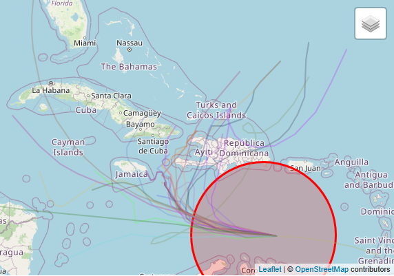
The tropics aren’t quite done yet. Invest 98AL is just north of the Guyanas and brewing. So far, spaghetti plots have placed it all over for it’s development and direction. Most of so far hook it to the north towards Hispaniola while a few may move it further into the Caribbean. Most plots average tropical storm status while a few suggest it may reach hurricane status. It does have plenty of time to develop in the Caribbean before moving, but it will depend on the shear to see where it goes.


