Overall Setup
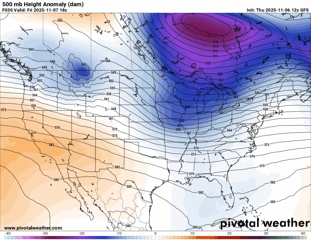
As we have been mentioning the past few days, a cold front will be moving in from the northwest and bring with it a line of showers and thunderstorms, a few of which could be severe. We’re in an overall “troughing” pattern for tomorrow as well, so increased cloud cover and rain will make it more of a gloomy November day. See below for more details:

Tonight’s Forecast
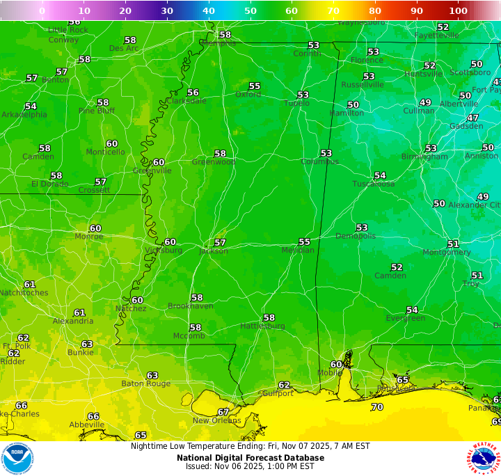
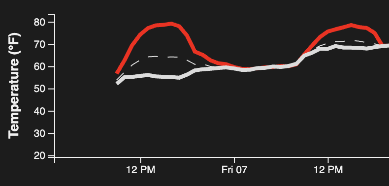
Tonight will be milder than recent nights. Around 11pm or midnight, the temperature (shown in red) will drop to meet the dew point (shown in white). When these two lines come together and stay close through the early morning hours, the air reaches saturation, which allows fog to develop, as long as winds are calm. This fog will likely persist until around 8am, so be careful if you’re out driving early, as visibility could be reduced. A few sprinkles could also pop up during the morning commute.
Tomorrow’s Forecast: Friday, November 7

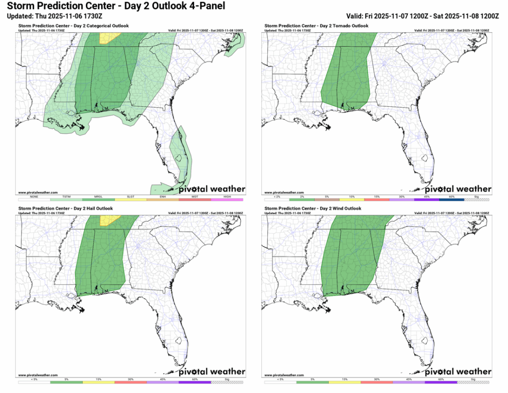
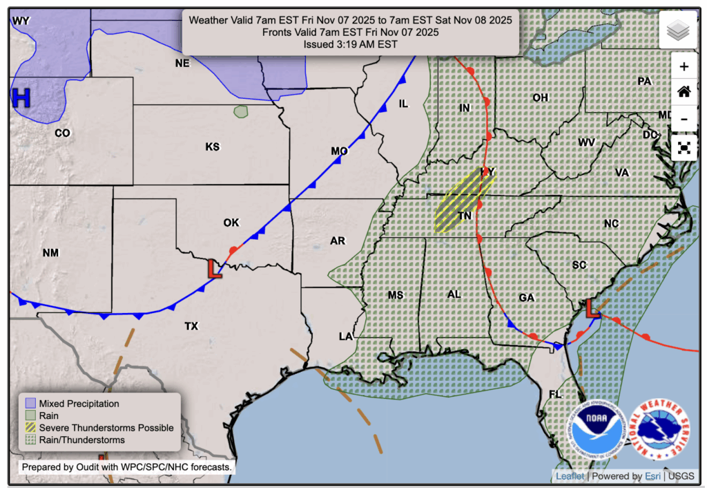
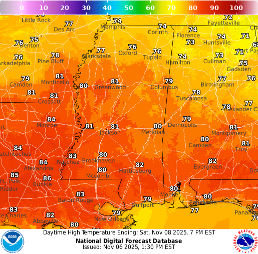
Friday will feel warm and a bit muggy, with highs in the upper 70s to near 80. With all that moisture in the air, a few showers and thunderstorms are expected to pop up from early afternoon into the evening. Some of these storms could turn strong at times, bringing gusty winds, small hail, and possibly a brief tornado. The Storm Prediction Center (SPC) has placed eastern Mississippi and all of Alabama under a Marginal Risk (1 out of 5) for severe weather, meaning most storms will stay below severe limits, but a few could get stronger.
This all happens ahead of the approaching cold front, which will move through late Friday night into Saturday. Once the front passes, cooler and drier air will settle in, making Sunday feel much more like fall again. Stay weather-aware tomorrow, just in case one of those afternoon storms turns strong.
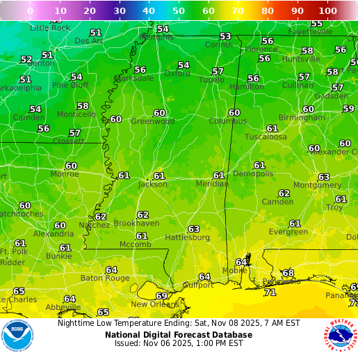
Weekend Forecast: Saturday, November 8 & Sunday, November 9
Saturday and Sunday look to be mostly clear, but there still is a chance of some showers for both days. We are still ahead of the front for Saturday, so humidity will still be high and some showers could be scattered around, most likely in the morning.
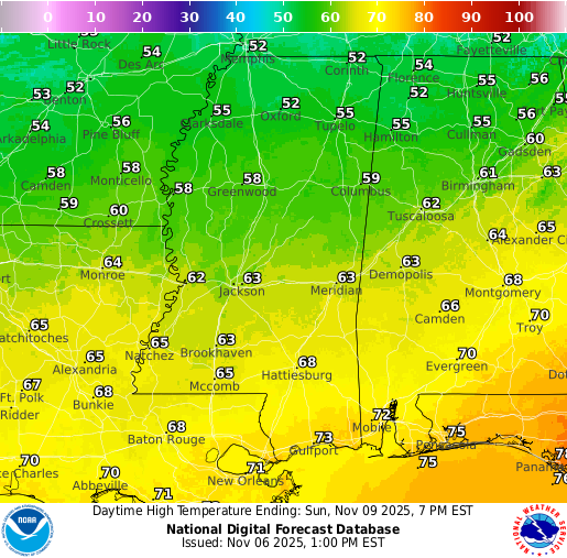
For Sunday, the front finally pushes through around mid-morning and will quickly drop the humidity. Before that, though, the front could bring a few scattered showers before leaving us dry for the rest of the day. Highs will be back to the 50s for the north and 60s for the south with the fall feel returning.
Extended Local Outlook
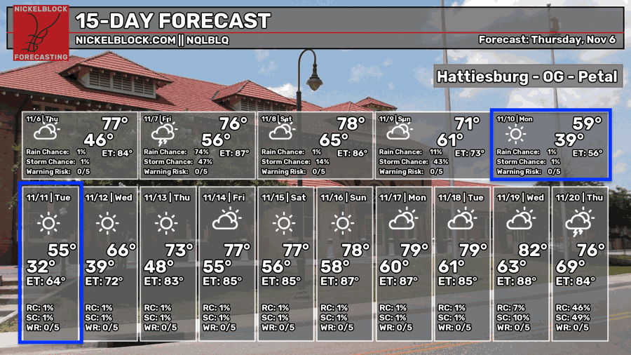
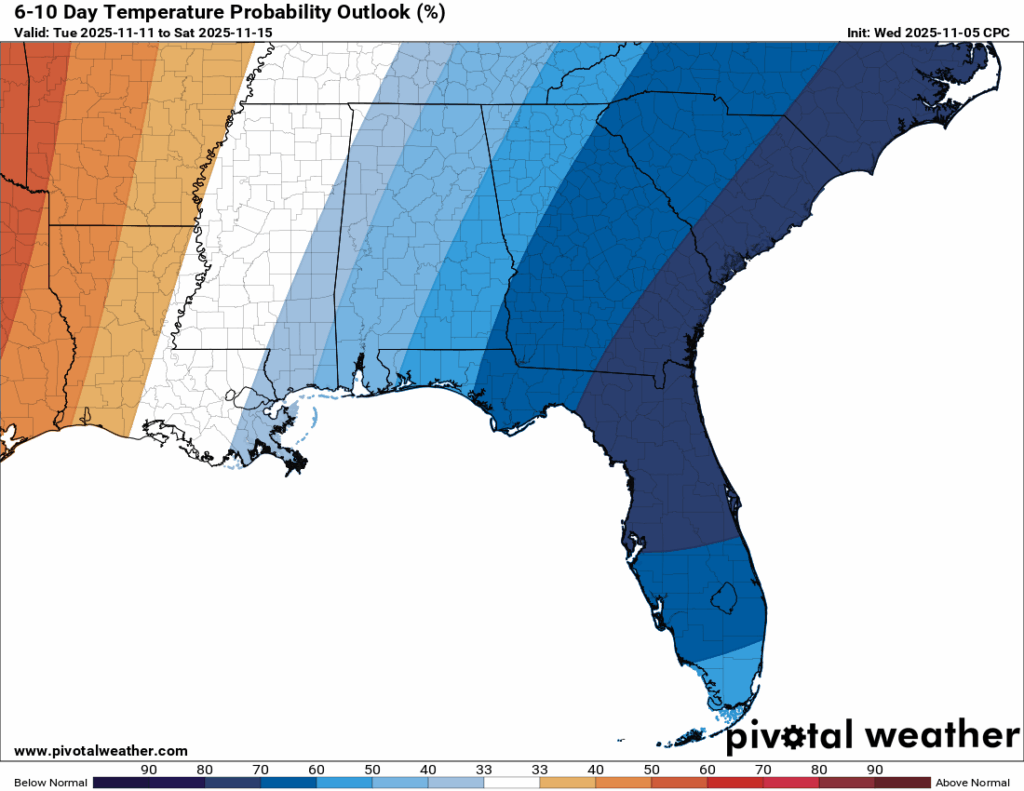
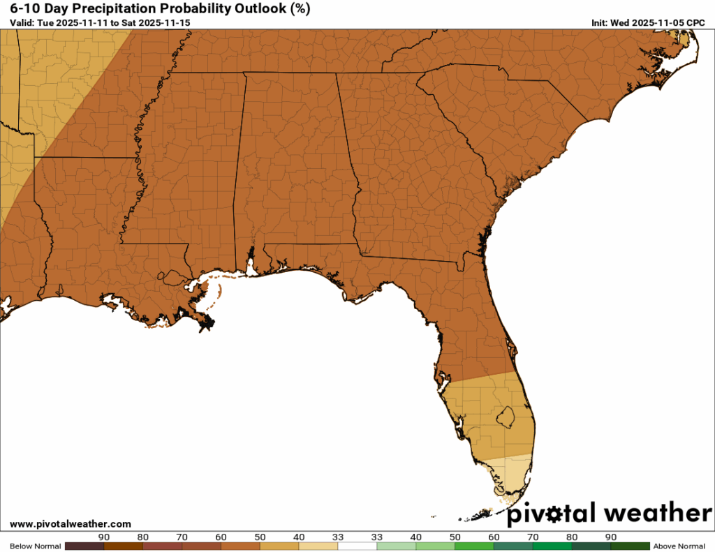
We are nearing the time of our average first freeze of the season, which is looking more and more likely to be Monday night into Tuesday morning. Highs on Monday and Tuesday will be only in the 50s, so if you don’t like the cold, maybe bring a sweater or even a jacket, especially if you’ll be out and about in the overnights! Overall, our pattern for the next 6-10 days will be likely near to below average (mostly dominated by cool air from the dip in the jet stream). We’re also trending on the dry side, with a very high chance of some below normal rainfall.

Latest Tropical Update
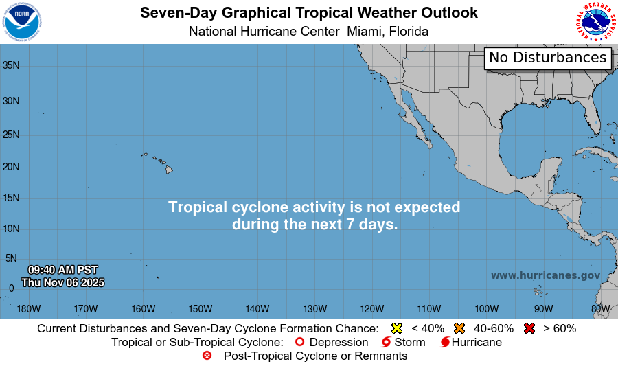
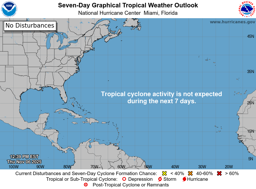
As I mentioned on Tuesday, the Atlantic and Pacific Basins are worry-free with no areas to watch for development for the next 7 days. We’re nearing the end of the official Hurricane Season, which concludes on December 1st, but there is still some time for development, as ocean temperatures are still extremely warm, especially in the Gulf.
REGIONAL DAY TO DAY FORECAST
Tonight: Patchy fog after 12 a.m., otherwise increasing clouds. Lows in the upper 50s. South-southeast winds around 5 mph, becoming calm overnight.
Friday: Scattered showers and thunderstorms developing by late morning into the afternoon. A few storms could be severe, with gusty winds and brief downpours. Highs in the upper 70s. Light winds becoming south 5 to 10 mph by midday. Chance of rain 75 percent.
Friday Night: A few lingering showers possible early, otherwise mostly cloudy. Lows in the lower 60s. South winds around 5 mph, becoming calm in the evening. Chance of rain 30 percent.
Saturday: Mostly sunny and warm with highs in the lower 80s. Chance of showers early. Calm winds becoming west-southwest around 5 mph during the day. Chance of rain 30 percent.
Saturday Night: Partly cloudy with a chance of showers after midnight. Lows in the upper 50s. South-southwest winds around 5 mph, shifting northwest after midnight. Chance of rain 30 percent.
Sunday: Sunny and cooler with highs in the 60s. Chance of showers in the early morning. North-northwest winds 10 to 15 mph, gusting up to 25 mph. Chance of rain 20 percent.
Sunday Night: Mostly clear and chilly with lows in the mid 30s. North-northwest winds 10 to 15 mph, gusting up to 25 mph.
Monday: Sunny and brisk with highs in the lower 50s. North-northwest winds 10 to 15 mph, gusts up to 20 mph.
Monday Night: Clear and cold with lows near 30.
Veterans Day: Sunny with highs near 60.
Tuesday Night: Clear with lows in the upper 30s.
Wednesday: Sunny with highs in the lower 70s.


