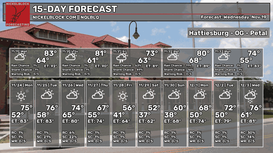
It’s been an unseasonably warm past few days with highs in the low 80s and more humid conditions. This trend will begin to fall as the next low pressure system comes in. As rain and storms roll in this weekend, be prepared for some heavy rain at times and a few thunderstorms.

We’re starting off with some patchy dense fog across the coastal and inland areas and this looks to wane by the mid-morning hours. Highs will be in the low to mid 80s with partly cloudy skies. Since there’s hardly any wind, we’ll have another foggy night into Thursday with lows in the low 60s. Temperatures will reach the low 80s with a few clouds in the sky and the low 60s overnight. Expect some showers to develop into the early morning hours.
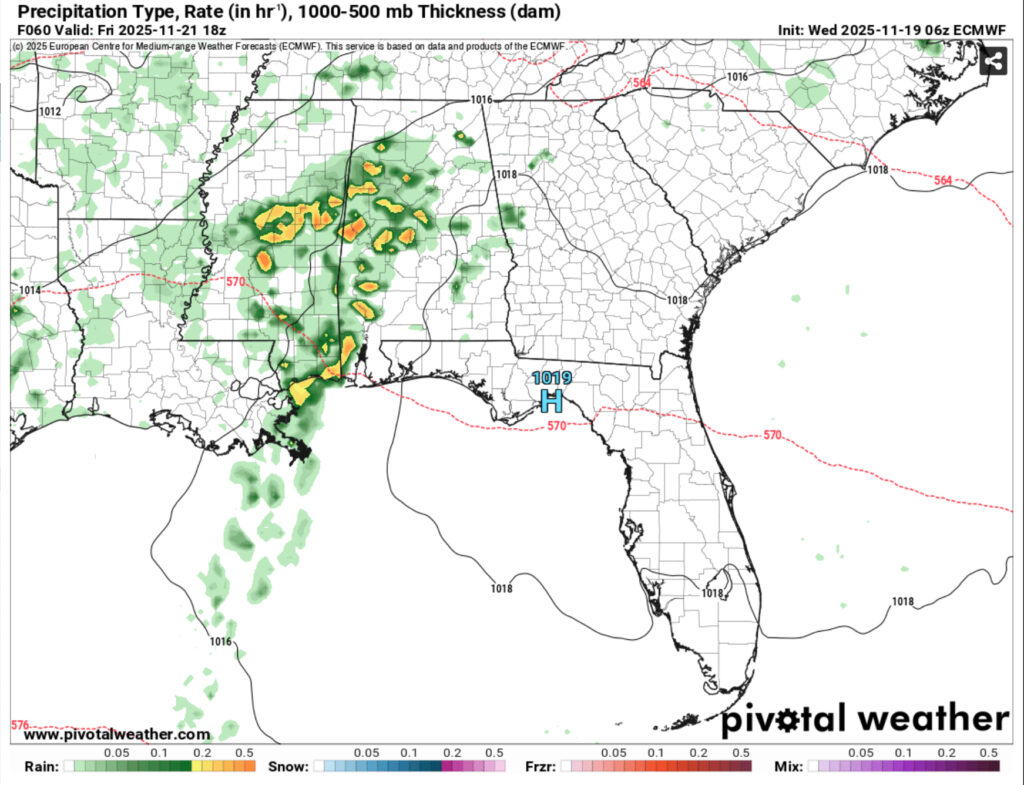
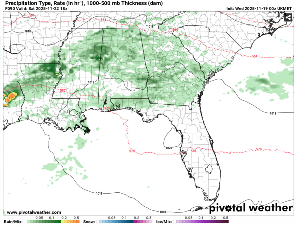
Model data has been inconsistent on the impact of both rounds of storms Friday and Saturday. The GFS shows hardly any rain, the ECMWF dumps a ton of rain, and the UKMET model is just in between. The Storm Prediction Center has not placed any severe weather threat for Friday either. Most of the parameters look pretty limited and it doesn’t help that the high pressure system moving out is slowing the front and much of the instability. Do I think there is still a chance of some strong storms? There is a chance.
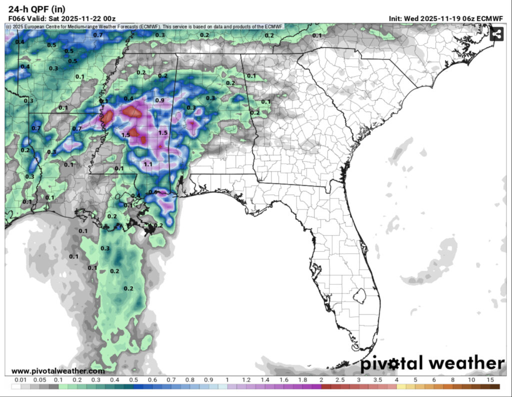
The ECMWF model shows over an inch of rain possible over the 24 hour period between Friday and Saturday. I do think there will be a period of consistent rain from the mid-morning to afternoon hours, so this may be possible. As we go along into Saturday, a slight chance of rain and thunderstorms is possible during the afternoon hours.
Sunday will be a bit different as the rain has moved out at this point. Temperatures will remain in the mid 70s with partly cloudy skies. Winds will shift to the north as the cold front finally moves in. This will be a brief period of dry weather before we gear up for the next possible rain event in the middle of next week.