High pressure is settling into the area today. But we may not be able to fully scour our the cloud cover. The HRRR model shows a pretty stout inversion set up today. That is where the temperature gets warmer as you climb higher in the sky. Often times, when that happens with cloud cover, it is tough to clear out the clouds.
That is shown pretty well here on the Skew-T chart. Usually, you know, I show these for tornadoes and severe weather. But they work just as well for identifying inversions, too!
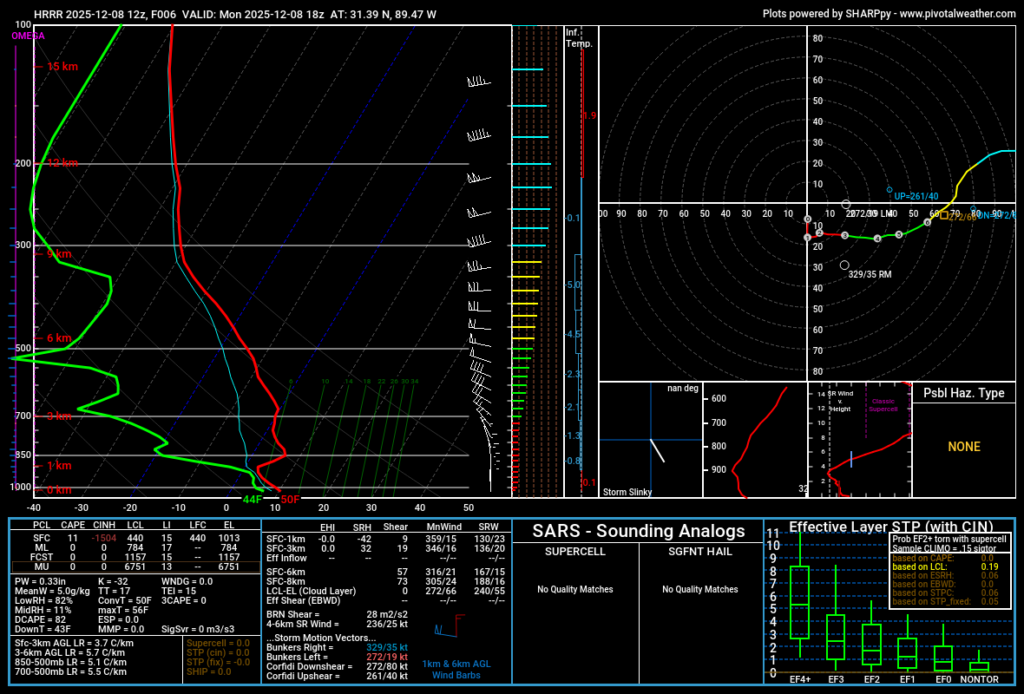
That red line is the temperature line. As you follow it upward on the cart, you are tracking the temperature higher and higher in the atmosphere. And any time that red line move to the right, it means we are getting warmer as we move higher.
Eventually this northerly breeze will clear things out. But it won’t stick around for long. That northwest wind will continue today and tomorrow. But by Wednesday things will shift back from the southwest. That should start to warm back up.
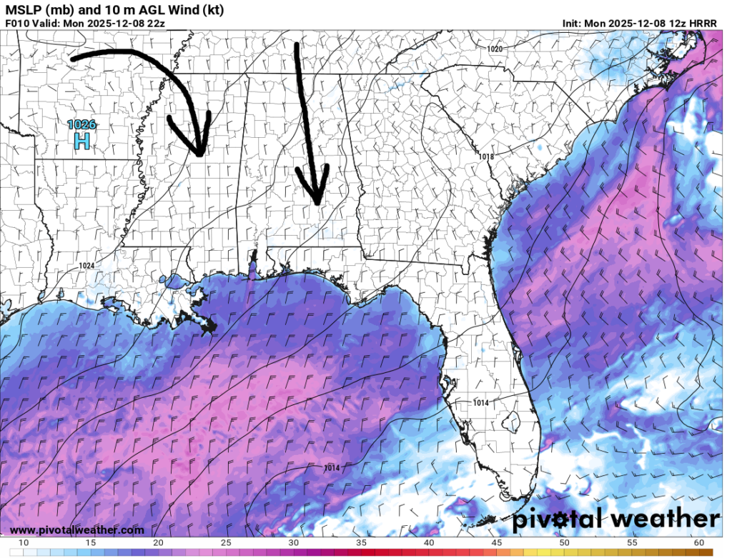
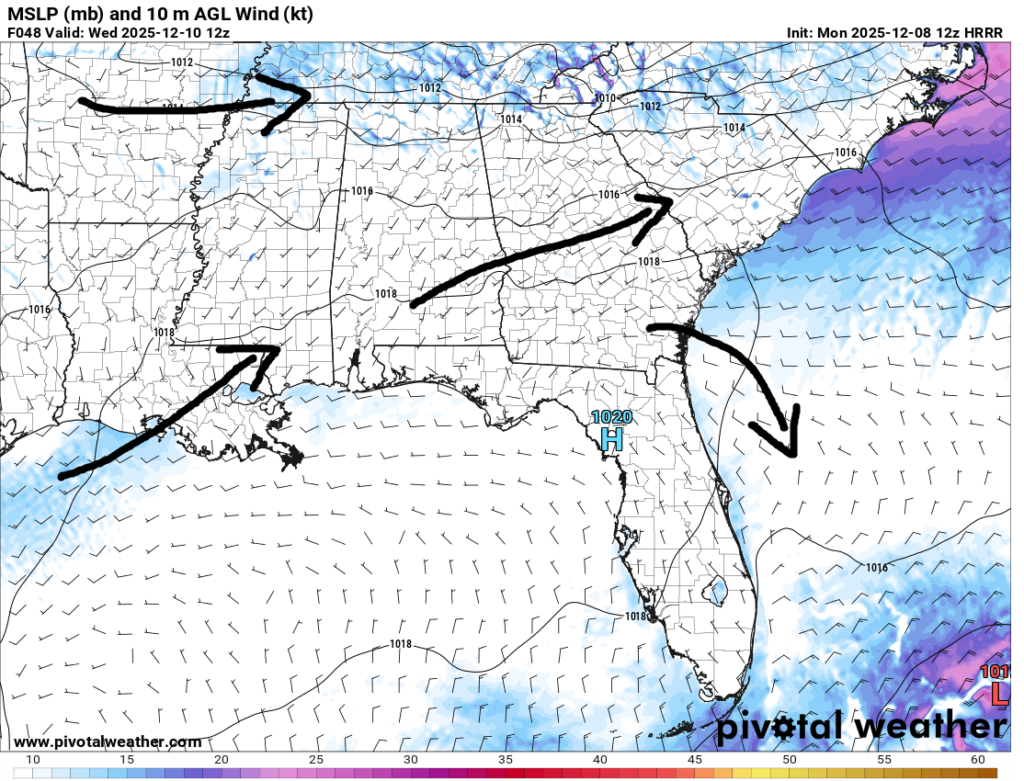
The data from the HRRR model above shows that pretty well. The black annotated arrows (my MS Paint skills really showing here) highlight the general flow in the lower atmosphere. That southwesterly flow will be a warmer wind that the north wind, so after a few cooler days to start the week, we should start to rebound back to around 65F to 70F by later this week.

LATER THIS WEEK
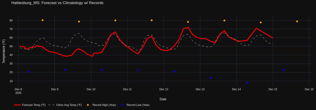
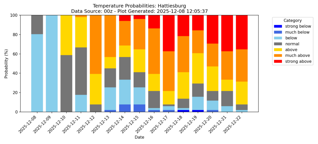
The warm up through Friday looks like it may come to an end on Saturday or Sunday. But until then it’ll be near-normal to slightly above normal. You can see how the chart for Hattiesburg looks here.
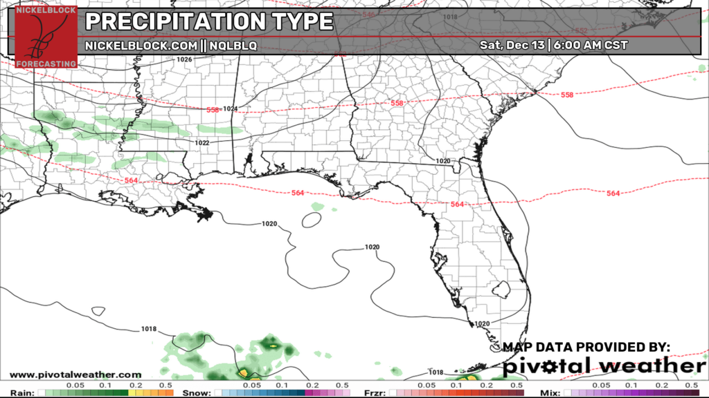
As we transition from this more mild weather into something potentially cooler, we may see a quick burst of some light rain this next weekend.
If and when we get our next cold shot is still a bit of a “TBD” situation when looking across the suite of model guidance. Here is a four-panel of the ECMWF, the GFS, the AIFS, and the GC-GFS.
This data is for Saturday afternoon.
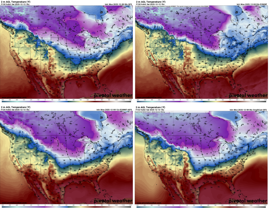
Noice all the purples and blues to our north. But also notice the shape of all of those colors. It is a bit different across each model. Some show the cooler temps further south. Others show it back north. Some have it diving south across Texas, others show it sliding east into the Great Lakes and Ohio River Valley.
I think the ECMWF probably has the best “take” on this with the AIFS/GC-GFS model close behind.
None of these show a big cold shot coming for our area. Instead most of it gives us a pass and we stick with highs in the 50s and 60s and lows in the mid 30s. That is a bit of a change from 24 hours ago.
Recall the previous forecasts were showing a day or two with temperatures well-below normal. Now, that isn;t looking as likely. The temperature probabilities, for example, show much more red across the baord.

NEXT WEEK
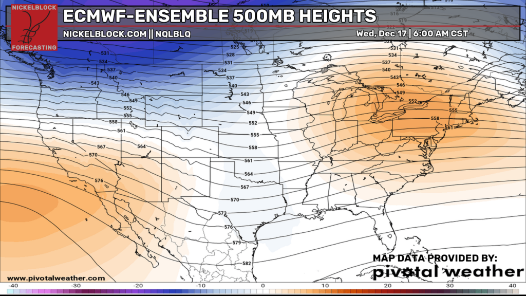
Guidance continues to lean toward a more mild outcome for next week for us. As our ridging builds across the east and up into the northeast, it means any shots of cold may be stuck up in the northwest and down along the foothills of the northern Rockies.
This would actually be a bit of an unsettled pattern for us, though. So while we would be mild, we would also see increased shots for rain and storms. So that is worth watching.
Right now there is nothing that really stands out in terms of a “Severe weather threat” or a “big time setup for storms” but the general pattern is favorable for passing systems and we should have enough of a fewtch off the Gulf to allow for storms to develop.
LOOKING OUT FURTHER
As we meander toward Christmas things get a bit more interesting. Mainly if we just look at the general pattern as well as the “control run” for the Cluster Data.
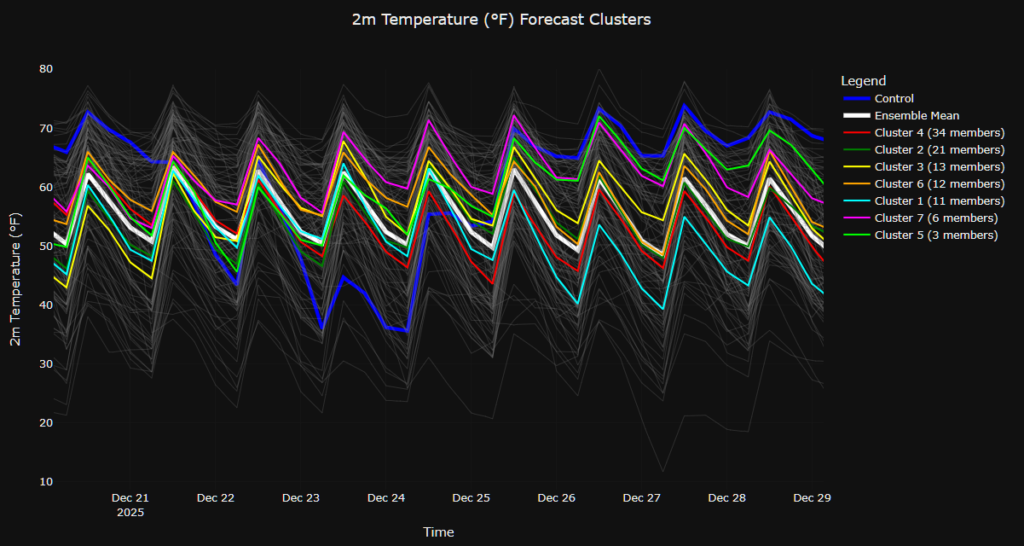
The general pattern suggests we should get another shot for cooler temps right around Christmas. Because if we ride the train we are currently on, the next round of cold would arrive around the 22nd.
The “Control Run” for the Cluster data here shows the shot of cold arriving a few days after that on the 23rd. That would set us up for a chilly few days right around Christmas and an actual reason for Santa to be wearing his big red coat!
But I will say that the Control Run is an outlier here. And we have a few other members that are outliers, but none of the main clusters are showing and “big cool down” coming.
So, worth monitoring, but nothing to write home about yet.


