This morning started off pretty frigid in the 20s, with a nice coating of frost on all the cars. We will stay cool today, with high temperatures around the low 50s. Overnight, we can expect the temperatures to fall once again; with the potential for more frost on the cars, so plan to allow some time to warm up during your morning commute.
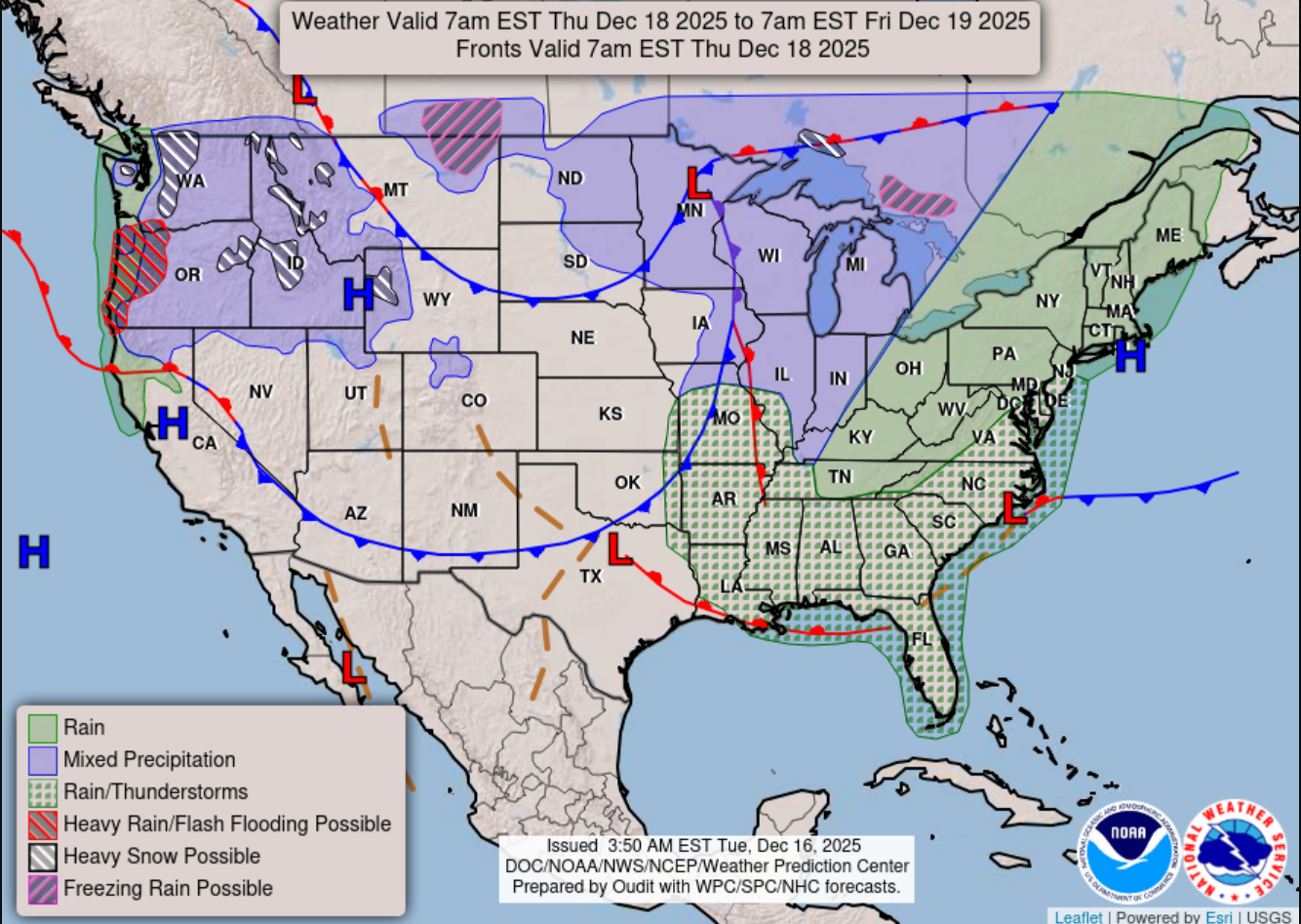
Wednesday will mark the beginning of our warming-up trend, with temperatures in the upper 50s and a small chance of scattered showers. Thursday, we will see unseasonably warm temperatures across the region, with some locations possibly reaching up to 75 degrees. Moving into Thursday night, there are increasing chances for thunderstorms, nothing severe at the moment, but keep an eye out for more updates, as this time of year is conducive to severe weather.
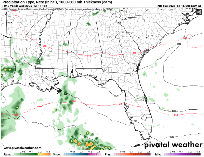
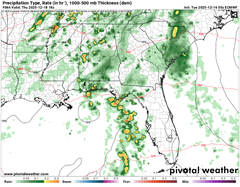
The increasing temperatures on Wednesday can be attributed to a short-wave ridge moving through the area. Moving into Thursday, we can see a cold-core trough centered in the Northern Great Plains, giving us this hefty warm front. Thursday afternoon, we will see more scattered storms before greater organization develops during the evening.
As this trough makes its way through the area, we could see some marginal severe thunderstorms, so keep checking for more updates. As the storms meander away and the cold front moves in on Friday, we can expect a brief cool-down.
LOOKING AHEAD TO THE WEEKEND:
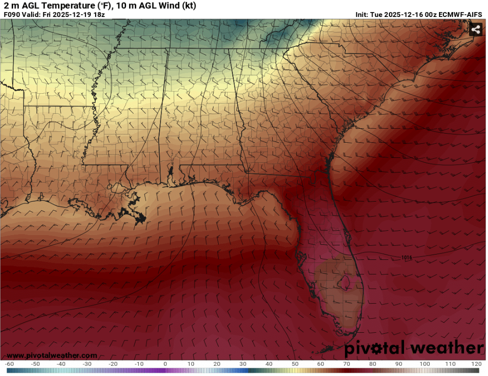
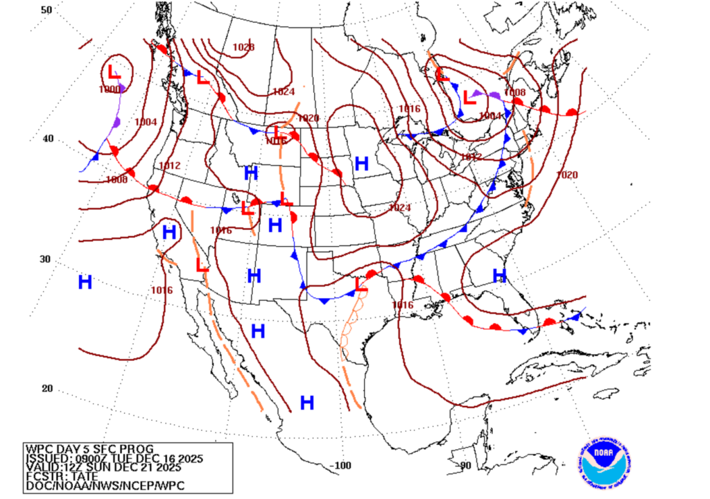
As the cold front moves in on Friday, we will see more moderate temperatures with highs in the low 60s and overnight lows in the lower 40s. Friday night into Saturday morning, the trough that caused this “cool down” will shift and now be centered over the Great Lakes, and we will move into a more ridging type of atmosphere, associated with clear skies and more moderate weather!
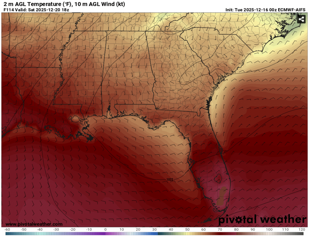
Saturday, temperatures will be in the mid-to-upper 60s with lows in mid-40s. We will see temperatures begin to increase Sunday with highs of low 70s and lows of mid 50s… we can thank the shifting winds and a shortwave associated with a low-pressure system for these warm temperatures.
There is also the chance of some scattered showers Sunday afternoon into Monday morning.
CHRISTMAS WEEK:
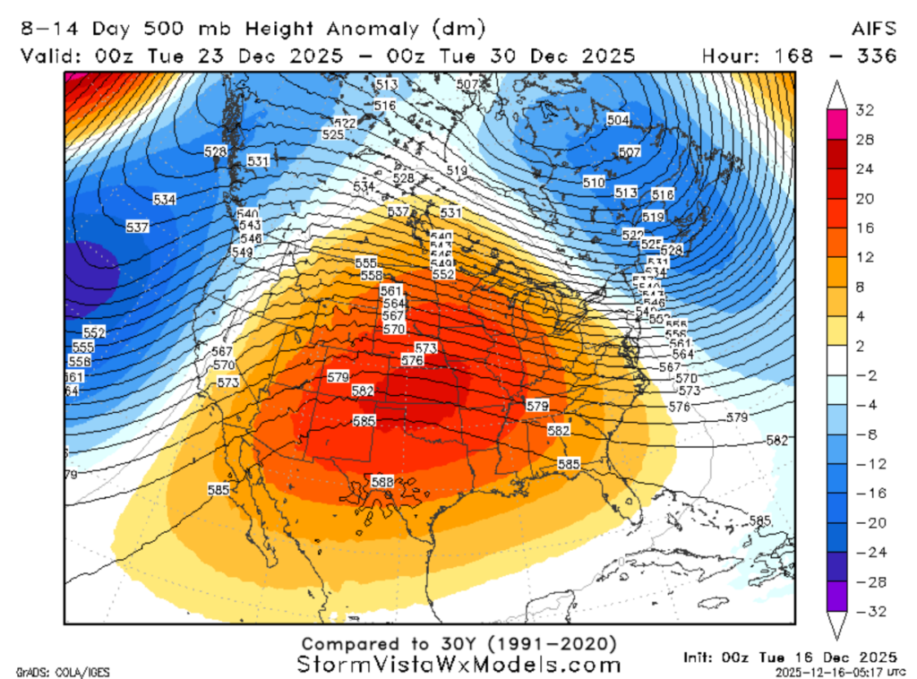
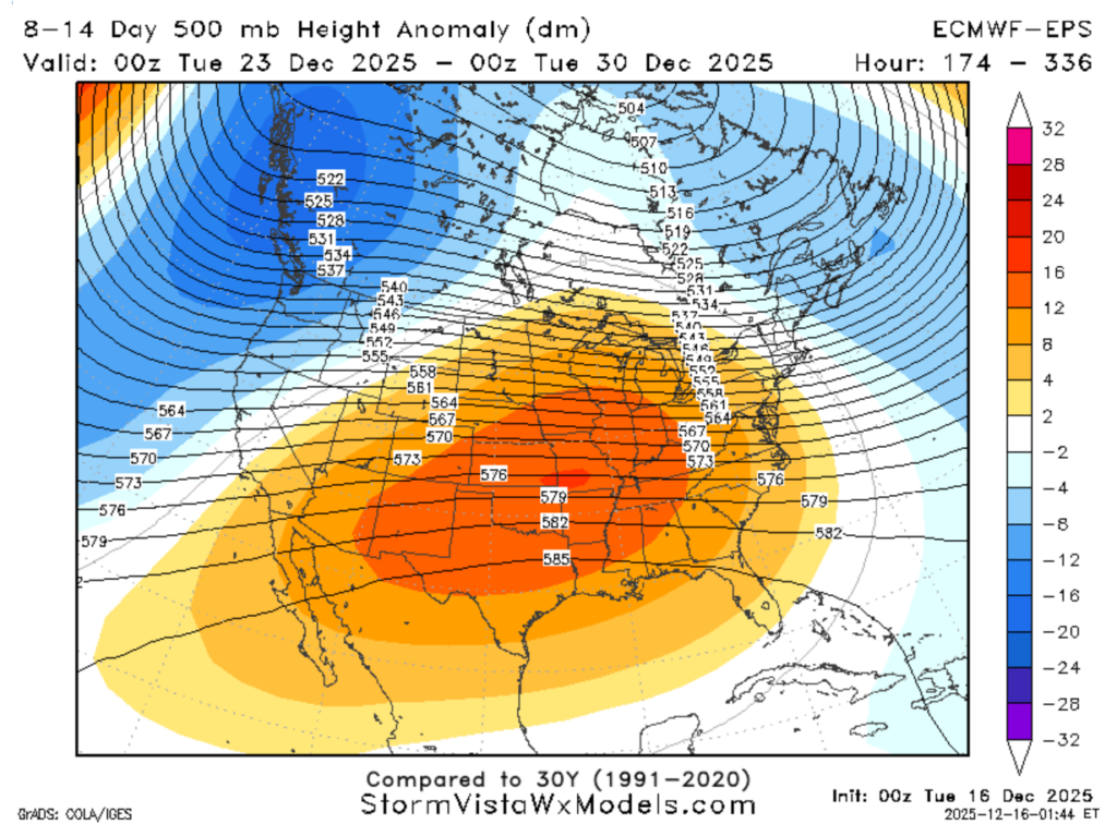
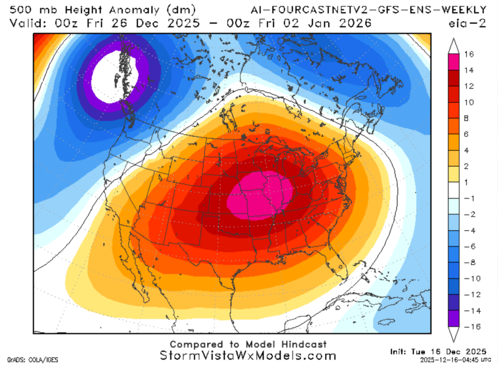
Starting out the week of Christmas, we see a upper-level ridging pattern begin to set up. Upper-level ridges are associated with high atmospheric pressure, which brings us more moderate, warm, and dry weather. While there is some chance of brief intrusions of colder air due to passing low pressure systems, it looks like we will be in a warmer-than-average holiday season.
Passing low-pressure systems bringing these shots of colder air is nothing out of the ordinary, but if any systems get closer, we could see precipitation. Nonetheless, precipitation anomaly maps continue to show a very dry next two weeks.
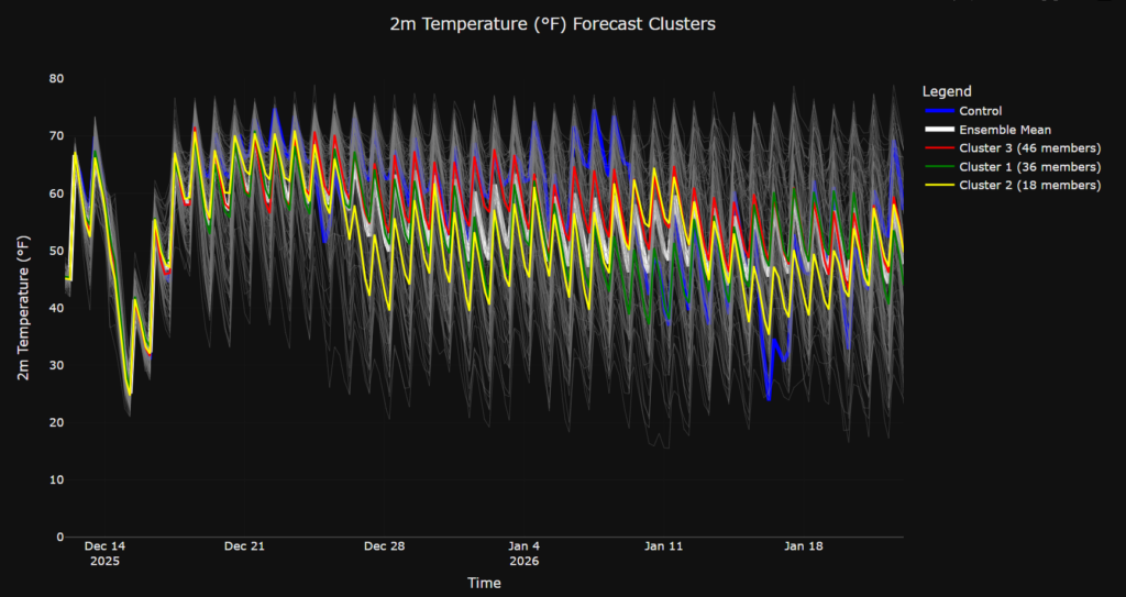
The models are in agreement with the persistent ridging pattern through Christmas and into the week of New Year’s, but based on cluster data, we cannot rule out any of those cold air shots.
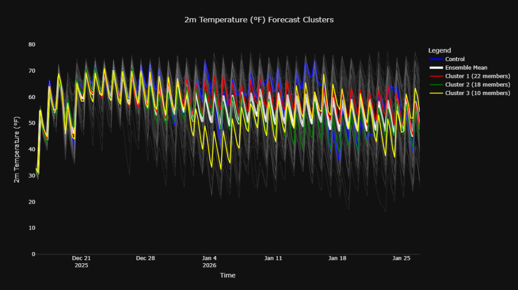
Most of the clusters are showing a generally warmer Christmas, but as we move into January, we can see the temperature dip in a couple of our clusters. So, Santa will not need his festive red coat and gloves for Christmas, but we might need them heading into the New Year.
NEW YEAR’S WEEK:
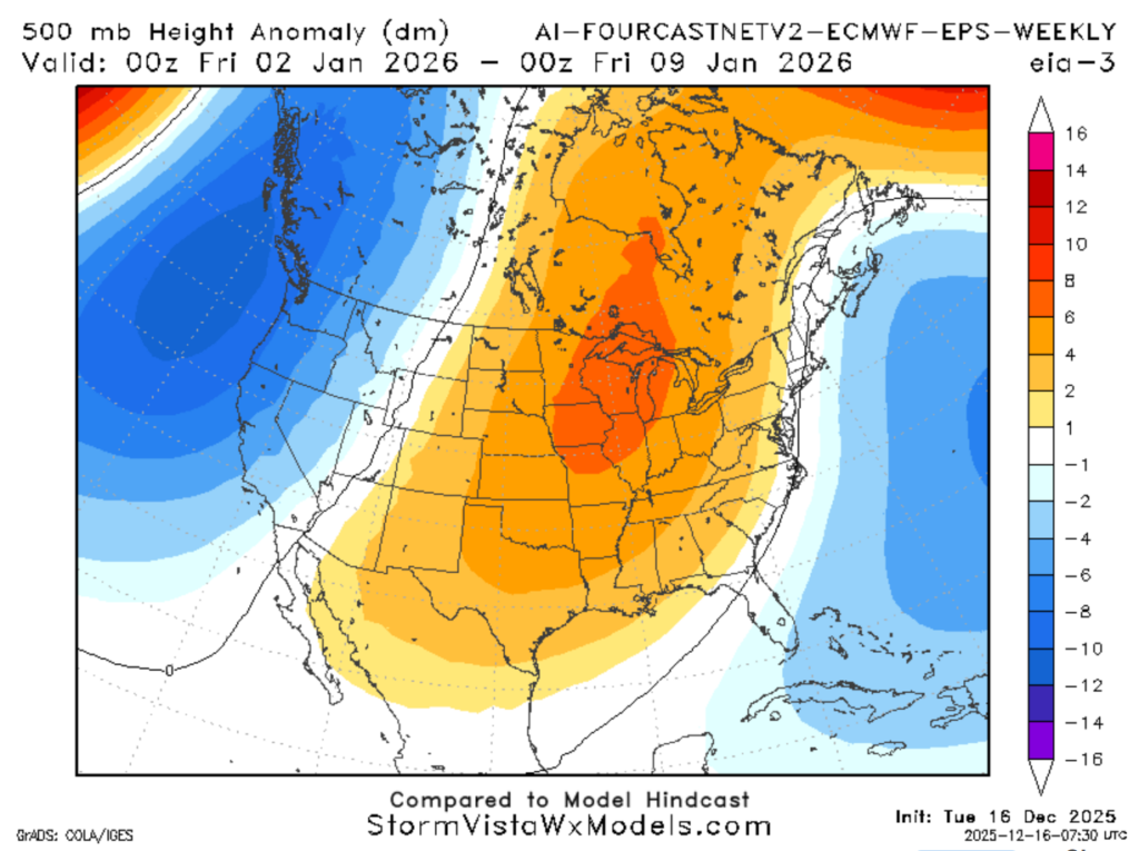
Our warm, dry, and mild conditions will likely persist into the New Year. Name a better way to say “Happy New Year’s” than 60 degrees! We could see some temperatures cooling down and chances of rain increasing around the second week of January, but it is something to keep an eye on.
Looking at our 500mb height anomaly maps, we can denote that until about January 9th, we are stuck in this persistent ridging. Again, look at our temperature cluster data, we can see the slight dip in some of our clusters around this time, but a more significant dip around the 14th of January.
Enjoy the nice, warm weather and Happy Holidays!


