Happy Thursday! Highs today will reach up to 70 degrees, with overnight lows in the low 50s. There is a chance for some showers and thunderstorms this afternoon and into the evening. These showers are from the lingering low-pressure system north of us. By Friday, the low-pressure system will have moved out of the region, and we will be feeling the cooler temperatures. By “cooler temperatures,” this means around 60 degrees. The overnight lows will be quite chilly; some places could see as low as the upper 30s.
Saturday brings back the warm, dry, and moderate weather due to the high-pressure system. The highs for Saturday and Sunday are expected to be unseasonably warm, around 70 degrees, with lows in the mid-50s. There is a slight chance of rain on Sunday morning, as a warm front moves in, so keep a raincoat handy.
LOOKING AT CHRISTMAS WEEK:
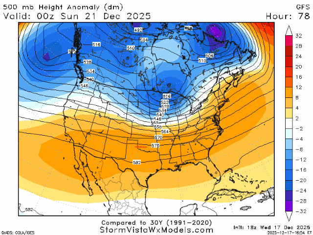
From this Sunday through Christmas, we are looking at the same warm, dry pattern. All the models agree on a consistent ridging pattern. A consistent ridging pattern brings moderate weather, with low chances of precipitation, warmer than average temperatures, and not a lot of variability. If we take a look at the 500mb height anomaly, we can see a steady height pattern.
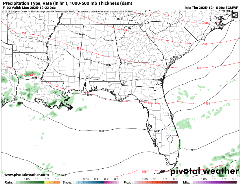
We could see some lingering precipitation on Monday from the warm front passing through, but the chances are low.
MOVING INTO THE NEW YEAR
From Christmas to the New Year, guess what? Warm! Who would have guessed? Looking at the composite models and cluster data from Christmas to New Year’s, we are seeing temperature in the mid-60s. Of course, this is far out, and we cannot be precise on the exact temperature for Christmas or New Year’s Day, but the models are suggesting the week will be on the warmer side.
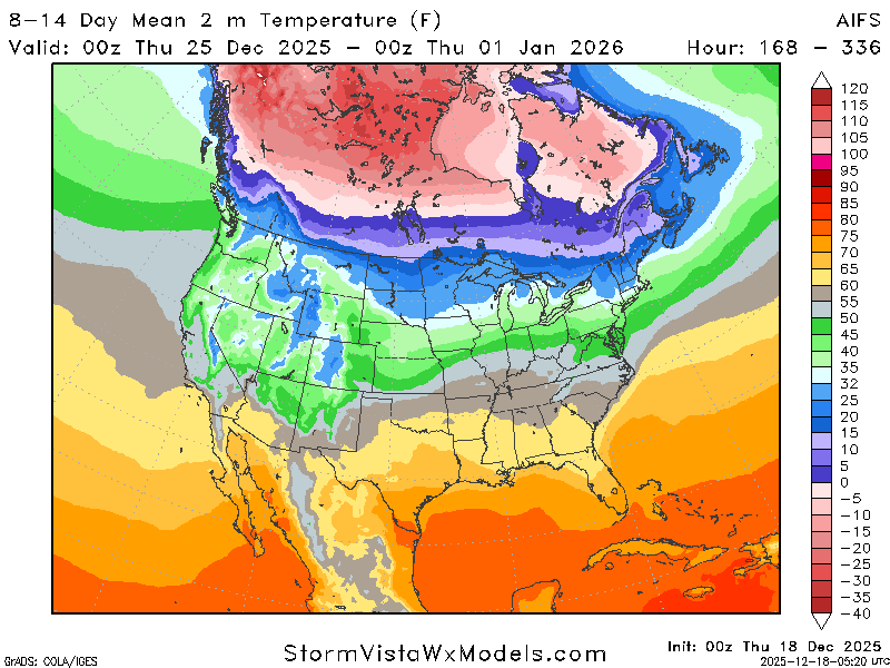
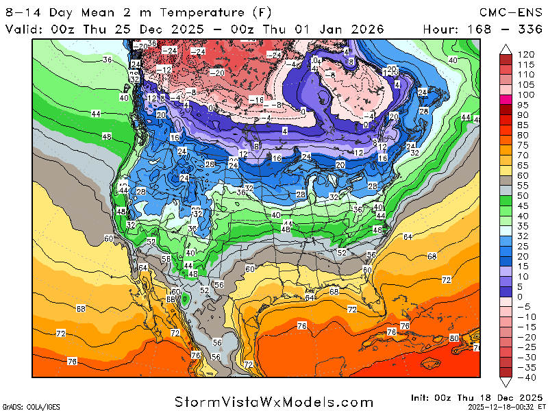
Looking at the two composite models above, we can see they agree on a generally warmer Christmas and New Year’s.
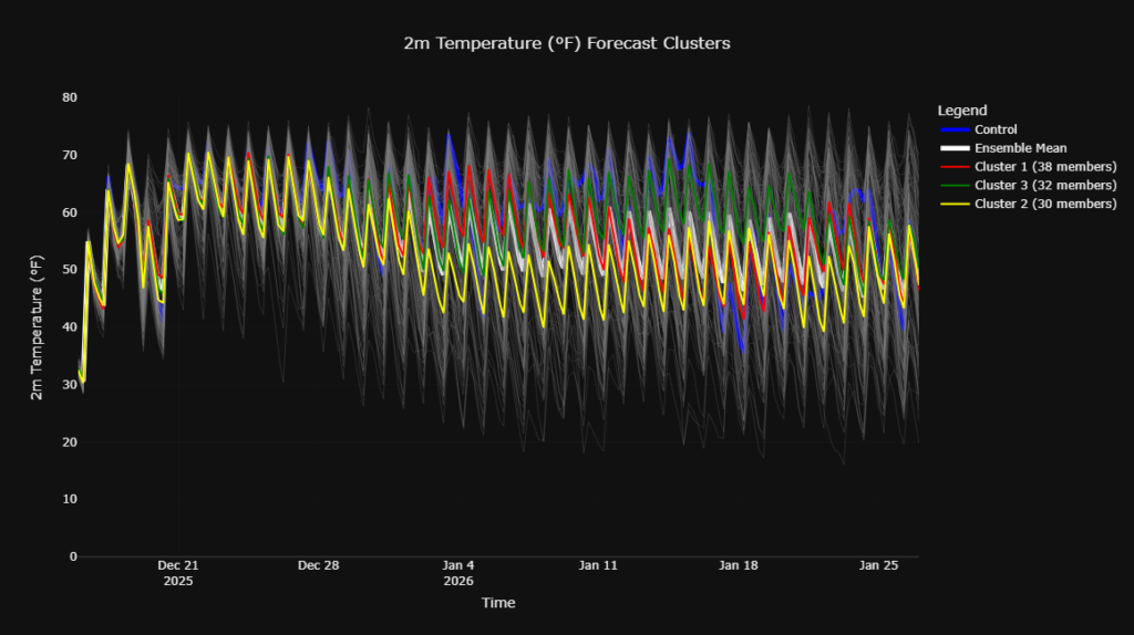
Looking at the cluster data above, from December 22nd to January 1st, we are pretty warm. That drop in the cluster data occurs right around January 2nd. While we can see there are members of the data suggesting we could go colder before then, most are hinting at a warm holiday season. Unfortunately, Frosty will have to wait till next year… hopefully.
Now, onto precipitation chances. While it is looking relatively dry, we could see some precipitation chances around the 28th and 29th of December. Let’s go back to our cluster data, but for precipitation chances!
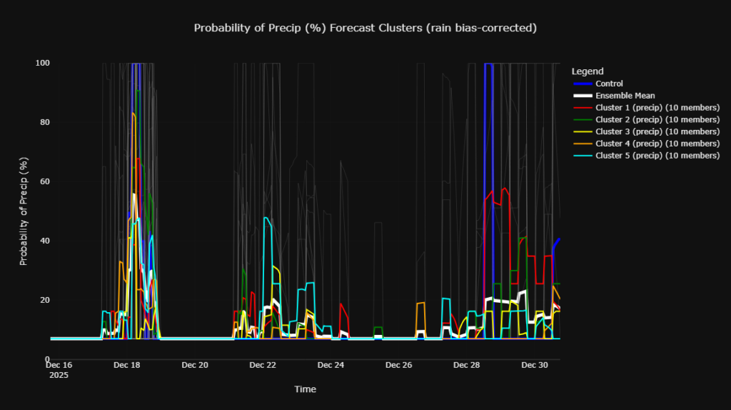
Okay, this looks scary, so let’s break it down. The jump in the clusters around the 28th-30th is what we are looking at. We have a decent number of members agreeing on an increasing chance of precipitation around this time. So, if you are planning an after-Christmas vacation, be sure to come back for more updates.
BEYOND THE NEW YEAR
Let’s keep looking ahead! As mentioned above, it appears to cool down slightly after the New Year and go back to the average temperature for this time of year. While the cluster data shows a bit of a cool down the composite weekly models do not agree. They are still showing above-average temperatures for this time frame.
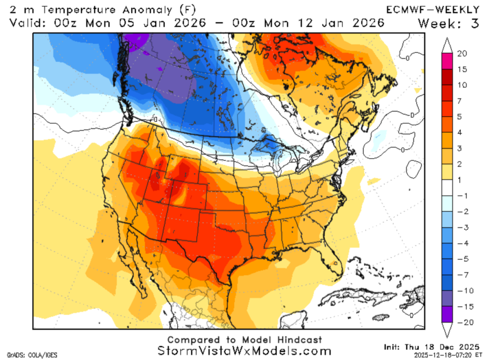
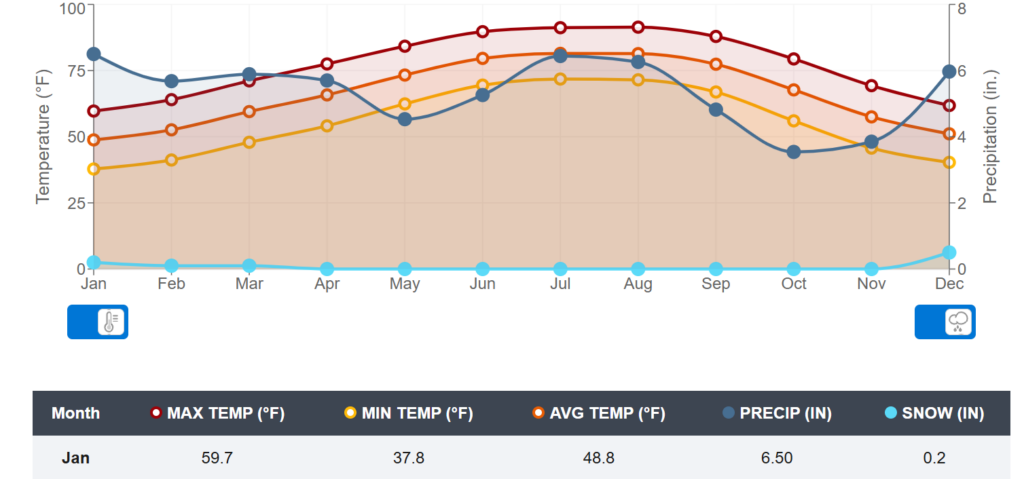
This is the ECMWF weekly for the first two weeks in January. As denoted by the legend on the right, the model is showing around a 3-5 degree above-average temperature for this time. The average maximum temperature for this time of year in Hattiesburg is around 60 degrees, and the average minimum is 38 degrees. The models indicate about 5 degrees warmer than these temperatures.