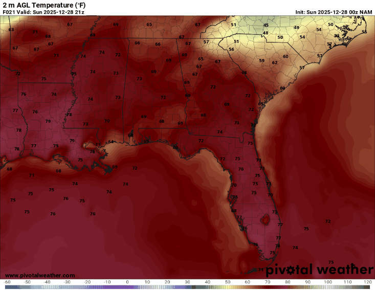
The high temperatures today will reach the upper-70s in some areas, but by Monday morning, the temperatures will plummet to the low 50s. This dramatic drop in temperatures is due to a strong cold front moving in. Ahead of the cooler air arriving on Monday, we can expect showers tonight.
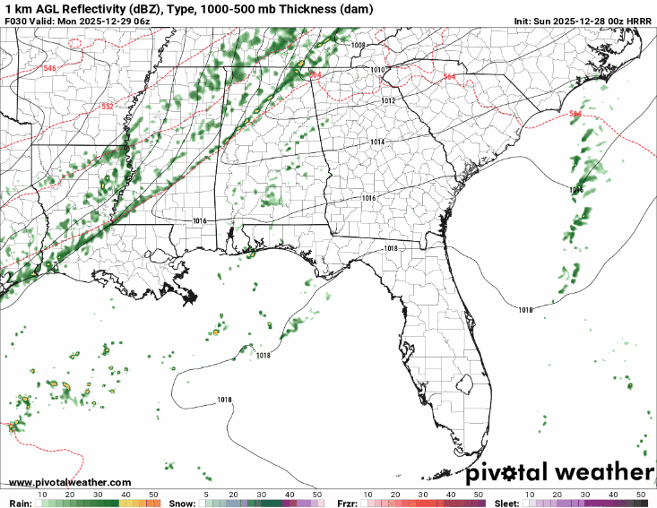
Looking at the GIF of precipitation above, we can see a well-defined line of precipitation. It takes on this shape because of the cold front behind it. Cold fronts typically follow a pattern. First, a line of precipitation, followed by the cooler air. There is no indication of any severe weather associated with this system, but periods of heavy rain and gusty winds will be possible.
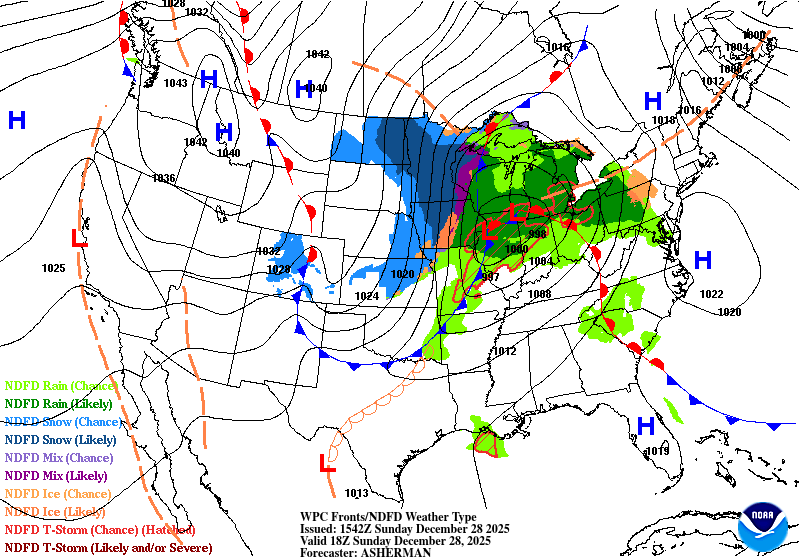
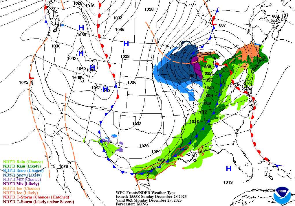
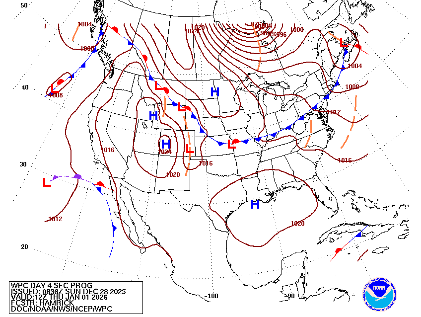
Looking at today’s surface analysis, we can see the cold frontal boundary is sitting north of our area, but by Monday at 12 a.m. it has made its way down into the region. This cold frontal boundary is what is responsible for the precipitation and cooler temperatures we will see.
Now, just how cold is it going to get? On Monday, expect highs in the low 50s, with overnight lows getting down into freezing range. These freezing temperatures are likely in Pike, Lamar, and Perry Counties, as well as the surrounding areas. You can expect frost on the surfaces on Tuesday morning due to these overnight freezing temperatures.
Tuesday and Wednesday will remain cold, with high temperatures in the high-40s to low-50s and the overnight lows likely getting down to that freezing point. So, make sure to cover the pipes, bring your pets in, and bundle up because it is going to be chilly.
If you are going out for New Year’s Eve, make sure to bring a coat!
New Year’s Day through the end of the week:
As the high pressure moves to our east, we will begin to see some warmer temperatures. The highs for New Year’s Day and the day after will make their way back to the lower 60s, and the low temperatures back to the lower 50s.
The surface analysis is showing the high pressure, which is causing the warming temperatures to start the year. This high pressure is moving toward the east, causing the winds to shift more southerly and allow warmer air to move back into the region.
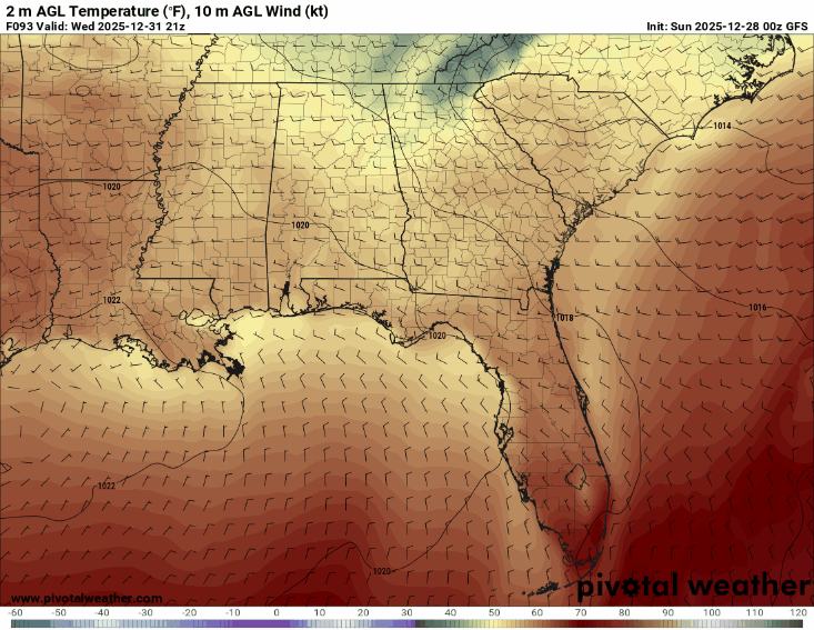
This GIF depicts the shifting winds bringing warmer temperatures for the first day of the year. Watch as they shift from northerly to southerly in 24 hours. As the high pressure is migrating to the east, a low pressure is moving in, which will lead to shower and thunderstorm chances on Friday and Saturday.
The models show a disagreement about the timing of the precipitation and the track expected with this low-pressure system.
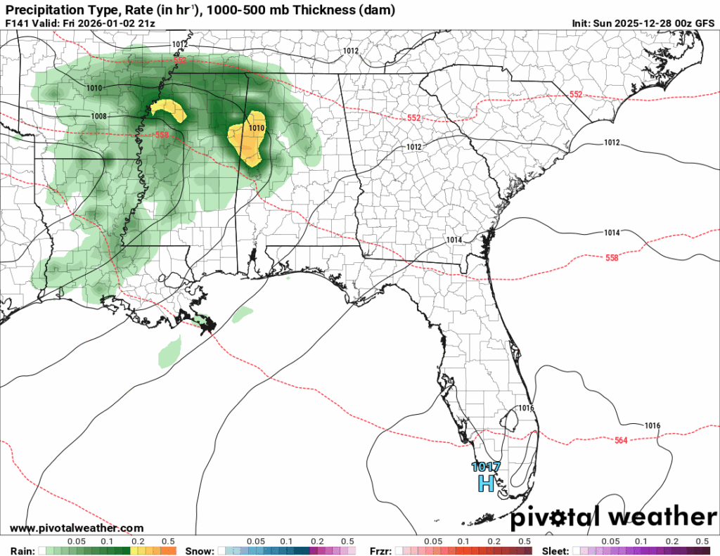
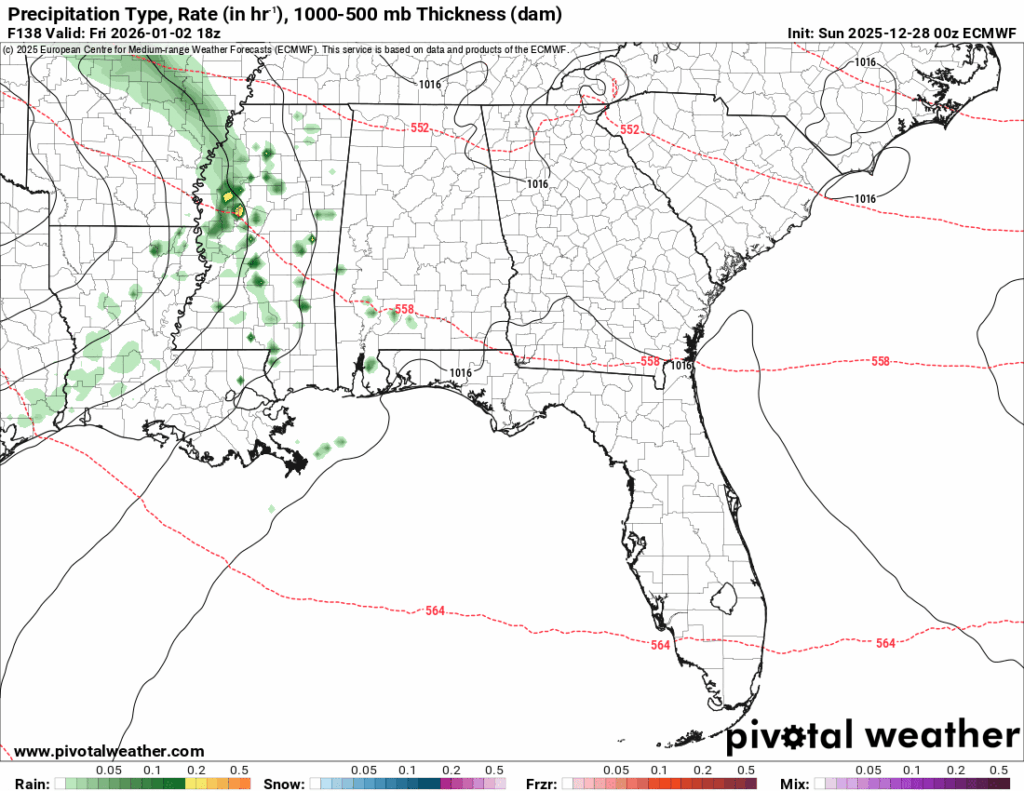
The GFS model shows showers developing Friday afternoon and evening, with the system moving due east toward Birmingham. While the ECMWF shows the majority of shower and thunderstorm chances Saturday morning, with the system moving northward towards Tennessee. In my opinion, the GFS has a better take on what is going to happen, but look out for more updates.
After these showers have passed, we can expect Sunday to be a bit cooler than the rest of the week, with highs in the low 60s.
Despite the two precipitation events that pass through, most long-range models are saying we will remain drier than average.
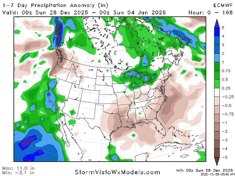
The ECMWF is indicating we will be about 1 inch below the normal amount of precipitation for this week. Let’s look at the drought monitor to see how this can impact us.
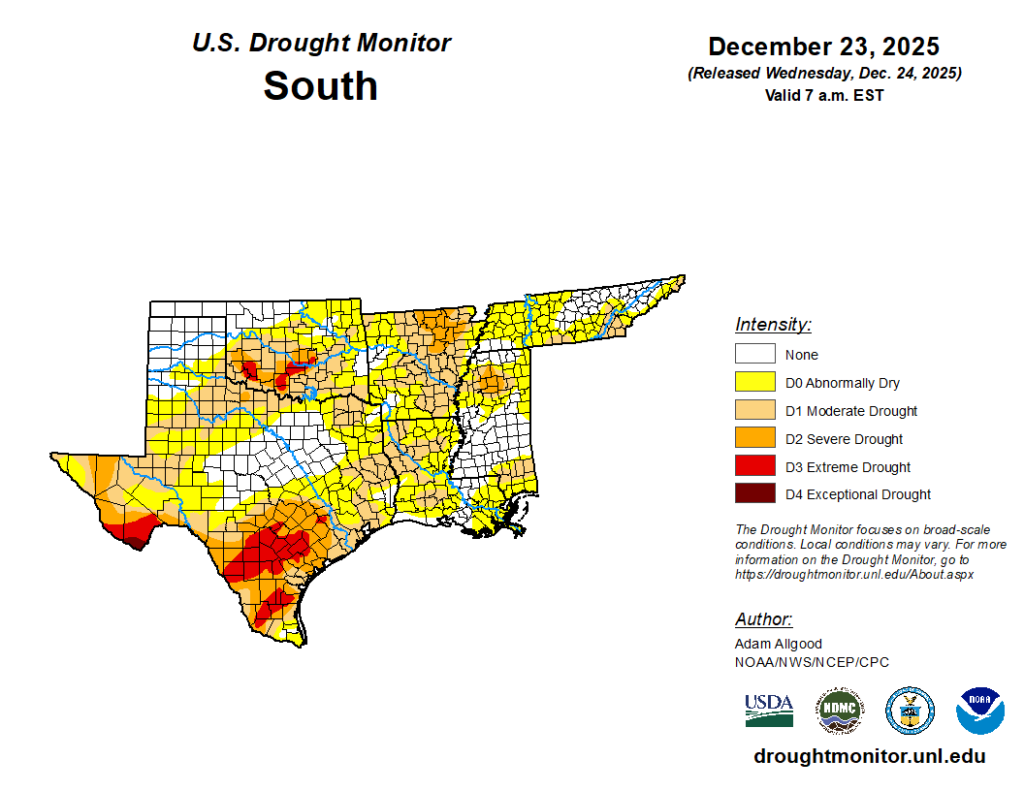
The region is currently ranging from no drought to moderate drought, but with the two precipitation events, hopefully, the regions in a moderate drought can move into better conditions.
First week of the year:
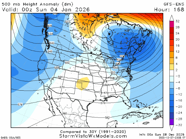
Looking forward to our first full week of the new year, models are trending warm (boo!!). Instead of being stuck in a prominent ridging or troughing upper atmosphere, we are looking more neutral.
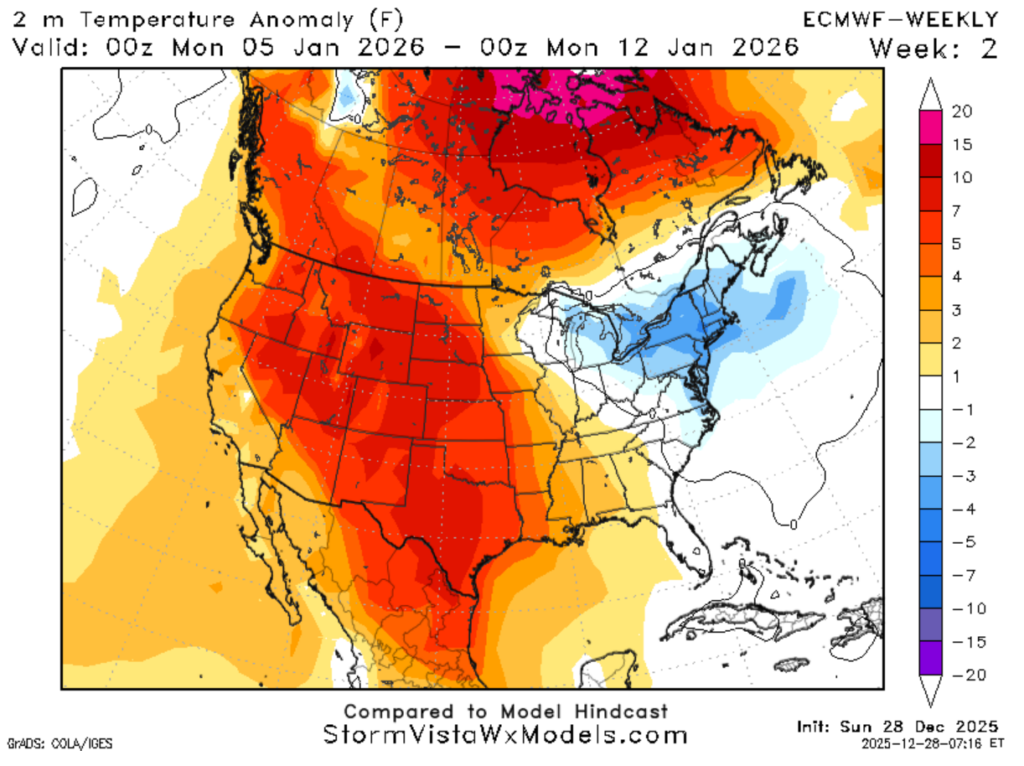
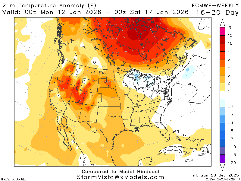
Looking at the map on the left, the 2m temperature anomaly, it looks like we will be about 3 to 4 degrees warmer than the average temperature in this first full week of January. Some models indicate it will be cooler than average, but the vast majority agree it will be slightly warmer. This more neutral upper atmosphere means there will be less variability in our weather.
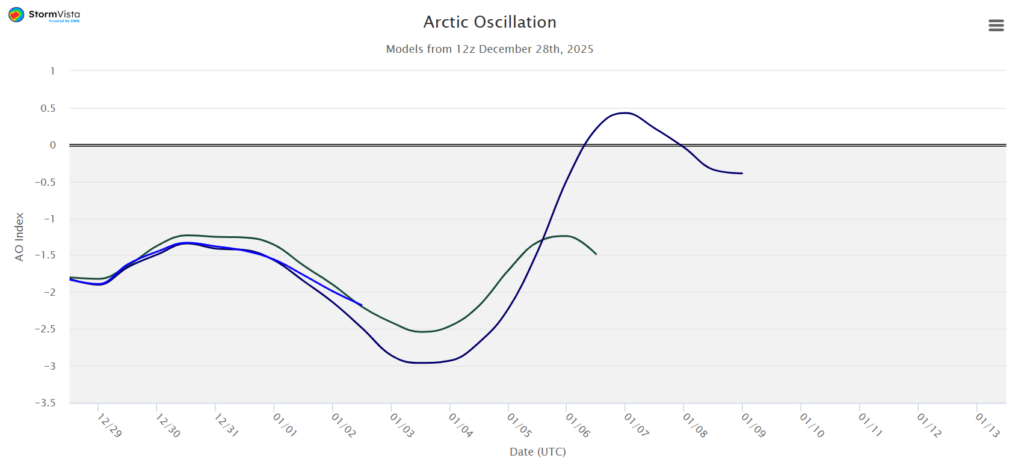
Looking at one of the teleconnections, the AO, we can see it begins to trend more positive on January 4th, which means it will begin to get warmer. This is in agreement with the 2m temperature anomaly that signals it will begin to be warmer this first week of January. Teleconnections are good for recognizing patterns, but temperatures are influenced by many local effects that teleconnections cannot take into account.
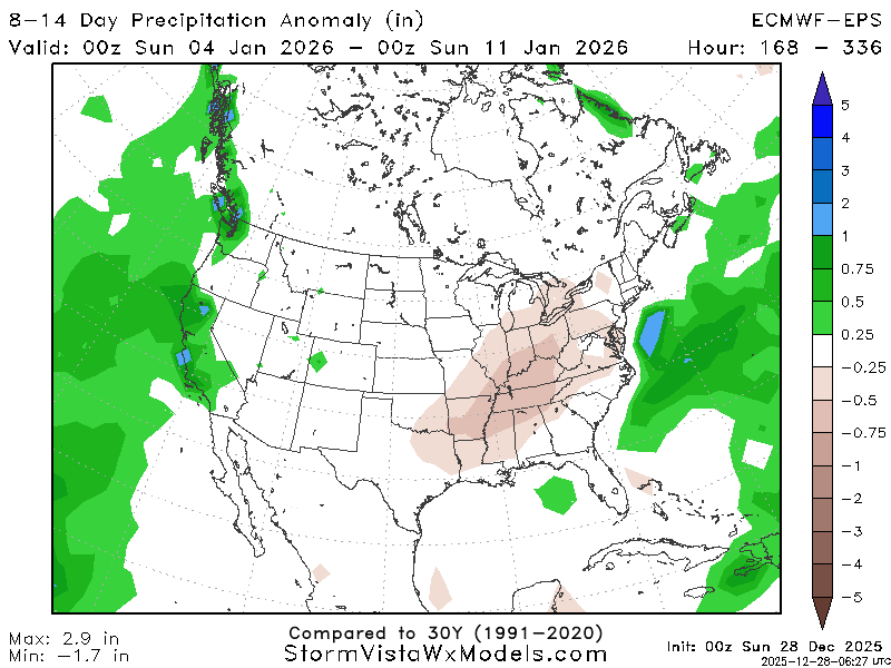
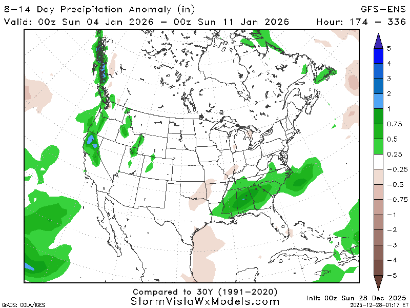
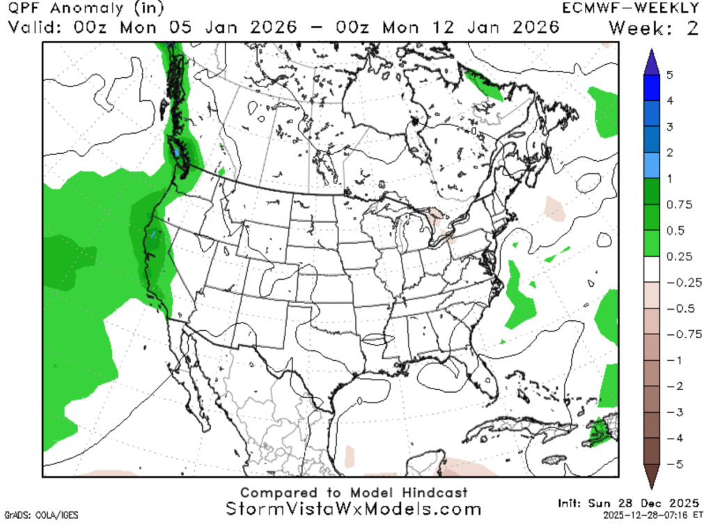
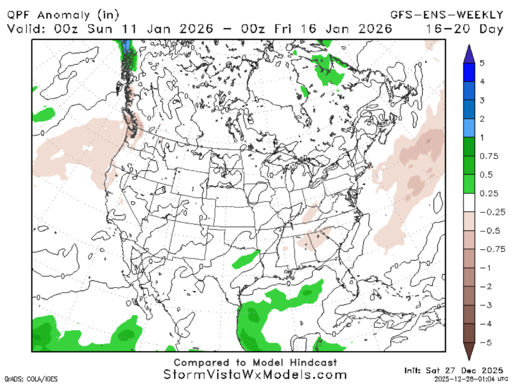
Using the ECMWF-EPS and GFS-ENS, let’s look at precipitation. As we can see, these maps are very different; the GFS-ENS is predicting the precipitation to be 0.5-0.75 inches above the average for this week, but the ECMWF-EPS is predicting it to be around the average.
A lot of the models are all over the place for the precipitation anomaly, but given the state of the upper atmosphere (neutral), I would lean towards an average precipitation week.
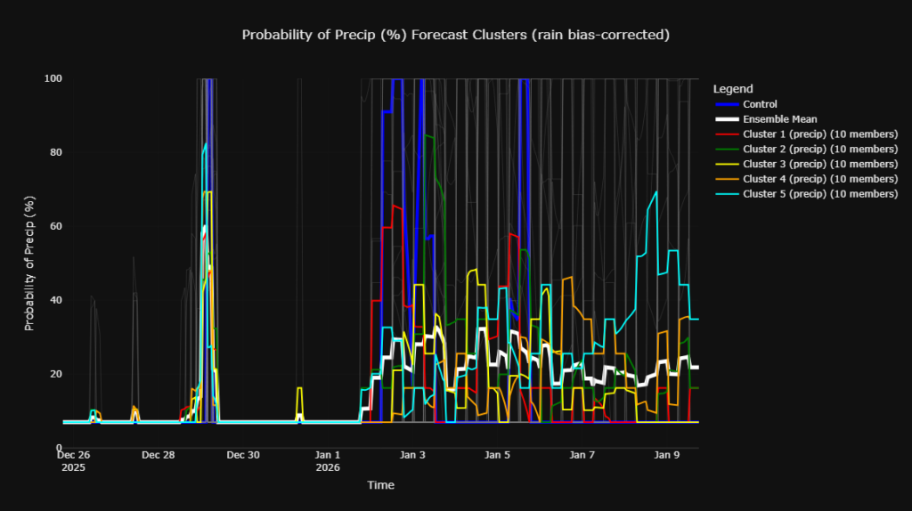
The clusters are also all over the place for precipitation. This is a good example of how complex the weather can be. So, for now, keep an eye on the rain chances if you have any outdoor plans for that first week of January and come back for more updates!
Looking out beyond the first week of January:
We are looking to maintain a pretty average temperature pattern into the second week of January. Models are also now agreeing that the precipitation chances are looking average.
It appears to only be about 1 degree above the average temperature for this time of year, so expect temperatures in the upper 50s to low 60s with lows in the upper 30s to mid 40s.
As shown above, the models are agreeing much more than they were for this week than the first week of January. It appears to be a pretty average week for precipitation, as both models show no dramatic changes.
The second week of January is looking pretty average, so what’s average?
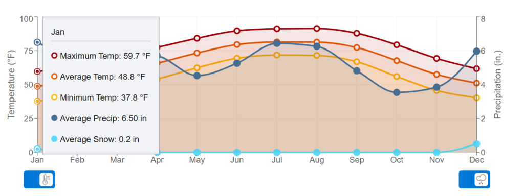
These are the average values for the entire month. The models are predicting the second week of January to be similar to these values for both precipitation totals and temperature values. For the precipitation average for the week, it would be around 1.5 inches, but this is based on the 30-year climatological average and is subject to change.


