Good afternoon and Happy New Year! The high temperatures today will be in the upper 60s, with some locations approaching 70-degree mark, and a few areas may briefly reach it. Overnight, the lows will dip down into the lower 50s.
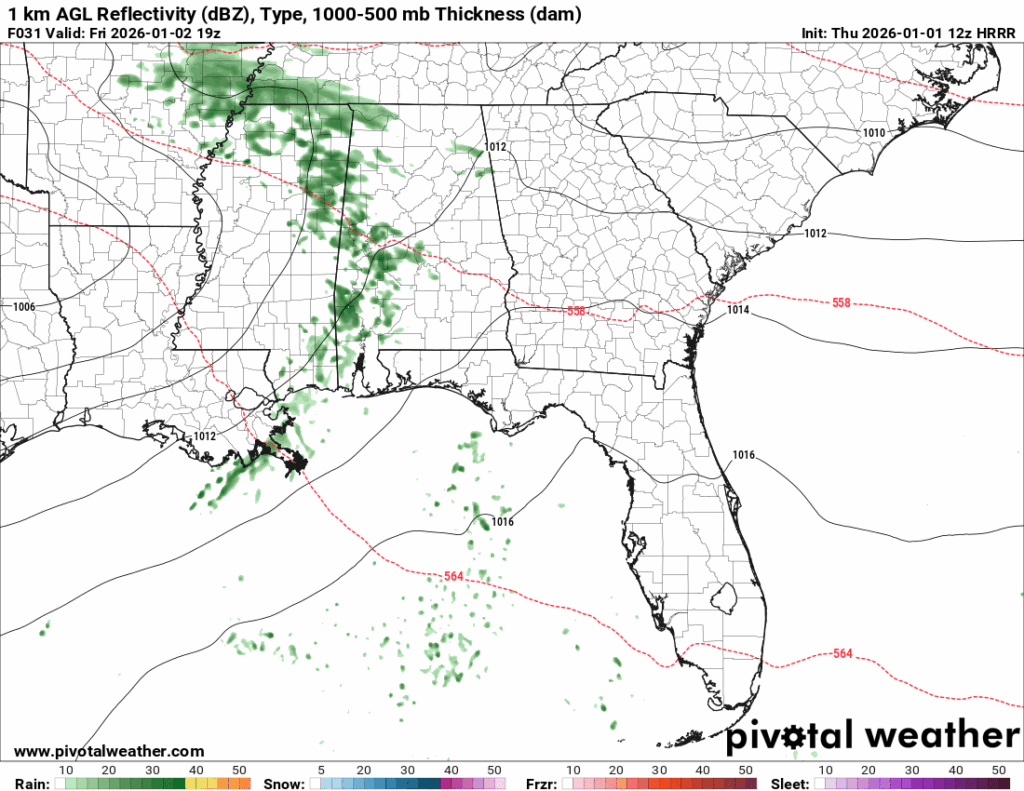
Friday high temperatures will likely reach the low 70s, and there will be scattered showers throughout the day. While most of the activity moves out by the afternoon, a few showers may linger into early Saturday morning.
The region remains ahead of a low-pressure system, placing us in the warm sector, which provides us with precipitation and unseasonably warm weather. A warm sector is exactly what it sounds like: the warm air mass in front of the passing system that causes temperatures to rise.
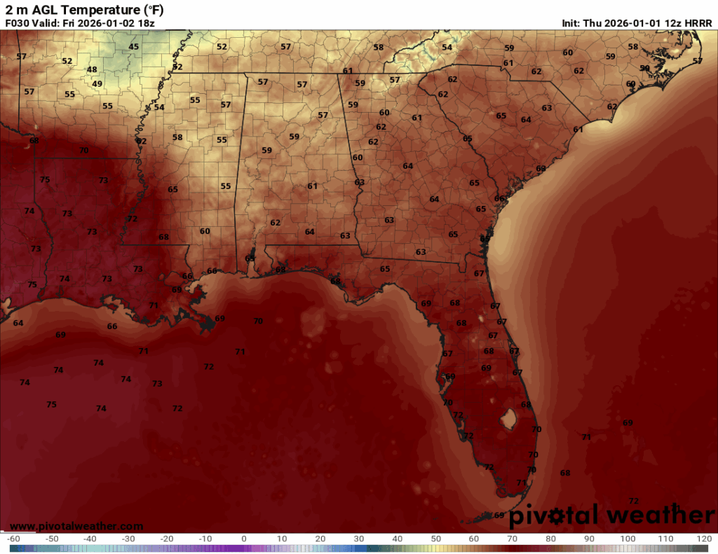
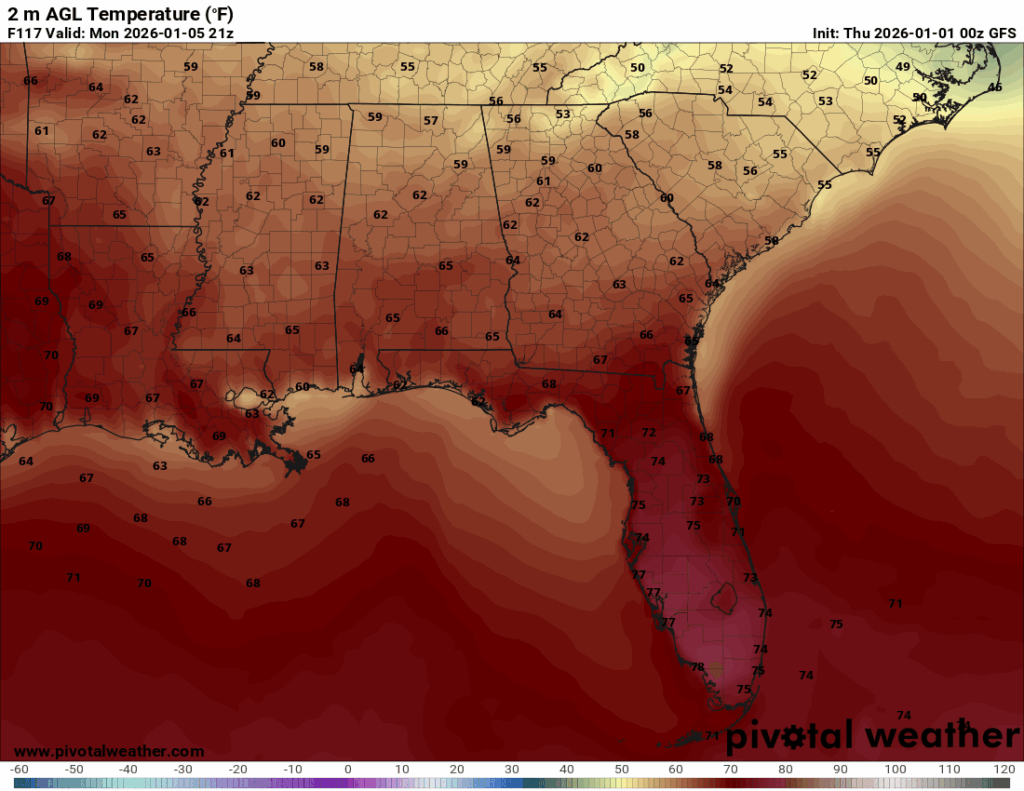
Looking at the temperature map for Friday, it shows that the warm sector pretty well! That harsh line dividing the 70-degree temperatures from the 50 to 60-degree temperatures is the boundary.
Saturday will remain warm, with high temperatures reaching the upper-60s to low-70s, but the overnight lows will be cooler, dropping into the low to mid-50s. By Sunday, we are out of the warm sector, and it is back to the cooler weather. High temperatures will fall into the mid to upper-50s, with overnight lows down in the low to mid-40s.
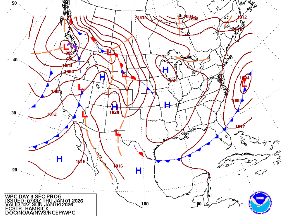
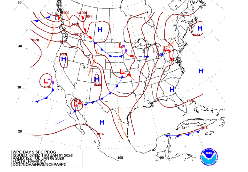
The surface analysis map for Sunday shows that the low-pressure system has completely moved out of our region, and now we are in a region of higher pressure, which is responsible for the cooler temperatures.
The weekend will start off pretty warm with the chance for scattered showers, but by Saturday afternoon, those showers should have moved on enough to enjoy the rest of the weekend. Sunday will be cooler but should have some sun, so a great day to get outside!
Starting off the work week:
Unfortunately, or fortunately, whichever you prefer, the cool temperatures on Sunday are not here to stay.
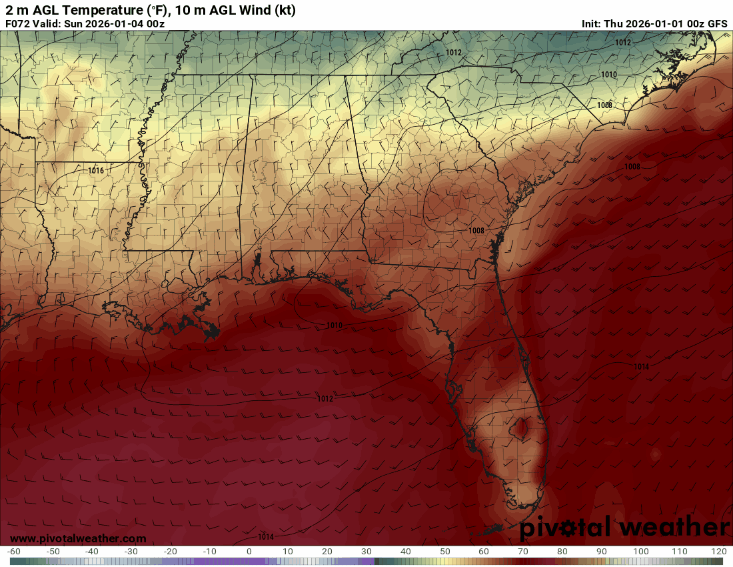
In the 24-hour window from Sunday to Monday, the winds in the region shift from northerly to southerly. On Sunday, we receive the cool air as the front passes through, resulting in northerly winds. Northerly winds, which originate in the north, transport cooler air into the region.
By Monday, the winds shift to southerly, and the Gulf gives us a nice warm up.
Monday through Thursday, expect high temperatures to range from the mid-60s to low-70s, and low temperatures to range from the mid-50s to mid-60s. Until Thursday, there are no notable chances for precipitation in the region.
The region will be under more of a high-pressure influence during this time, moderating the chances for any precipitation, but by Thursday, things change.
Let’s take a look at next Thursday’s chance for precipitation. At the moment, the GFS and the ECMWF are in disagreement over the track of the low-pressure system. This uncertainty then leads to differences in the precipitation amounts in the region.
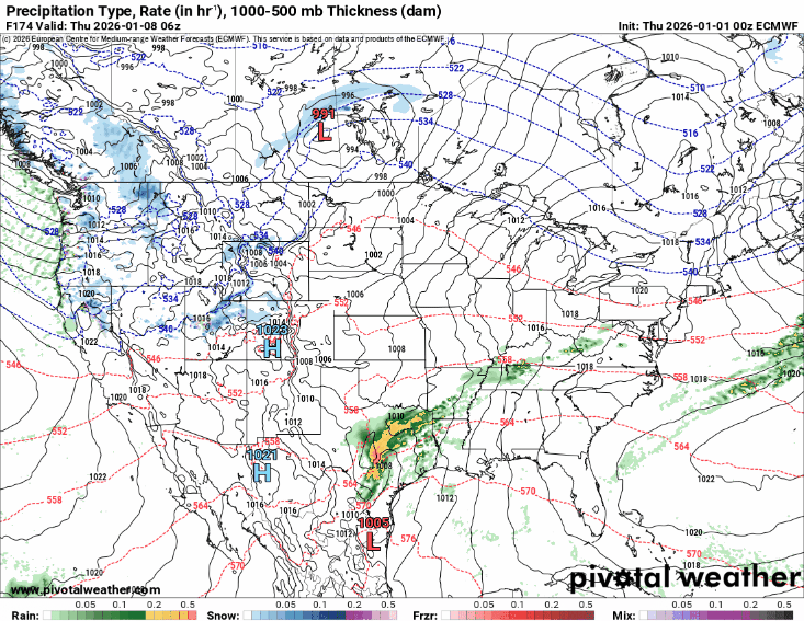
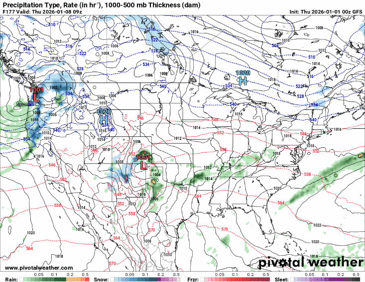
Talk about a disagreement…So, the ECMWF is on the left and has the low-pressure bringing widespread precipitation and thunderstorm chances into our area, while the GFS is on the right and shows the low-pressure moving north, resulting in limited precipitation for the region, far less than what the ECMWF predicts.
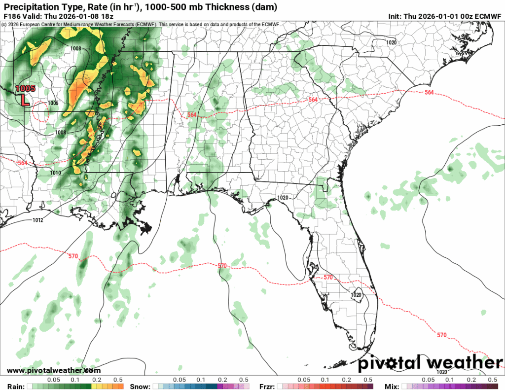
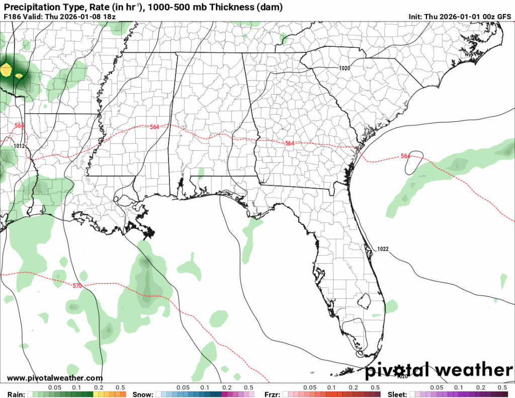
Zooming into those Thursday chances, we once again can see the stark contrast between the models. `
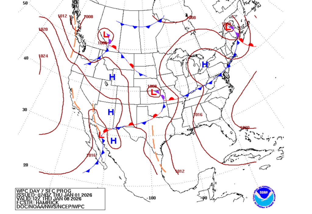
Currently, the WPC is leaning more towards the GFS prediction and has the system moving more northward. The system can still bring precipitation and thunderstorm chances to the region, but the impacts would not be as strong.
Looking out to the workweek, I would expect high temperatures ranging between 60 and 70 degrees with lows in the mid-50s to low-60s.
For Thursday, while the confidence in a specific track is limited, I favor the odds of the system moving farther north and not tracking directly through this region; however, it can still bring scattered showers as well as a possible thunderstorm, so stay prepared and continue to monitor the forecasts!
This system is still several days out, so keep a lookout for more updates. As we get closer to this time, we will have a better idea of what is in store.
Moving into next weekend:
Moving into next Friday and beyond, let’s see what is in store.
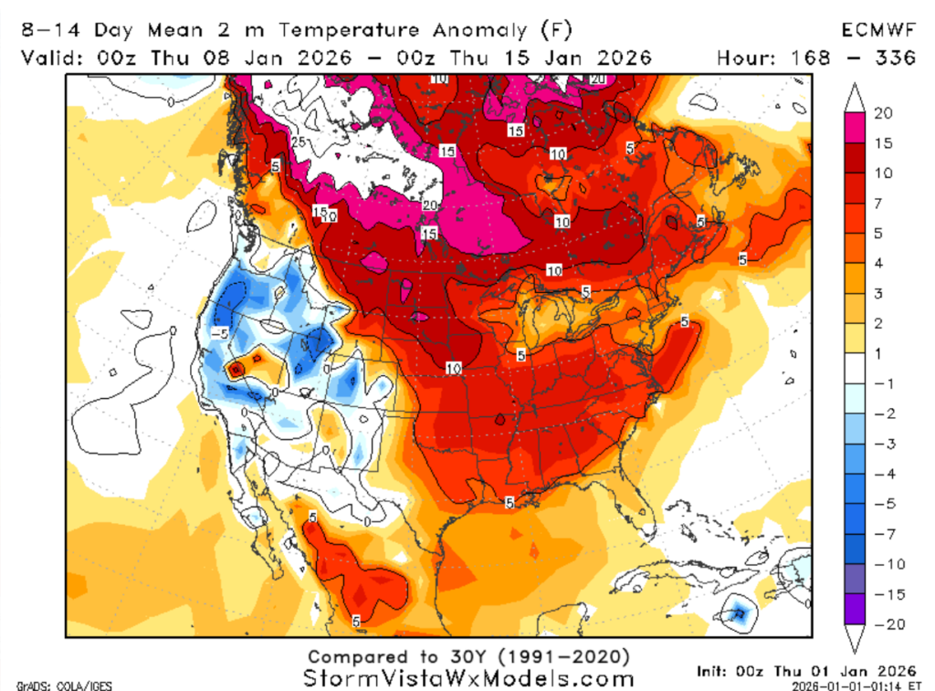
We are still looking at a warming trend for this period, with models predicting well-above-average temperatures for this time of year. Most models are predicting temperatures anywhere from 5 to 10+ degrees warmer than average.
Currently, I would not rule out any possible shots of cold air due to the changes in the upper atmosphere pattern. So, while the overall temperature pattern is showing warmer-than-average conditions, it is still possible to experience cooler days while our atmosphere changes patterns.
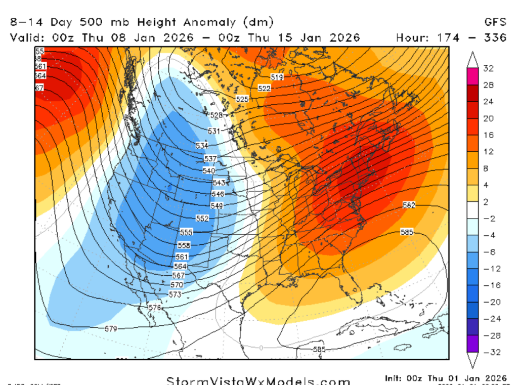
We appear to be moving out of the ridging atmosphere and into a more trough-like atmosphere. With this troughing environment, it is not uncommon to get occasional shots of cold air and increased precipitation.
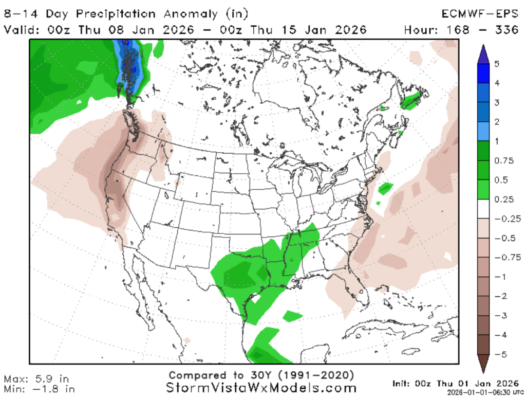
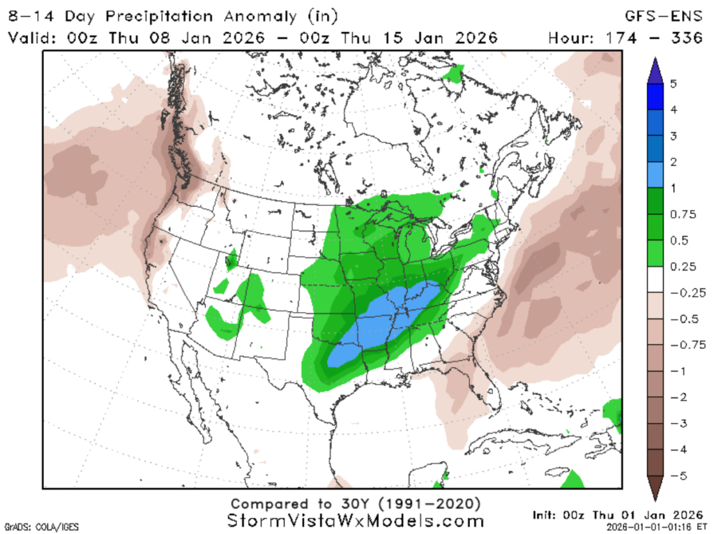
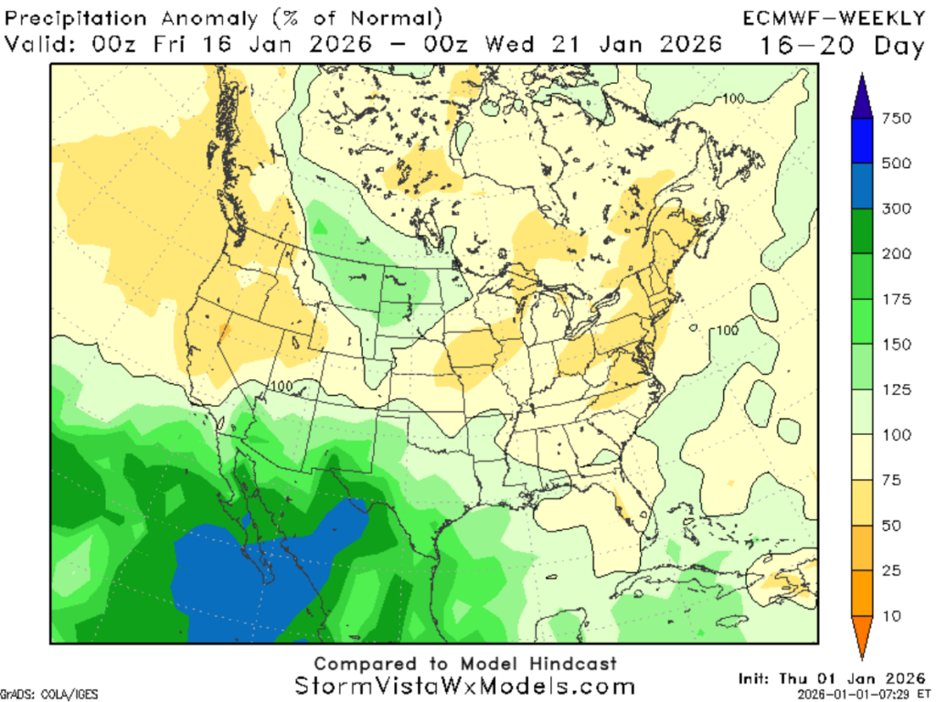
Checking on our precipitation chances, it appears we will have near-or above-average amounts of precipitation during this timeframe.
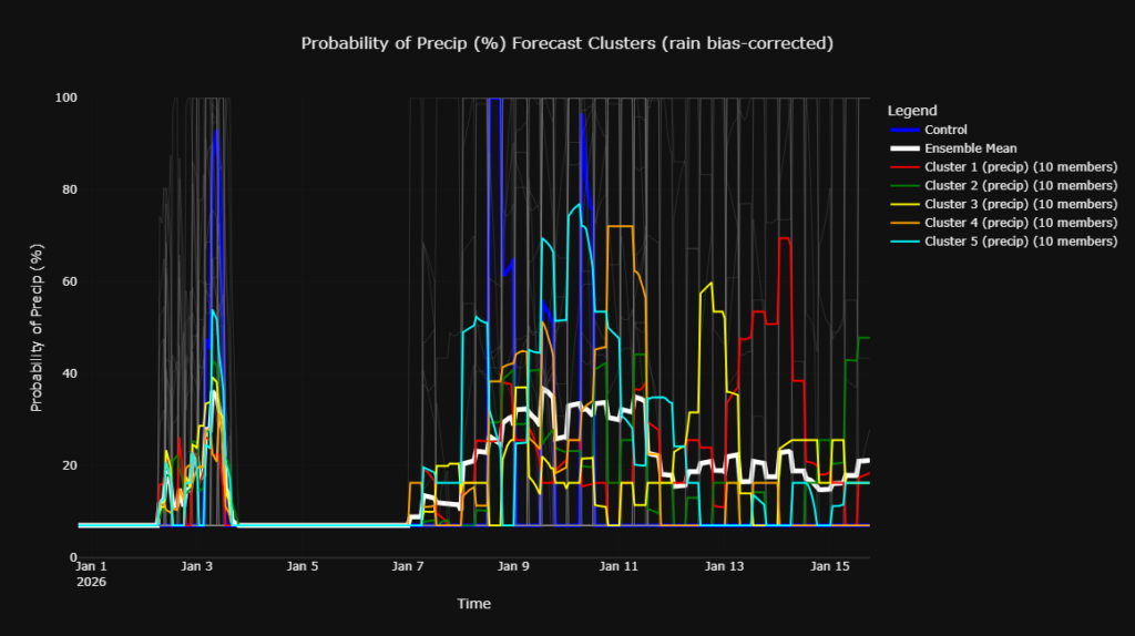
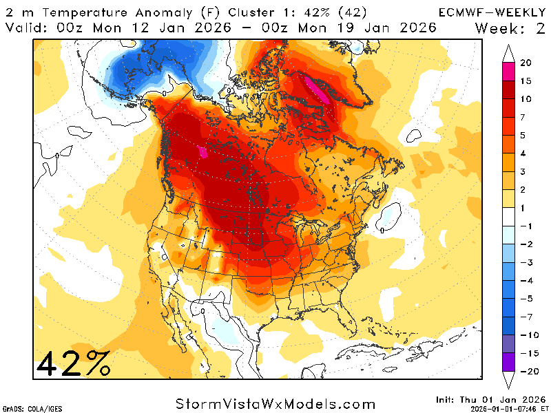
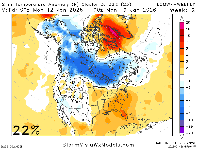
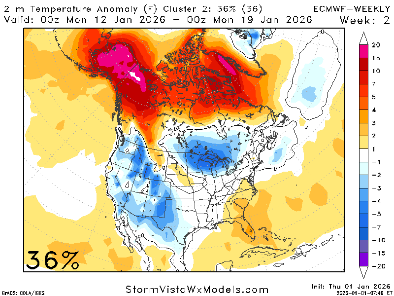
A quick look at the clusters for this period also indicates increased precipitation chances and variable temperatures. The temperature cluster clearly depicts the range of possible outcomes. Around January 11th, we can see there are some members showing 60 degrees and other showing 35 degrees.

In summary, for the timeframe of January 8th through the 15th, expect warmer-than-average temperatures with higher-than-normal chances of precipitation, but do not rule out any shots of cold air. These variable temperature conditions and precipitation chances are due to the atmosphere moving into a trough-like pattern.
Looking out further:
There is a 60/40 split between slightly warmer-than-average and near-average temperatures for this period. There are some models that are trending cooler-than-average, but the majority agree with near to above-average temperatures.
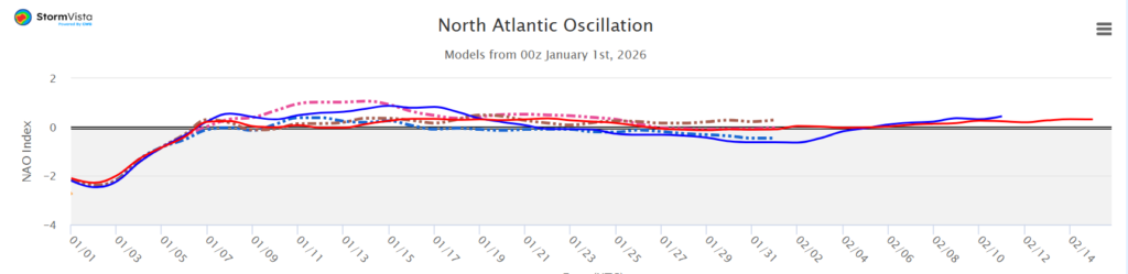
Looking at the NAO to help solidify this pattern, it is neutral to slightly positive, indicating temperatures near the seasonal average.
The quantitative precipitation forecast (QPF) is average for the region at this time, with a slight tendency toward above-average totals. In other words, expect normal to slightly greater-than-normal precipitation totals.
Looking at the upper atmosphere for this time, it is in a slight ridging pattern, which helps explain why the conditions are generally near average. A ridging pattern is associated with a more stable atmosphere, which moderates the weather, creating calm and clear conditions.
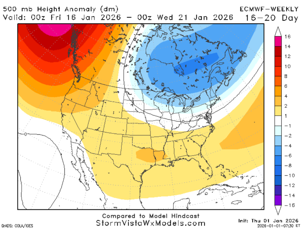
In brief, for January 15th and beyond, expect temperatures near or slightly warmer-than-average, with average precipitation chances. However, there is a prominent trough located to the north, so occasional cold intrusions cannot be ruled out.


