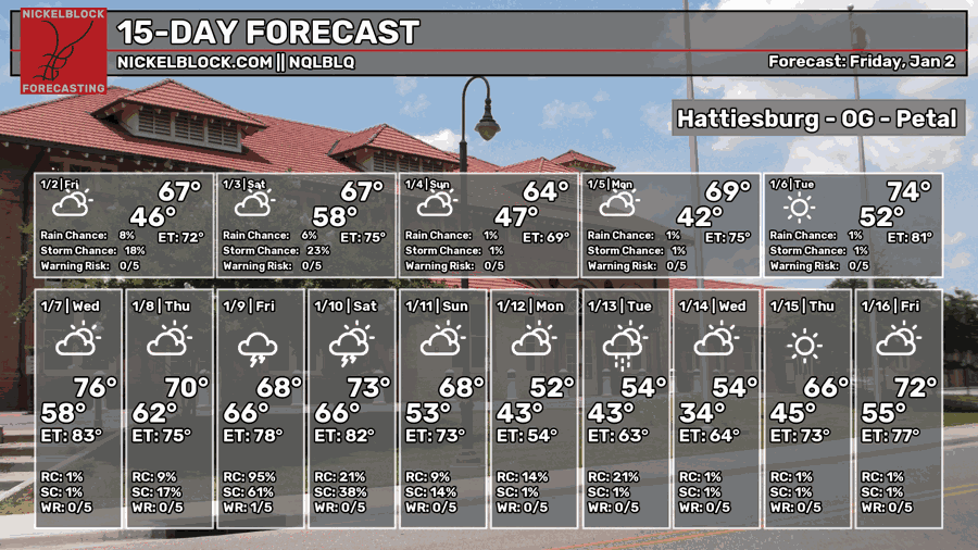
It’s warming back up with intermittent clouds across much of the South today with milder conditions across the board. There’s a slight chance for showers across much of Mississippi and Alabama today as the front slowly moves in during the weekend. It’ll be slow rolling for this front as the one behind it dissipates and it stalls out before finally moving through by Sunday, and we’ll feel the temperatures fall then as well.

Today and This Weekend
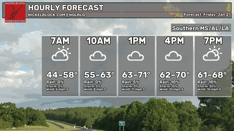
So far, the HRRR model is showing isolated and scattered thunderstorms across much of the region until the early morning hours tomorrow. Highs will be in the low 70s and a low in the low 60s. Since the front won’t move out until late Saturday, we’ll keep similar conditions for Saturday with more cloudy skies across the region. Much of the central and northern parts of MS/LA/AL will be much cooler than us earlier in the day and winds will shift towards the north behind the front.
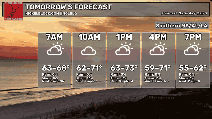
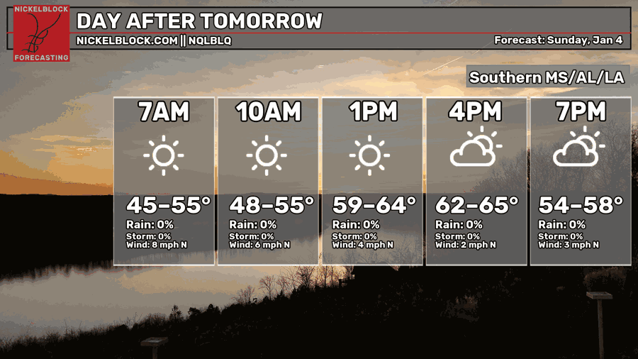
Expect cooler conditions and sunnier skies on Sunday. Winds will still be out of the north, but not as gusty as Saturday evening. There will be a quick shift in the upper levels that won’t allow for cooler conditions to continue past Monday, so we can expect temperatures to go back to above seasonal norms by next week.
Next Week
Next week, it’s looking fairly warm for early January. Conditions will warm to above seasonal norms, so temperatures will average in the low 70s for many of us. Part of this is due to the growing high pressure system in the Atlantic and the other part is a developing low pressure system across the Plains. Due to this, a pressure gradient will form allowing for more southerly winds to increase the humidity and bring in warmer air.
Since we’re caught in this pattern, overall high temperatures will spike a bit into the mid 70s by Wednesday, but lows will gradually climb from the 40s to the 60s by Friday. Friday will be a bit cooler overall, but that’s because of the incoming low.
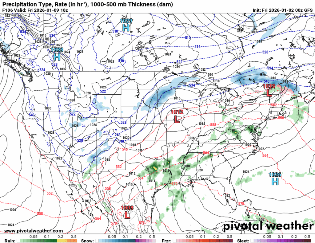
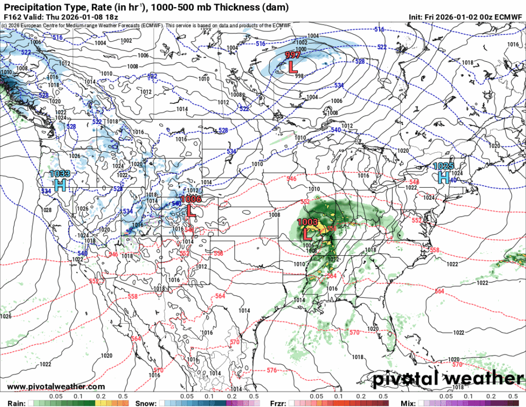
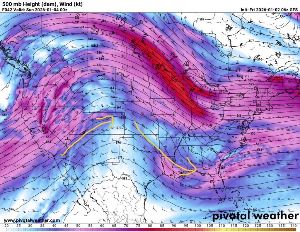
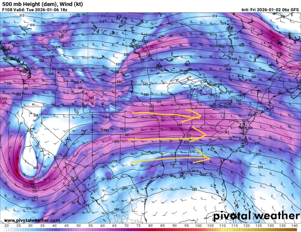
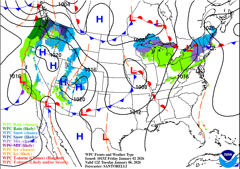
Comparing both models at the same time next Friday, they display two completely different timelines. The low develops much faster in the eastern Plains by Thursday according to the GFS (left) while it fully develops in the southeast as shown by the European model (right). Another thing of note is that due to the Atlantic high, the front will be extended and more linear as it moves through the Midwest. As such, it will begin to stall and allow for more rain chances next weekend. It’s too early to say what kind of effects the incoming system will have as even the Euro model weakens it as it moves closer into eastern Louisiana into Mississippi.
Overall, expect rain and possible thunderstorms on Friday. As far as severity, it’s difficult to say until model guidance agrees with each other.
Temperature Probabilities
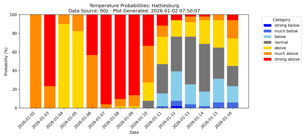
As we can see, this weekend will be above seasonal norms. Afterwards, temperatures will be much further above until next weekend when the cold front moves in. Averages will begin to even out by the beginning of the following week near MLK day.