Good afternoon! We are starting this Tuesday off with high temperatures in the low 70s and overnight lows only dropping into the mid 60s.
Throughout the week, this warm pattern will remain in place, with high temperatures in the low to mid-70s and low temperatures only falling into the low 60s. By Friday, we will see some rainfall and a chance for thunderstorms.
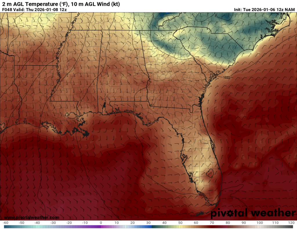
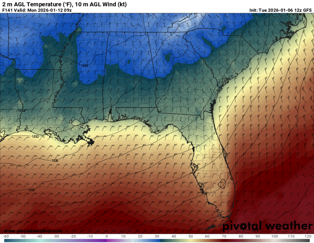
Southerly winds help moderate temperatures by transporting warm, moist air from the Gulf. As a result, temperatures rise and the difference between daytime highs and lows decrease, supporting the warming pattern for the week as the winds remain southerly until Saturday.
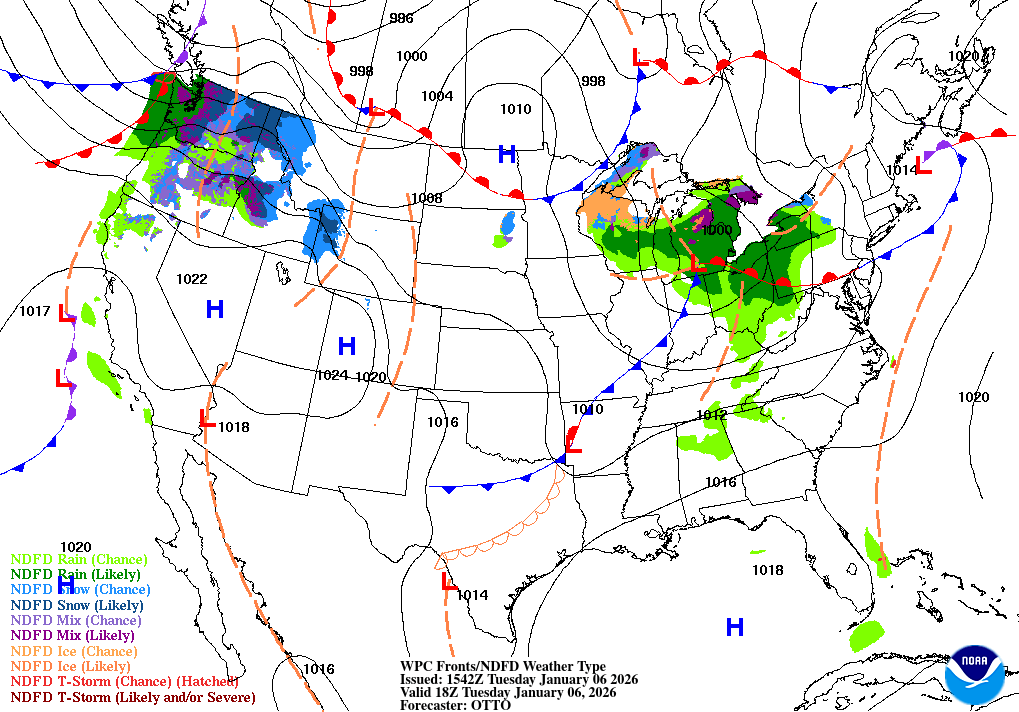
Surface analysis maps are one of my favorites to help understand the bigger picture. Looking at East Texas, there is a line with semicircles running through the state. This line signals a warm front and is also influencing the temperatures (warm) in the region.
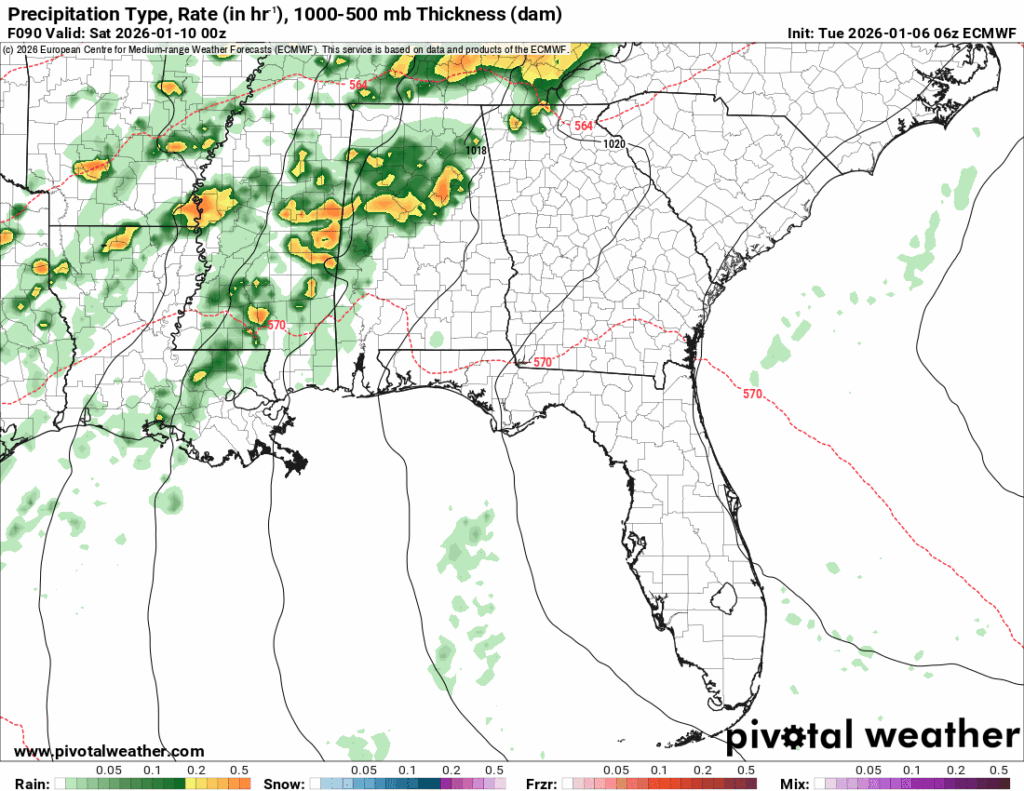
We could see some scattered showers late Thursday night into the early hours of Friday ahead of the front that will impact later Friday, but the primary round of storms is expected Friday evening.
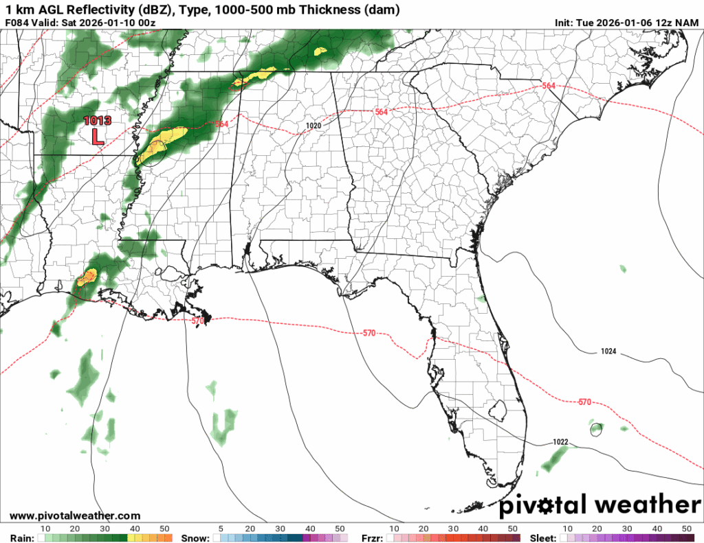
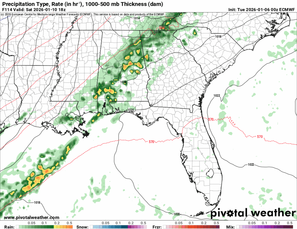
This is the NAM’s take on the storms associated with the low-pressure system. As of now, many of the models disagree on the strength of the front, but it is likely that by tomorrow, the models will be in better alignment.
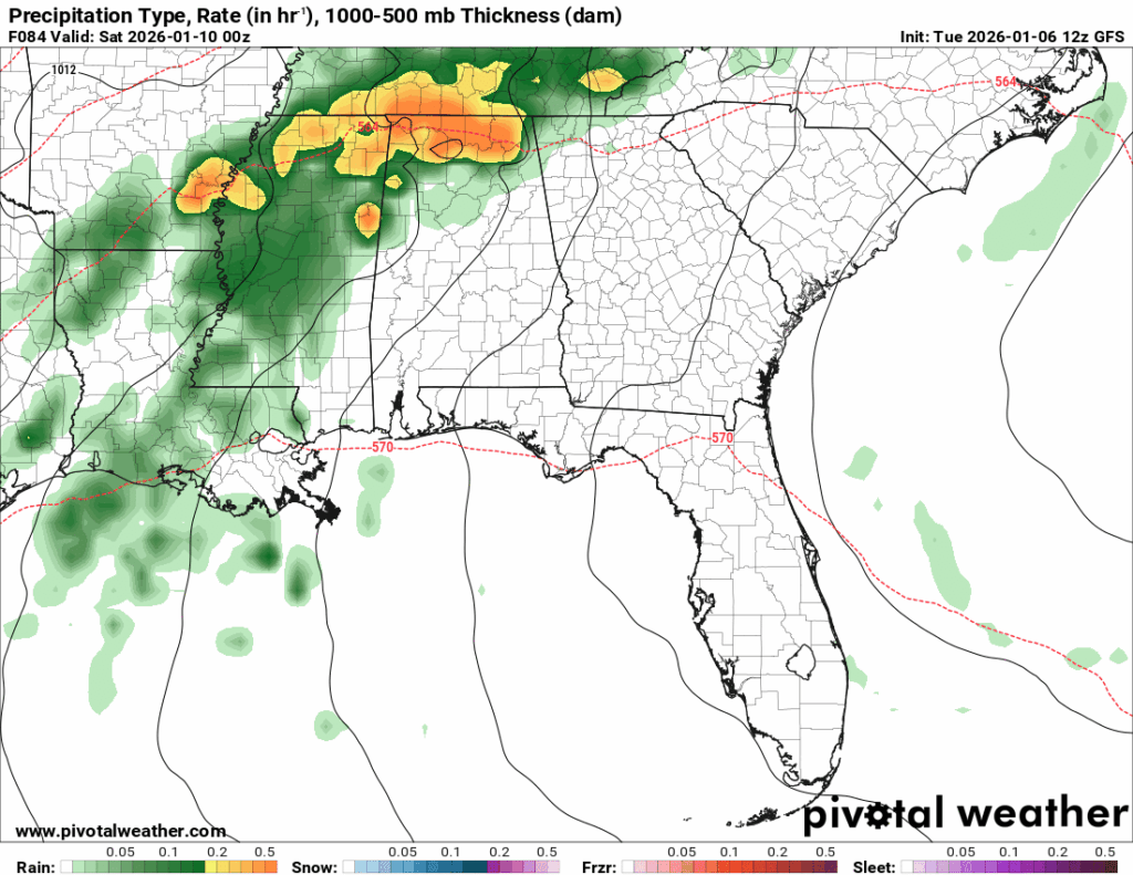
The GFS, on the left, is taking a more organized solution, while the ECMWF, on the right, has a more dispersed scenario.
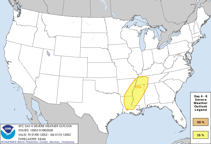
Currently, the SPC has the surrounding region highlighted in a 15% chance for severe weather.
At this time, I would anticipate widespread rainfall throughout the night on Friday with the chance for an isolated thunderstorm or two that could reach severe criteria. Within severe criteria, you cannot rule out hail or a brief tornado. For now, be weather aware and prepared, but come back for more updates as the models start to align.
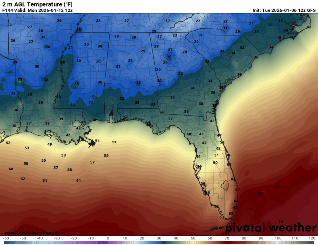
To break down the next 72 hours: Expect warm temperatures with cloudy skies, highs in the low-to-mid 70s, and lows in the low-to-mid 60s. Friday, the rain returns with a chance for an isolated thunderstorm or two.
Looking into the weekend:
Saturday will stay warm with lingering showers and thunderstorm chances as the front continues through the area, followed by a noticeable cool-down.
As the front continues through the area Saturday morning and afternoon, isolated thunderstorms can’t be ruled out, so keep those in mind if you are making any weekend plans. By Saturday night, most precipitation should exit the region, and we will begin to see cooler temperatures.
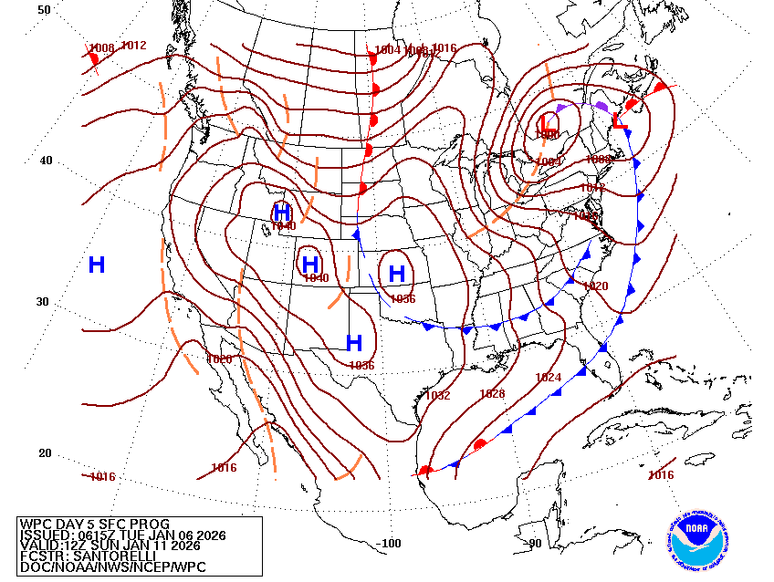
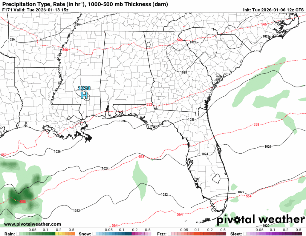
This surface analysis is for Sunday at 6 a.m.: the blue lines with triangles indicate a cold front. As I have mentioned in a previous post, the cold front follows the storm(typically). So, Friday and Saturday will be warm with storms, but by Sunday, expect cool and cloudy weather as the cold front moves in.
Look at those northerly winds, they are associated with the front and transport the cool air from up north down into our region.
Sunday through Wednesday, high temperatures will range from the low to upper 50s, with lows ranging from the upper 30s to mid 40s. Overnight lows on Sunday in some areas could approach the freezing mark as the cold front digs in.
We could reach that freezing mark in a couple of the counties, so be on the lookout for that and grab a coat for the next work week, as it will stay chilly all week.
We will remain dry through the week as high pressure settles in over the area, preventing any strong chances for precipitation.
To summarize: The weekend will start warm and stormy and then do a complete 180 and be chilly and mostly cloudy. To begin the next workweek, expect dry and chilly conditions, so add that coat back into your work bag!
Halfway through January… already?
Well, it looks like our big cool-down will not be sticking around for too long. We will be back to near-average or slightly-above-average temperatures the following week. Most models agree on average or slightly-warmer-than-average temperatures for this period, but there are still some indications of cooler-than-average conditions.
I agree more with average to slightly cooler-than-average conditions, based on the upper atmosphere setup and climatological patterns.
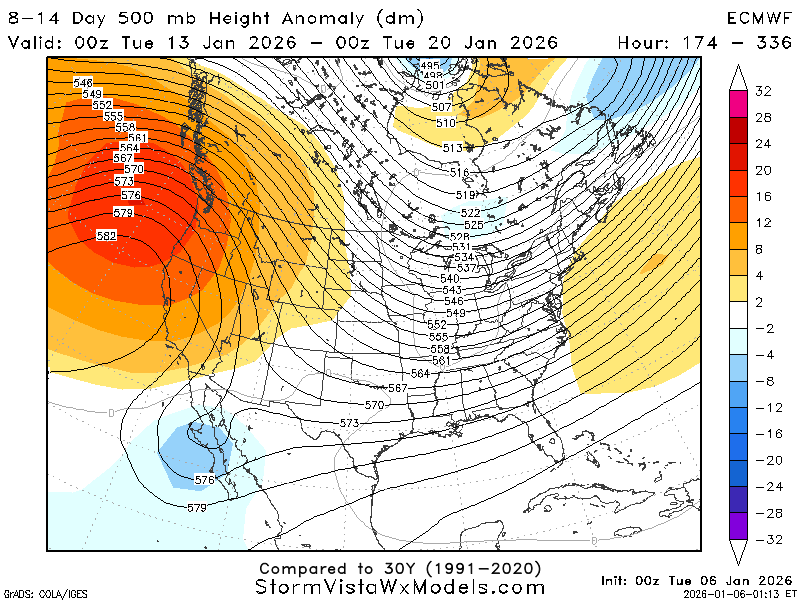
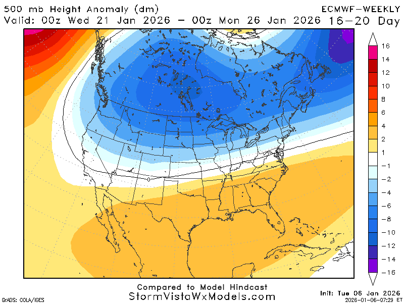
Looking at the 500mb height anomaly, we are settled into a weak troughing to near-neutral environment, which supports the slightly warmer-than-average temperatures the models are predicting. These setups often promote a more southerly flow off the Gulf, but this environment is shifting to a ridging pattern.
The big ridge to the west that is moving into the Pacific Northwest will be traveling east into the region. Ridges cause the winds to shift and, most of the time (not all), bring in cooler temperatures.
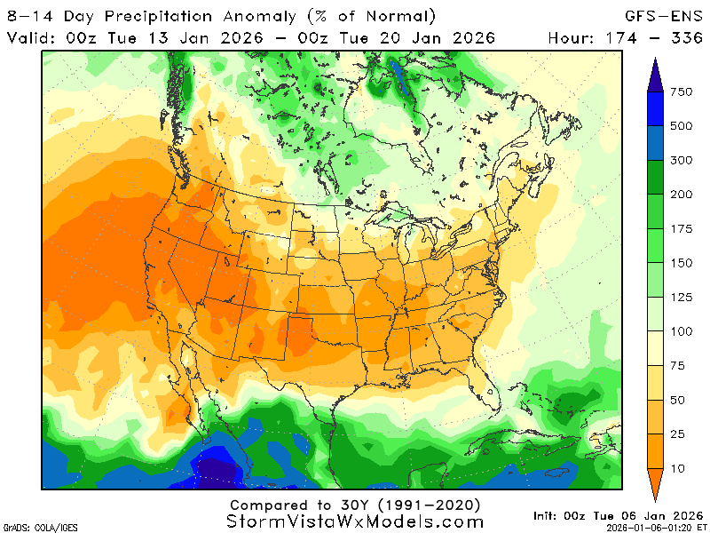
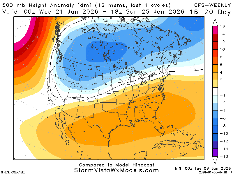
This period also appears to be generally dry. While we are in a slightly troughed environment, the big ridge out west could be inhibiting any systems from bringing precipitation into this region, as a lot of the rainfall and storms that occur in this region originate out west.
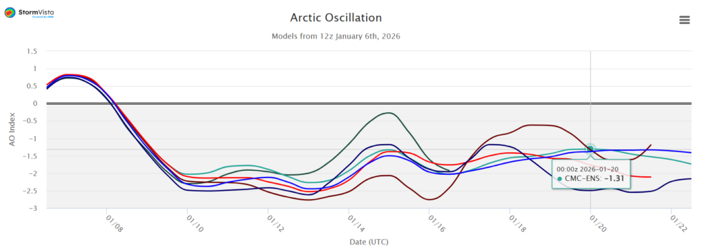
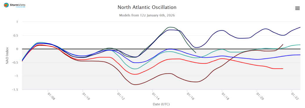
The long-range models show partial agreement, but the teleconnections are not as consistent. Both the AO and NAO are directly correlated to temperature, meaning if either goes down, our temperatures go down and vice versa.
Here, the AO is forecasted to remain negative through January 22nd, with a slight increase around January 14th, but not returning all the way back to the neutral state. While the NAO is more variable, indicating the cold front expected early next week, then it has members that are both super positive and super negative around January 14th.
In my view, the AO has a better depiction of what is happening regarding temperatures. We get that cold front early next week, and then our temperatures increase to near-average or slightly cooler-than-average.
A quick look at the clusters, shows some variability in temperatures. These show both the high and low temperatures for each day, so it looks a little bit more chaotic.
Again, we can see the cold front around January 11th-12th, followed by a rebound toward the average or slightly cooler-than-average around the 14th. While some members suggesting it to be slightly warmer than average, and confidence is limited, I favor an average to cooler-than-average week.
To summarize this time period from January 13th to January 20th, expect drier-than-average conditions with limited precipitation chances and temperatures to be near-average to cooler-than-average. A prominent ridge to the west could shift this forecast.
Beyond January 20th:
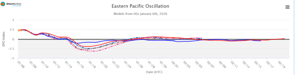
Opposite of the AO and NAO, a positive EPO typically results in cooler and wetter conditions. Looking at January 20th and beyond, the EPO seems to be mostly neutral, which supports average temperatures and precipitation.
As I have said probably too many times by now, temperature relies on a number of factors, just because the EPO says conditions will be average does not mean they will be, so let’s look at some other maps!
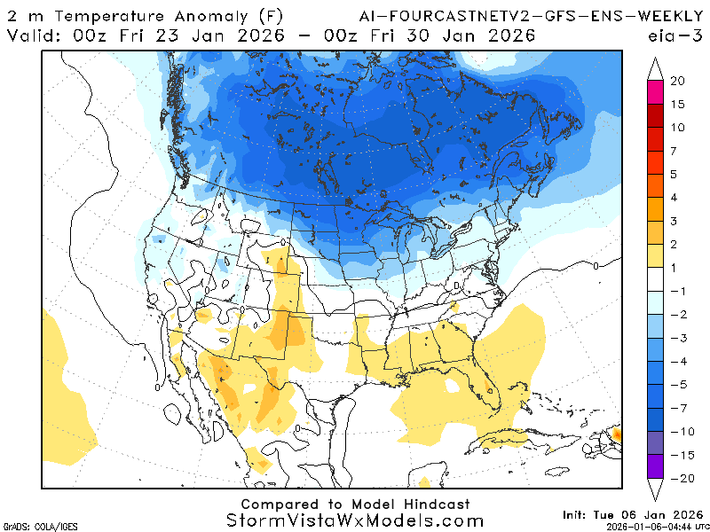
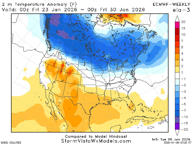
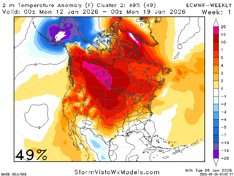
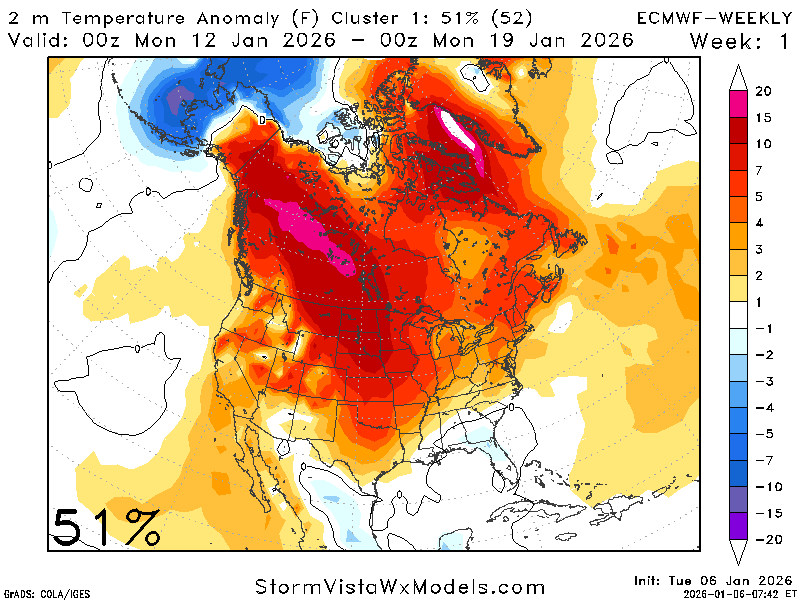
The AI-GFS and ECMWF weekly both suggest warmer-than-average during this period, with the ECMWF indicating temperatures about 3 degrees above average and the AI-GFS closer to 1 degree above average. Both also agree with super cold weather sitting to the north, which could lead to intrusions based on the upper atmospheric setup.
That cool air to the north definitely has the possibility to intrude down here, given this upper atmospheric profile. We are in a ridging atmosphere, but with a strong cool trough above that could penetrate southward. So, while the temperatures are predicted to be above-average, I would not rule out a blast of cool air.
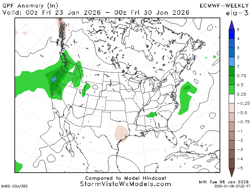
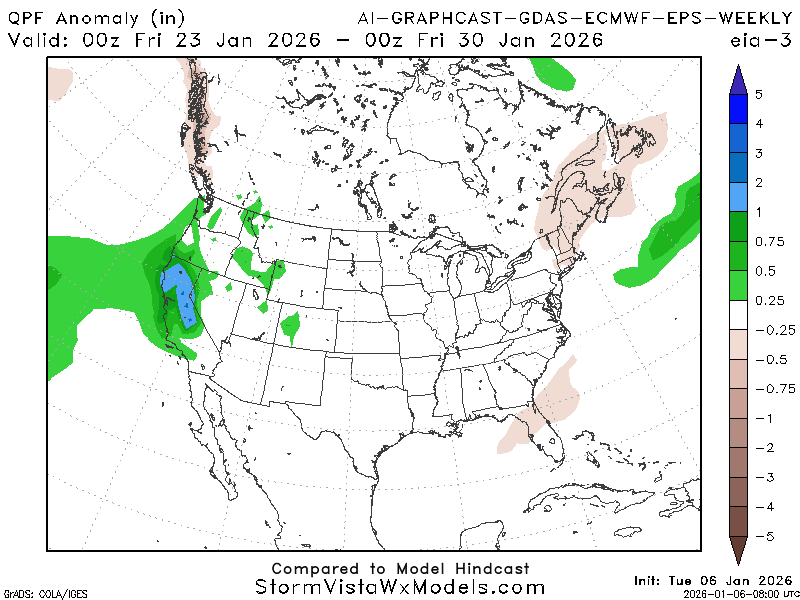
Due to that ridging atmosphere in the region, precipitation will be limited. It appears to be a near-average to slightly below-average week for precipitation. Hopefully, we can get some precipitation soon, as the last two weeks are forecasted to be rather dry, and we do not want to slip into a drought. As of December 31st, most the region was considered “abnormally dry” by the USDA and we do not want to slip into a drought!
For the week of January 20th, expect slightly warmer-than-average temperatures, with chances for cold intrusions, and drier-than-average conditions. We will continue to monitor drought conditions and update as necessary.


