Good afternoon and happy almost Friday! It is definitely a warm one today, with high temperatures reaching the mid-70s today, phew wee, it’s only January. Overnight, lows will not drop much, only reaching the upper-60s.
Scattered showers are expected to begin early this evening, and precipitation will likely persist until Saturday. There is no severe threat with the showers this evening; the region is currently in the “thunderstorm” risk category, so expect light showers and some possible thunder.
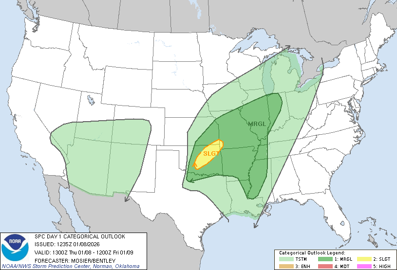
By Friday, things become more organized, and the chances for thunderstorms increase. Currently, we are under a slight risk of severe weather on Friday.
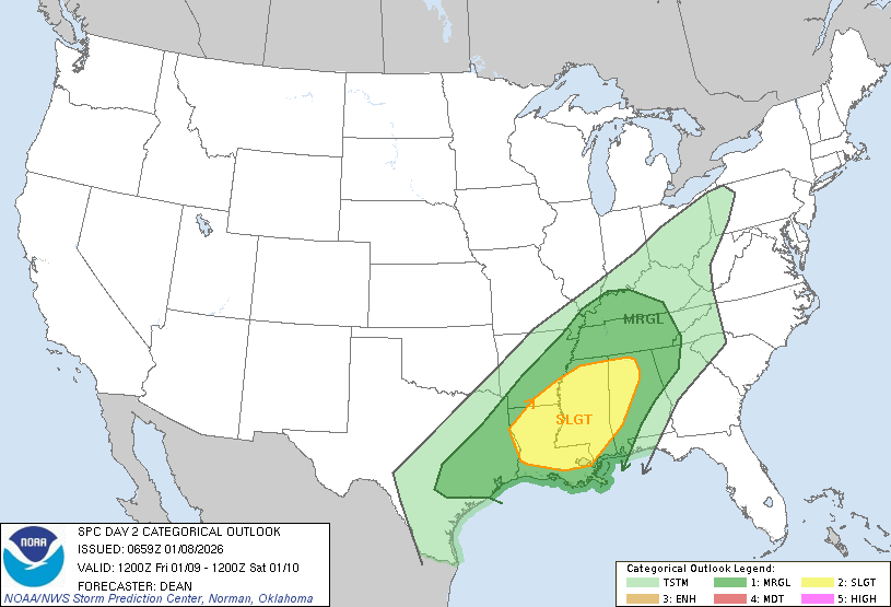
Friday afternoon through Saturday morning are the best chances for isolated thunderstorms. With these storms, you can get heavy rain, lightning, gusty winds, small hail, and even a few brief tornadoes.
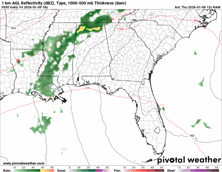
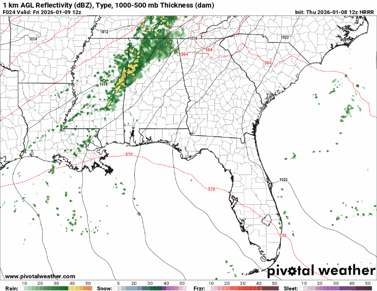
On the left is the NAM, on the right is the HRRR; while they do not exactly align, the overall pattern and timing are similar. The HRRR does not extend as far in forecast hours as the NAM, but the storms will likely stick around through midday Saturday.
Currently, I would expect the most “severe” storms to occur late afternoon to early evening on Friday, with chances persisting throughout the night. During this time, isolated thunderstorms could become strong, meaning brief tornado watch/ warning could be issued, as they can spin up tornadoes at any moment. Look out for small hail, heavy rain, and damaging winds.
Please remain weather aware and continue to monitor throughout the day for any changes.
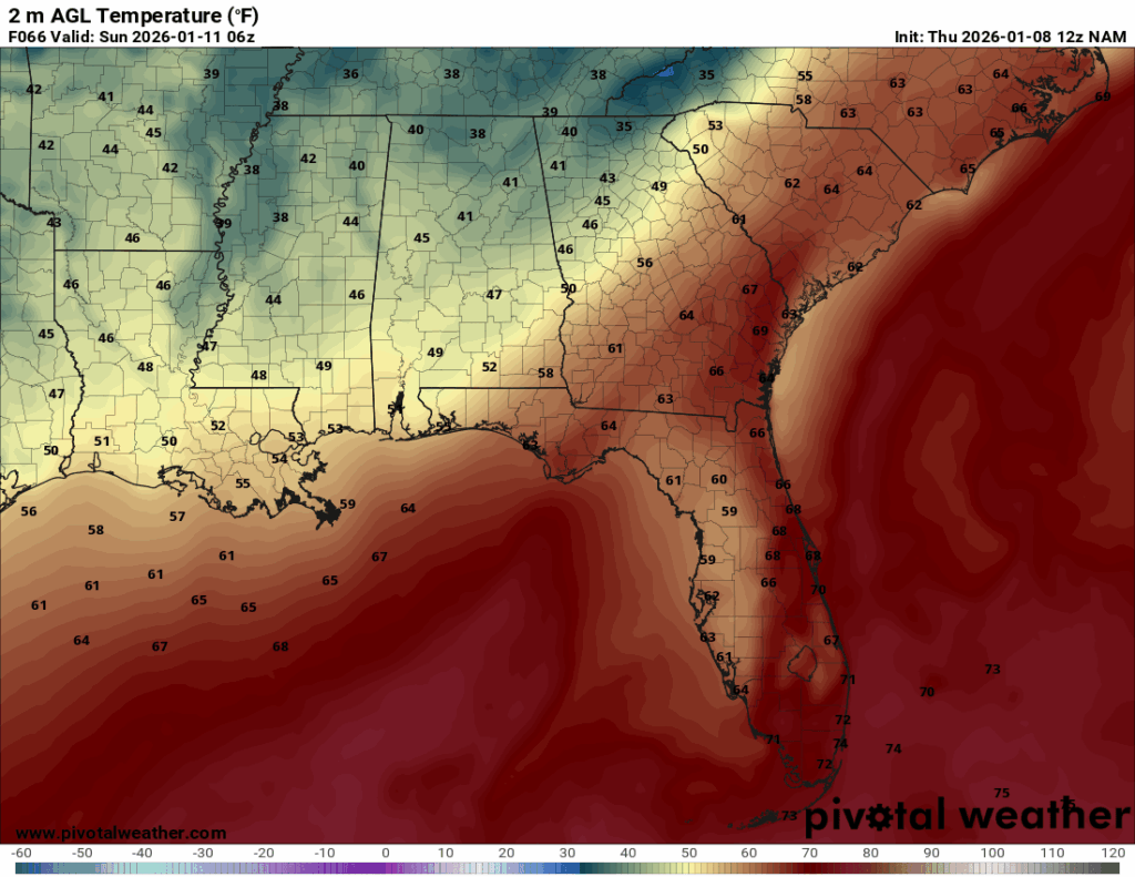
Look! You can see the cool temperatures! Now, this is midnight on Sunday, so after we have dealt with all of the storms and warm weather, the cool temperatures will be there to greet us.
To summarize: Friday will start with scattered showers that become more organized by early evening, with temperatures reaching those mid-to-upper 70s. Then expect a few isolated thunderstorms to impact the area through the evening into Saturday. Saturday will bring chances lingering isolated storms in the morning, and continued light rain throughout the day, along with high temperatures in the mid-60s. By Sunday, the precipitation will have completely left the area, and temperatures will only reach those upper-50s.
Starting off next week:
Woohoo! Cool temperatures incoming… After our warm and stormy weekend, we will start next week off on a cooler note.
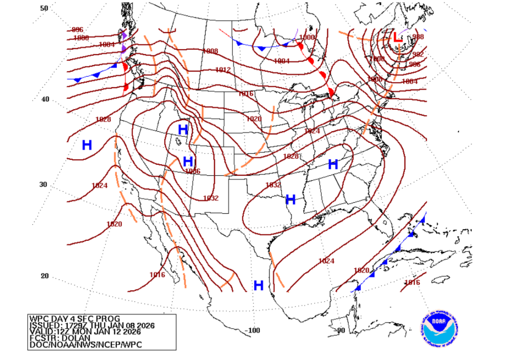
The region is shifting into a zone of high pressure. This means we will have moderate temperatures, less precipitation, and clearer skies. The high pressure will persist until Thursday, when we receive another surge of cool air from a passing low-pressure system, which could also result in chances for precipitation.

The cold front, that blue line with triangles, is expected to move through the area by around 6 am Thursday, so expect another shot of cool air by then, along with the possibility of some precipitation.
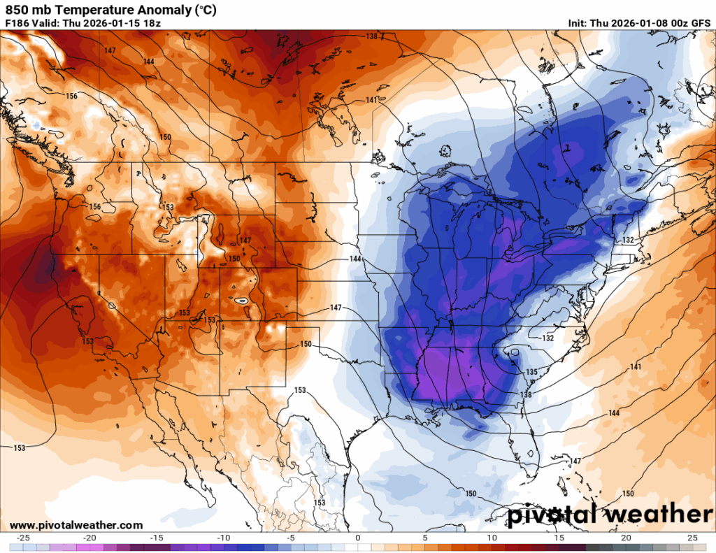
We are looking at the 850mb temperature anomaly for Thursday, and phew, it’s looking chilly, about 10 to 15 degrees below average. Now, it’s important to remember this is not the surface, so it will be slightly warmer at the surface, but still much cooler than it has been this last week!
High temperatures for the week will range from the low-50s to low-60s, with low temperatures for the week ranging from the low-30s to mid-40s. There is the chance some areas will see freezing temperatures on a couple of mornings this week, so have your coats and hot coffee ready!

Now, what is this? I just said lack of precipitation from high pressure…
This is the ECMWF predicting a bunch of precipitation for Wednesday morning due to a low-pressure system in the Gulf. The GFS also shows precipitation but keeps it mostly centered over the Gulf and away from our region. While it is unlikely this much precipitation would impact the region from a Gulf-centered low-pressure system, it cannot be completely ruled out.
All in all, expect cooler weather this week with a few chances to hit that freezing point, generally dry, but chances for precipitation due to passing low-pressure systems. Bundle up in the mornings when it is coldest and have your raincoat handy just in case.
Looking out to next weekend:
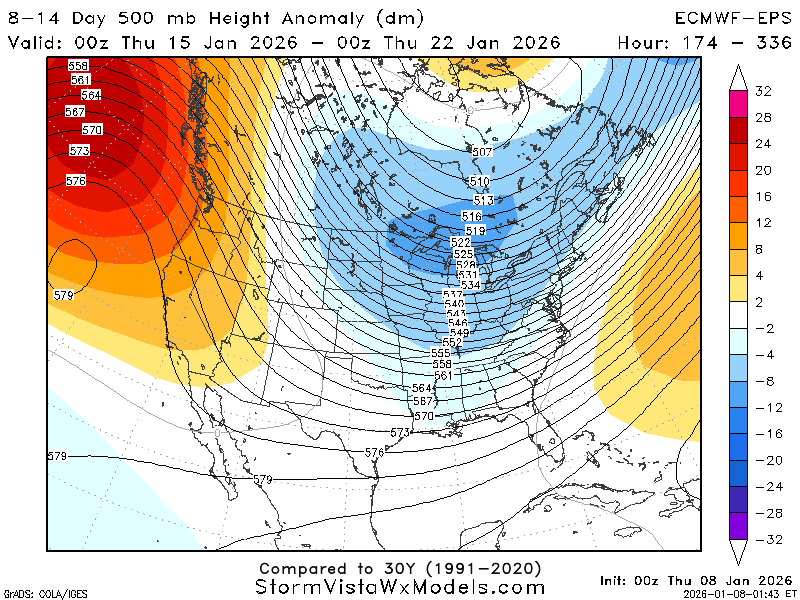
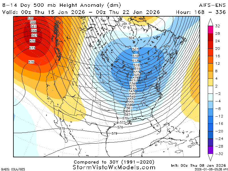
Looking at the 500mb height anomaly map, the region is in a troughed upper atmosphere. Troughing upper atmospheres lead to cooler, cloudier conditions at the surface as they are driven by lower pressures. Troughs also lead to greater chances for precipitation, so average to above-average totals for our QPF maps would be expected.
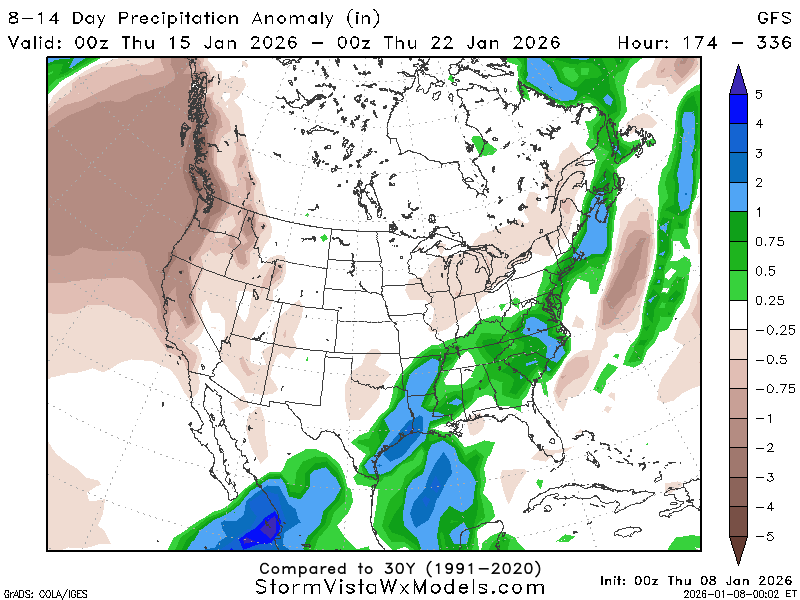
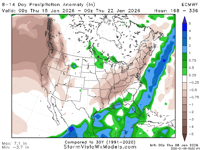
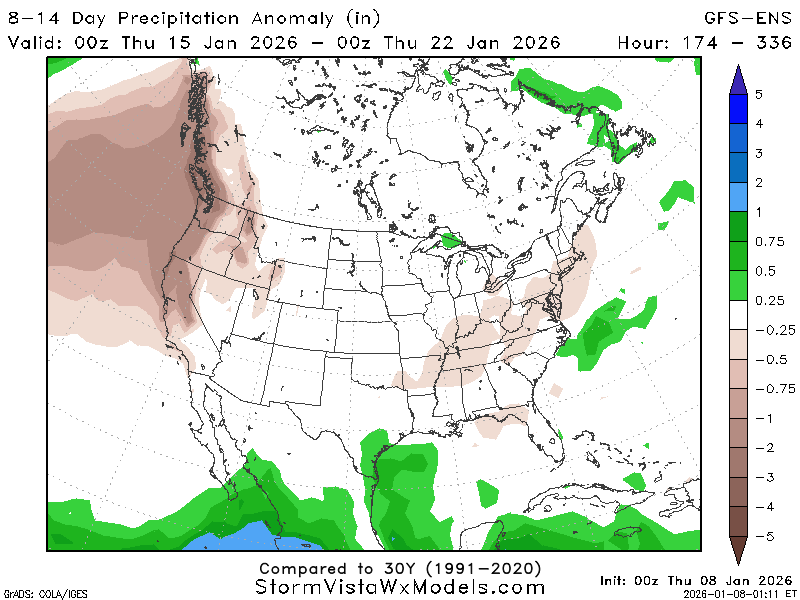
Look at that! Near to above-average precipitation is expected for the week.
Now, there are a couple of models signaling a drier-than-average week for precipitation during this period. This is likely due to differences in the placement of the upper-level trough, as some models have the trough farther north or south than others, which alters precipitation chances.
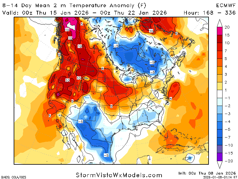
Chilly temperatures! The region is near average to 3 degrees below average for this time frame, which aligns with the upper atmospheric setup.

The AO confirms that cooler-than-average temperatures can be expected during this timeframe of January 15th-January 22nd, as a negative AO typically signals cooler temperatures.

Looking at the PNA, it remains positive and neutral for the majority of the timeframe, with some members going negative. A positive PNA supports a cooler, and wetter southeast, again reinforcing our forecast for this week.
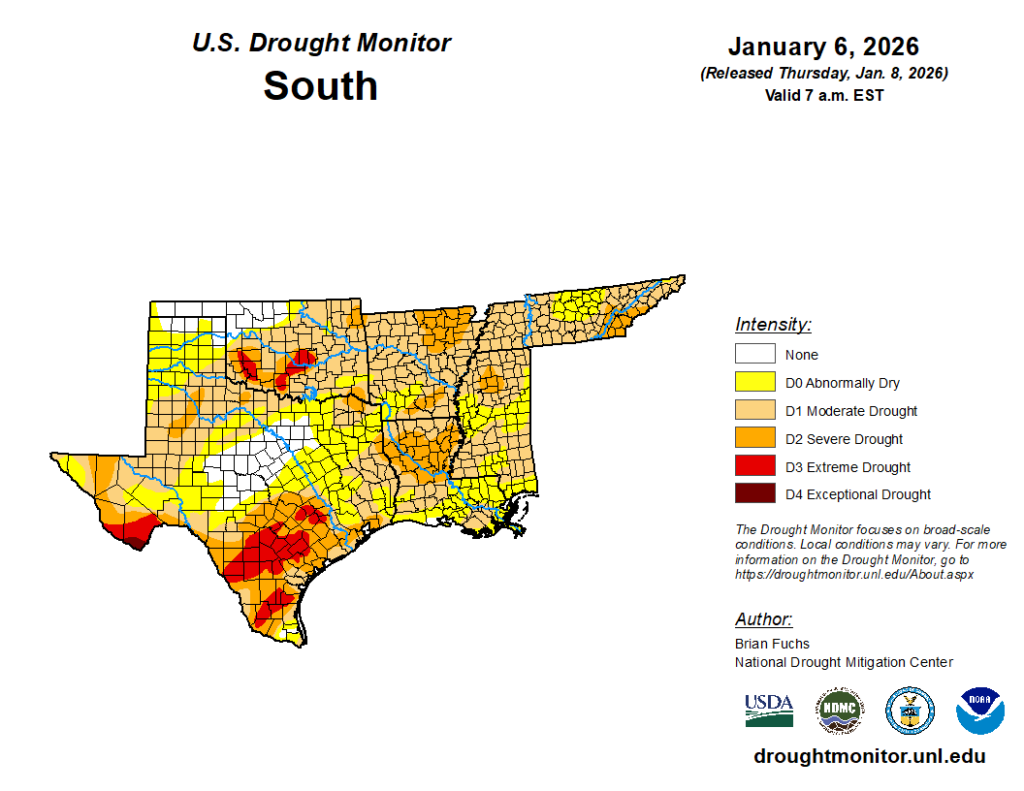
Taking another look at the drought monitor, it appears that most of the region is classified as abnormally dry to in moderate drought. Hopefully, increasing rain chances will improve these conditions.
To break it down: For the week of January 15th through January 22nd, expect near- to cooler-than-average temperatures, along with periodic chances for precipitation driven by the upper atmospheric pattern.
Looking out further:

Since we are looking beyond 14 days, it’s a good idea to check on the climate-based models, such as the teleconnections! At first glance, the NAO looks a bit chaotic, but taking a closer look from January 23rd to February 5th, most members are slightly below 0, which supports slightly cooler-than-average temperatures.
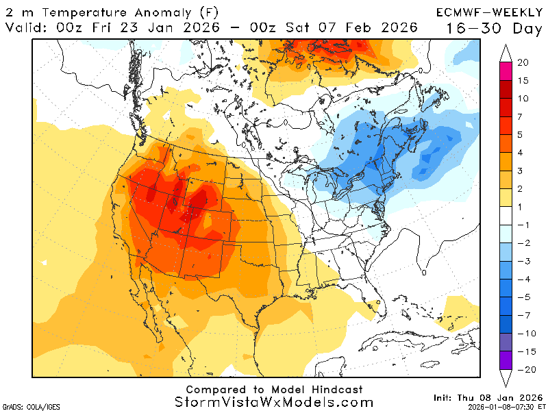
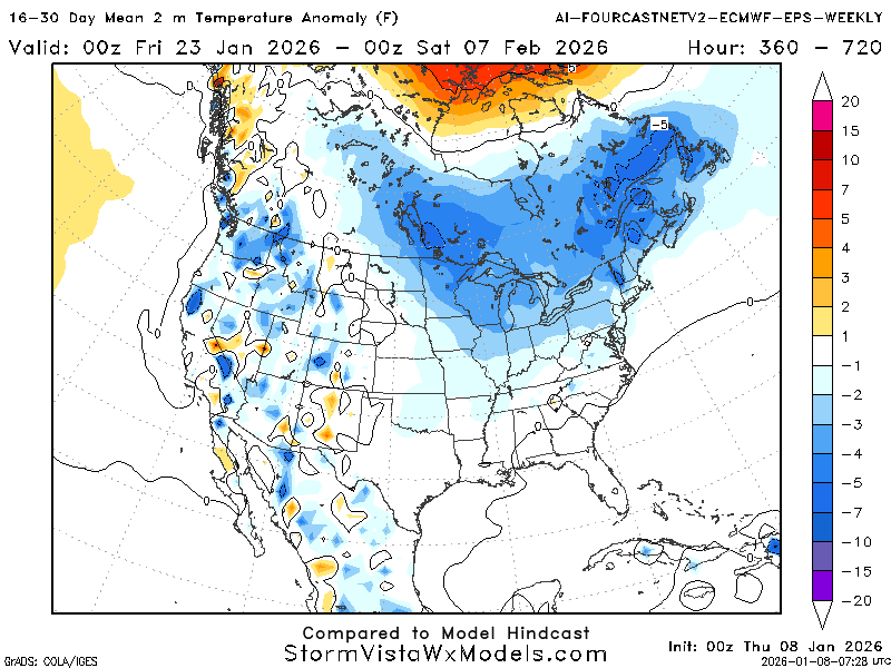
There appears to be a disagreement between the models regarding the temperature outlook. The ECMWF has the majority of the country, including our region, with warmer-than-average temperatures. While the ECMWF-EPS places most of the country, including our region, near seasonal averages.
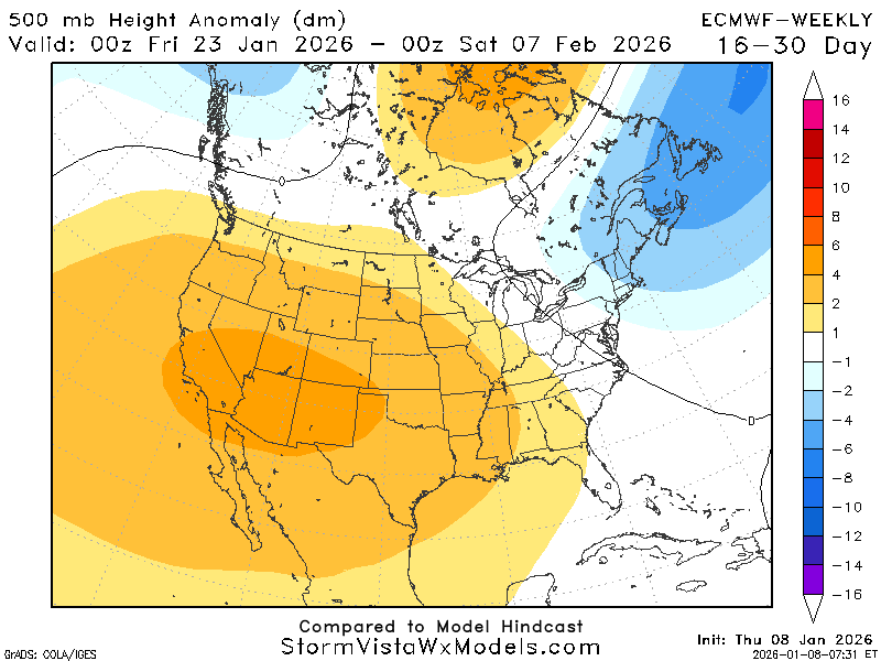
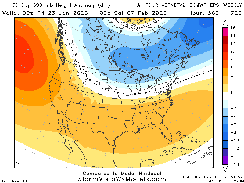
The most likely cause for these differences in temperatures throughout the country is the upper-level pattern. The ECMWF depicts a ridge across much of the country, which would moderate temperatures and result in warmer-than-average conditions. Meanwhile, ECMWF-EPS shows a trough over the northern half of the country, causing cooler temperatures.
Most of the other long-range models also indicate a prominent trough on the northern half of the country, which could allow the cooler temperatures and shots of cold air down into this region.
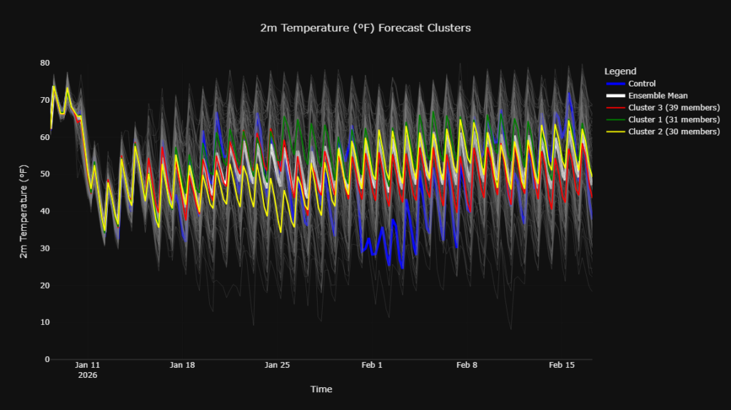
The clusters appear to be showing average temperatures, with the occasional outlier going much cooler or warmer than the others.
Even though confidence is low, my forecast leans toward average to slightly cooler-than-average (1-2 degrees) temperatures. This aligns with the EPS as well as the slightly negative NAO signal. Also, I would not rule out cold intrusions due to the upper-level pattern.
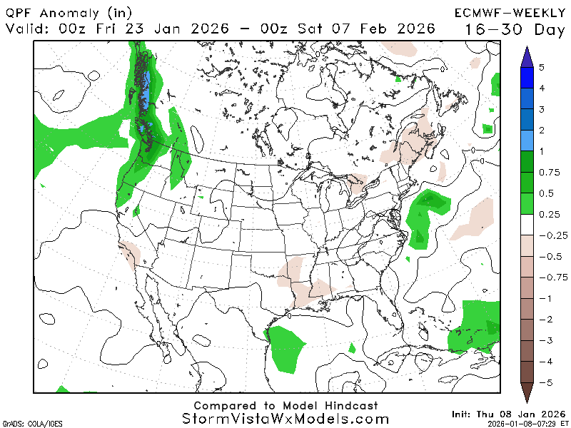
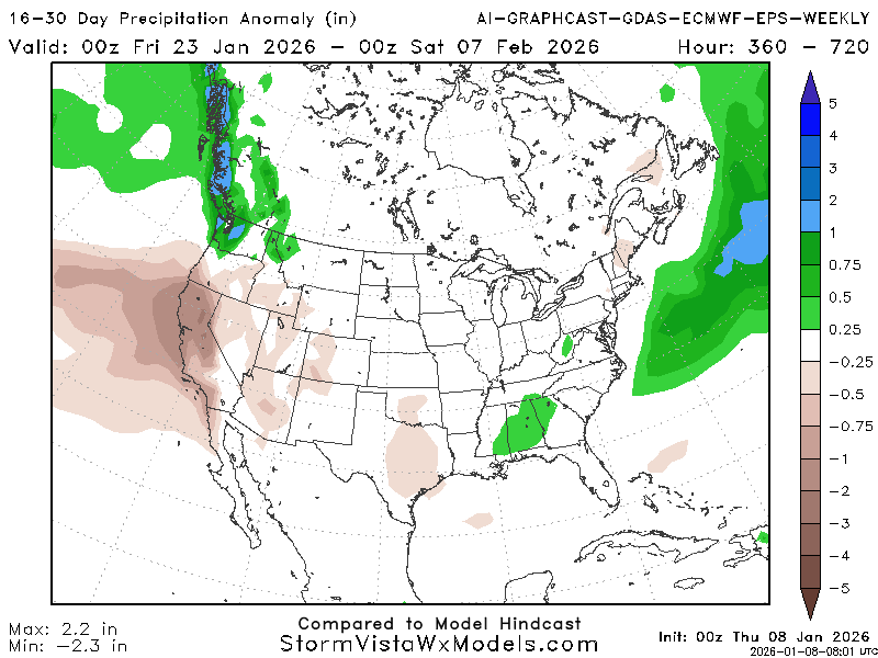
Although these models do not agree on much else, they are almost in agreement on precipitation. The region is expected to see in average amounts of precipitation for both models, with ECMWF trending a little less-than-average and the EPS trending a little more-than-average.
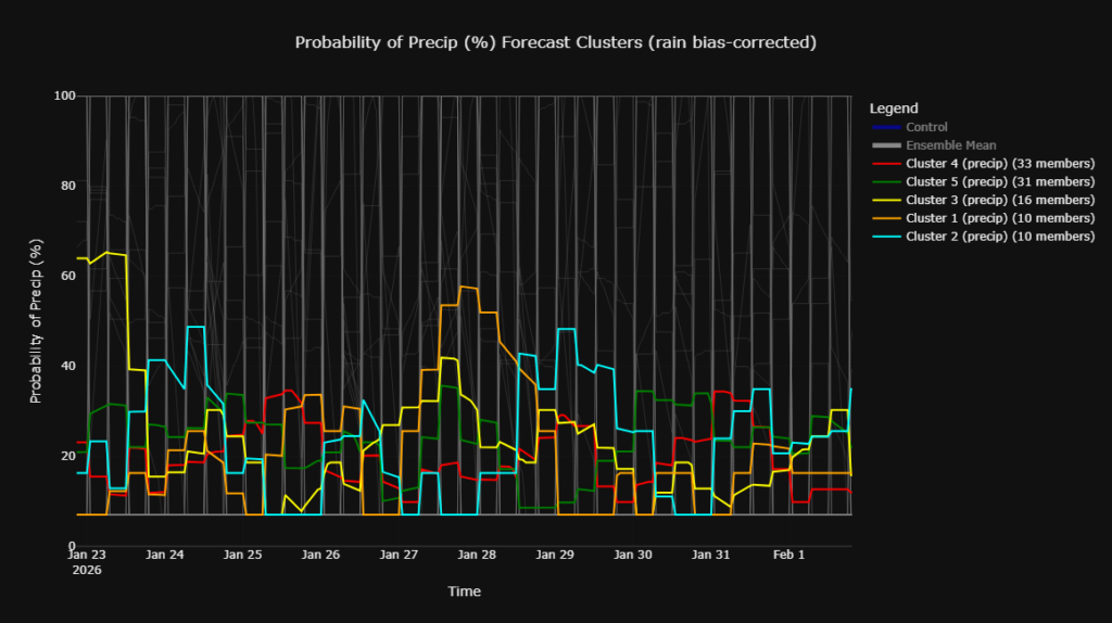
Taking a peek at the precipitation clusters, the probabilities are looking near to slightly greater-than-average. With most of the members settling around 20% for the majority of the days within the time period, but with an increase around the 28th-29Sth.
In brief, looking out beyond January 22nd, expect slightly cooler-than-average temperatures, with average chances for precipitation, and the chance for cold air intrusions.


