While the main severe weather threat is expected Friday into Saturday morning, some of our area is also under a Marginal Risk (Level 1 of 5) from the Storm Prediction Center for tonight through 6 AM tomorrow. This is due to the first line of storms developing ahead of the main line. This line is not expected to be as intense as Friday night’s, but any storm that does manage to form could briefly become strong to severe since the atmosphere is already primed.
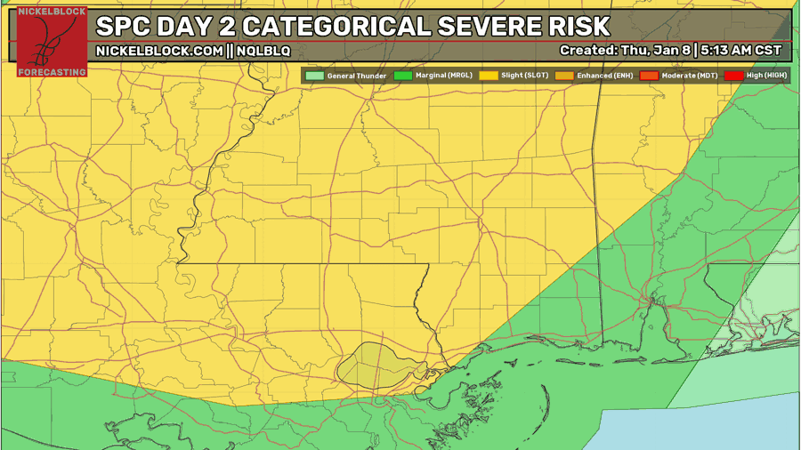
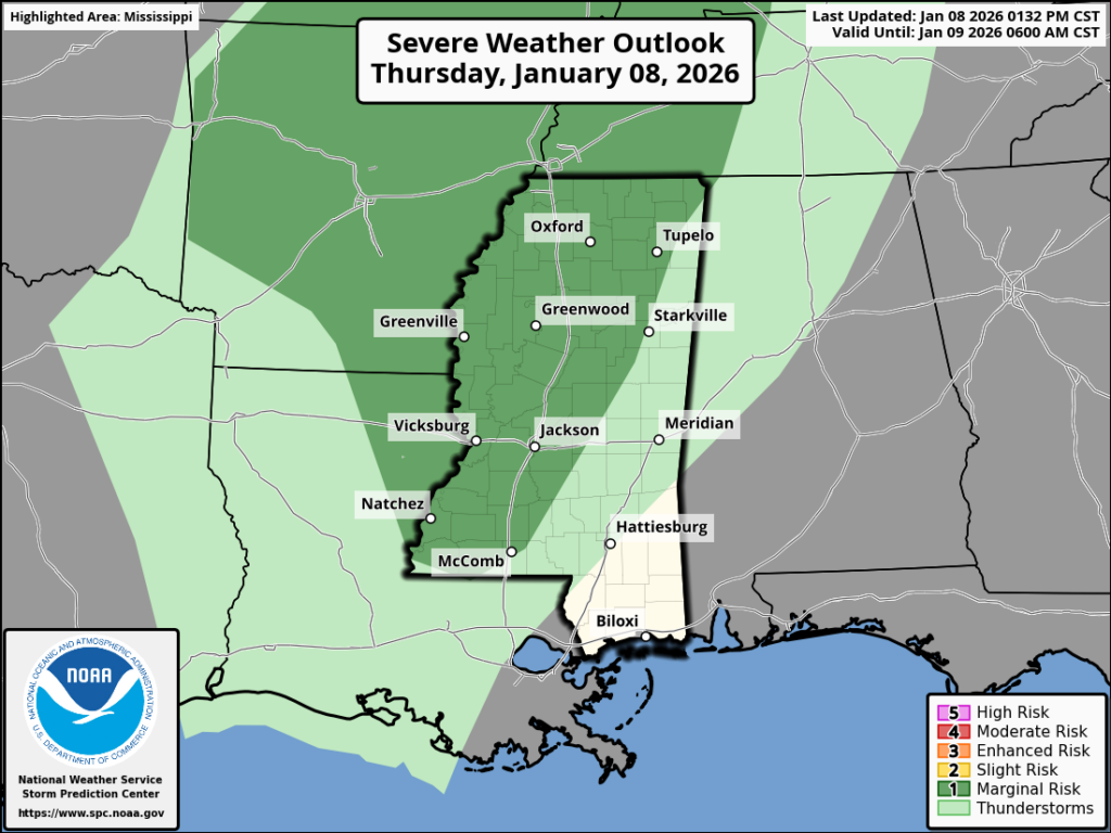
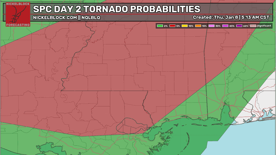
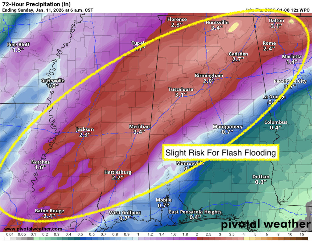
Looking at the Day 2 outlook, which runs from 6 AM tomorrow through 6 AM Saturday, much of the region is under a Slight Risk (Level 2 of 5). It would not be surprising if the SPC issues a smaller Enhanced Risk (Level 3 of 5) somewhere in the area as confidence increases. The main threats overall include very heavy rainfall, gusty to damaging winds, and hail, with a few tornadoes possible somewhere in the region. Areas within the Slight Risk also carry a higher than normal tornado potential, and up to EF2-strength cannot be ruled out.
This is not an “every storm will be severe” situation. Instead, it is a setup where some storms could become severe, and they are very easily able to rotate given the strong wind shear that will be in place. Rainfall totals of 2-3 inches are expected across the area, with locally higher amounts possible, which could lead to areas of flash flooding, especially in spots that see repeated or heavier downpours. Ensure you stay weather aware, especially late Friday into early Saturday, and ensure you have notifications for our NickelBlock Forecasting app turned on so you can receive instant alerts for NWS watches and warnings.

Tonight’s Forecast
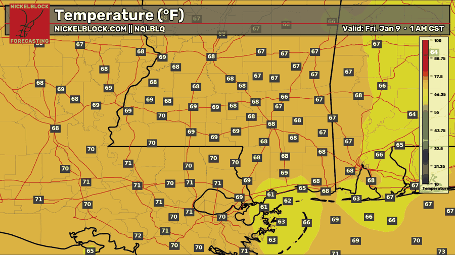
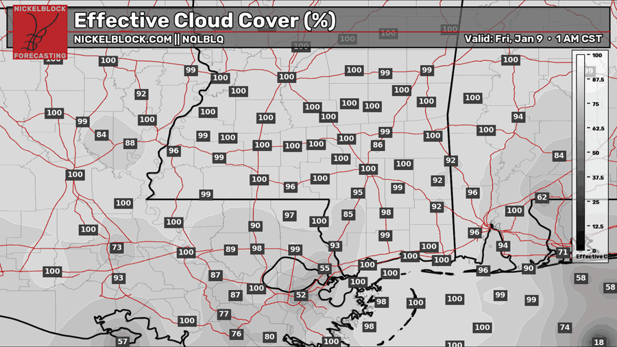
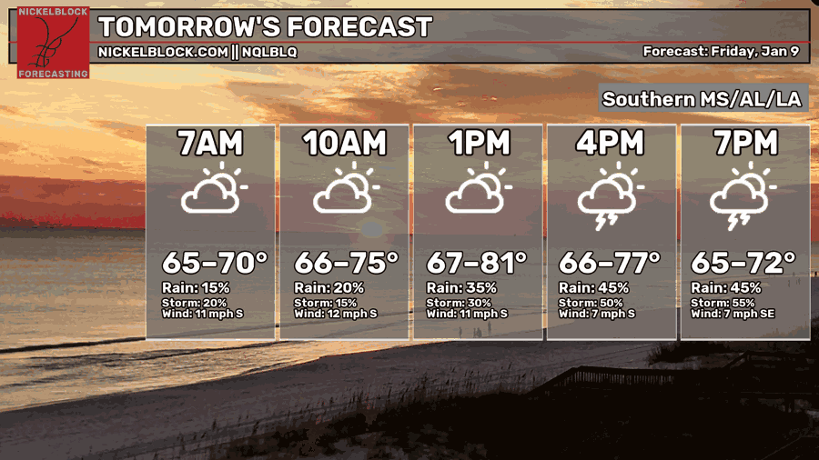
Tonight’s low will be much warmer than usual. With dew points well into the 60s ahead of the front, temperatures will not be able to cool to a typical overnight low, so expect lows in the upper 60s to lower 70s. Clouds will stay in place all night, and the first round of showers and thunderstorms will move through late tonight into early tomorrow. A few storms could become strong to severe, including a low tornado risk, but the primary severe weather window still looks to be Friday night into Saturday morning.
Severe Weather Outlook: Friday & Saturday
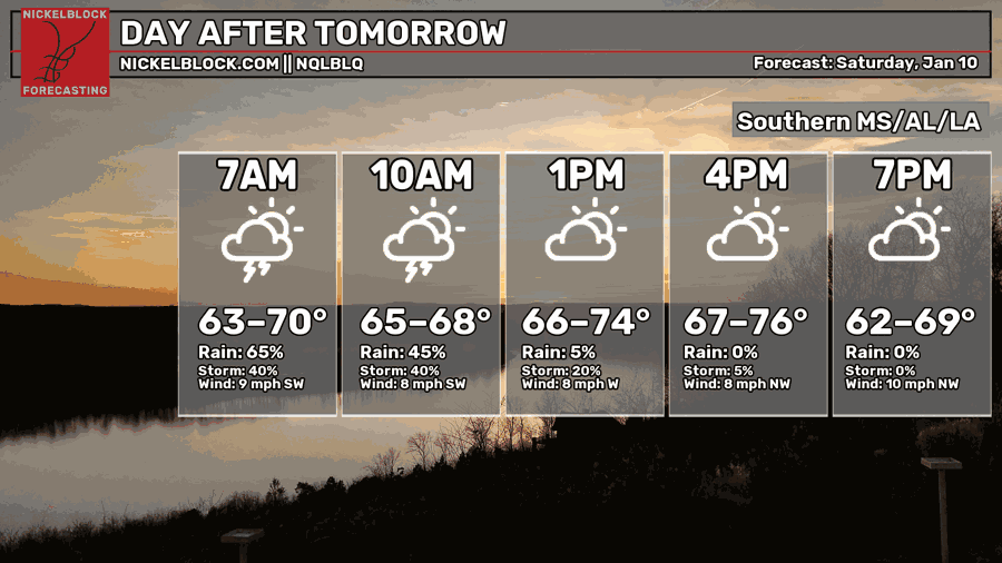
Friday will be remarkably warm for this time of year, with highs ranging from the upper 60s to the low 80s thanks to a strong southerly flow pulling in very humid air. On Saturday, we will not be fully behind the cold front right away, so warm, moist air will still be in place. It will be cooler than Friday, but still mild overall, with temperatures generally in the 70s.
The first round of storms will develop along and north of the warm front, mainly during the day on Friday. With the atmosphere so warm and unstable, any storm that forms in this environment could ramp up quickly, so we will need to keep a close eye on radar through the afternoon and evening.
The largest severe weather threat arrives late Friday night into Saturday morning as the cold front pushes through. That’s when storm coverage should increase, and storms are more likely to organize, bringing the greatest risk for damaging wind, hail, and a few tornadoes.

Extended Local Outlook
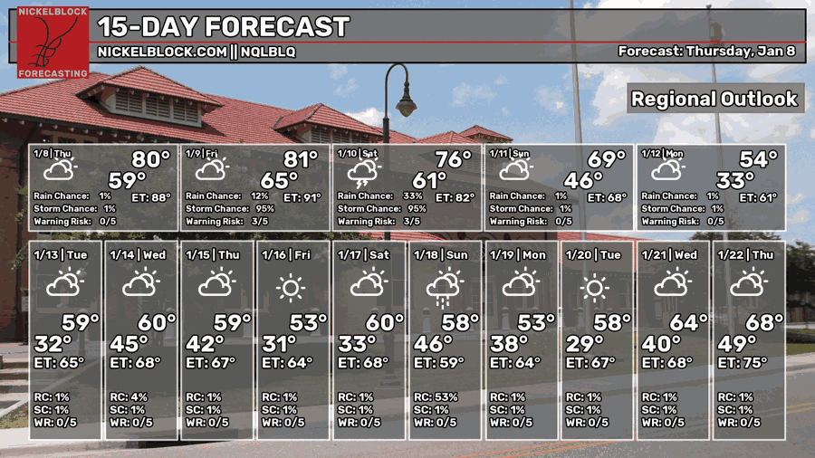
By Sunday, the front will be well east of us, and we’ll be on the cooler, drier side of the system. Dew points will drop sharply, and highs will settle back into the upper 60s. Skies should turn partly sunny, but it will stay breezy, with gusts up to around 25 mph before winds ease on Monday.
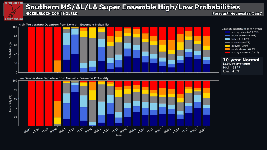
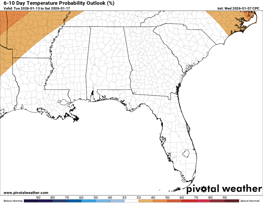
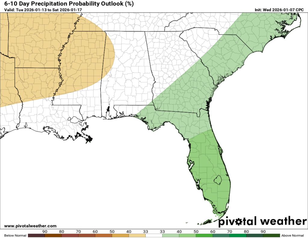
Looking beyond the weekend, the 6-10 day outlook is finally leaning closer to normal for both temperatures and precipitation. The Super Ensemble plot supports that idea as well. Overall, I still see a few more below-average days than above-average ones later this month, but next week looks close to seasonal, with typical highs around 58 degrees.