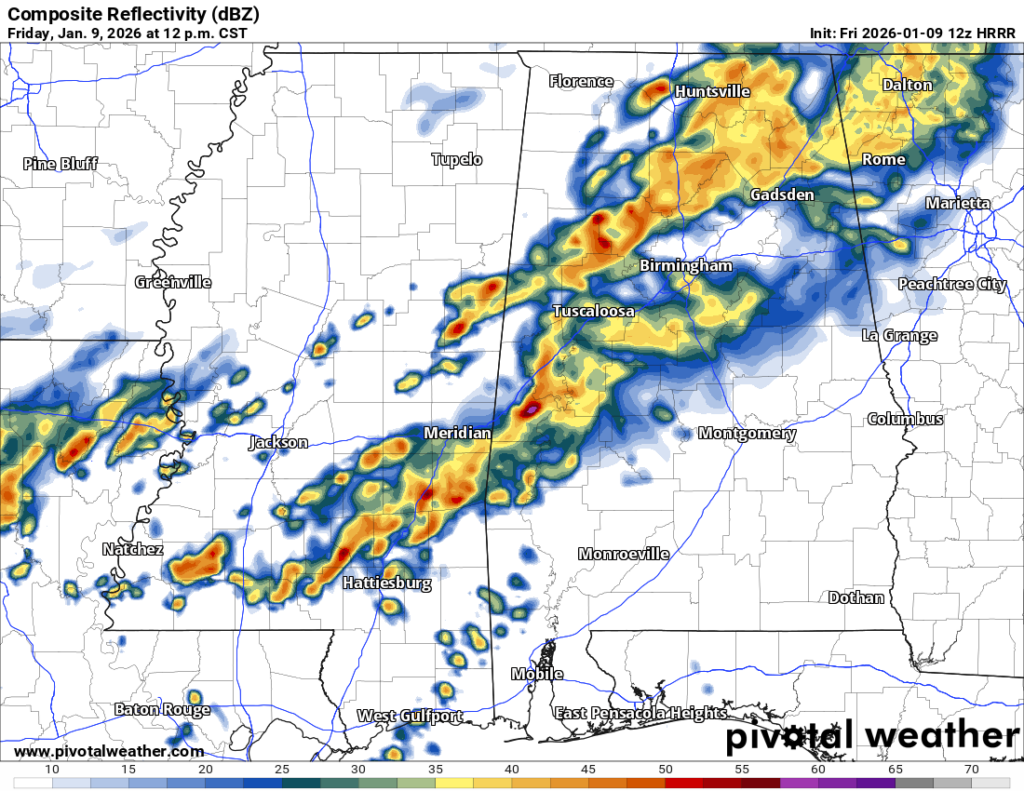
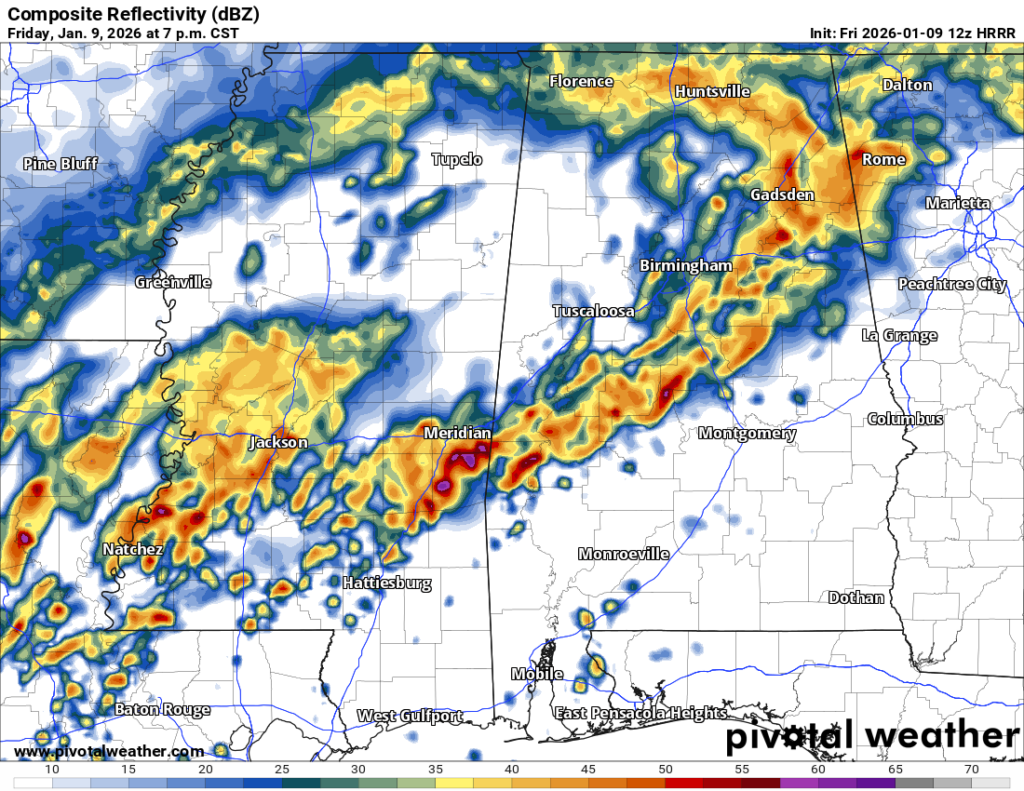
The severe weather has started off early with a few tornado warnings including Marion, Covington, and Jones counties. There is a band of storms that is currently moving northeast and may continue on with some rotating cells as it moves that direction.
Ingredients
So far, we have a decent amount of helicity contributing to the tornado development moving through the Pine Belt. This will move slightly north as the line moves towards I-20 towards the late morning hours.
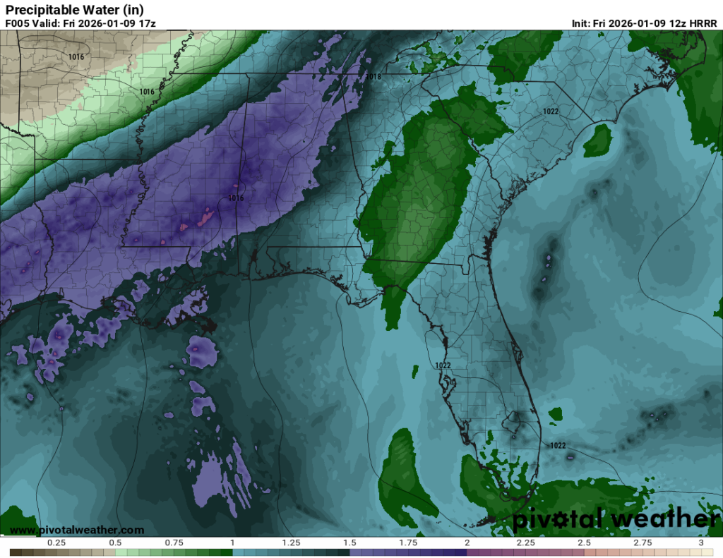
Even when we get a break from the typical severe parameters, one thing we can expect is heavy rain and flash flooding. The precipitable water amounts are very high (close to 2 inches!) which means there is plenty of moisture to work with in these storms. Combo this with a line that isn’t propagating further north very fast and that will add to the flash flooding risk.
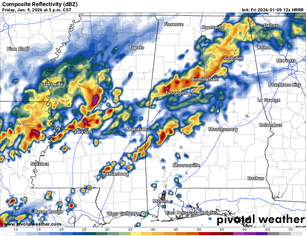
Starting off in the mid-afternoon is when we’ll see some scattered severe cells possible. We should expect heavy rain, lightning, high winds, and a tornado possible around this point.
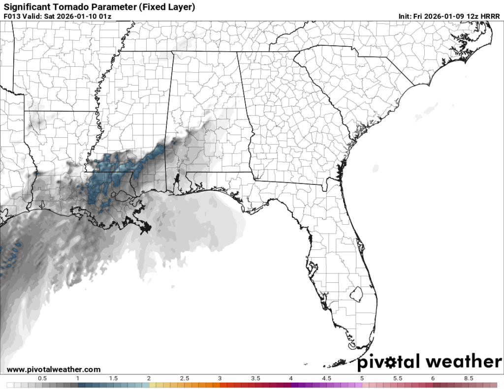
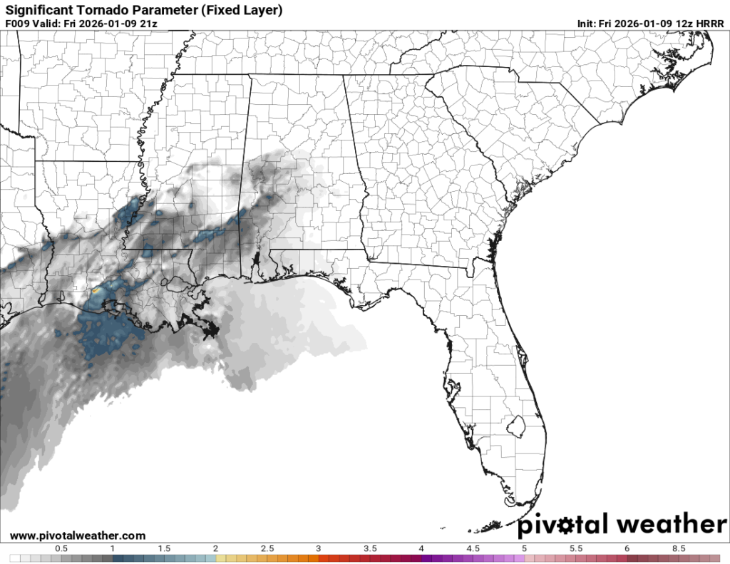
The late evening hours are when a more organized system of severe weather moves in. This is when we can expect a higher chance of high winds, flooding and tornadoes possible. The SigTor parameter still remains on the lower side, but still possible for much of the Pine Belt.
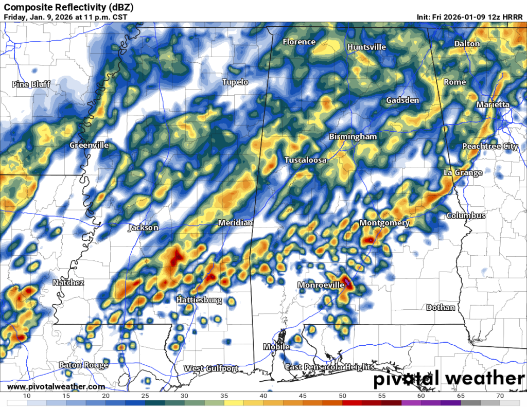
As we round midnight, the severe weather potential begins to lessen a bit as the helicity begins to weaken and move further south. The storms look more scattered as they move further north then east.
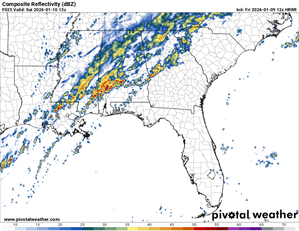
As the cold front moves through, much of the severe weather potential moves towards the coastline. The same risks are possible as we go into the morning hours albeit scattered instead of widespread.
Bottom Line
Severe weather potential today and tomorrow are somewhat limited but possible as shown by the few tornado warnings we had this morning. Our main risks look to be flash flooding, high winds and a possible tornado, especially towards the evening hours. The helicity and significant tornado parameter hovers around southwestern Mississippi/southeastern Louisiana to much of the Pine Belt and the coastal areas. Also keep in mind that model guidance has been complicated about the outcome of the incoming weather, so be sure to listen to your local NWS office and keep your phone with you for the Nickelblock app and other warnings. Nick will likely have an update later as well.


