If you know that lyric, you’re probably popping your joins as you get up out of bed every morning. Anyways, let’s take a look at the current updates to the wintry weather coming in on Saturday and Sunday. For many of us in the Pine Belt, things are looking better in one way but not so great in another, i.e. ice vs. possible severe weather. For others around the I-49 to I-55 corridor, there’s still a fine line. For anyone else above the I-20 corridor, the main concern will be freezing rain and how much of it.

Today
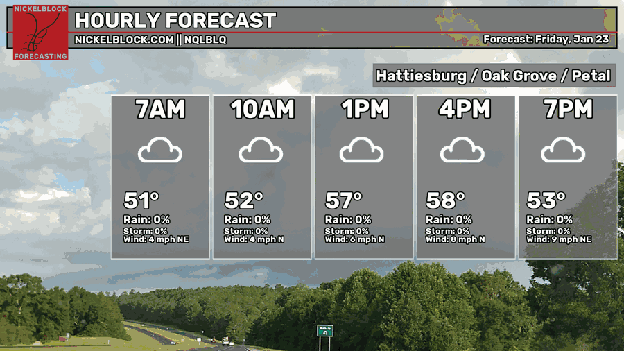
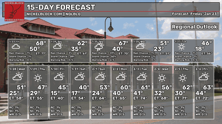
It’s going to be another cloudy one today. Winds are shifting towards the north and it’s going to be fairly humid and damp today. Highs in the upper 50s and lows in the upper 30s.
Tomorrow
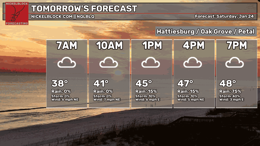
As the cold front moves in, it’ll drop temperatures a good 10 degrees and rain chances will increase as we go into the afternoon.
As we go into the latter part of the weekend, we’ll be split between two factions: winter weather and severe weather. So far, the northern parts of Louisiana, southwestern and northwestern parts of Mississippi are the most likely to receive freezing rain accumulation. The south central, southeastern parts of Mississippi, southeastern Louisiana and southern Alabama are more likely to receive rain and/or severe weather.
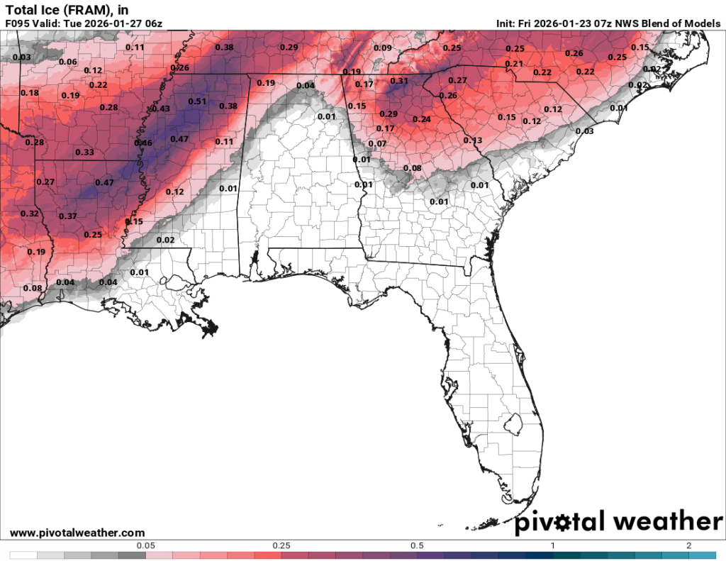
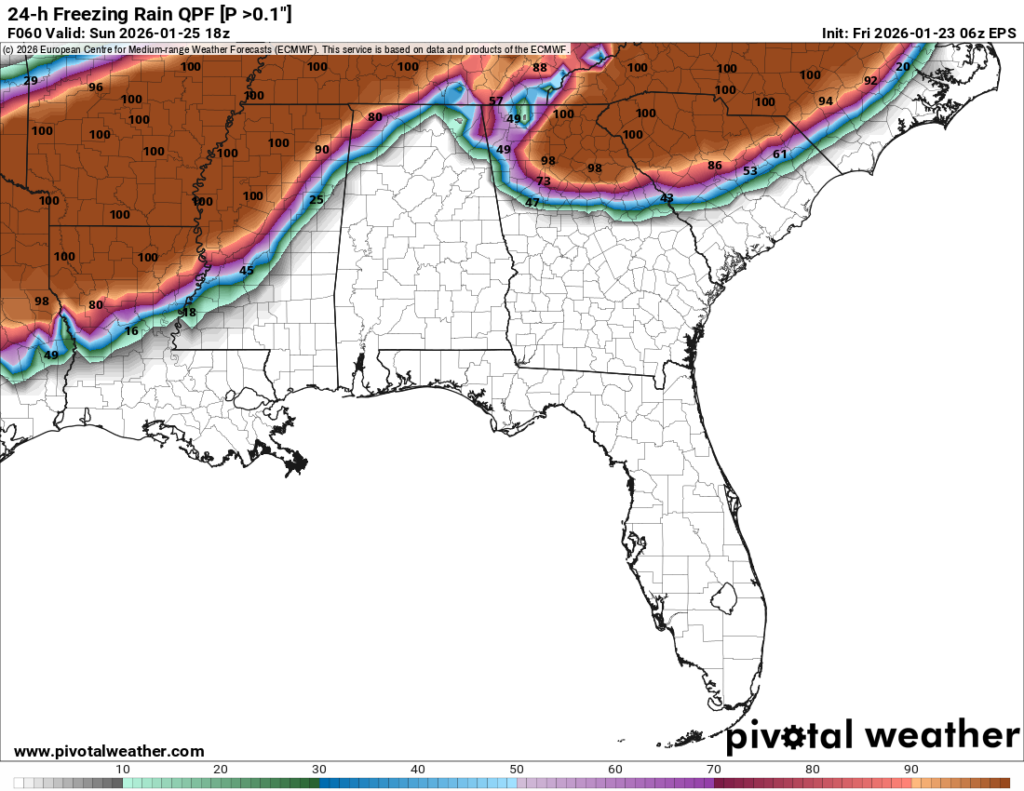
Looking at the EPS ensemble and the NWS blend, we can see the concentration of the heaviest ice. Most of it is relegated to the Louisiana/Mississippi Delta. However, some areas such as Greenville, Oxford, Monroe, Memphis Metro Area and much of northern Mississippi will see the heaviest accumulation. Those on the edge of the ice storm will also be on the point of caution with how much accumulates as this can affect roads, trees and power lines.
That being said, many areas across south MS/LA/AL should also look out for black ice on the roads. There will be a massive drop in temperature between the storm’s passing and the morning hours on Monday. We’ll fall well below freezing, so any areas that don’t dry up enough may form black ice on the roads overnight.
Severe Weather on Sunday
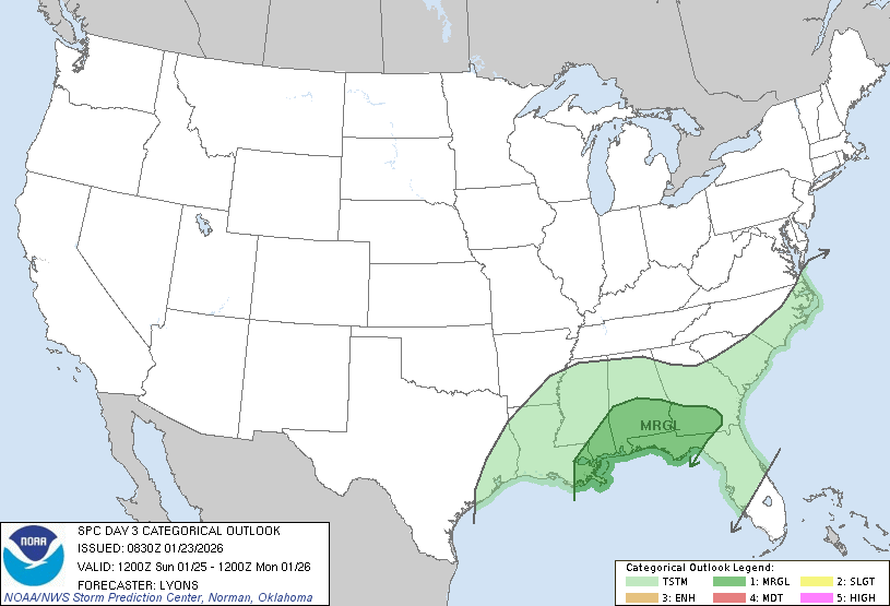
Yep, and at the same time we also have a chance of severe weather! How about that! While it’s a low end severe risk, there’s still something to be cautious about. Both the GFS and Euro models are split on the location of the severe weather, but right now it’s around the extreme southeastern Louisiana area to central Florida. The GFS model currently places the risk further east while the Euro model places it around the Pine Belt area and spikes near central Alabama. Either way, there is a chance.
Severe risks so far look like heavy rain, high winds and a possible tornado.
Colder than Average Week
The beginning of the week is going to start of cold. Monday we’ll have a low in the low 20s and a high in the mid 30s with winds out of the north. Bring your coat and something to cover your ears as the cold isn’t going away for a while. Not only that, cover your pipes as it’s going to stay cold for several hours at night with a low in the mid 10s. The rest of the week we’ll be in the low to mid 40s and lows in the 20s, so I would keep your pipes wrapped for a little while. By Thursday, expect another cold front that will drop temperatures in to the mid 10s again and another cold few days.


Thanks for all you do for the Pinebelt. We love you, Nick.