As the afternoon data comes down, a few updates about the derived parameters – in particular the “FRAM” data that estimates ice accretion during freezing rain and sleet events.
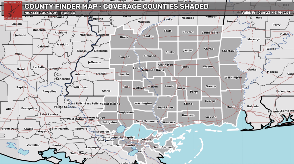
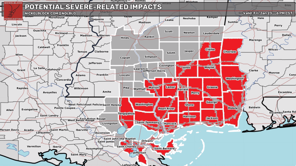
Again, I’m talking about the highlighted counties on this map below:
Looking at the change from the icing extent last night (black line on left map) and this morning’s data…. to this afternoon’s data on the right.
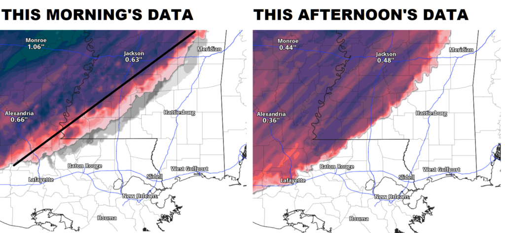
We continue to see the data supporting ice accretion oozing southeast. Not by much, but by 10 -20 miles here and there along the line. And the cutoff between “no freezing rain and no sleet” and “impactful and disruptive freezing rain and sleet” is a lot sharper this afternoon.
WHAT DOES THIS MEAN?
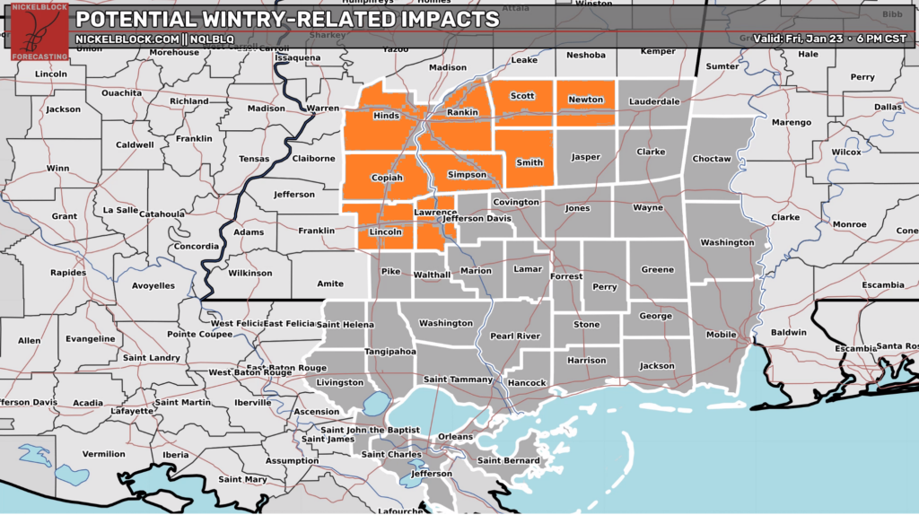
It means if you live in Hinds, Rankin, Scott, western Newton, Smith, Simpson, Copiah Lincoln, Lawrence, northern Jeff Davis, or northern Pike counties…. you are all included in the risk for impactful freezing rain / sleet. That includes disruptions to travel and the chance for some power outages.
So, Pike County and Jeff Davis County, you are added to the list on this map from yesterday.
I know the next questions are, “Will is keep moving southeast? Will it make it to XYZ-town? Any chance for snow?
The short answers are: Probably, Depends, and no.
I think we will continue to see this line sag southeast, but not by much. You figure, if every 6 hours we gain 5-15 miles… and the switch-over to wintry precip is supposed to happen in 12-18 hours, we can only move the line so far southeast. Another 45 miles at best. And at least another 15 miles, I suppose.
But the southeastern push is uneven. It isn’t a uniform move. In some places we have gained area to the southeast, in others it hasn’t really moved much at all. And trying to determine where the next round of model guidance is going to pivot things is not a skillful exercise. Plus, the models aren’t perfect, by any means, so even if they show something, it doesn’t mean it will happen.
Instead, I would encourage everyone to not worry about the specifics of the line and look at the general trend.
And the general trend is, “the forecast for freezing rain and sleet continues for the original counties and now includes portions of two extra counties. Given model trends it may include portions of Jasper, Covington, and Walthall counties, as well as St Helena Parish.” But any further incursions (I love that word) of ice further south are less likely.
WHAT ABOUT SEVERE WEATHER?
The Storm Prediction Center has increased that risk, too, for parts of the area. But the true risk will end up being to our east.
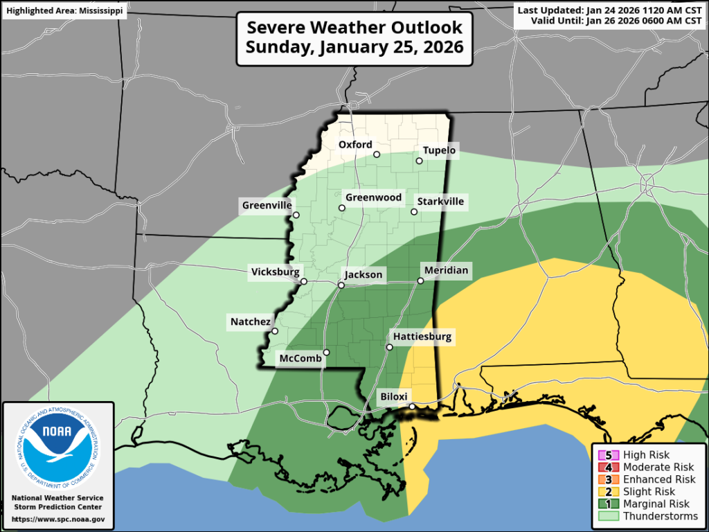
Parts of our southeastern counties are now in a Slight Risk. A Slight Risk is a “2” on the 1-to-5 scale where a “5” is the highest risk for the most significant severe weather. The rest of the area is under a Marginal Risk.
This is mainly for as the cold front approaches and then kicks through the area. Ahead of and along the front we may see some isolated strong to severe storms. And, given the wind profile, it looks like the risk for brief heavy rain, lightning, wind gusts up to 65mph, hail, and a few tornadoes will be a concern.
This would mean a handful of extra counties are added to the map from yesterday’s forecast:
Other data supports this, too. The NQLBOT data supports a handful of strong storms across the area tomorrow. Mainly around mid-morning as the front passes through.
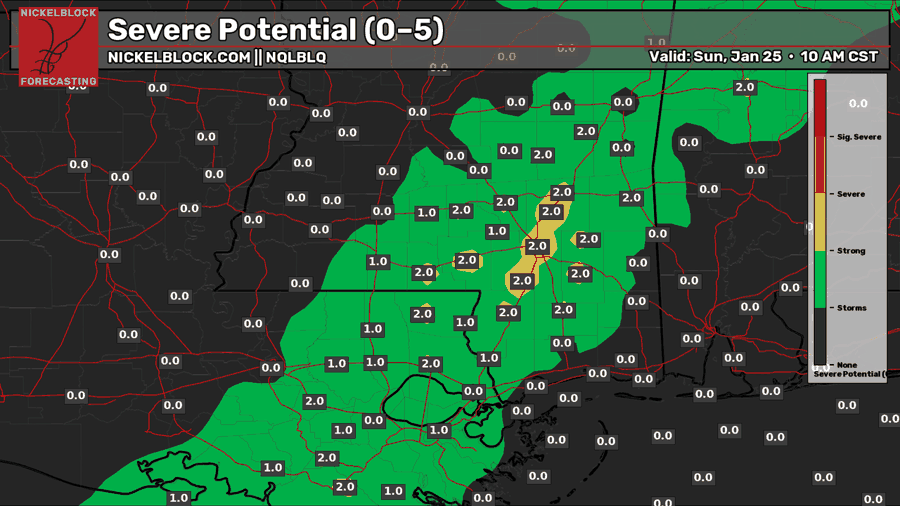
While tornadoes are a concern, we are not concerned about EF-2 or stronger tornadoes for tomorrow. These would be brief and weak EF-0 and EF-1 tornadoes. On the ground for a handful of miles at best.
BOTTOM LINE
This forecast continues to evolve, like most high impact weather events. Hang in there and we will do our best to keep you updated as things change.


Hey Nick … thanks for all you .. But it is ..32 degrees at my house n I live 8 miles east of Richton ..