A Look Back
This past weekend was certainly an interesting one. What made it so challenging to forecast was the insane temperature gradient that set up right across our region. In some cases, locations within the same county were stuck in the 30s with freezing rain, while towns just a few miles away were sitting in the 60s or even 70s with thunderstorms. We knew an extremely tight baroclinic zone would be in place, but pinning down the exact timing and placement of that boundary proved to be the toughest part.
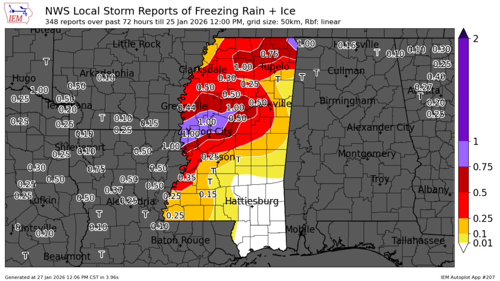
Above is a look at the local storm reports of freezing rain and ice from this past weekend, and you can really see just how sharp the gradient was. As we talked about before the event, a glaze of ice was possible from northwest of Hattiesburg up toward Jackson, with areas north and northwest of Jackson likely seeing up to around an inch of ice. That ended up verifying pretty well.
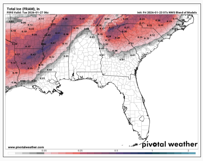
Next to the storm reports is the National Blend of Models guidance from ahead of the storm. It did a good job overall showing where that gradient would set up. Things could have shifted a bit farther southeast, but in general, the model handled the placement fairly well.
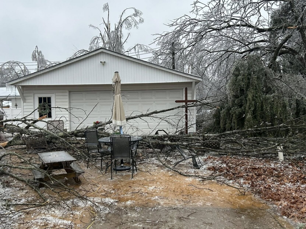
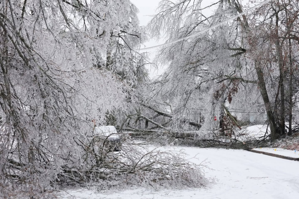
These images show just how much damage the freezing rain caused across central and northern Mississippi and surrounding states. The ice load on trees and power lines led to widespread outages, with tens of thousands of customers losing power at the peak of the storm. Many areas saw tree limbs snap and fall onto roads and lines, which made travel difficult and slowed restoration efforts. For a part of the country that rarely deals with significant icing, this was truly a significant storm.
Oh, yeah, there were also some tornadoes in Alabama & Florida
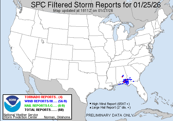
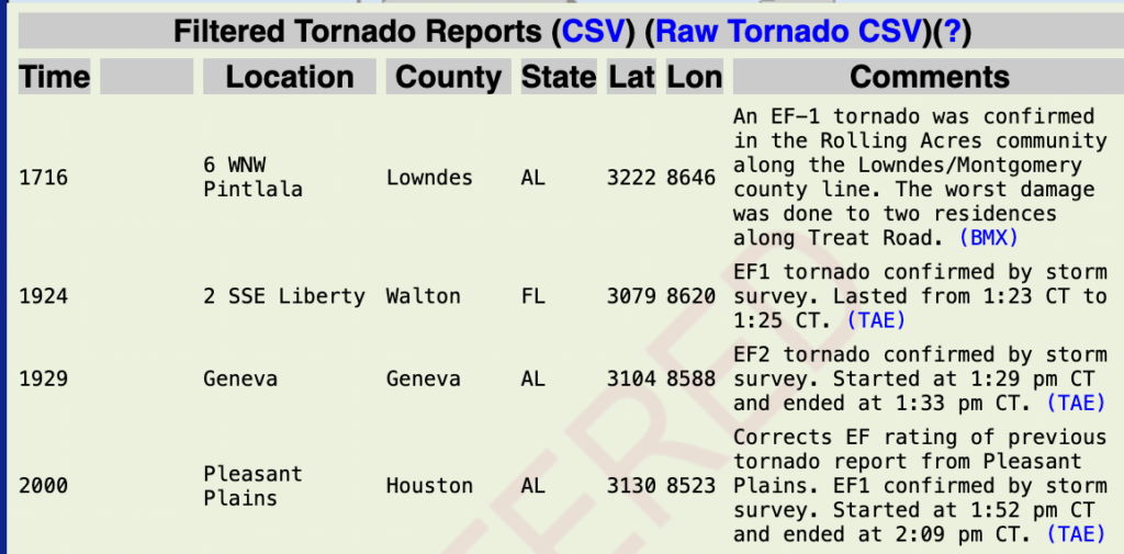
The SPC issuing a Slight Risk for southern Alabama and the Florida Panhandle ended up being a good call, given the storm reports that came in. There were four tornadoes confirmed, including three EF1s and one EF2, along with 56 severe wind reports. Luckily, no severe storms for us, but we certainly had the potential. This was a truly remarkable storm with a wide range of impacts across the region.

Tonight’s Forecast
Tonight we’re looking at another cold night ahead, with lows in the lower 30s, just at or below freezing for most. No precipitation is forecast for tonight, as we are under an area of high pressure keeping us dry. Watch out for any wet spots still out and about, as they could freeze overnight.
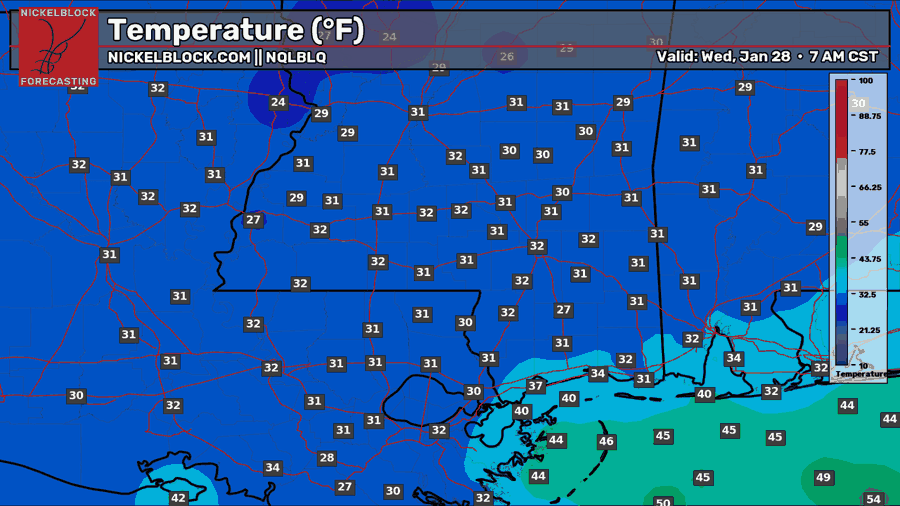
Tomorrow’s Forecast: Wednesday, January 28
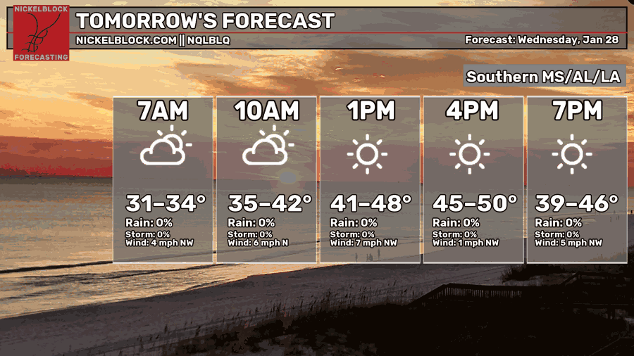
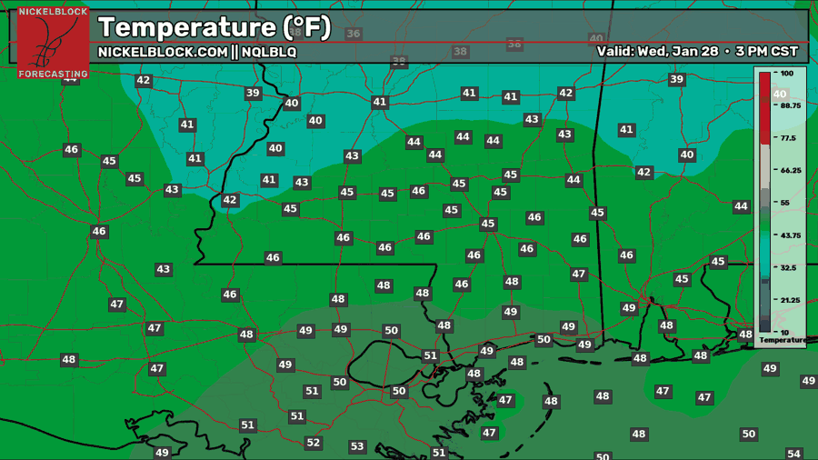
Tomorrow, expect a mix of sun and clouds with a high in the 40s. Areas further south will see a high closer to 50. We’re below average in temperatures due to a mainly northwest flow, which is continuing to bring us this cold air.
Thursday’s Forecast: January 29
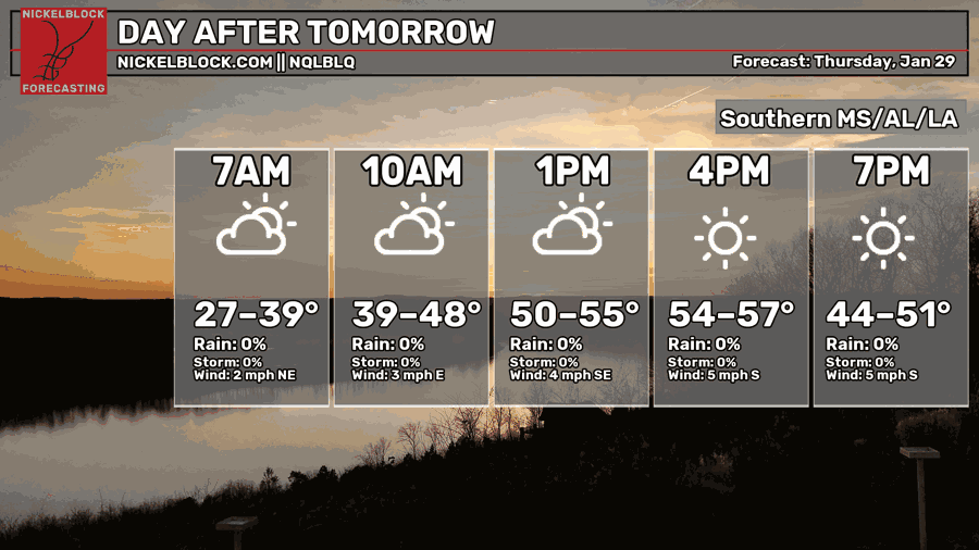
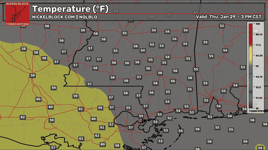
We warm up a bit on Thursday as the flow turns more southerly. Highs will climb into the mid 50s across much of the area, with locations in Louisiana getting closer to 60. Expect a mix of sun and clouds through the day.
Weekend Snow?
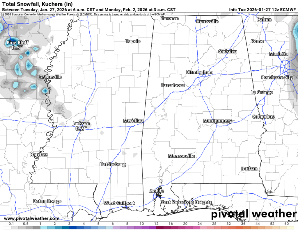
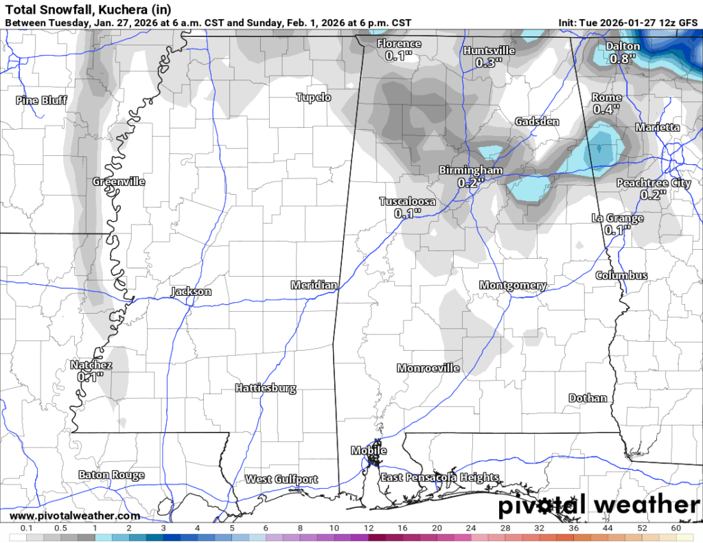
Now to the weekend snow chance that everyone has been talking about. At this point, the setup looks pretty underwhelming. Both the Euro and GFS are showing little to no snowfall across the region, with most areas staying dry. At best, a few flurries could sneak in, but moisture looks too limited for anything more than that. This is not shaping up to be a meaningful snow event, but we’ll continue to monitor it and update if anything changes. Stay tuned.

Extended Local Outlook
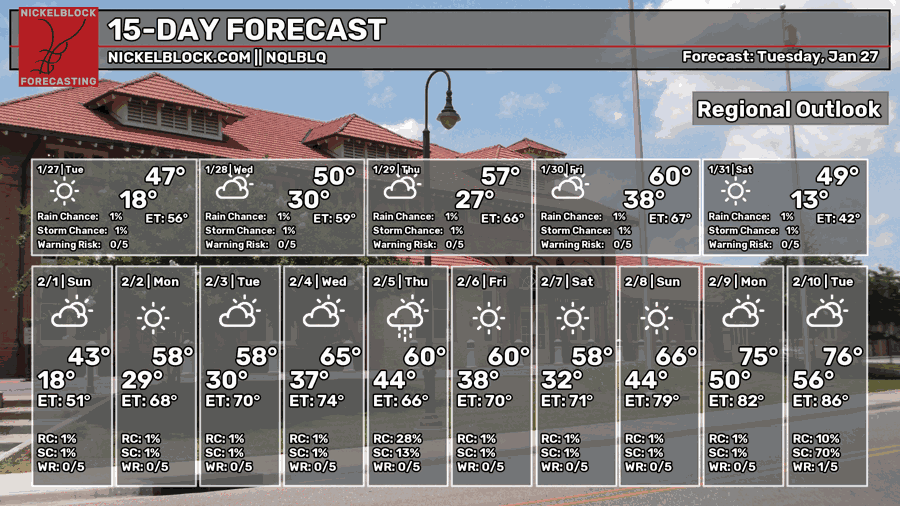
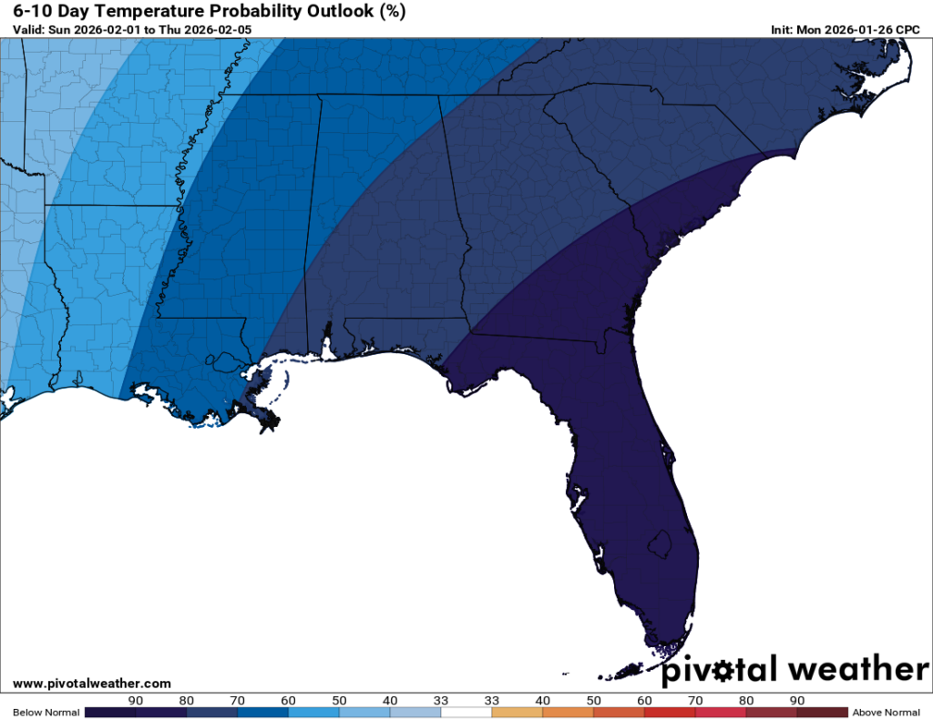
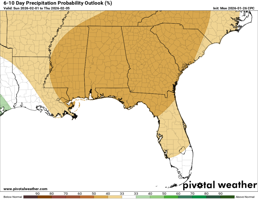
We’ll continue to run below average temperature-wise, with cold conditions expected to stick around for the near future. Friday will be the exception, feeling almost warm with highs reaching 60, but not before we start the morning off in the teens. BRRR! The CPC is also signaling mostly dry weather over the next 6-10 days.


