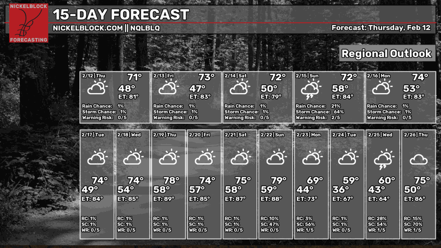
Overall Setup
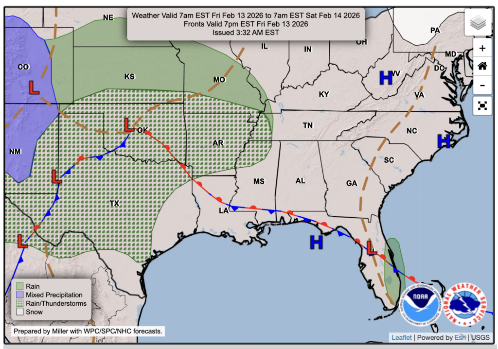
Tomorrow is Friday the 13th, and we have a spooky stationary front parked over us to keep us some company. Just kidding, the only thing spooky is the significant humidity difference that will be felt tomorrow because of it – more on that below. Looking at the setup for the line of thunderstorms expected for late Saturday night into Sunday morning, a low-pressure system and associated cold front will sweep through our region, bringing potentially strong to severe wind gusts and heavy downpours. We might see a few early light rain showers out and about for Valentine’s Evening, but nothing that will cancel any plans for date night.

Tonight’s Forecast
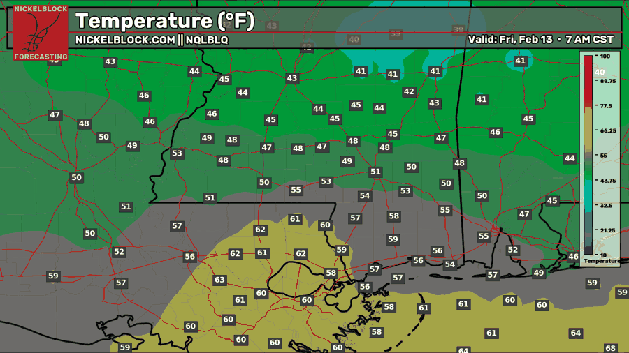
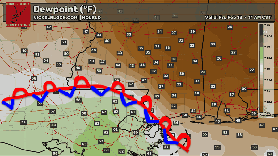
Tonight, it will feel like a spring night in southern Louisiana and like winter in southern Mississippi due to the spooky stationary front. As you can see from my beautiful drawing above, areas north of the front will see lows in the low to mid 40s to around 50, with dew points in the 30s to 40s, so it’ll feel noticeably drier, while areas south of the front will stay much milder with lows in the 60s and dew points in the low 60s, making it feel muggy. As the sun comes up tomorrow morning, we could see a stray sprinkle near the front, but most spots stay dry.

Tomorrow’s Forecast: Friday, February 13
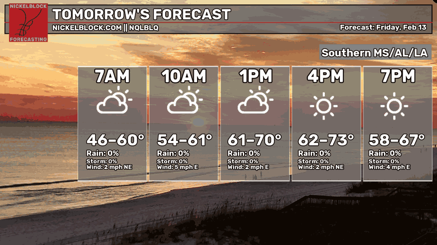
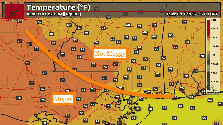
On Friday, temperatures warm up nicely to the low to mid-70s. The closer southwest you are, the warmer your high temperature will be. Our stationary front will still be in the same spot by tomorrow, so the line of mugginess vs non-mugginess will stay the same as tonight’s. No rain is in the forecast, except for that minimal morning shower chance along the front. We’ll see mostly cloudy skies tomorrow, but there will be some sun throughout the day.
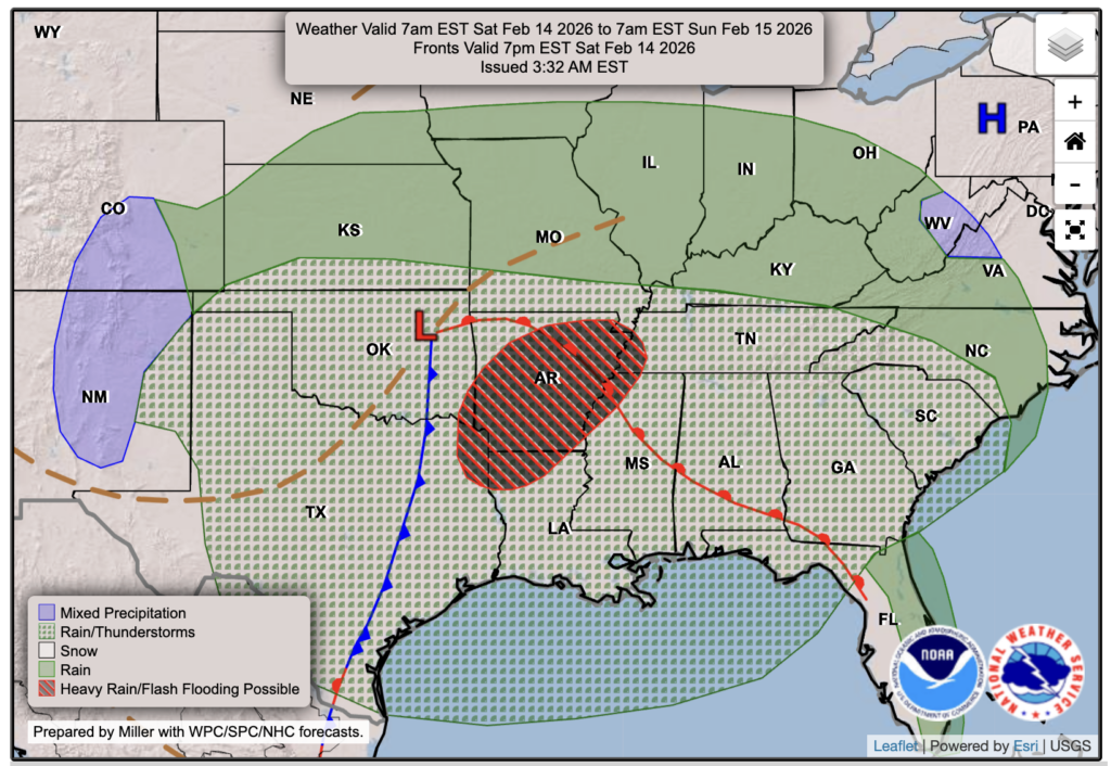
Valentine’s Day Forecast: Saturday, February 14
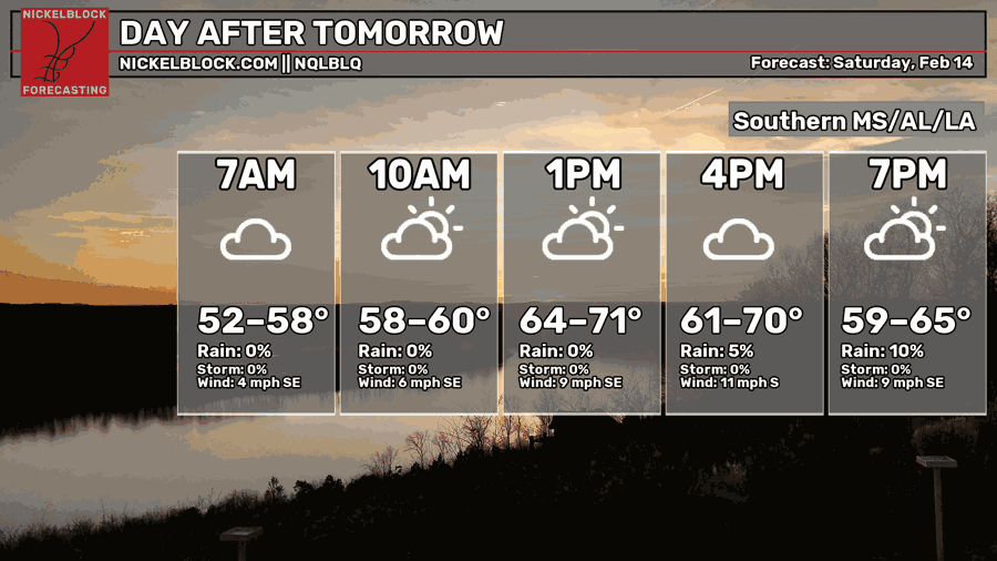
Clouds will increase ahead of our stormy Valentine’s Night as dew points and temperatures climb on a strong southerly flow. Highs will reach the mid 60s to low 70s. As for rain, a few early showers are possible from the afternoon into the evening, but nothing widespread or high impact. I’d still recommend bringing an umbrella or rain jacket to dinner plans just in case you get caught in a passing shower. The heavier stuff holds off until after midnight, so your evening plans should be in good shape.
Late Saturday Night into Sunday Morning
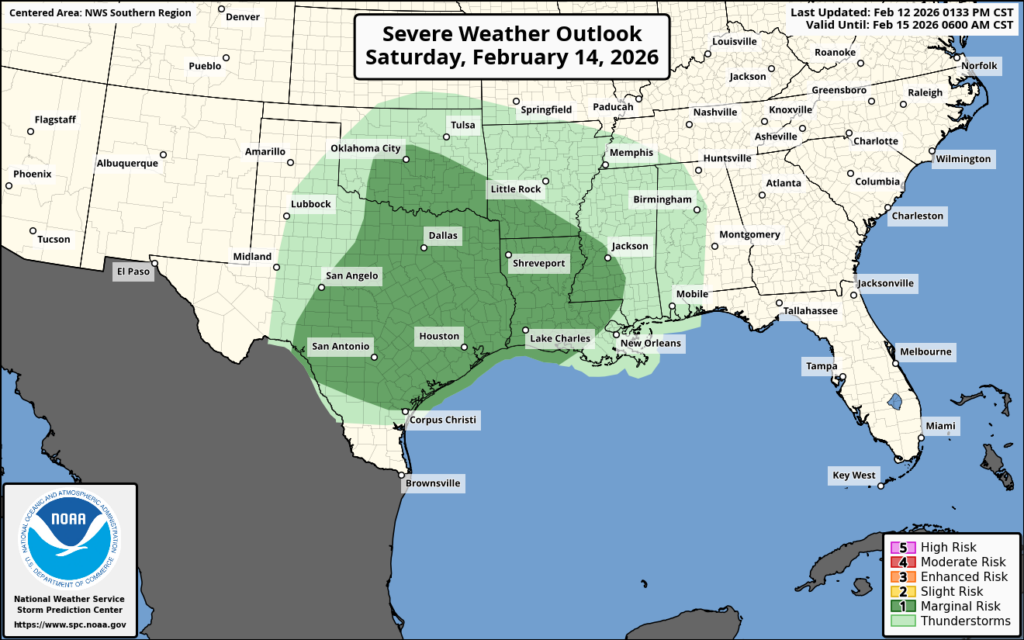
The SPC has finally issued a Marginal Risk of severe weather for this event from central Texas through most of Louisiana and southwestern Mississippi. This is a level 1/5 on the SPC scale and is currently a wind-driven risk. As we have mentioned, the atmosphere will be primed with high moisture and wind energy, but by the time the line reaches us, instability will be lacking, which will limit the severe threat.
Gusty winds will be a concern, though, since we could have 30-40 mph gusts, plus any severe storms that can produce even higher gusts. Stay with us through Saturday, so you can get the most up-to-date information, and ensure you have alerts enabled for the NickelBlock Forecasting app on your phone!

Extended Local Outlook
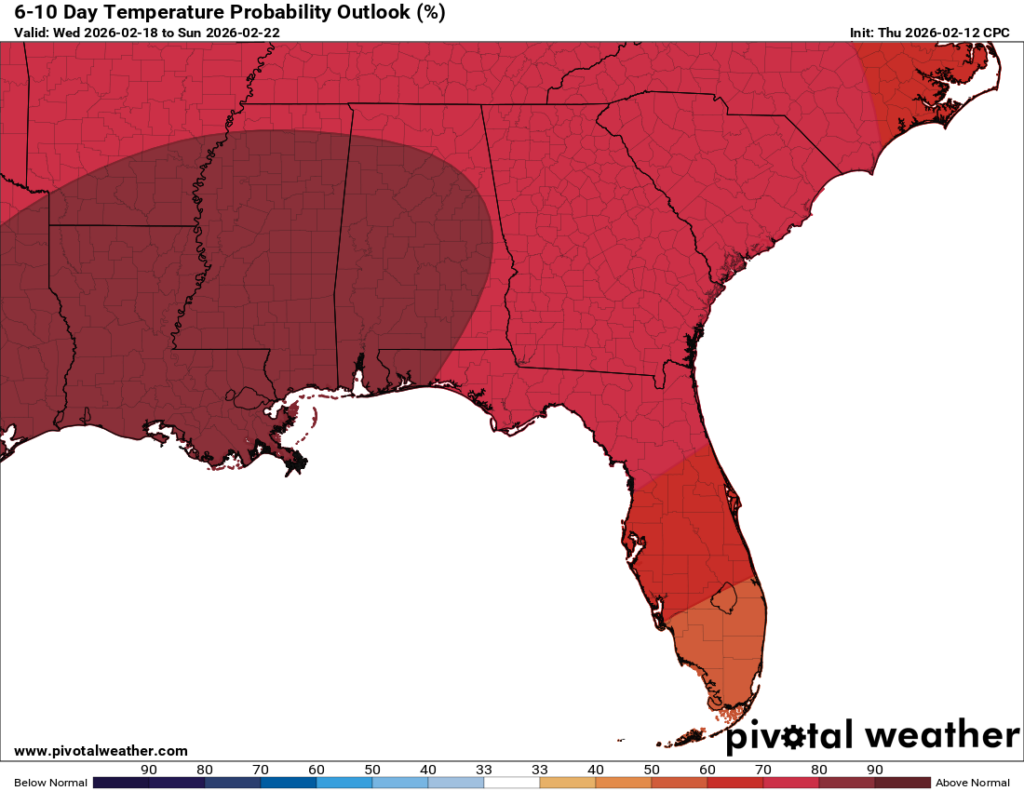
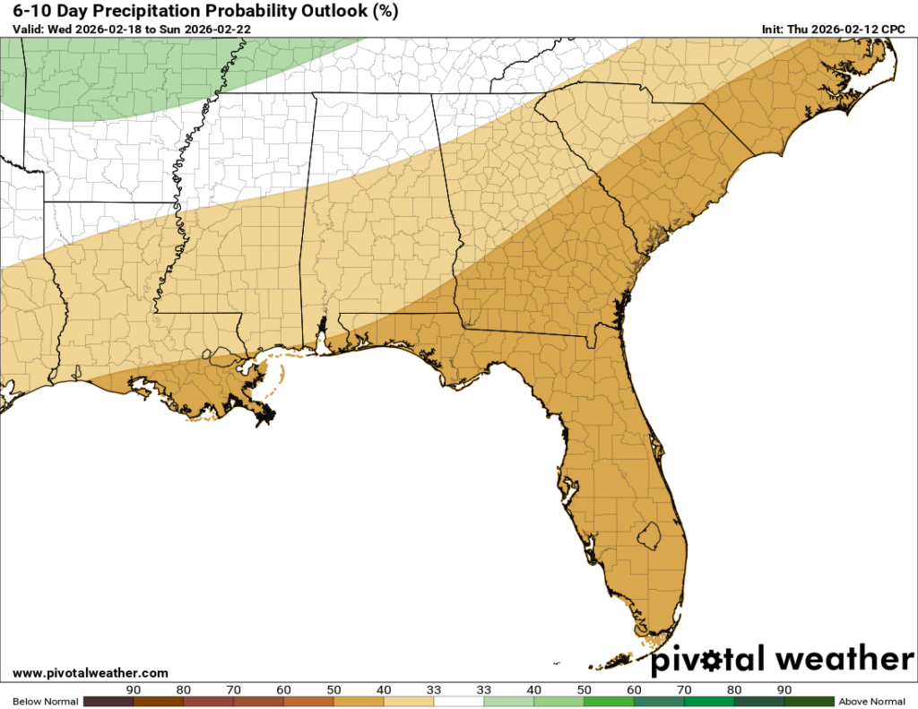
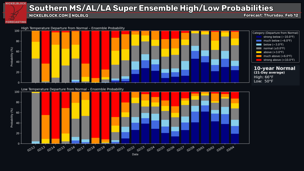
Not much in terms of big rain makers next week, and certainly no blizzards or hurricanes at that. Yet again, we’ll see another warmer, drier 6-10 days ahead following this weekend’s round of storms. Do we see a break in the pattern in the last week or two of the month? Our probability chart shows some uncertainty, but I see much more blue than red!
As Nick has mentioned, please watch what you read online and try not to fall for people who use your anxiety for money on social media. We will always give you the most accurate forecast, and never try to mislead you or overhype something that doesn’t need to be. We’re so thankful for our audience and sponsors this Valentine’s Day weekend!


