Overall Setup
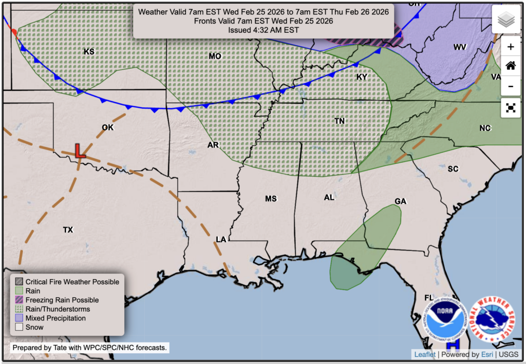
We’ve seen cooler-than-average temperatures over the past few days, along with a sharp drop in humidity, which is a huge contrast to the hot, humid February we’ve had so far. Yesterday, we were under a Red Flag Warning, meaning weather conditions were favorable for fires to spread quickly. There are still several fires burning across southern Mississippi because of these dry conditions. While the Red Flag Warning has been canceled, conditions remain favorable for fire spread today and will still be somewhat favorable on Wednesday, though not quite as concerning.
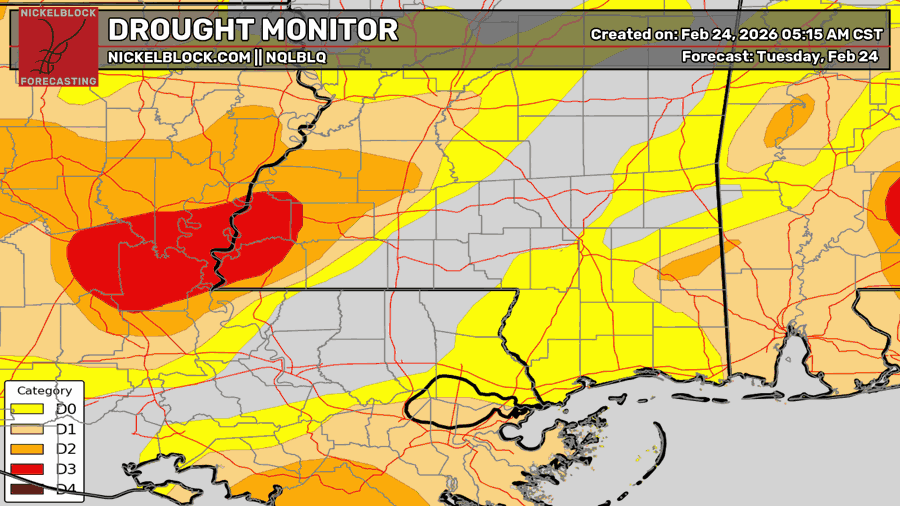
Much of the region is currently under at least abnormally dry conditions, while areas in extreme southwest Mississippi and east-central Louisiana are under moderate to severe drought, according to the latest Drought Monitor. We’re expecting a chance of rain on Thursday, along with increasing humidity, which should help ease fire weather conditions and begin to chip away at the drought.

Tonight’s Forecast
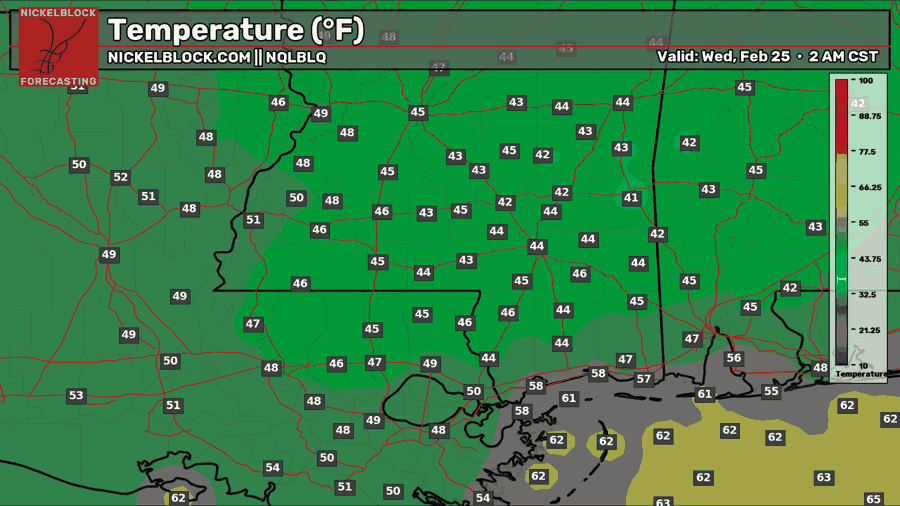
Tonight, we’ll see a low in the low to mid 40s with partly cloudy skies. A relatively cool and dry night ahead.
Tomorrow’s Forecast: Wednesday, February 25
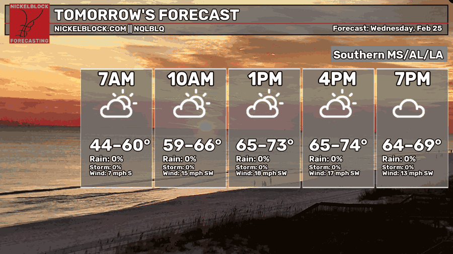
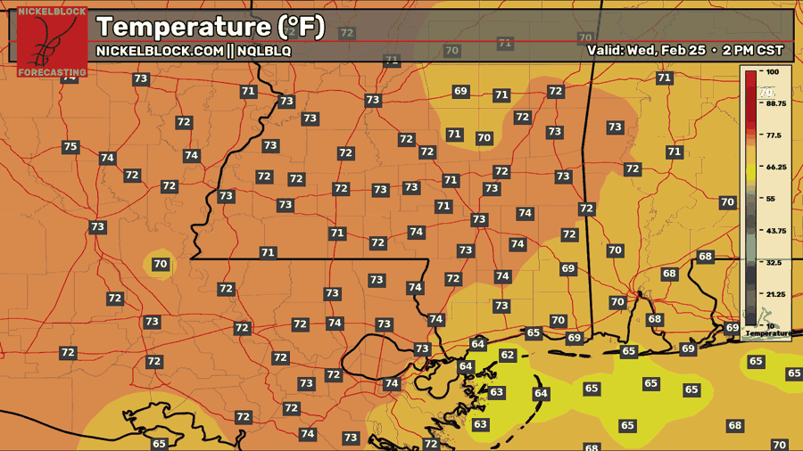
By tomorrow, winds will shift in from the south, and that’ll help temperatures climb back into the lower 70s. With that wind shift, we’ll also be dealing with some gusty winds, and that could push some of the wildfire smoke north of the fires into spots like Laurel and Hattiesburg. So if you notice a little haze tomorrow, that’s why.
Dew points will also rebound into the 50s and 60s, which is a big change from the teens and 20s we had yesterday and today. That added moisture will help lower the fire danger quite a bit, but the gusty winds could still make it tougher to get any ongoing fires fully contained.

Thursday’s Forecast: February 26
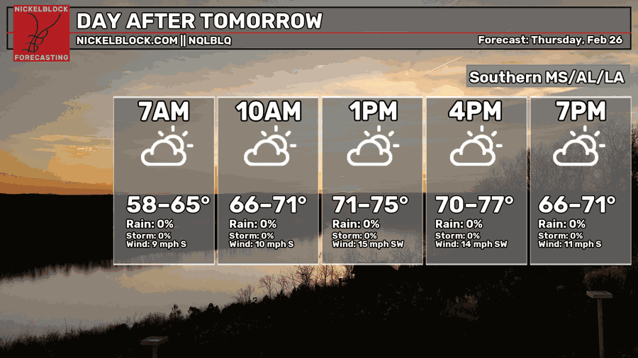
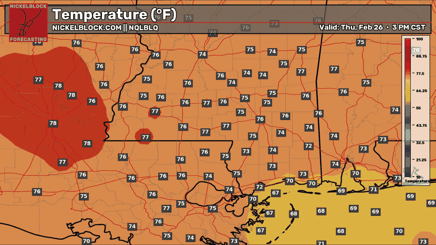
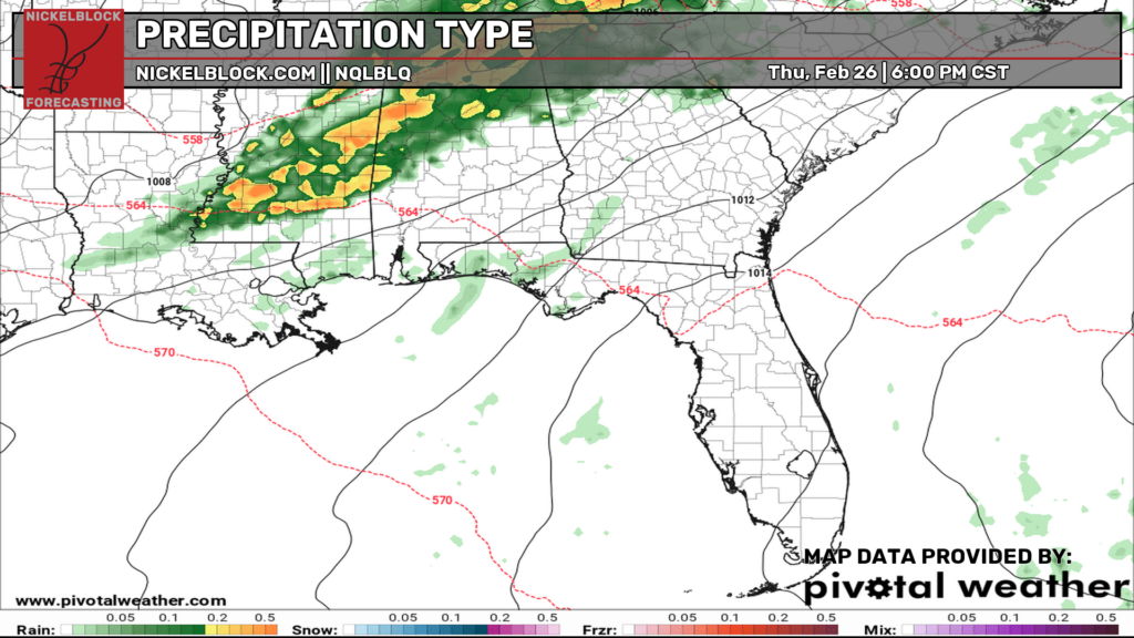
Thursday, we’re looking at a round of showers and thunderstorms moving through with a cold front, with the best timing from the afternoon into the evening, then winding down with spotty showers Friday morning. Severe weather is not expected, but we could still see some heavier downpours, gusty winds, and plenty of lightning and thunder, so I’d definitely pack the umbrella for work on Thursday.

Extended Local Outlook
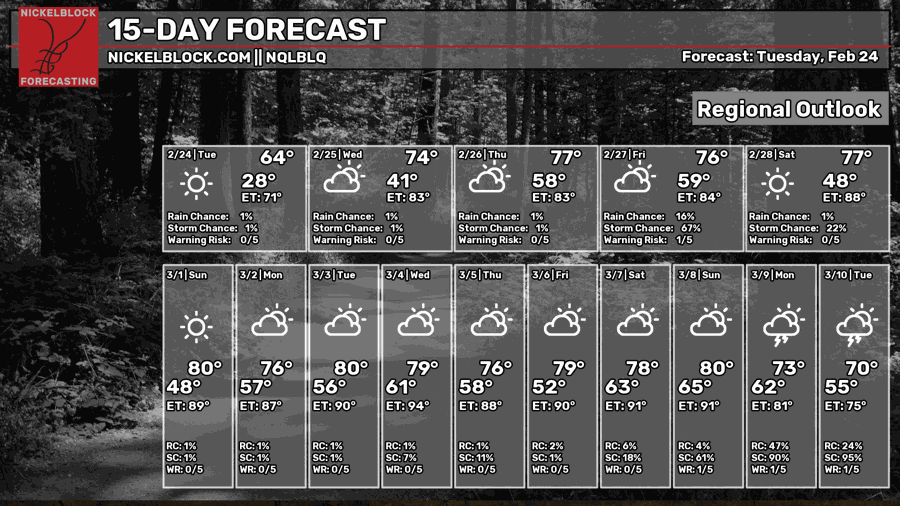
Looking ahead at this weekend, Friday, any leftover rain should be out of here by noon-ish. We’ll see a high in the low-to-mid 70s and clearing skies through the evening. Saturday looks beautiful will plenty of sun and highs in the 70s, plus lower humidity! Sunday looks to be back to near 80 with clear skies all day. A nice weekend ahead!
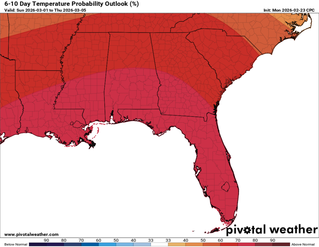
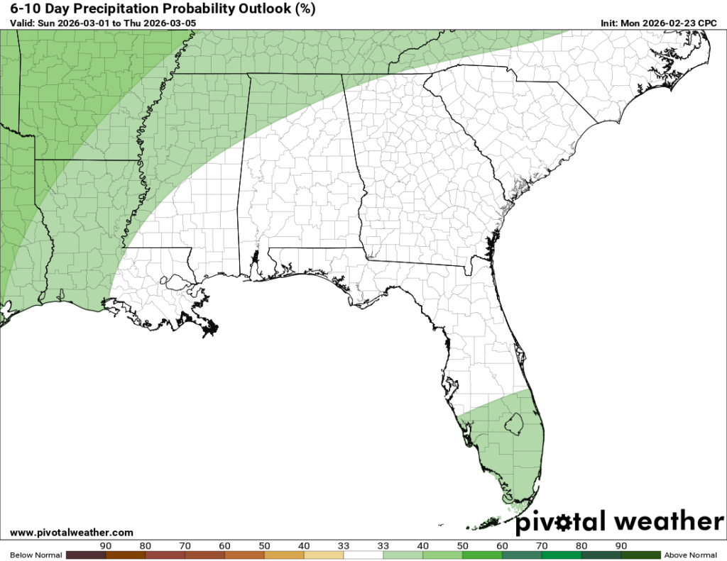
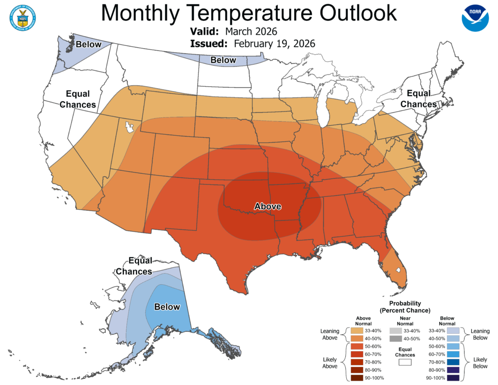
The 6-10 day outlook runs from March 1st through March 6th, and it still looks pretty confident that we’ll stay above average in temperatures. That ridging pattern I’ve been talking about looks like it may park itself over the South into March, which is one reason the Climate Prediction Center is also favoring above-normal temperatures for the month overall.
That said, the CPC isn’t the final word, and it has been wrong plenty of times, so we don’t base the forecast on it alone. Our in-house super ensembles are also showing a better chance of warmer rather than cooler temperatures, at least through the first half of March, which adds more confidence to the warmer overall look. And as I said before, that does not mean winter is over or that we can’t still get some colder shots of air, it just might be a bit harder. This is just the overall pattern and the most likely trend for the month as a whole.


