We’ve got a warm and humid weekend ahead with on and off rain Friday and Saturday! The latter part of the weekend also looks wet as the front stalls over us, but it’ll run out of steam at that point. We’ll see a slight break from the rain by Tuesday but contend with an incoming cold front by Thursday that will flip the script a bit on the weather we’ve had so far! Cooler temperatures are ahead by next weekend.

Today
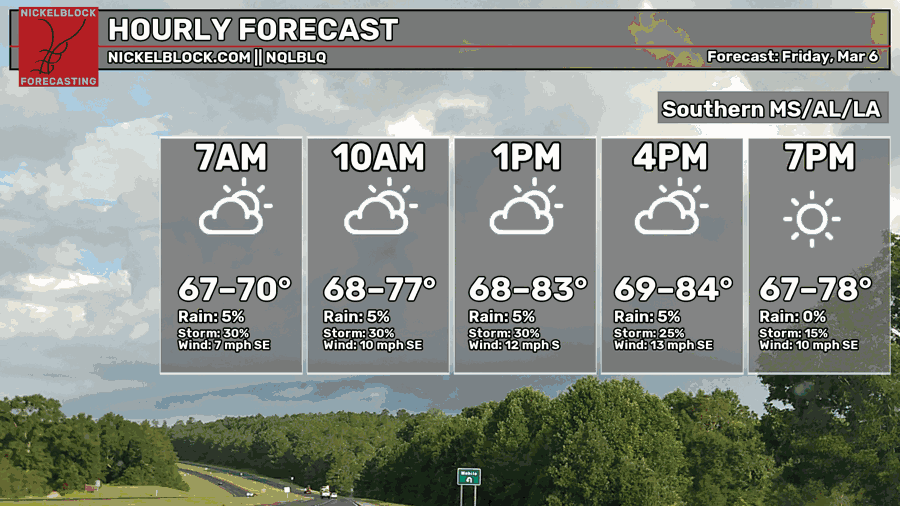
Waking up this morning, I already noticed the streets were damp which means we had an early morning shower. A few more of these are possible into the mid-morning and into the afternoon. A few may develop into thunderstorms, but otherwise we’re going to see scattered showers across much of southeastern MS/southwestern AL. It’s going to be a muggy one with temperatures in the low 80s today and low 60s tonight. Winds out of the south and the southeast.

Tomorrow
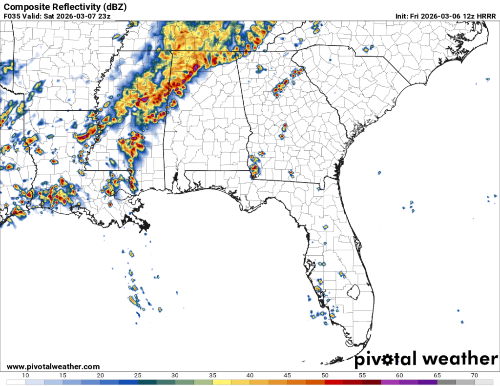
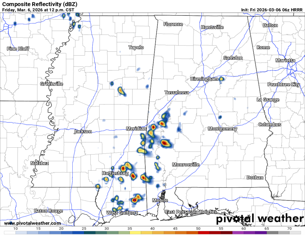
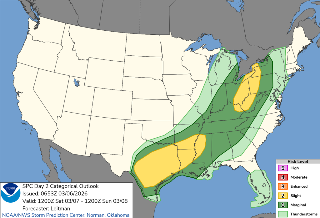
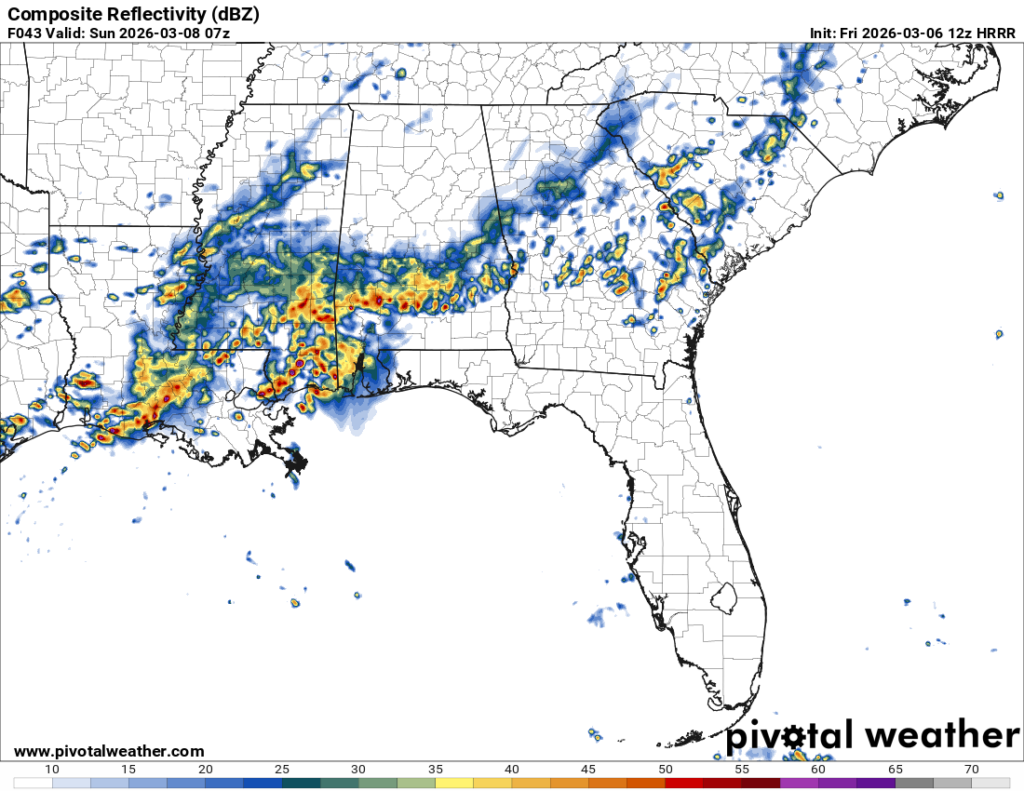
Saturday is going to start off fairly nice with mostly cloudy skies, however by the late afternoon, the rain and thunderstorms will start rolling in. The Storm Prediction Center has placed south MS/LA under a Marginal (1/5) risk for severe weather tomorrow. The storms moving in from the south look to cluster fairly quickly. Convection looks very good, however shear and helicity are a different story. There’s not much to work with for high winds and tornado potential, however the chance is not zero. I do think that areas around eastern TX/west LA will have a higher potential for high winds and hail with a small chance for tornadoes. For us, however, it looks like the dynamics aren’t completely there.
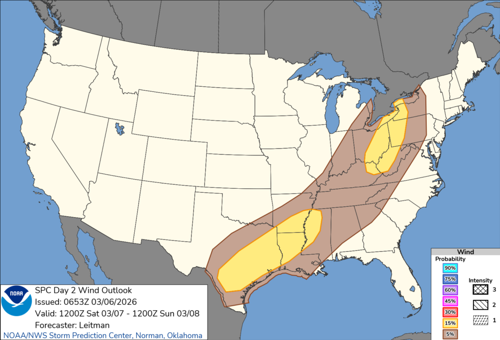
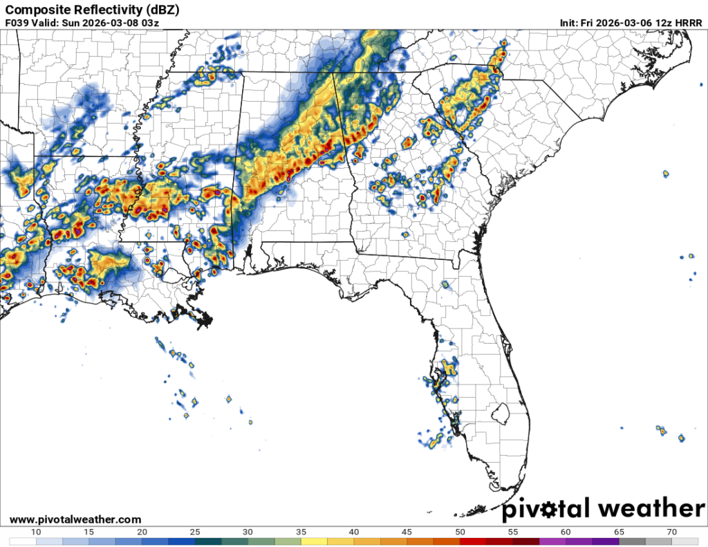
Looking at the outlook above, the wind potential is concentrated towards Texas, north Louisiana/south Arkansas and the Mississippi Delta region. I think we’ll see some wind gusts around our neck of the woods, but overall I think this will be a thunderstorm and heavy rain event. We’ll have to worry about the heavy rain overnight since the main system is moving in past midnight and into the early morning hours.
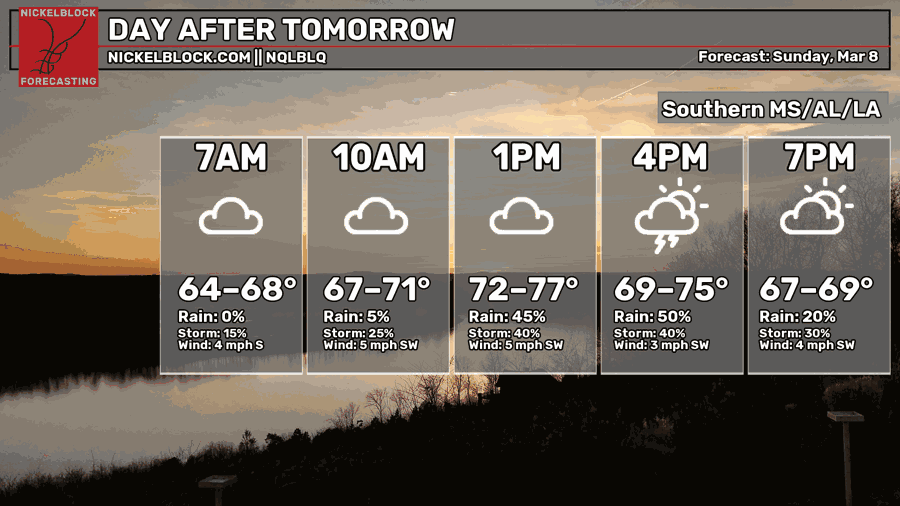
Sunday
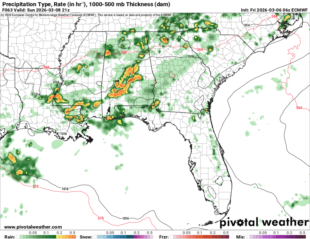
//Courtesy: Pivotal Weather
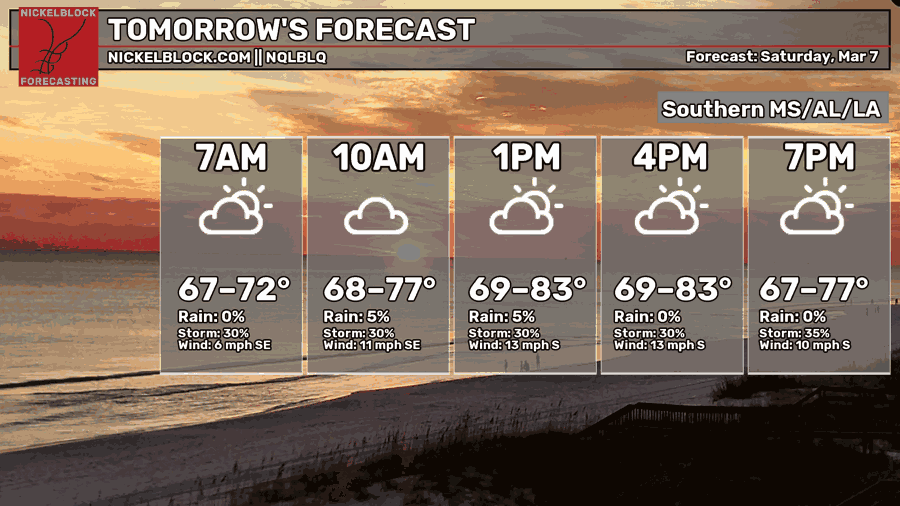
Daylight savings time begins on Sunday, and we’re going to wake up with an hour less of sleep and soggy conditions! There will be a brief break from the storms in the morning, however the front is going to bring another round of showers and thunderstorms to us from the northwest by the afternoon. It’ll be slightly cooler compared to Saturday with a high in the mid 70s, but that’ll be offset by the incoming rain.
Next Week
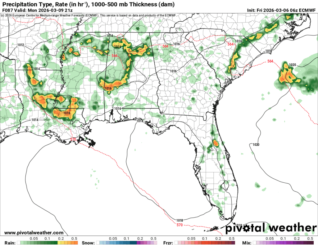
It’s going to be a damp start to the week (I need more synonyms for wet ground) on Monday. The front I’ve been talking about during the weekend will finally move through by Tuesday making it drier overall, but won’t really cool us off. There’s no real wedge to move this system, so that means it just kinda dissipates and we’re left with warm conditions under the large Atlantic high. It won’t be until Thursday that a much larger low pressure system will move over the southeast US to move things along.
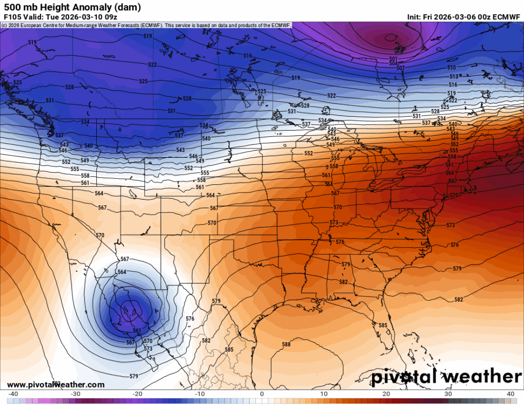
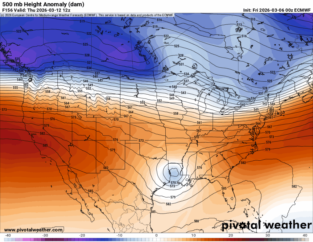
Looking at the graphic above, that pinched trough I mentioned a few days ago will finally gain some steam and move across the southern part of the country to the southeast and bring that low pressure system to us. It gets much weaker, but the good news is that it helps to move the anomalous ridge out to the Atlantic. With that, we’ll get another shot for rain and thunderstorms on Thursday and Friday. We’ll have a slight drop off in temperatures to start the week off in the upper 70s, but we’ll be right back into the low 80s and even the mid 80s by mid-week. Afterwards, the weekend will be another warm one before another cold front moves in.
While this won’t be until the week after next, another cold front is going to move in bringing cooler than average temperatures before leveling out by mid-week next week. The other good news is that all the rain we’ve had will hopefully quell some of the fire weather we’ve had in the past week.