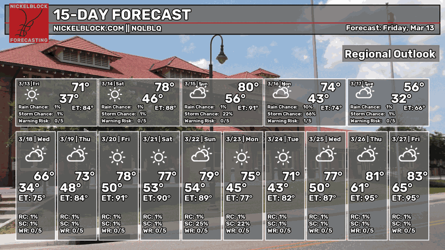
We’re at another Friday the 13th, 2 months in a row (don’t let ol’ Hockey Mask know)! After the severe weather event and much warmer and more humid conditions, we’ll finally have a more pleasant weekend… with a little hiccup at the end. Later in the evening, on Sunday, we can expect some storms to roll through with a chance of severe weather. Compared to Wednesday’s event, this isn’t looking as impressive due to a few factors, but we may still see some strong storms.

Today
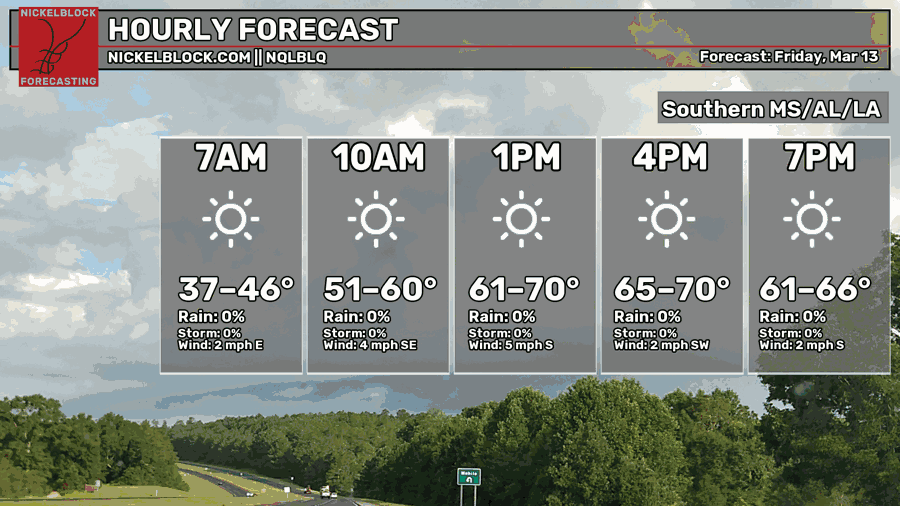
Many of us started off this morning a lot colder than we’ve been used to! Lows around the Pine Belt were in the mid-upper 30s, thankfully with little wind. Today will be a great Friday to be out with few clouds in the sky and a high just around 70. If you’re at a baseball game or just out tonight, bring a flannel or jacket as it’ll be a little bit cooler. Overnight, we’ll fall into the mid 40s.

Saturday
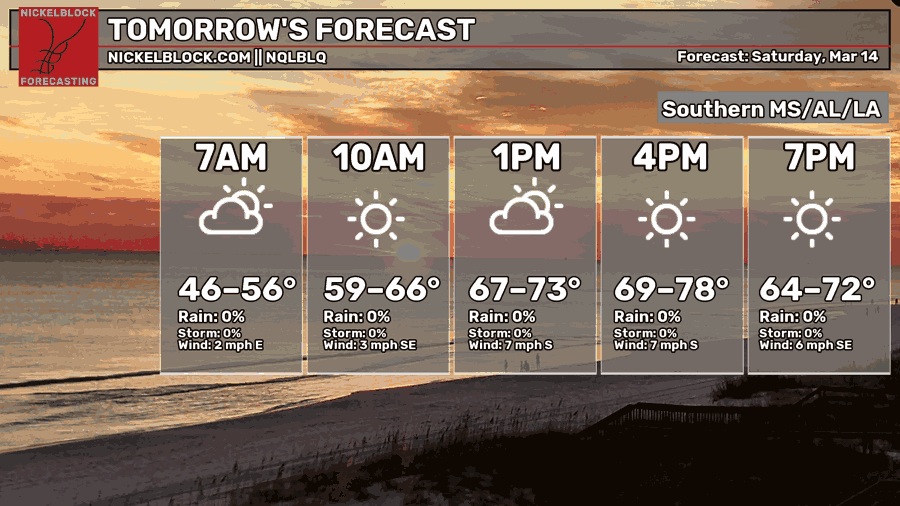
Saturday will be another pleasant day with mostly sunny skies and winds out of the south. It’ll feel a bit warmer tomorrow with a high in the upper 70s to around 80 in some areas. Overnight, we’ll fall back around the mid 50s indicating a warmer end to the weekend.
Sunday
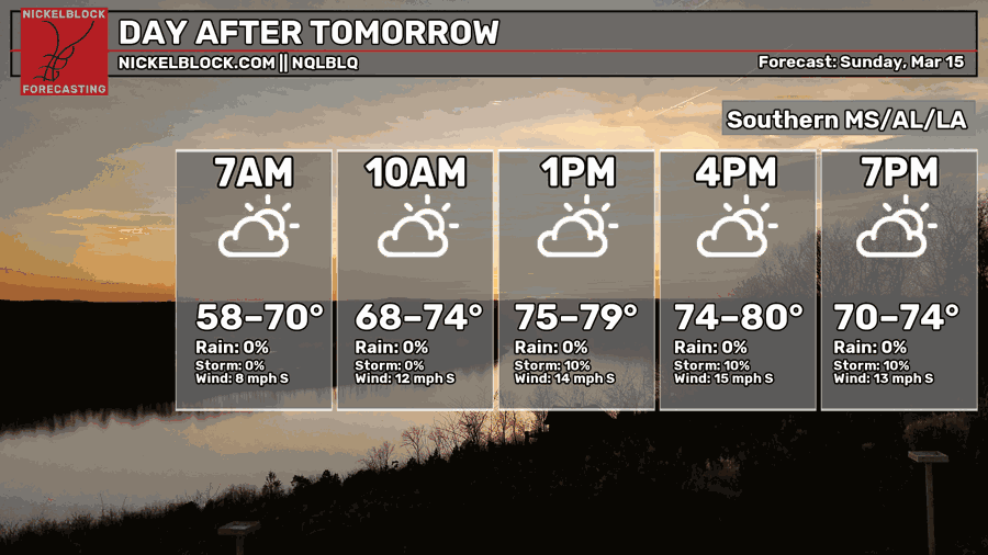
Starting off Sunday, it’ll be a mild morning before it warms up into the upper 70s and eventually around 80. Stronger southerly winds will move in ahead of the front, however rain ahead of the main QLCS is going to be pretty limited.
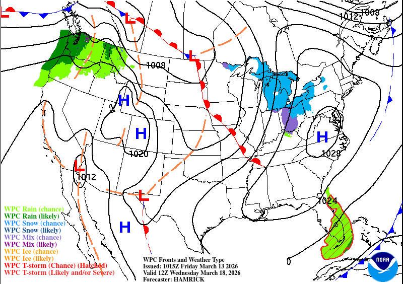
Severe Weather Overnight on Sunday
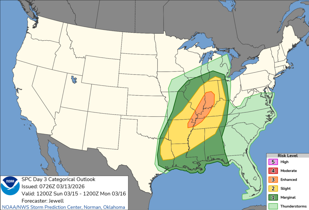
As you can see above, the main severe weather threat is further north into the upper MS River valley. Most of the severe threat will remain north and west of us in parts of Louisiana, Arkansas, and northern Mississippi. There are a few factors that limit the severe weather for many of us in South Louisiana, the Coast, and the Pine Belt.
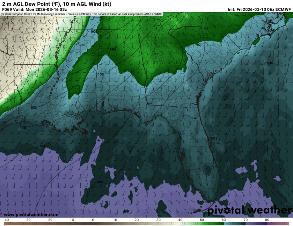

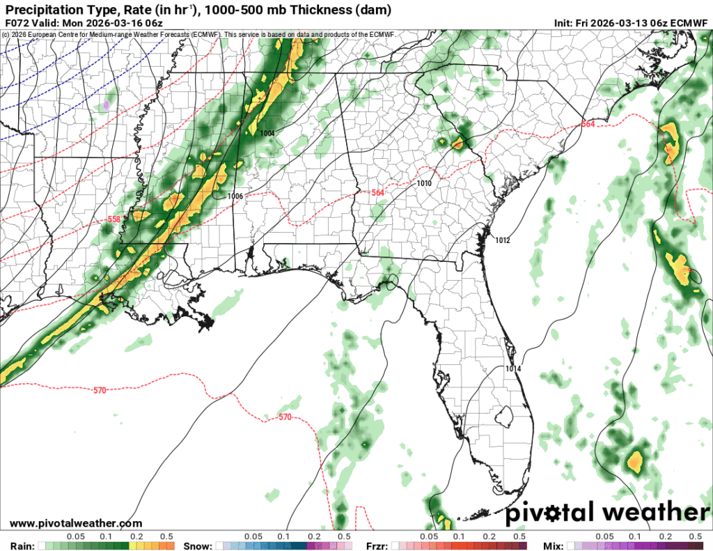
One factor is the lack of instability. Some of this is from the surface, but our most unstable convection (MUCAPE) is a little on the lower side this time compared to Wednesday. Despite a good amount of moisture (as shown by the dew point map above) the moisture isn’t feeding into a high amount of instability. Most of the instability is associated with the main line instead limiting convective supercells ahead of the line which would give us our usual threat for severe weather. Another thing of note is that the line weakens significantly by the time it moves past the Mississippi River. Looking at the images above, you can see the line thins out and breaks up within a 6 hour period.
All this to say that we may still see some strong storms either way, but the severe threat is more limited this time around. This looks to mainly be a wind event with a possible tornado. Expect some heavy rain, lightning, and wind. This line will be out early Monday morning for most of us.
Next Week
The first half of the week starts off pretty cool! A large high pressure system will move in behind the cold front with an absolutely massive trough in the upper levels adding to the cooler temperature trend. This won’t last forever, but it’ll keep things cooler than average for a few days. Starting off Monday, temperatures will be in the low 50s with gusty northerly winds, so bring a coat for the work day. Overnight, we’ll just reach the freezing mark. Tuesday will be slightly warmer with calmer winds and a high in the mid 50s. Overnight we’ll reach the low 40s.
By midweek, the average temperature will warm back up as the trough wanes and a warm front develops at the surface. From Wednesday to Friday, high temperatures will jump from the mid 60s on Wednesday to the upper 70s by Friday. Low temperatures will only rise from the upper 40s to low 50s which is a good indicator of less humid conditions overall. It’ll be a cool start off to the week but drier which is a nice change from last week!