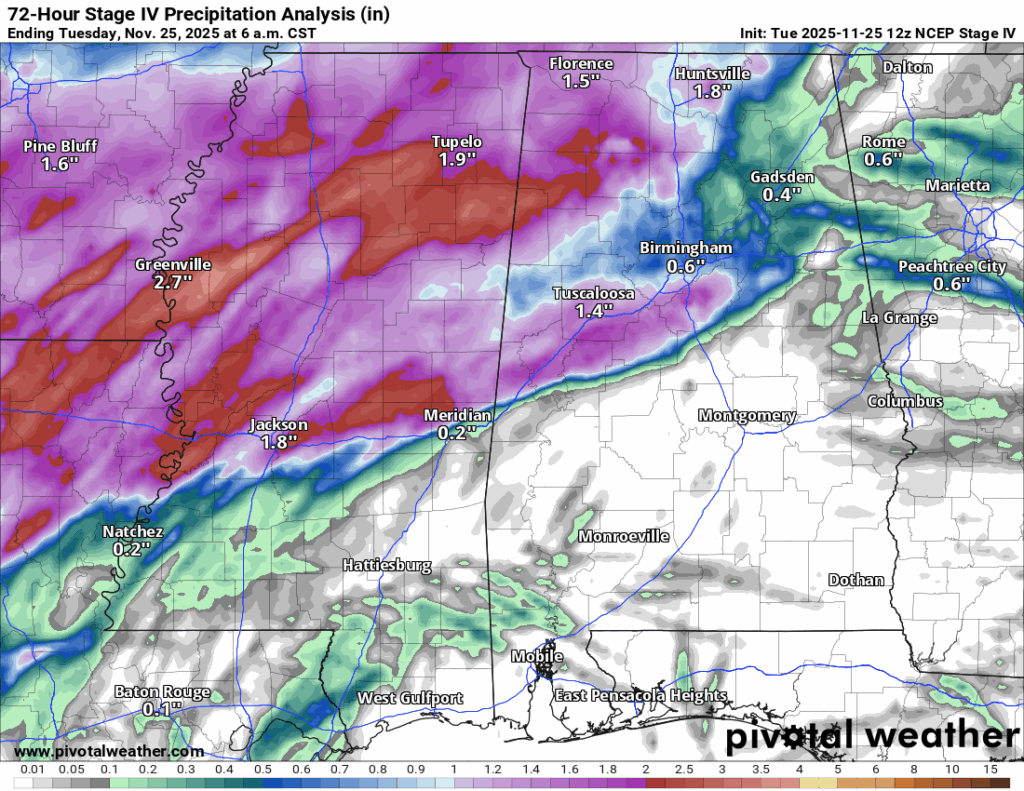
Last night’s storms really delivered for the northern half of the region. Most spots across central and northern Mississippi, northern Louisiana, and western Alabama picked up a solid one to three inches of rain. Farther south, amounts dropped off quite a bit, with much lighter totals across southern Mississippi, Alabama, and Louisiana.
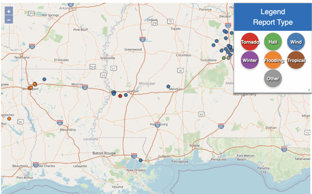
There were a handful of wind damage reports in the region. We also had a confirmed EF0 tornado in western Hinds County, just west of Jackson. Peak winds were estimated around 75 miles per hour, and it was on the ground for just under two miles. The damage was mainly to trees, many of them already weakened or dead, and there were no reports of structural damage.
Overall, the setup lined up pretty well with what the SPC had outlined. They highlighted the chance for one or two tornadoes and damaging winds, and that’s exactly how things played out last night.
Overall Setup
As the cold front moves out of our area, high pressure will move it’s way in and leave us with a much nicer few days to come than the past few days.

Tonight’s Forecast
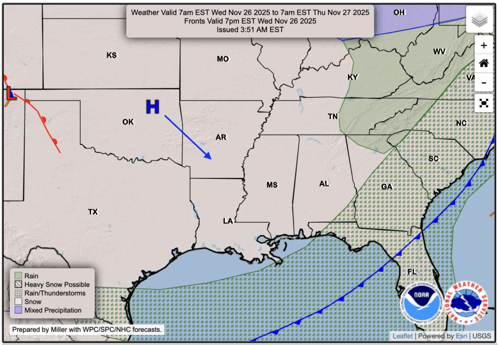
Tonight, we’ll stay partly cloudy with temperatures in the lower 50s. Closer to the coast it will be near 60, while areas farther north will drop into the 40s. The rain and storms are out of Louisiana and Mississippi, but it will take a little longer to clear southern Alabama, likely moving out around four to five in the morning.
Tomorrow’s Forecast: Wednesday, November 26
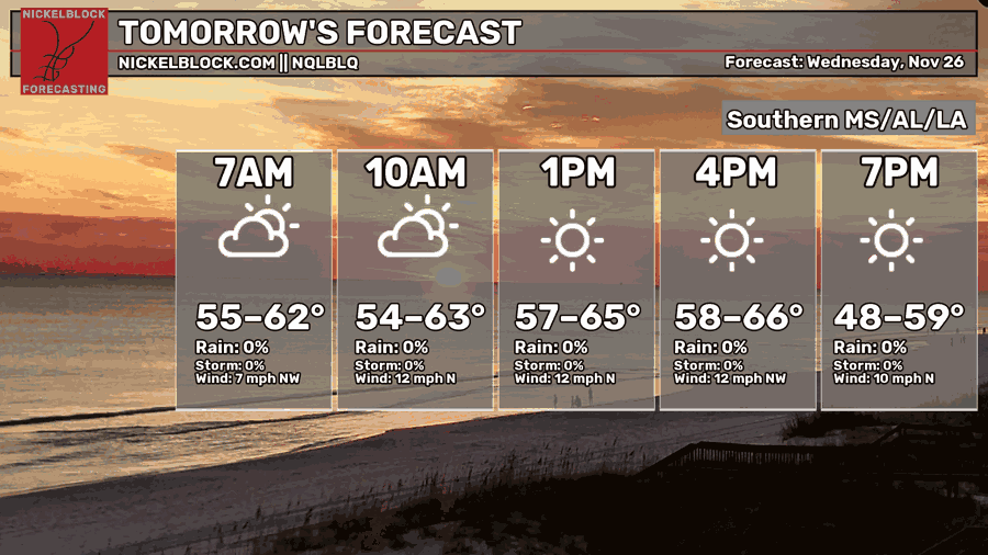
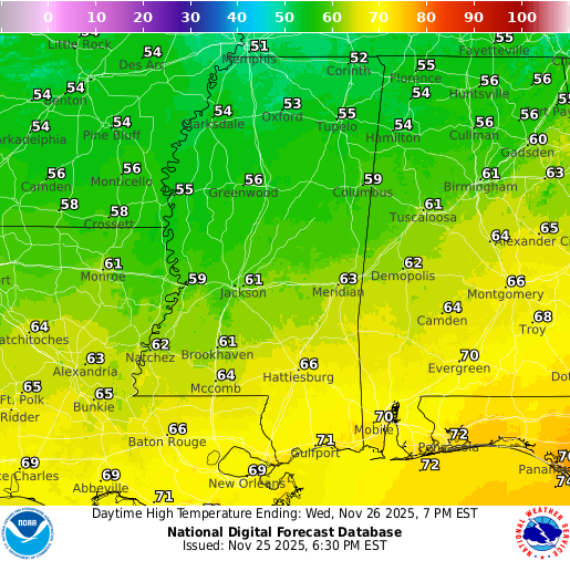
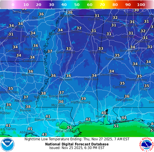
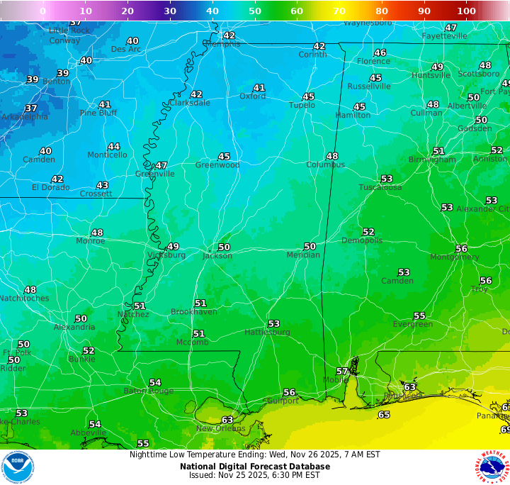
Tomorrow is looking to be a very nice day, truly feeling like fall. It should be a nice day to get outside with the kids, who are likely off for Thanksgiving break! High temperatures will sit in the high 50s to mid 60s and overnight lows will be chilly, in the mid to upper 30s. Some northern locations have a very good chance of seeing temperatures near freezing.
It will be a breezy day, with winds picking up mostly by midday. Sustained winds around 10 to 15 mph and gusts up to 20 to 25 mph will make it feel cooler than the actual temperatures.
Thanksgiving Forecast: Thursday, November 27
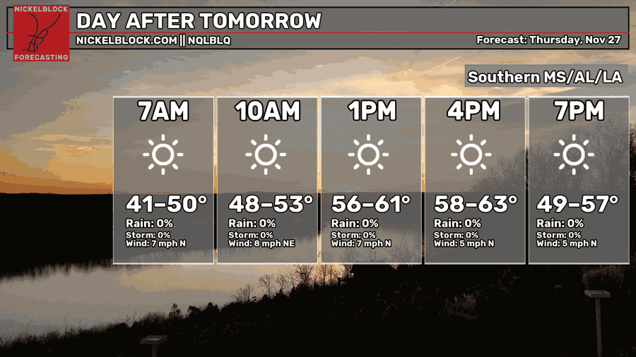
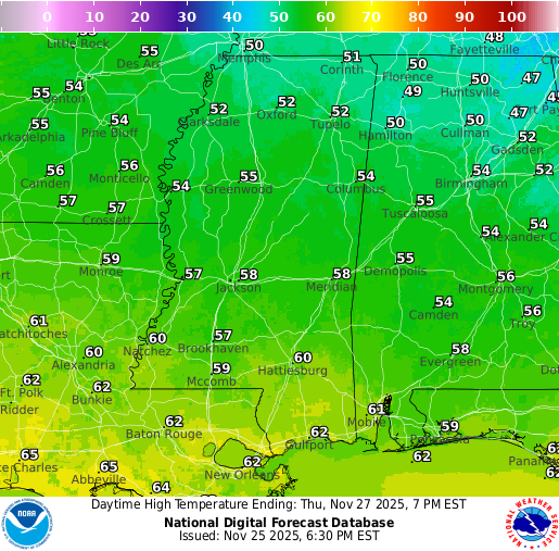
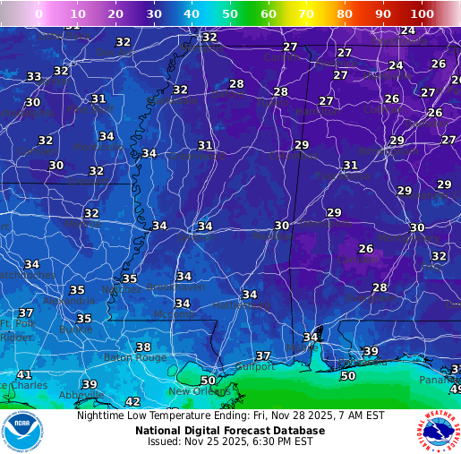
Thanksgiving Day is looking even better, but perhaps a bit cooler. Sunny skies will prevail for most of the day and we will stay dry. Overnight lows into Friday will be much chillier, with most of us seeing a low in the lower 30s. Check out those mid-to-upper 20s in northern MS and AL! Enjoy your meal!
Extended Local Outlook
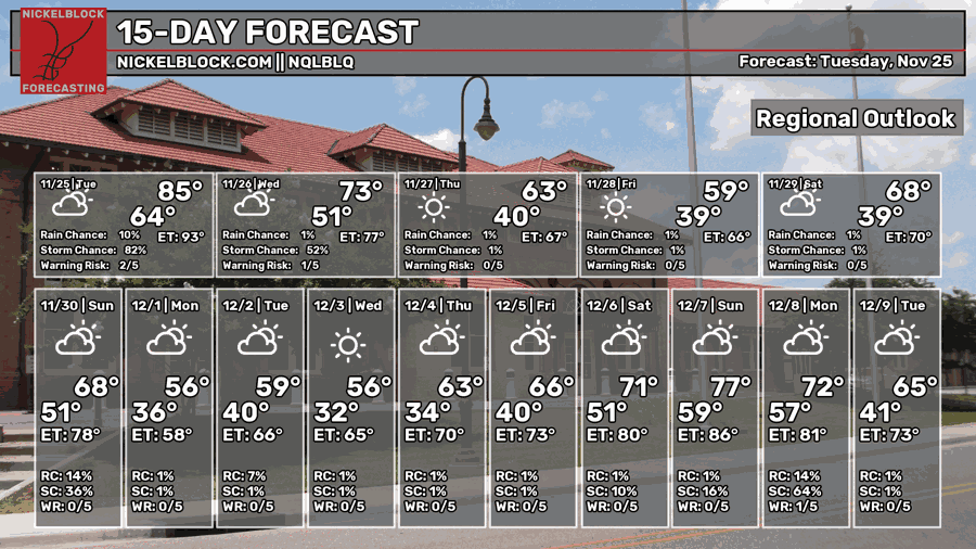
Looking ahead, we should stay dry through Friday and into the first half of Saturday. By Saturday evening, a line of rain, and possibly some thunderstorms, could move through and continue into Sunday afternoon. Severe weather isn’t expected at this time, but we’ll keep an eye on it and update as we get closer.
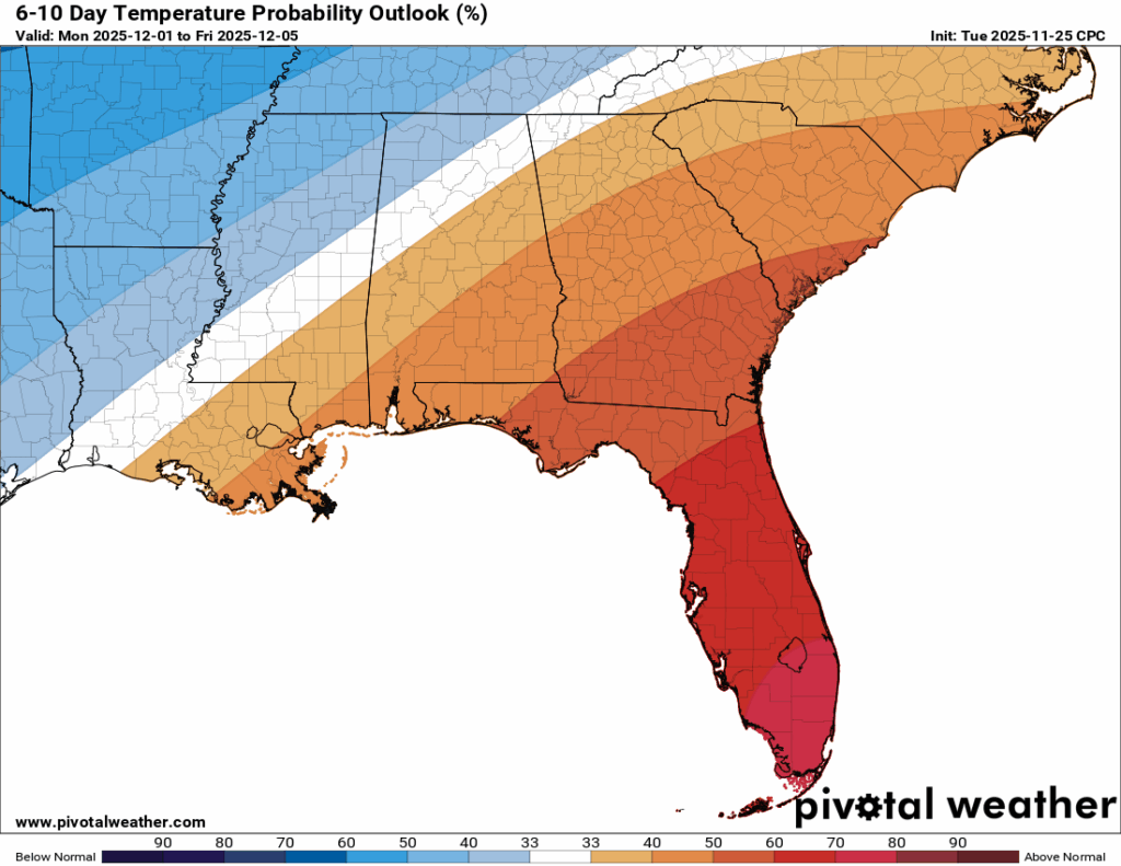
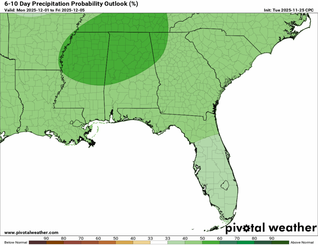
Looking out over the 6-10 day period, temperatures are trending near normal, with us falling between the above and below normal ranges. Rainfall looks to be above average, mostly due to the rain chances this weekend.

REGIONAL DAY TO DAY FORECAST
Tonight: Partly cloudy. Lows in the low 50s. Calm wind becoming northwest around 5 mph after midnight.
Wednesday: Mostly sunny. Highs in the mid 60s. North-northwest wind 5 to 15 mph, with gusts up to 20 mph.
Wednesday Night: Clear. Lows in the upper 30s. North wind 5 to 10 mph, with gusts up to 20 mph.
Thursday (Thanksgiving): Sunny. Highs in the lower 60s. North wind 5 to 10 mph.
Thursday Night: Mostly clear. Lows in the mid 30s. North wind around 5 mph becoming calm.
Friday: Mostly sunny. Highs in the upper 50s. Calm wind becoming east-northeast around 5 mph in the morning.
Friday Night: Mostly cloudy. Lows in the mid 30s. Calm wind becoming east around 5 mph after midnight.
Saturday: Partly sunny. Highs in the mid 60s. Southeast wind 5 to 10 mph.
Saturday Night: A chance of showers, mainly after midnight. Mostly cloudy. Lows in the lower 50s. Chance of rain 50 percent.
Sunday: A chance of showers. Mostly cloudy. Highs in the mid 60s. Chance of rain 50 percent.
Sunday Night: A chance of showers and thunderstorms. Cloudy. Lows in the mid 40s. Chance of rain 30 percent.
Monday: A chance of showers and thunderstorms. Cloudy. Highs in the upper 50s. Chance of rain 40 percent.
Monday Night: Showers possible and a chance of a thunderstorm. Cloudy. Lows in the mid 40s. Chance of rain 40 percent.
Tuesday: A chance of showers. Partly sunny. Highs in the lower 60s. Chance of rain 30 percent.


