This weekend has been a very pleasant one compared to the rest of Summer. Being outside as much as I was yesterday, it was hot but not sweltering and miserable. The good news is, this will hang around a little longer! The bad news (or good news if you have a garden), more rain!
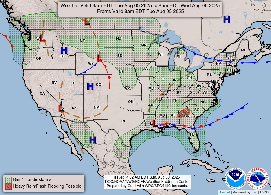
We’ve got a few setups to look at going into the week for the reasons why we have more chances of rain. The first is our stationary front that wants to hang around a bit longer. Part of that reason is because it’s between a front in the Ohio River Valley and a high pressure system that’s building to the east of it. It doesn’t have anywhere to go but west until it dissolves and will provide moisture flow and high dewpoints in the mid 70s.
The second setup is the high pressure system that will eventually take over the Atlantic and mid-South and eventually the Deep South. This will increase the heat index as we move into the weekend. The third setup is a wave from a low pressure system off the Bay of Campeche that will move up the Gulf to the coastal South and rain us out by Friday.
This Week
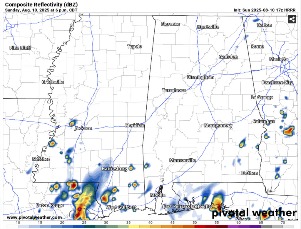
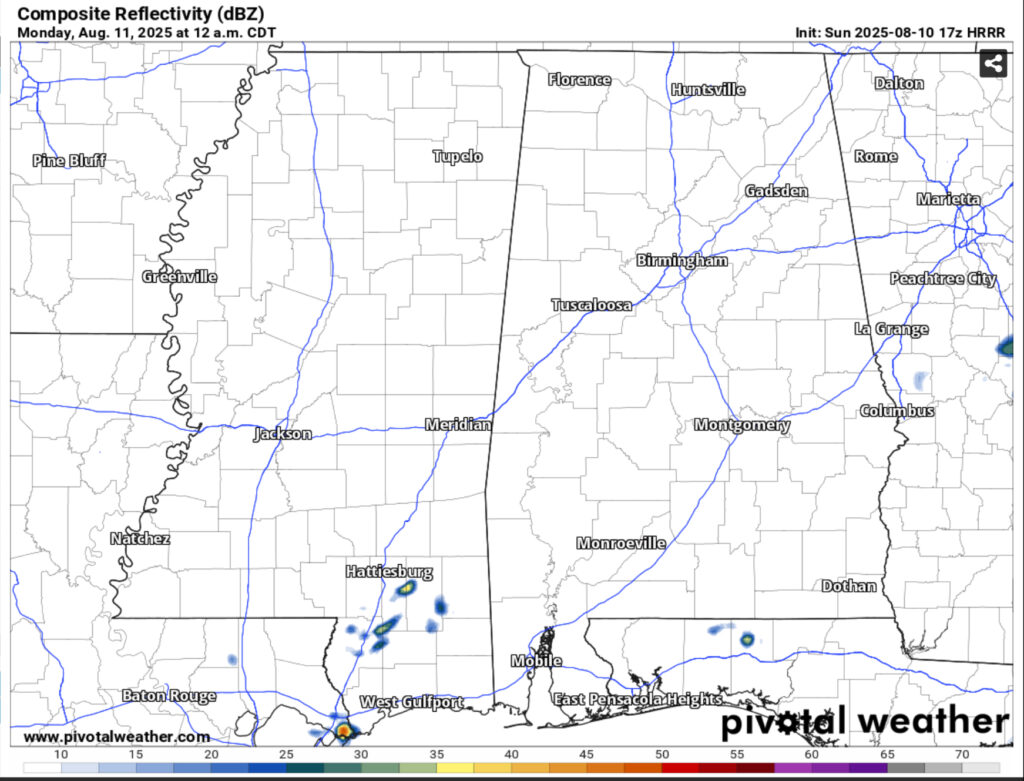
Today will be a cloudier day with highs in the low 90s and some isolated thunderstorms across parts of the Hwy 84 corridor and south. Overnight there will be a few isolated showers before we settle into the mid 70s. Monday will be a similar story to today with more afternoon thunderstorms and highs in the low 90s.
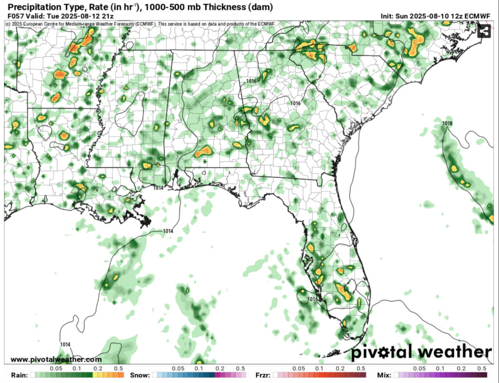
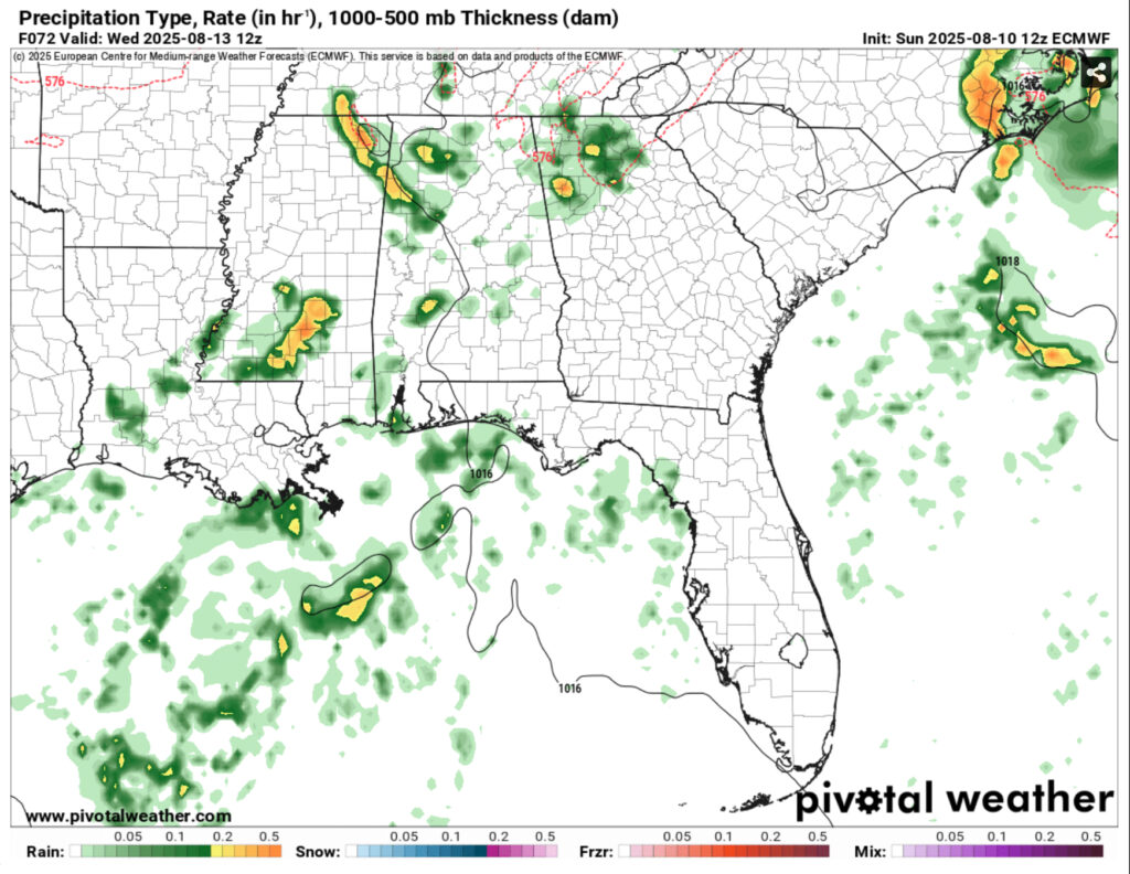
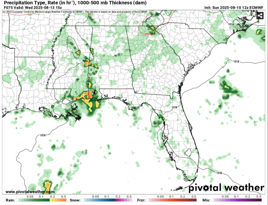
Overnight into Tuesday, rain chances will be possible during the early morning hours and be on and off into the afternoon when they’ll be scattered across most of the Deep South. Overnight, some rain is possible and a shortwave will move in from the west bringing some early morning thunderstorms. Wednesday will have some mid-morning thunderstorms move in and last until the early evening. Highs will be around 90 with lows in the mid 70s.
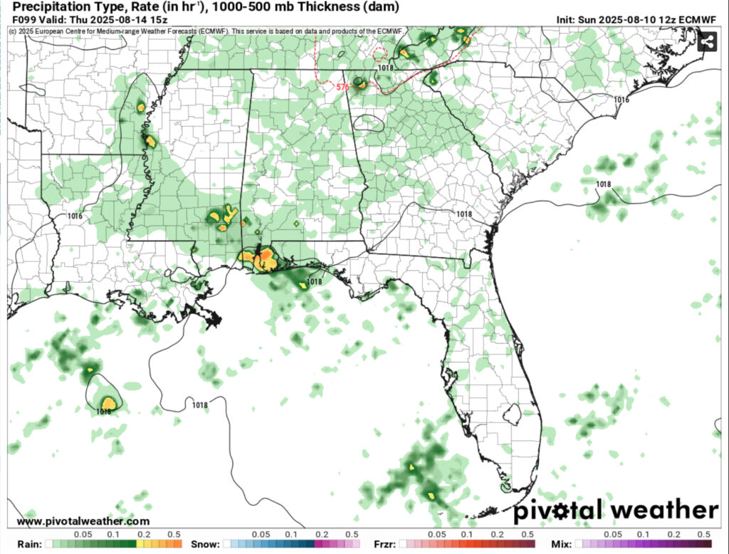
Thursday will see rain chances slow down a bit, but not leave us as rain moves in from the northeast this time. By Friday, a line of thunderstorms from the Gulf will move in during the afternoon. Highs will reach the low 90s with the experienced temperatures reaching closer to 100. The weekend will see rain chances slim up as the high pressure builds in, but a few afternoon thunderstorms are still possible. Experienced temperatures will reach the low 100s.
Regional Day-to-Day Forecast
This Afternoon – A 30 percent chance of showers and thunderstorms in the afternoon. Partly sunny, with a high in the low 90s. Heat index values as high as 98. East northeast wind around 5 mph.
Tonight – A slight chance of showers and thunderstorms. Mostly cloudy, then gradually becoming mostly clear, with a low in the mid 70s. East northeast wind around 5 mph becoming calm.
Monday – A 30 percent chance of showers and thunderstorms, mainly in the afternoon. Mostly sunny, with a high in the low 90s. Heat index values as high as 99. Calm wind becoming northeast around 5 mph in the morning.
Monday Night – A chance of showers and thunderstorms overnight. Partly cloudy, with a low around 74. East southeast wind around 5 mph becoming calm. Chance of precipitation is 30%.
Tuesday – Showers and thunderstorms likely in the afternoon. High around 90. Calm wind becoming southeast around 5 mph in the afternoon. Chance of precipitation is 70%. New rainfall amounts between a quarter and half of an inch possible.
Tuesday Night – Showers and thunderstorms likely overnight. Mostly cloudy, with a low in the low to mid 70s. South wind around 5 mph becoming calm. Chance of precipitation is 60%. New precipitation amounts of less than a tenth of an inch, except higher amounts possible in thunderstorms.
Wednesday – Showers and thunderstorms possible starting in the morning. High in the low 90s. Calm wind becoming south southwest around 5 mph. Chance of precipitation is 80%.
Wednesday Night – A 20 percent chance of showers and thunderstorms before midnight. Partly cloudy, with a low in the mid 70s. Calm wind.
Thursday – Showers and thunderstorms likely in the afternoon. Mostly sunny, with a high in the low 90s. Calm wind becoming southwest around 5 mph in the afternoon. Chance of precipitation is 60%.
Thursday Night – Partly cloudy, with a low in the mid 70s.
Friday – A 50 percent chance of showers and thunderstorms. Mostly sunny, with a high in the mid 90s.
Friday Night – Partly cloudy, with a low in the mid 70s.
Saturday – A 40 percent chance of showers and thunderstorms. Mostly sunny, with a high in the mid 90s.


