Overall Setup

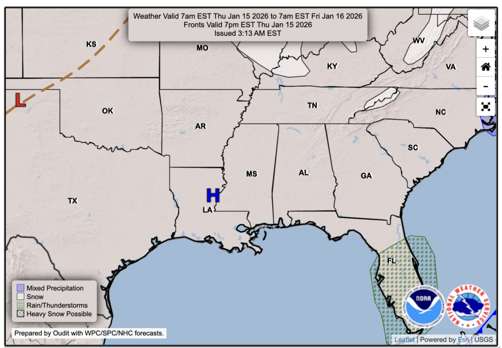
A few scattered showers are moving into our area tonight, and they will linger in spots for the day tomorrow due to a cold front pushing through. By Thursday, we’ll be free from any frontal systems at the surface, with an area of high pressure positioned over us, keeping us sunny and dry. What the forecast chart does not show, however, is the below-average temperatures on Thursday, which are driven by a deep trough at 500 mb.

Tonight’s Forecast
Again, showers are on the move and will bring some rounds of rain overnight into tomorrow morning. Not everyone will see consistent rain, but at least some drizzle and overcast conditions. Lows tonight will reach the low-to-mid 40s, so no snow for tonight! Sorry to the snow lovers who read the hyped social media posts about potential snow. 🙁
Tomorrow’s Forecast: Wednesday, January 14
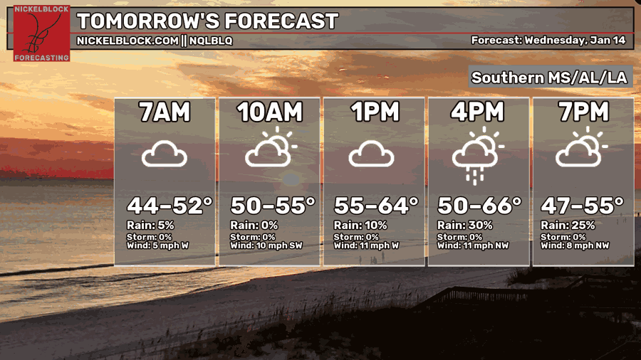
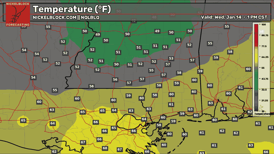
On Wednesday, we can expect mostly cloudy skies throughout the day. The morning rain will gradually taper off, becoming more isolated by the afternoon. The HRRR and NAM models indicate that a separate line of rain, potentially heavier than the morning showers, will pass through along the cold front from mid-afternoon into the evening. High temperatures range from the 50s for those who are further north and the low 60s for those further south. Make sure to bring your umbrella and raincoat for tomorrow!
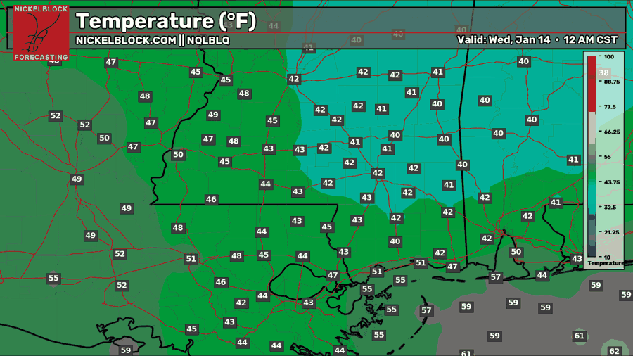
Thursday’s Forecast: January 15
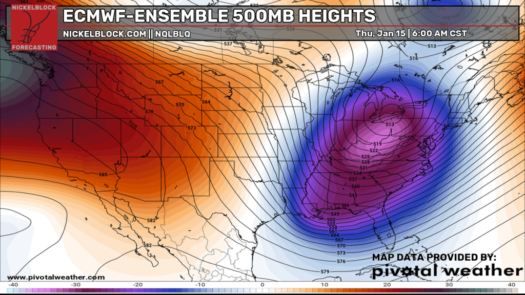
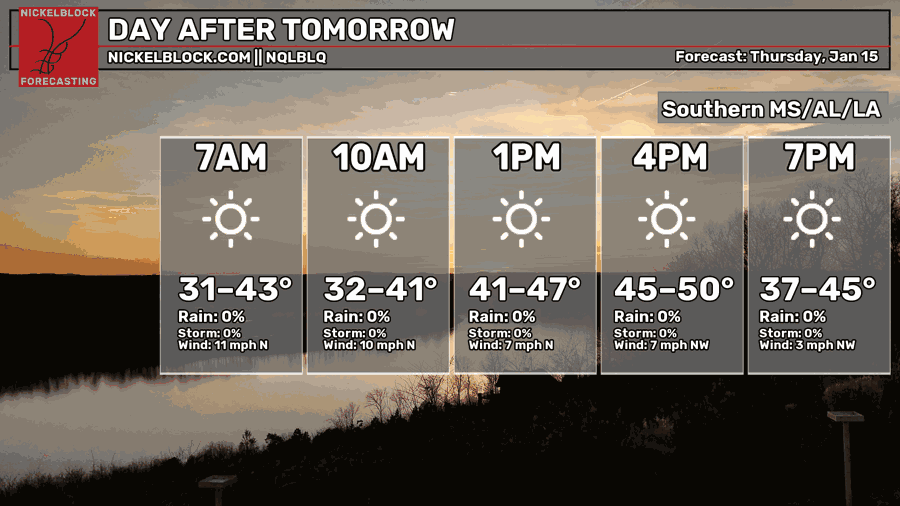
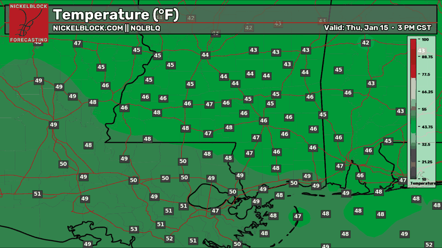
A noticeable cooldown is expected on Thursday as a trough in the 500 mb height pattern shifts southward, bringing a supply of cool, northerly air. Daytime highs will struggle to reach the 40s, with some areas farther south possibly seeing low 50s, while nighttime lows are forecasted to dip into the lower 30s. The high pressure system at the surface, which I mentioned earlier, will help keep it sunny, dry, and mostly clear of clouds.

Extended Local Outlook
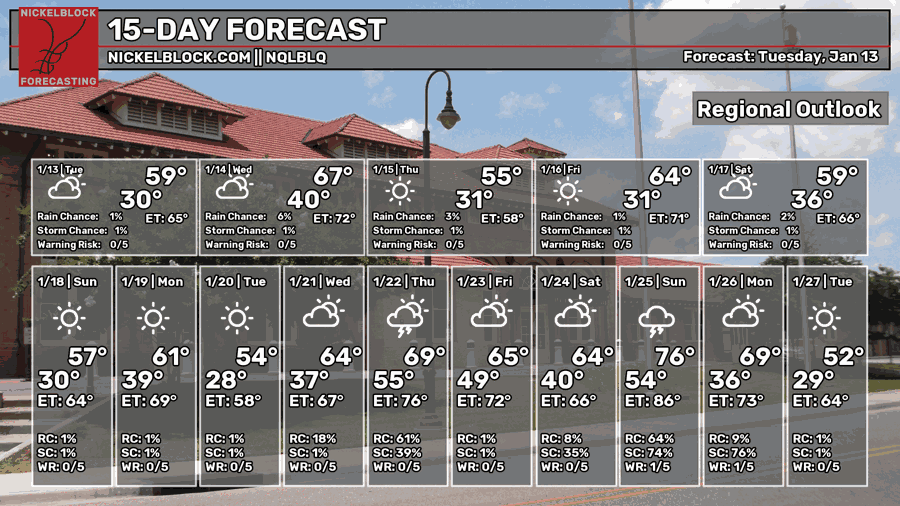
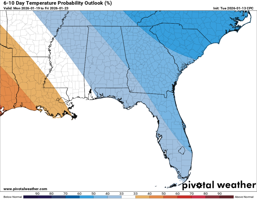
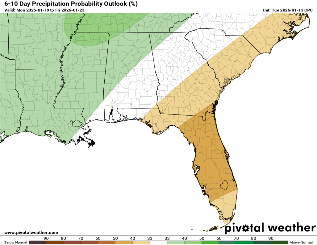
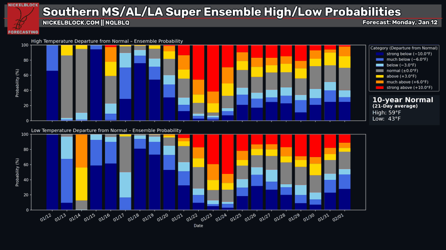
Looking at the 15-day forecast, as well as the 6-10 day outlook from the CPC, we’ll begin to stay in a more seasonable temperature pattern for the near future, with highs sitting near the average of 59 to 60 degrees, plus or minus a few degrees. A wetter pattern is also looking more likely, since we’ll see a few dips in the jet stream that storm tracks like to ride on.