things are looking fairly wet for the next several days as a stalling front will remain across the southeast. For us, a myriad of mesoscale convective systems will move in and bring a lot of afternoon and evening thunderstorms. While these will meander, it won’t be until later in the week when the upper atmosphere begins to move more that we’ll get some relief from the rain.
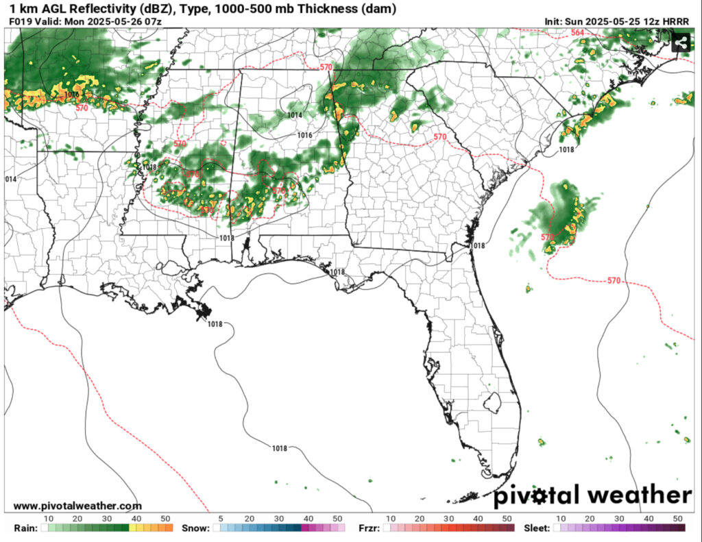
A broad surface low will allow plenty of moisture from the Gulf to move inland, and an upper atmosphere trough will influence the direction of the rain for the next 36 hours. Our first system will move through northern Mississippi with a higher chance of severe weather. By the time it reaches our area, we’ll have a small chance of severe weather but high winds, lightning, and localized heavy rain. For us, this looks to move in in the late evening and last until the early morning hours.
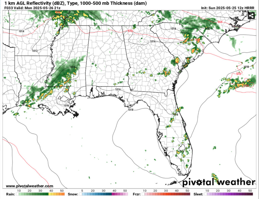
Another MCS will move in early afternoon on Monday affecting much of northern Louisiana to central Mississippi before moving southeast towards the Pine Belt and coastal LA/MS. The SPC has placed most of the central Deep South under a Marginal (1/5) risk for severe thunderstorms. The same threats apply as Sunday.
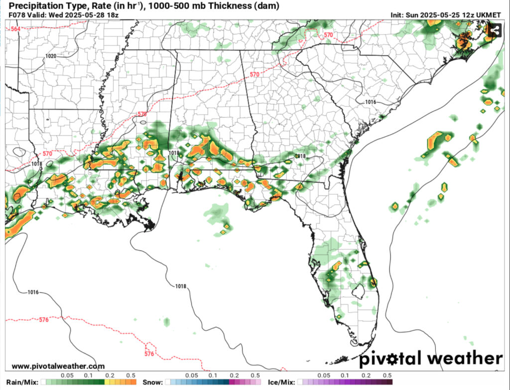
Tuesday and Wednesday will be similar stories as the main front moves south allowing another system to move in further south and with more potency. A chance of storms is possible Tuesday morning and afternoon. By Wednesday, the front will move far enough to stay south of I-20 allowing more diurnal/coastal influence for the showers and thunderstorms. Thursday and Friday will bring in a trailing low pressure system and another major chance for rain before the longwave cold front moves out.
Afterwards, we’ll be in a slightly cooler pattern with rain chances much lower and temperatures in the mid to upper 80s. Temperatures during the week will be cooler than normal by mid-week mainly due to the cloud cover and rain chances. Severe weather chances mainly stay in the Marginal (1/5) risk from today to Tuesday, however there may be a small chance later in the week for some isolated severe weather.
Regional Day-to-Day Forecast
This Afternoon – A 30 percent chance of showers and thunderstorms. Mostly sunny, with a steady temperature in the upper 80s. South southwest wind around 5 mph.
Tonight – A chance of showers and thunderstorms after midnight. Patchy fog after 5am. Otherwise, partly cloudy, with a low in the low 70s. South wind around 5 mph becoming calm. Chance of precipitation is 30%.
Memorial Day – A 40 percent chance of showers and thunderstorms in the early afternoon. Patchy fog before 8am. Otherwise, mostly sunny, with a high in the low 90s. Heat index values as high as 97. Calm wind becoming south around 5 mph in the afternoon.
Monday Night – Partly cloudy, with a low in . East wind around 5 mph becoming calm after midnight.
Tuesday – A chance of showers and thunderstorms starting in the morning. Partly sunny, with a high in the low 90s. South wind 5 to 10 mph. Chance of precipitation is 60%. New rainfall amounts between a half and three quarters of an inch possible.
Tuesday Night – A 40 percent chance of showers and thunderstorms before midnight. Mostly cloudy, with a low around 70. South southwest wind around 5 mph becoming calm in the evening.
Wednesday – A chance of showers, then showers and thunderstorms in the afternoon. High in the upper 80s. Calm wind becoming southwest around 5 mph in the afternoon. Chance of precipitation is 90%.
Wednesday Night – A chance of showers and thunderstorms. Mostly cloudy, with a low in the upper 60s. Calm wind. Chance of precipitation is 40%.
Thursday – A chance of showers and thunderstorms starting in the morning. Partly sunny, with a high in the mid to upper 80s. Calm wind becoming west southwest around 5 mph. Chance of precipitation is 60%.
Thursday Night – A 30 percent chance of showers and thunderstorms. Mostly cloudy, with a low in the upper 60s.
Friday – Showers and thunderstorms likely. Partly sunny, with a high in the mid 80s. Chance of precipitation is 60%.
Friday Night – A 20 percent chance of showers and thunderstorms. Partly cloudy, with a low in the low to mid 60s.
Saturday – A 30 percent chance of showers and thunderstorms. Sunny, with a high in the mid 80s.
Saturday Night – Mostly clear, with a low in the low to mid 60s.
Sunday – A slight chance of showers and thunderstorms. Mostly sunny, with a high in the upper 80s.


