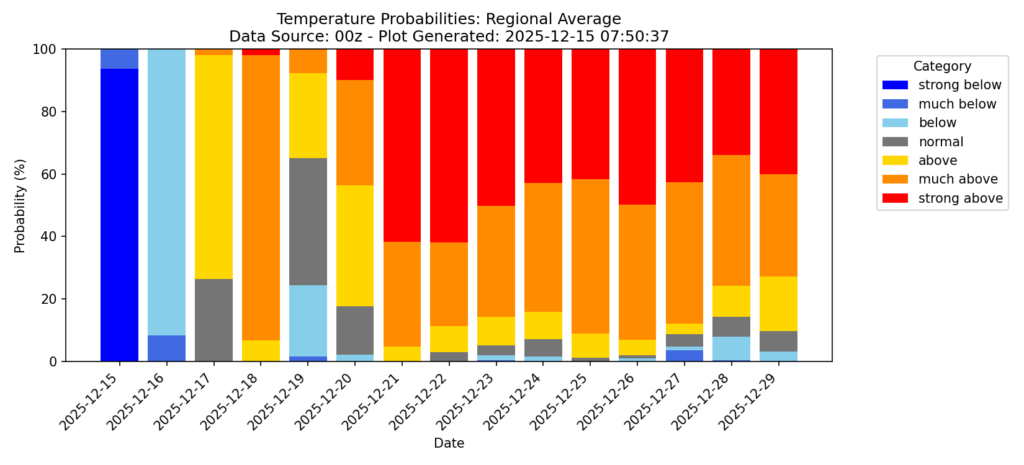
Hey everyone! The past few days, especially yesterday, have been very cold for our region. Good news if you’re not a fan of the cold – the ensembles are gaining confidence that a warm up starts Thursday. We should climb back to above average temperatures, with highs pushing into the 70s and likely staying there through the end of the year as a ridge builds in.
We’re also seeing teleconnections like a negative Pacific North American Oscillation (PNA) and a positive Eastern Pacific Oscillation (EPO), which typically favor a warmer pattern across the South and keep the coldest air bottled up farther north.
Overall Setup
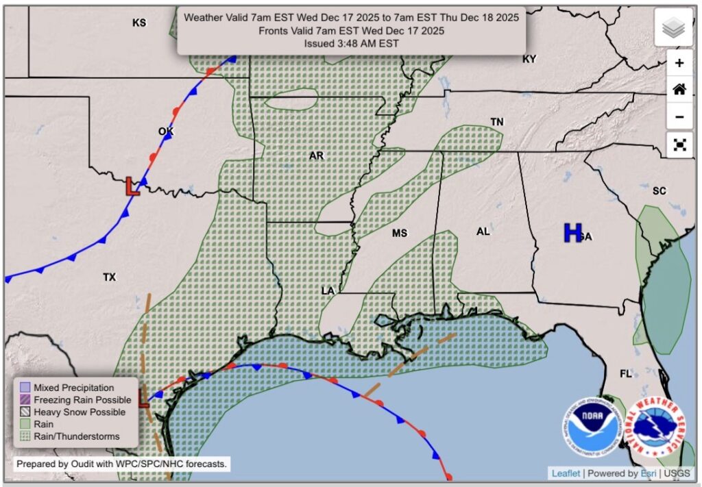
Our overall setup for tomorrow will feature a coastal low pressure system in the northwestern gulf that could bring some scattered showers and thunderstorms throughout the day. We’ll see more rain on Thursday from a cold front that will sweep through from the northwest.

Tonight’s Forecast
Tonight, we’ll see temperatures about 20 degrees warmer than last night, sitting in the 40s. The night will start off cloudy, but through the night into the very early morning hours we could see some rain try to come through, and possibly some thunderstorms embeeded within.
Tomorrow’s Forecast: Wednesday, December 17
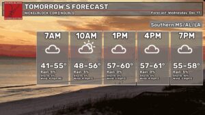
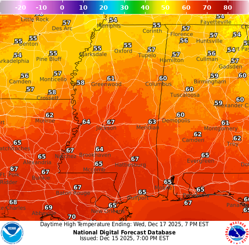
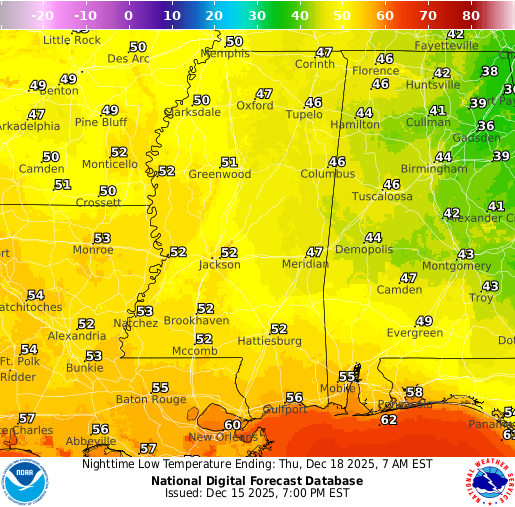
Throughout the day on Wednesday, we’ll see some scattered showers and thunderstorms and mostly cloudy skies. Temperatures are much milder than recent days, sitting in the high 60s. Our low Wednesday night will also feel much milder, in the low to mid 50s. We could use the rain, as well as the warmer temps, so it’s a win-win situation!
Thursday’s Forecast: December 18
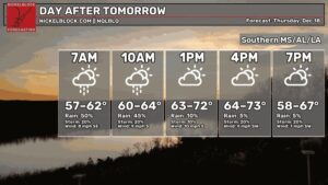
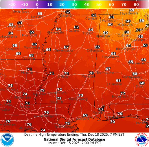
Thursday will feature more rain than Wednesday, with showers and thunderstorms in the forecast on and off throughout the day. Highs will be toasty, reaching the low to mid 70s! By Thursday night into Friday morning, the cold front will have pushed through, changing our wind direction to out of the northwest, and dropping lows down into the 40s.
Extended Local Outlook
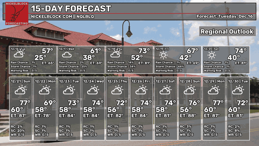
Looking ahead, Friday is looking clear and bright as the front will have said its goodbyes, with highs in the upper 60s. By Saturday, we’ll start off clear, build increasing clouds by the evening, but stay dry overall. We’re watching the potential for some more rain on Sunday, as a piece of energy with an increased amount of moisture looks like it wants to hang around our area then.
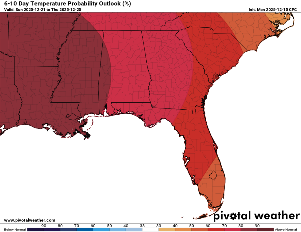
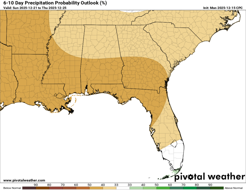
For the 6-10 day outlook, we can see that the CPC is agreeing with a warmer and drier pattern through Christmas, and even beyond that. While there are some shots of rain possible for Sunday and next week, it won’t be enough to be considered “average”, therefore we will have below average rainfall during that timeframe.

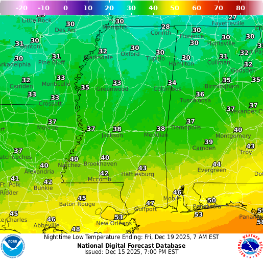
REGIONAL DAY TO DAY FORECAST
Tonight: A chance of showers after midnight. Mostly cloudy. Lows in the low 40s. Calm wind becoming southeast around 5 mph. Chance of rain 30 percent.
Wednesday: Mostly cloudy. Highs in the mid 60s. Calm wind becoming southeast around 5 mph.
Wednesday Night: A chance of showers after midnight. Mostly cloudy. Lows in the low 50s. Calm wind becoming southeast around 5 mph. Chance of rain 40 percent.
Thursday: Showers and thunderstorms, mostly cloudy. Highs in the low-to-mid 70s. Southeast wind 5 to 10 mph becoming southwest in the afternoon. Chance of rain 70-80 percent.
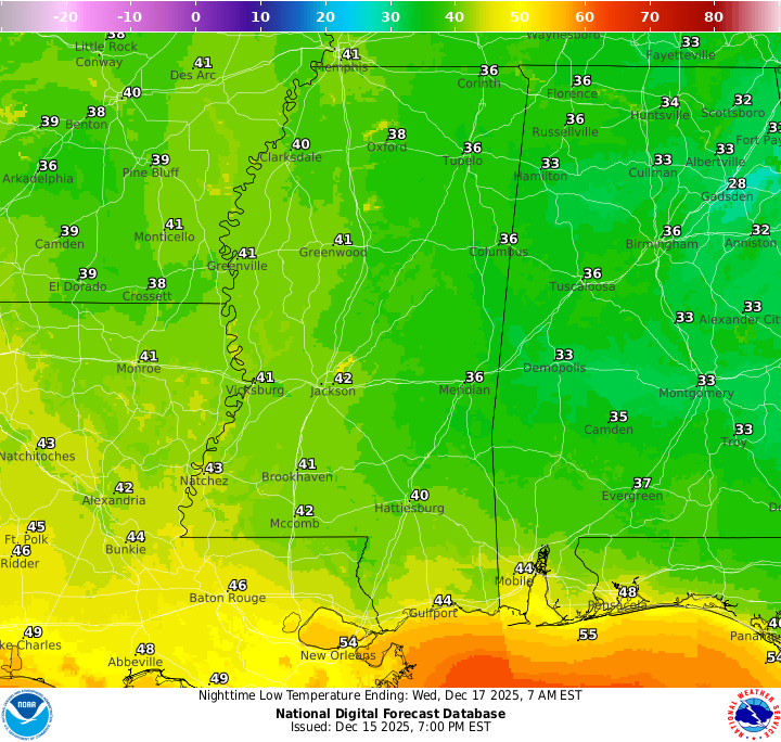
Thursday Night: A chance of showers before midnight. Partly cloudy. Lows in the low 40s. Southwest wind around 5 mph becoming north after midnight. Chance of rain 60 percent.
Friday: Sunny. Highs in the upper 60s. North wind around 5 mph.
Friday Night: Mostly clear. Lows in the lower 40s. Calm wind.
Saturday: Mostly sunny. Highs near 70.
Saturday Night: Increasing clouds. Lows in the mid 50s.
Sunday: Mostly cloudy, with a chance of showers. Highs in the mid 70s. Chance of rain 30 percent.
Sunday Night: A chance of showers. Mostly cloudy. Lows in the upper 50s. Chance of rain 20 percent.
Monday: Partly sunny. Highs in the mid 70s.


