Overall Setup
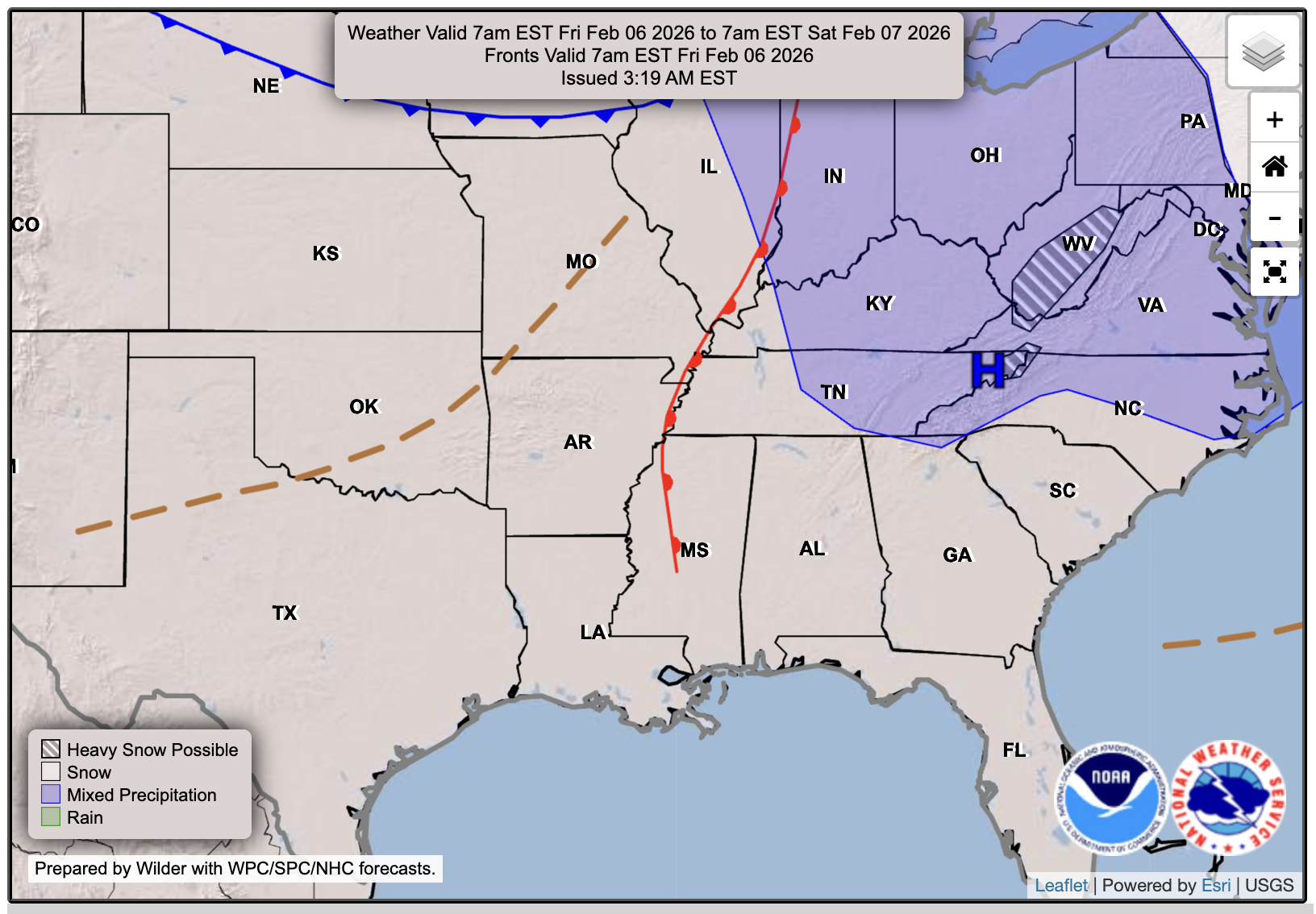
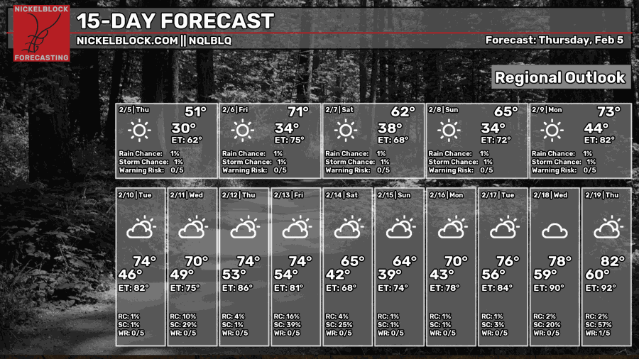
Over the next few days, we will see a series of fronts coming through the area. Since there is no moisture to work with, no precipitation is expected with any of them. However, the upper-level wind energy is expected to mix down to the surface, leaving us with some gusty winds through the weekend. The next time we might see rain is on Wednesday next week, so we are in a brief dry stretch.

Tonight’s Forecast
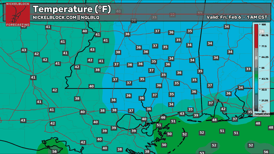
Temperatures tonight will drop to the upper 30s and lower 40s, depending on your location. The gusty winds will make it feel like it’s 30-32 degrees, but our actual air temperature isn’t expected to drop below freezing. Overall, a cool night with clear skies and gusty winds is to be expected.
Tomorrow’s Forecast: Friday, February 6
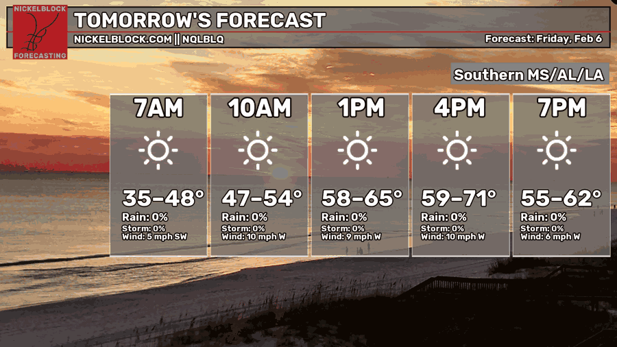
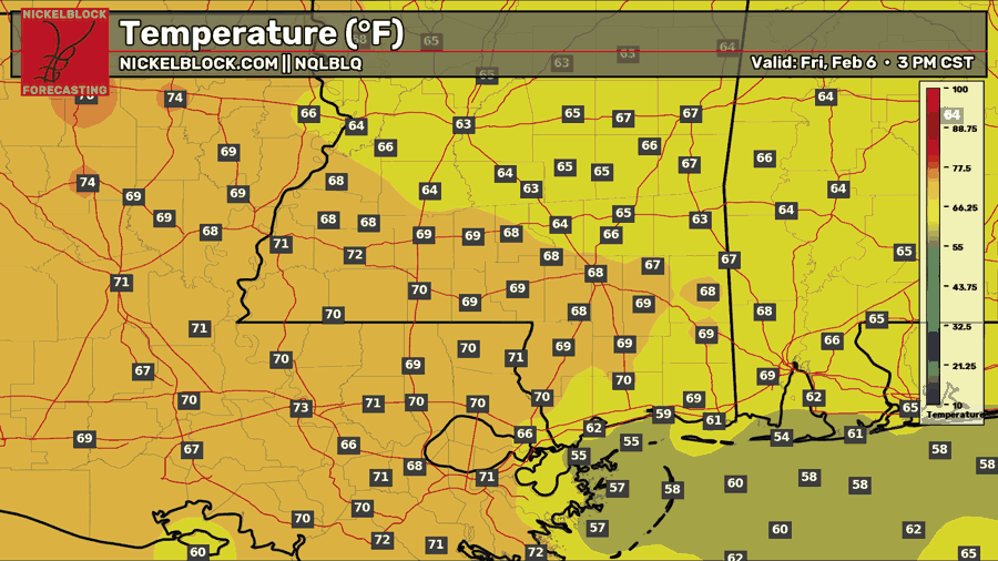
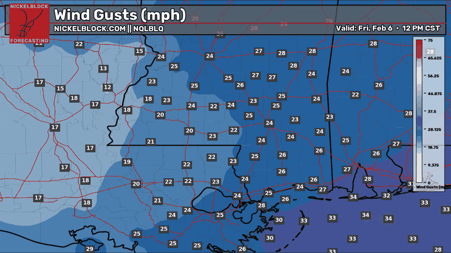
We’ll warm up throughout the day tomorrow, starting the weekend in the upper 60s and lower 70s. It will feel like spring outside with the abundant sunshine and above-normal temperatures for this time of year. Wind gusts will stay fairly consistent through Friday, gusting 20-30 mph, which might make it feel slightly cooler than it is.
Weekend Forecast
Saturday, February 7
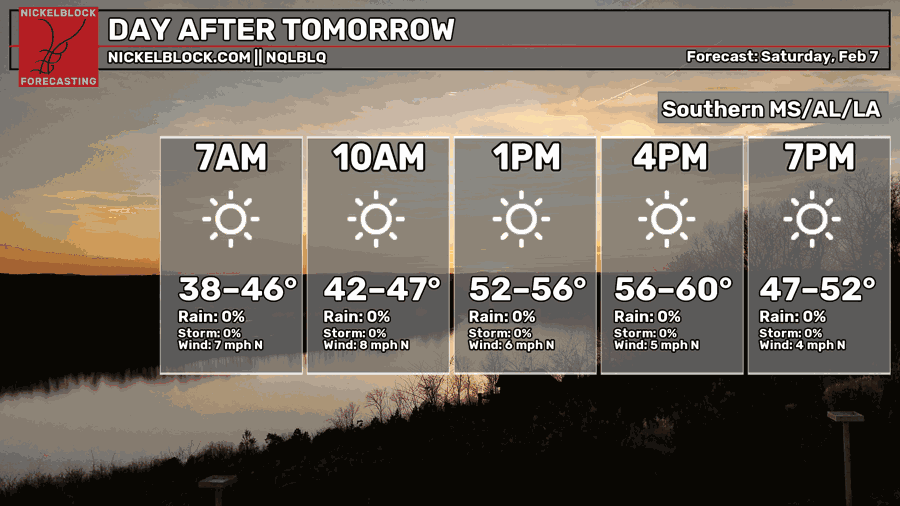
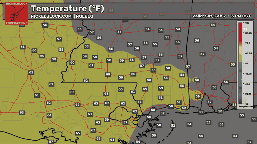
We do cool down back to near-average temperatures on Saturday, that being the upper 50s and lower 60s. Skies will be clear. Winds will still be gusty in the morning, but will definitely calm down as the day goes on.
Super Bowl Sunday: February 8
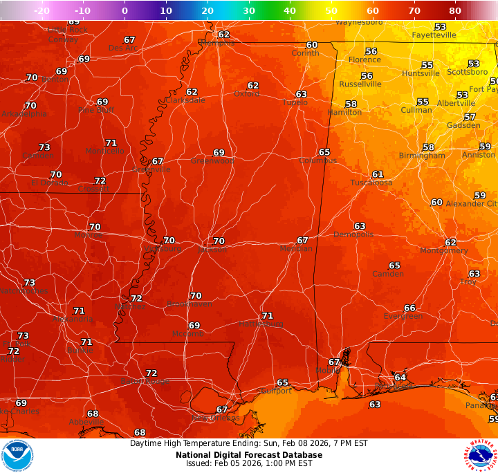
As we head into kickoff on Sunday, the weather is a total touchdown. Clear skies, temperatures in the 70s, calm winds, and just about perfect conditions for a Super Bowl Sunday BBQ!

Extended Local Outlook
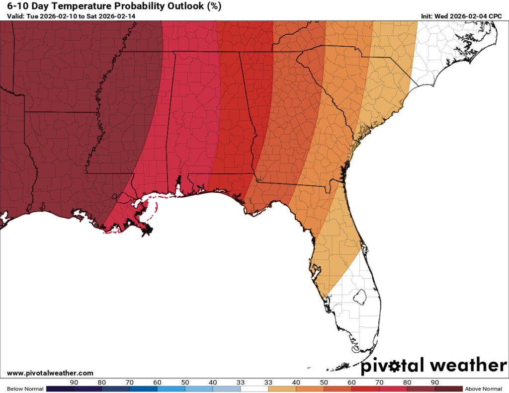
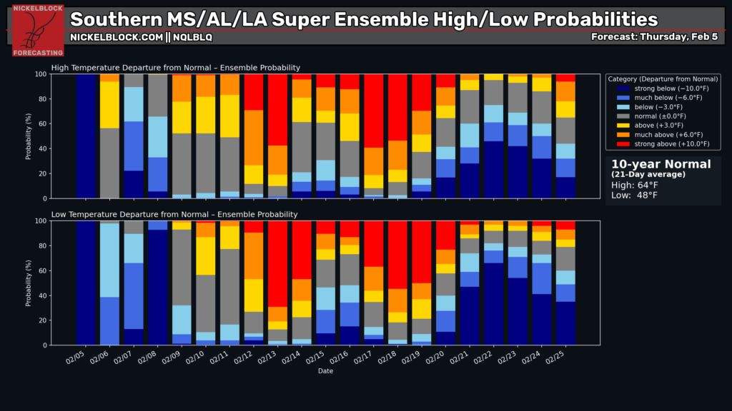
SPRING IS HERE EARLY!!!
Well, not exactly. We are feeling a touch of it and will experience above-normal temperatures through at least the 3rd week of February, according to the latest guidance. The return of a ridging pattern makes it much more likely that we will see warmer temperatures until guidance indicates a pattern flip in the last week of February. How long will that last? is the question. For now, enjoy the warmer temperatures, and don’t give up your hope if you are on TEAM SNOW!