Overall Setup
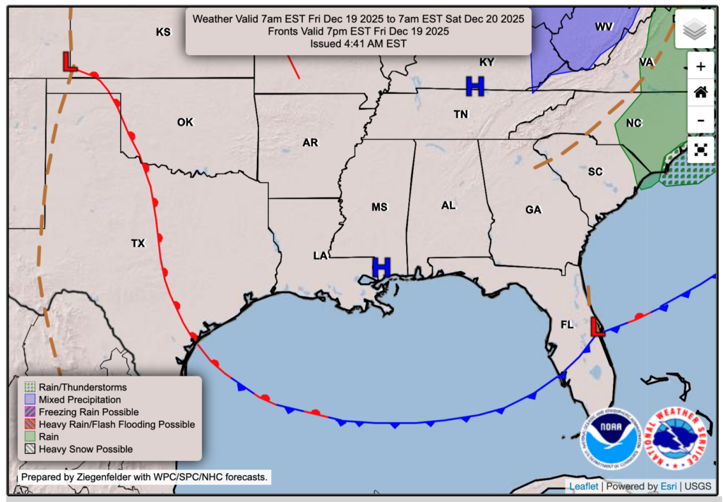
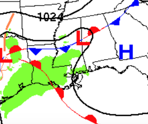
The cold front that has brought us this rain for yesterday and today is moving out and away tonight, which will allow some high pressure to fill in its place, clearing up our skies and leaving us with a beautiful fall-like day tomorrow. The front did overperform more than expected, and there’s been a few severe thunderstorm warnings in central and eastern Mississippi and western Alabama. There’s currently a severe thunderstorm warning just north of Meridian, with a tornado possible along with wind gusts up to 60 mph. We’ll see the severe stuff wind down fairly soon, within the next couple of hours.

Tonight’s Forecast
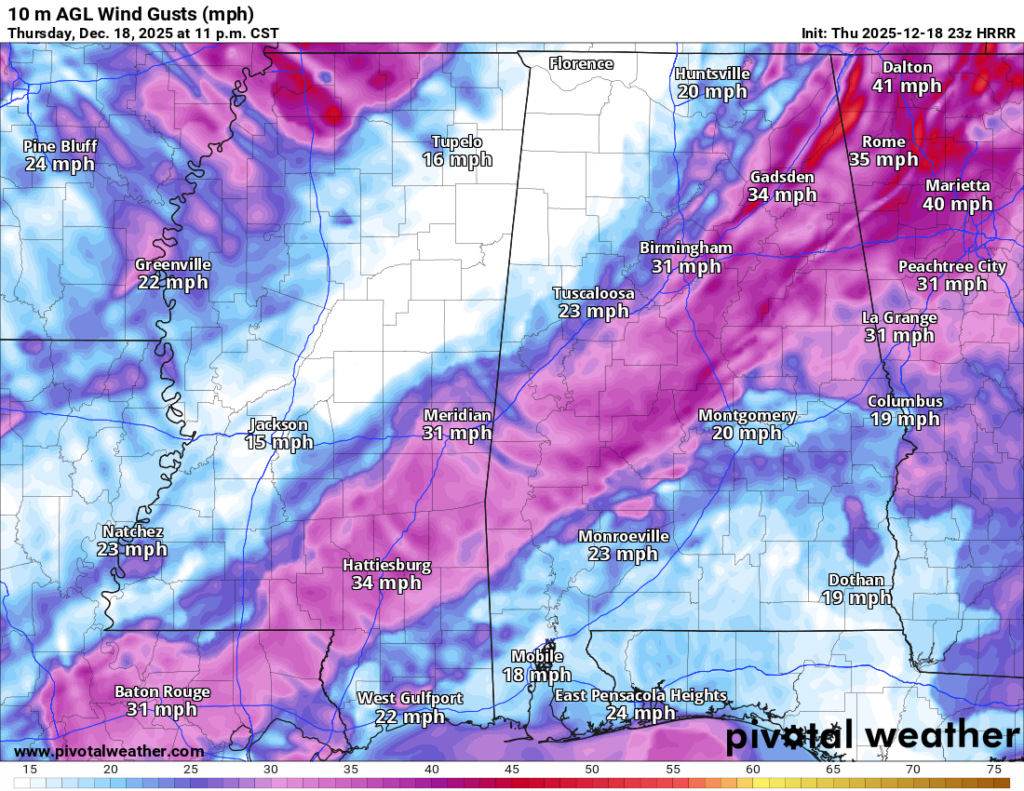
A few more showers or thunderstorms are possible for those closer to the coast in the next few hours, but the main threat is on its way out of here. As the cold front departs, along the final band of rain & storms, it will bring some notable gusty winds behind the line of rain, with some gusts as high as 30-40 mph.
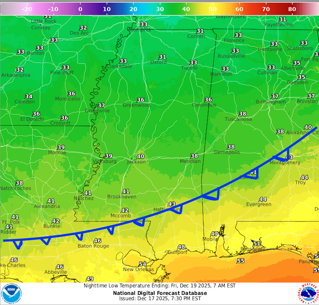
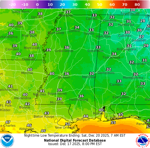
It will be much chillier behind the front, which is why those in central/northern areas will see their lows dipping down into the 30s, while those south of the front will see 40s or 50s for their low. You can see where the front will be by looking at my well-drawn frontal boundary in the temperature map above!
Tomorrow’s Forecast: Friday, December 19
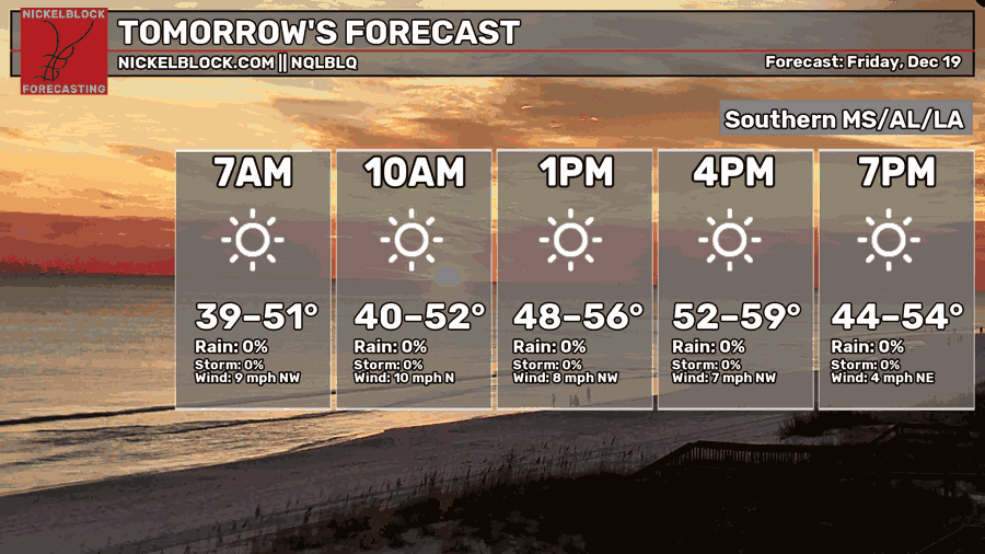
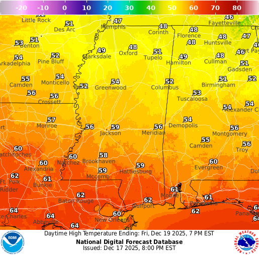
We’ll take a quick break from the 70s on Friday as a cooler air mass briefly drops into the Deep South. Highs will run a little different depending on where you are, but most spots should top out in the upper 50s to lower 60s. The good news is it won’t feel gloomy at all. Expect plenty of sunshine and a nice, crisp feel to the air, with a light north breeze keeping it on the cooler side through the afternoon. It’ll be a one day cool down before temperatures start climbing again heading into the weekend.
Weekend Forecast: December 20–21
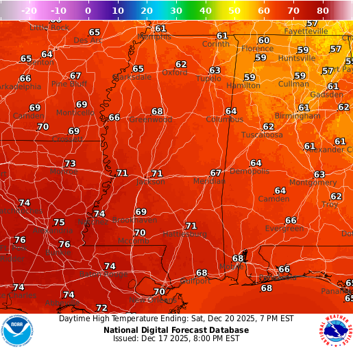
Heading into the weekend, Saturday stays bright and sunny with no rain expected. Highs will be in the lower 70s, so it’ll be a great day to be outside.
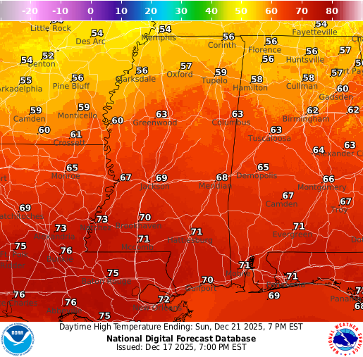
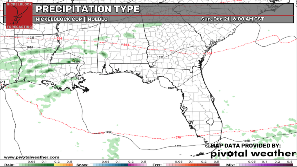
On Sunday, we’ll turn a bit more unsettled. We’re looking at a chance for a few light, isolated rain showers at times, especially from the morning into the afternoon, with more cloud cover around overall. This is tied to a trough nearby and a stationary front in the region, along with a warm front trying to lift through. Rain won’t be a washout, but keep the umbrella in mind if you’ve got plans.
Extended Local Outlook
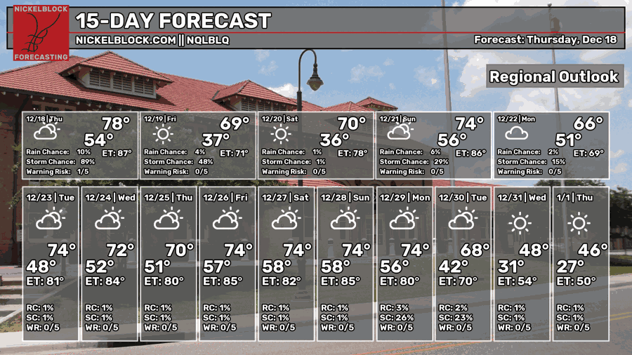
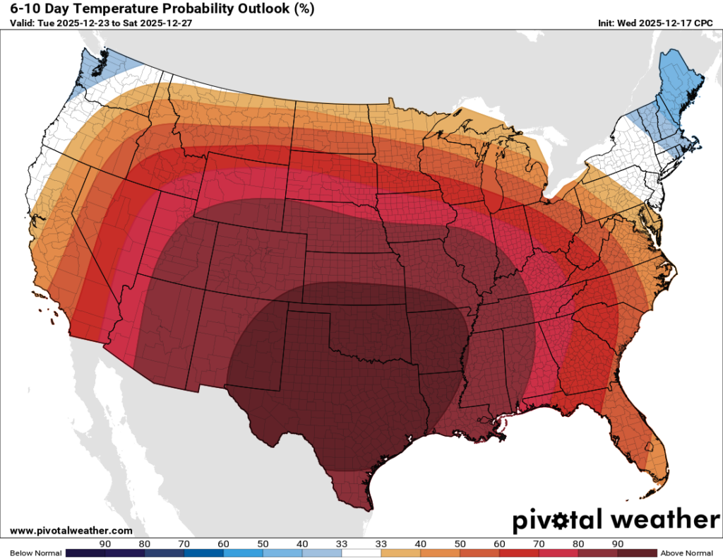
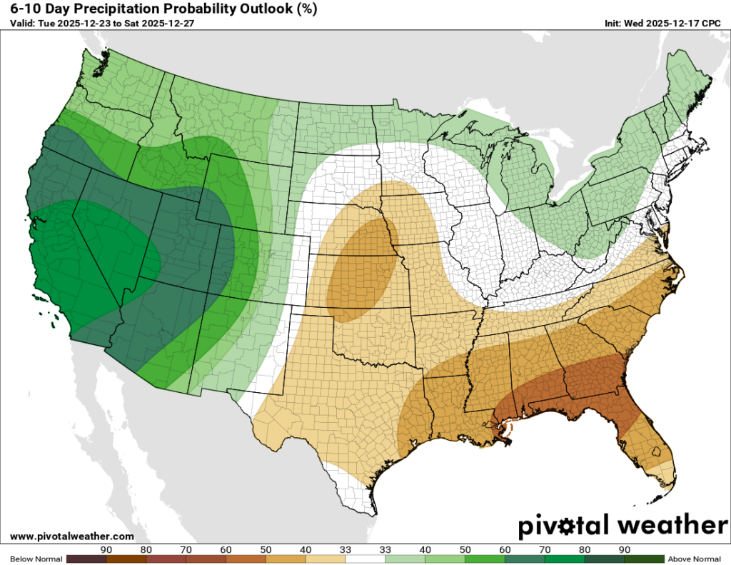
Talk about high probabilities! The CPC has not backed down on the “Torchmas” overall pattern for Christmas week, meaning above average temperatures for almost all of the United States. Similarly, we’re staying drier than average as a large ridge takes shape.

REGIONAL DAY TO DAY FORECAST
Tonight: A chance of some leftover showers before midnight. Mostly cloudy, then gradually becoming mostly clear. Lows in the mid 40s. Southwest wind 5 to 10 mph becoming north-northwest after midnight. Chance of rain 40 percent.
Friday: Sunny. Highs in the upper 60s. North wind around 5 mph.
Friday Night: Mostly clear. Lows in the mid 30s. Calm wind.
Saturday: Sunny. Highs near 70. Light south-southeast wind becoming south 5 to 10 mph in the morning.
Saturday Night: Partly cloudy. Lows in the low 50s. South wind around 5 mph becoming calm in the evening.
Sunday: A chance of showers anytime. Partly sunny. Highs in the low 70s. Calm wind becoming southeast around 5 mph in the morning. Chance of rain 30 percent.
Sunday Night: A chance of showers before midnight. Mostly cloudy. Lows in the low 50s. East wind around 5 mph becoming calm. Chance of rain 20 percent.
Monday: Partly sunny. Highs near 70.
Monday Night: Partly cloudy. Lows in the low 50s.
Tuesday: Mostly sunny. Highs in the mid 70s.
Tuesday Night: Partly cloudy. Lows in the mid 50s.
Wednesday: Mostly sunny. Highs in the mid 70s.


