General Central/Eastern Kansas Forecast
Short-Term (Thursday-Friday)
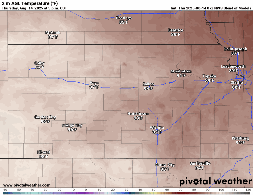
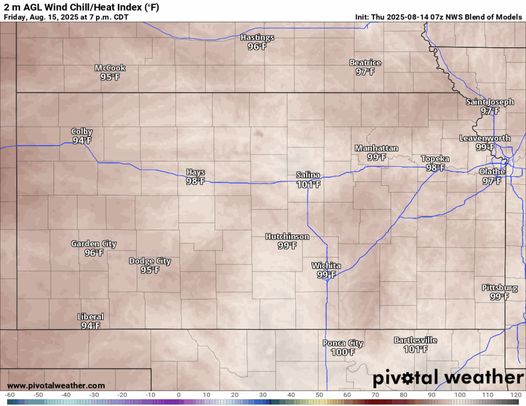
A return to average, dry summer-like conditions will continue through today and tomorrow, as high pressure from the southwestern US will fill in over the state this afternoon. High temperatures today will be around average, reaching the upper 80s to mid 90s, with southerly winds of 5 to 15 mph, gusting to 30 (mainly in north-central Kansas). Heat indices will make it into the mid to upper 90s owing to relative humidity values of 45-55%. Low temperatures tonight will start to creep a touch warmer, but still comfortable, getting down into the low to mid 70s.
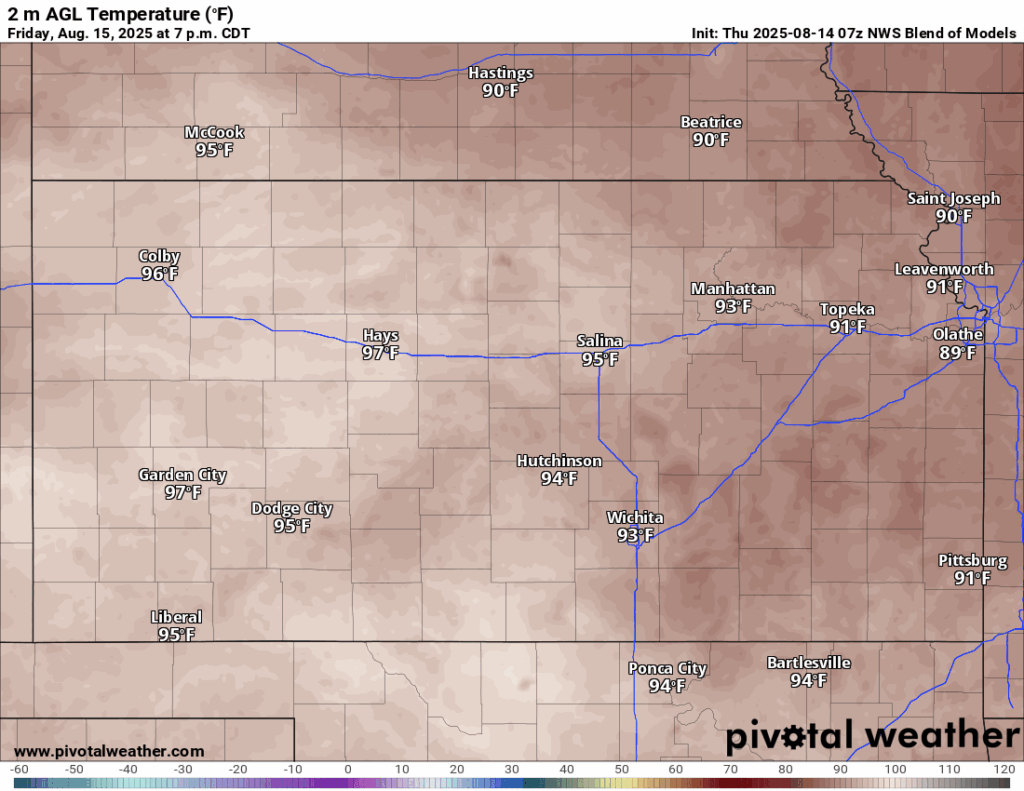
By tomorrow, more of the same conditions as today, with highs in the low to mid 90s and winds out of the south at 5 to 15 mph, gusting to 25 (again mainly towards north-central Kansas). Heat indices tomorrow afternoon will get close to advisory criteria, reaching the upper 90s to low 100s given relative humidity values of 50-65%. Overnight lows look to be much warmer tomorrow night compared to tonight, with lows in the mid to upper 70s.
Long-Term (Saturday-Wednesday)
Saturday will see another day of hot and dry conditions across the area before we see the return of daily scattered showers and thunderstorms starting from Sunday/Monday. Temperatures will still be fairly warm (right around average for this time of year), but the high pressure system sitting over us may displace enough to allow for weak northwesterly flow aloft to return. This could bring some weak disturbances through our region and spur scattered showers and thunderstorms during the afternoon and evening hours, but consistent, widespread heavy rainfall is not anticipated at this time. These storms would be more akin to garden variety thunderstorms and may bring no more than a heavy downpour before dissipating after a couple of hours.
Climate Outlook
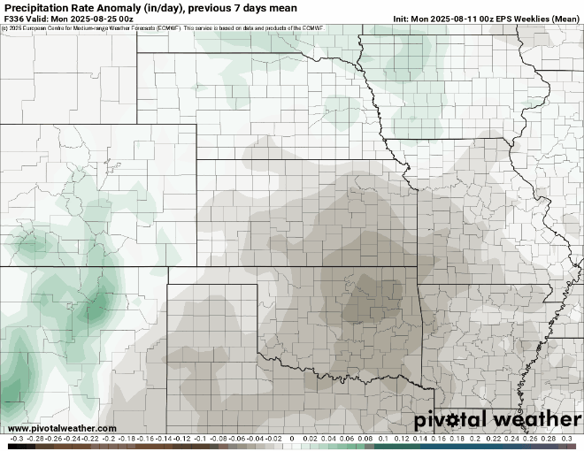
Overall, the general long-range pattern looks to still be the same; high pressure in the southwestern US overspreading the central plains, keeping us warm and dry. Temperature-wise, we will look to stay right around average for the next month or so due to the high pressure not being overly strong for this time of year. Rainfall will stay right around average to maybe a touch below average due to a lack of a strong enough signal to mark widespread pattern changes that would allow for greater precipitation chances. At this point, anticipate a seasonally average summer heading into mid-September for the most part, with warm (but not overly hot for extended periods) and dry conditions.
Regional Soil Moisture Outlook
Around Westmoreland


Around Scranton


Around Burlington


Around Altoona