General Central/Eastern Kansas Forecast
Short-Term (Monday-Tuesday)
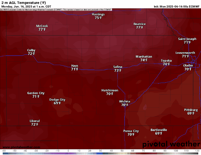
Today will mark our last of clear weather in the short-term period before more unsettled weather will enter our area. High temperatures today will reach the upper 80s to low 90s, with light winds out of the southeast at 5 to 10 mph. These southeasterlies will help to pull in more gulf moisture to set the stage for more active weather tomorrow. Dew point temperatures will range mostly in the upper 60s and relative humidity values look to range between 50-60%. By tonight, overnight lows will be in the upper 60s to low 70s. Temperatures tomorrow will vary widely to between the upper 70s to low 90s, depending on cloud cover and rain-cooled air.
Tomorrow is shaping up to be quite a complicated forecast for central and eastern Kansas, as we could be gearing up for multiple rounds of thunderstorms from the early morning to evening hours. Round one looks to sweep through in the overnight to early morning hours from the west/northwest and bring potentially heavy rainfall and a damaging wind gust or two. Round two’s storm evolution in the afternoon will be highly dependent on what happens with round one and what boundaries get left behind and/or how the atmosphere recovers in front of a weak cold front. IF we do see a second round of storms Tuesday, they will be capable of all severe hazards plus heavy rainfall (1-3+ inches likely in the more intense thunderstorms), however, more information will be needed to uncover greater specifics over the next 24 hours.

Potential total rainfall from the HRRR through tomorrow // Courtesy: Pivotal Weather

Potential total rainfall from the 3km NAM through tomorrow // Courtesy: Pivotal Weather

Long-Term (Wednesday-Sunday)
Beginning Wednesday, we will start to feel more summer-like, as high pressure will move in behind this system from Tuesday and sit over the southern US. Temperatures will be slightly cooler following the departure of Tuesday’s weak cold front, being in the mid 80s. From Thursday onwards though, temperatures will consistently climb into the upper 80s to mid 90s. Heat indices may begin to become a factor towards the end of the week, where heat indices may climb to the upper 90s to potentially low 100s.
Regional Soil Moisture Forecast
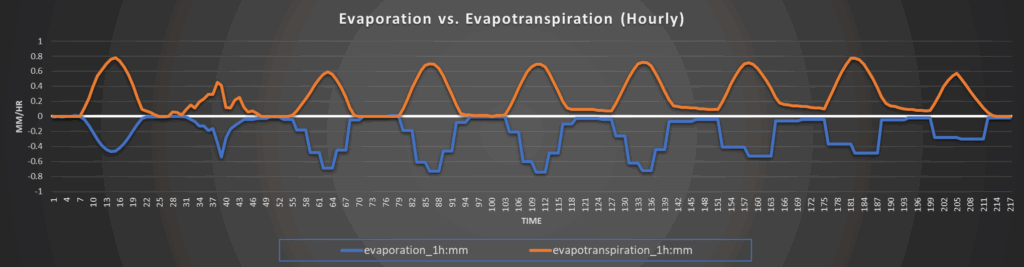
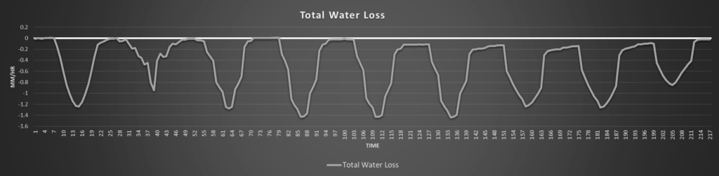
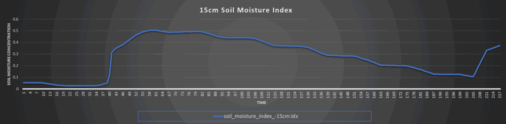
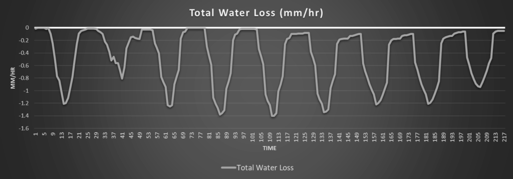
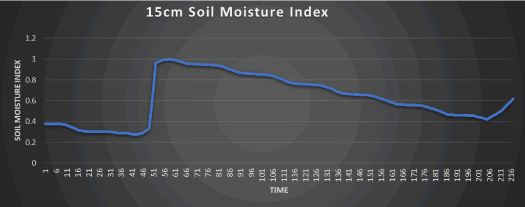
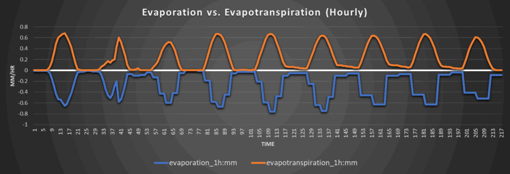
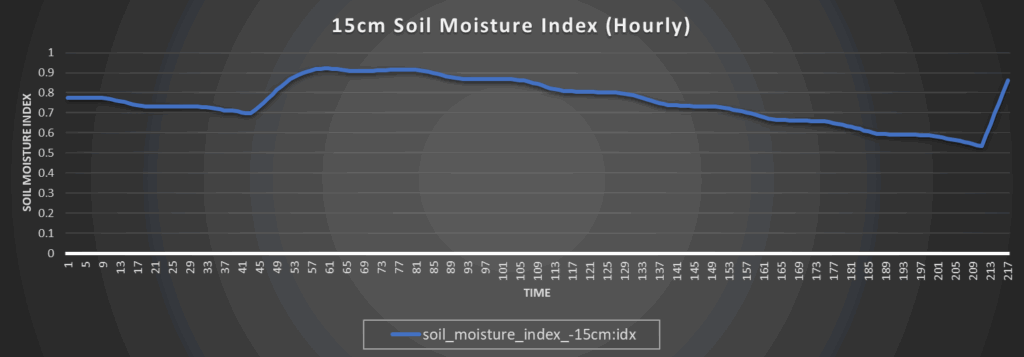
Soils will dry again today with the warming temperatures before becoming very saturated tomorrow due to the potential multiple rounds of heavy rainfall. Flash flooding and washing out of soils may be a concern in areas that do see these stronger thunderstorms, as they will be very efficient rainmakers due to precipitable water being between 1.25 to 2 inches. River and lake flooding may again become a concern too from the heavier rainfall. After Tuesday, we will begin to dry out long-term as rain chances lessen and the heat builds.
Around Westmoreland
Around Scranton
Around Burlington
Around Altoona