We’ve already passed our high temperature for the day today. Crazy, right? Well, considering the large cold front that’s already passing through, it’s going to be cold and breezy all day today! We’ll likely hover around the 40s for the rest of the day before we drop off below the freezing mark overnight.

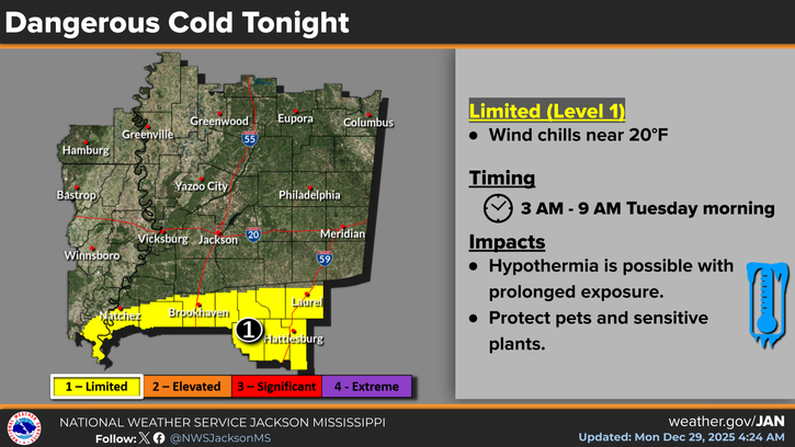
The NWS in Jackson has placed a cold weather warning for tonight as winds will continue to gust over 20mph tomorrow morning.
Today
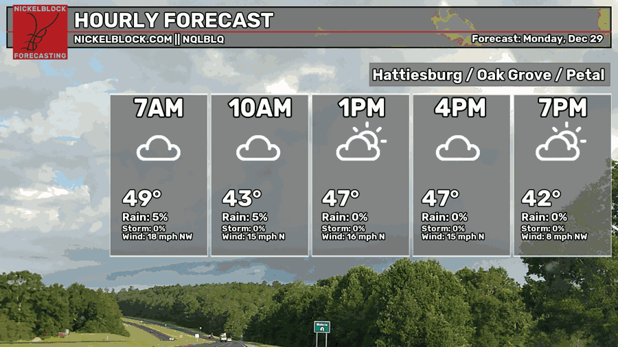
As I already mentioned, temperatures will continue to plummet during the day with varying degrees of cloudiness. Expect temperatures to hover around the 40s for most of the day with winds out of the north from 10-20mph and 30mph wind gusts possible. Overnight, the winds will continue with a low in the upper 20s.
Tomorrow
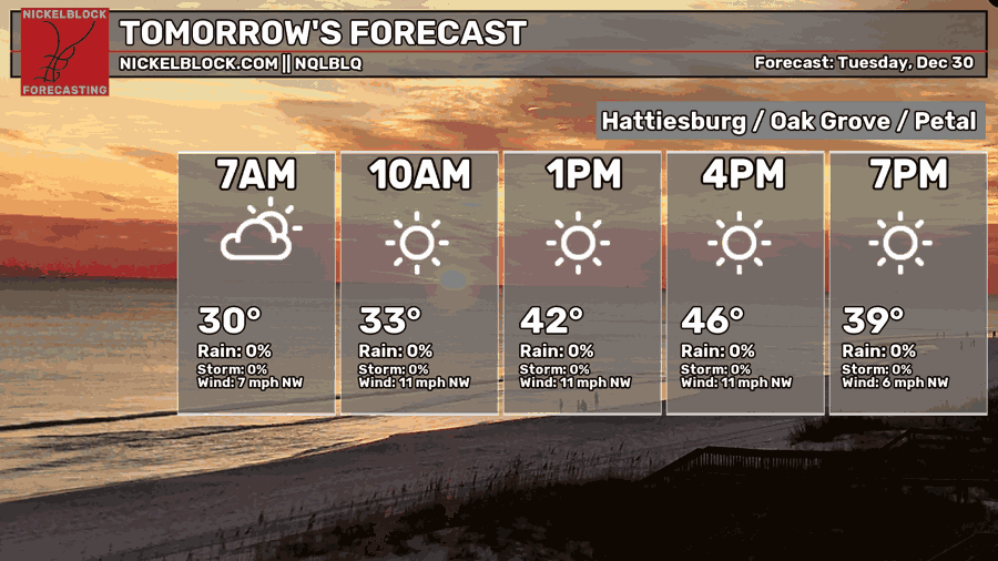
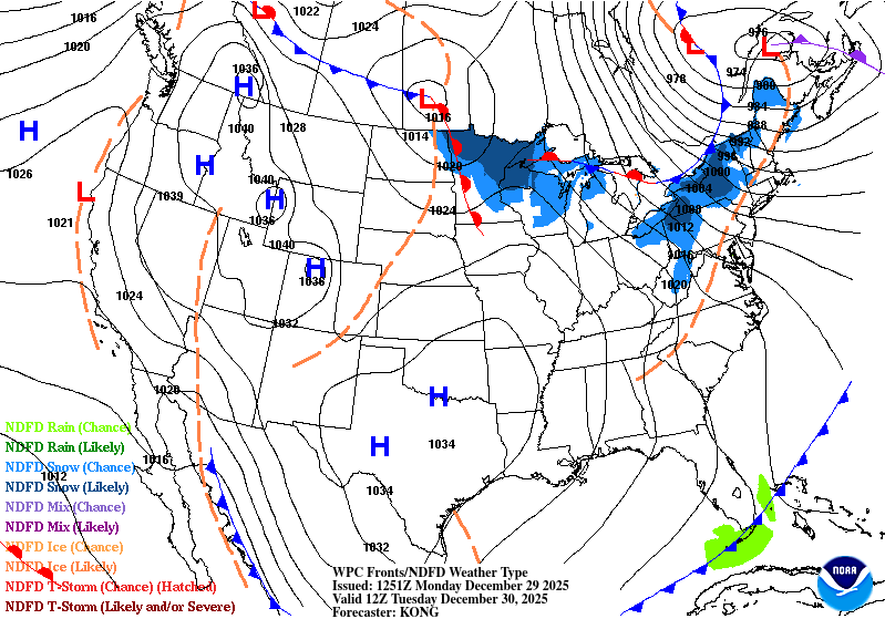
Looking at that high pressure system above, the pressure gradient from that will still provide some gusty northerly winds tomorrow. Highs will be in the mid 40s during the day with clouds clearing by the morning. Overnight, expect temperatures to fall into the mid 20s, so keep your plants covered and your pets indoors.
New Years Eve
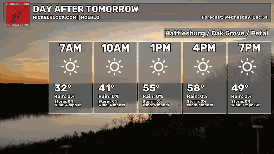
Expect New Year’s Eve to be much milder a less breezy. Highs will be in the upper 50s, so if you’re off from work, go outside and enjoy it for a little while! If you’re going to watch the ball drop, bring a heavier jacket with you as it’ll fall into the low 40s/upper 30s by midnight. The low will fall into the low 30s overnight.
New Year’s Day and Friday
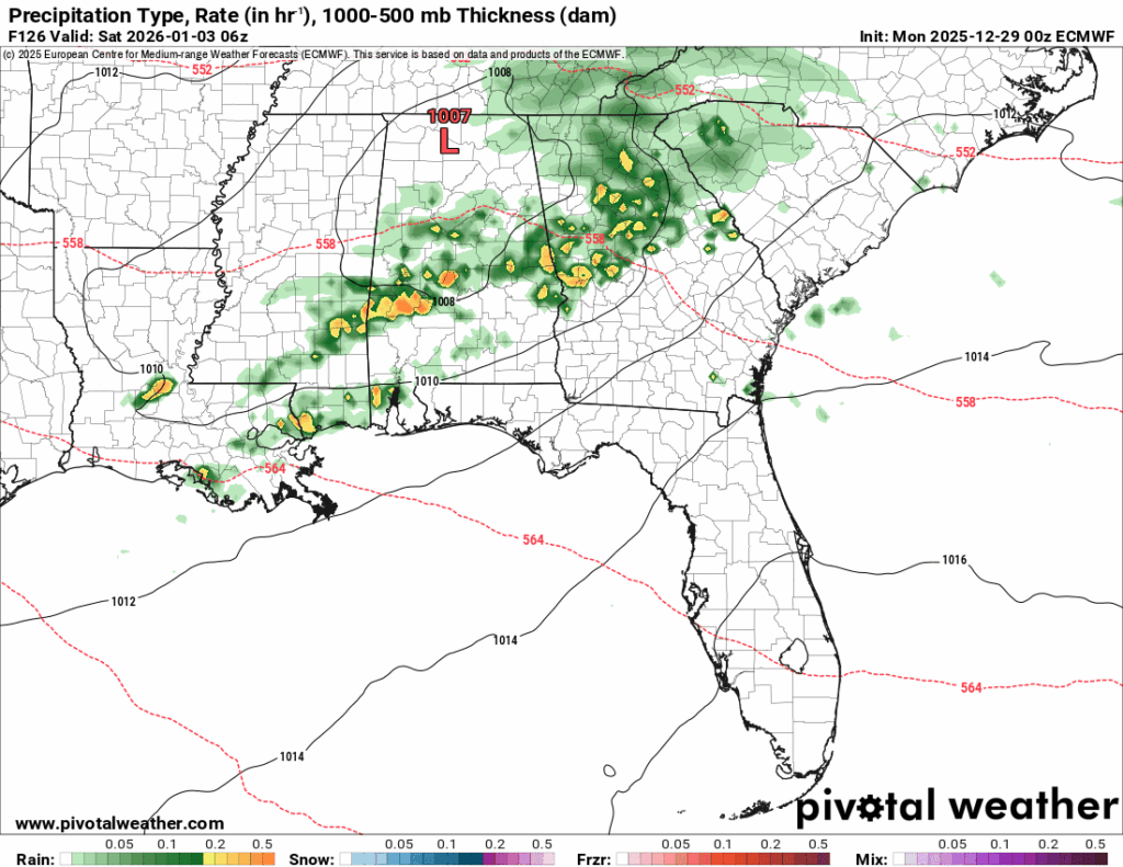
New Year’s Day will be quite pleasant as temperatures reach the mid 60s during the day with mostly sunny skies. A pretty good day to start off 2026! Overnight, temperatures will only fall into the low 50s as another front is approaching and winds shift towards the south. Friday will be slightly warmer with increasing clouds and higher rain chances by the late evening hours. Most of this will be closer to midnight, but expect a few stray showers before you go to bed. These should move out by the morning on Saturday.
Hope you all have a safe and great New Year!


