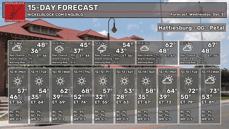
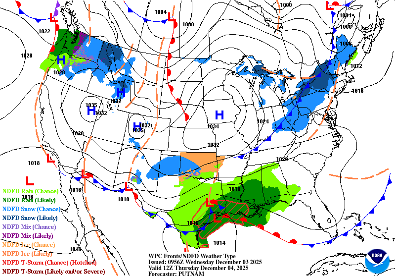
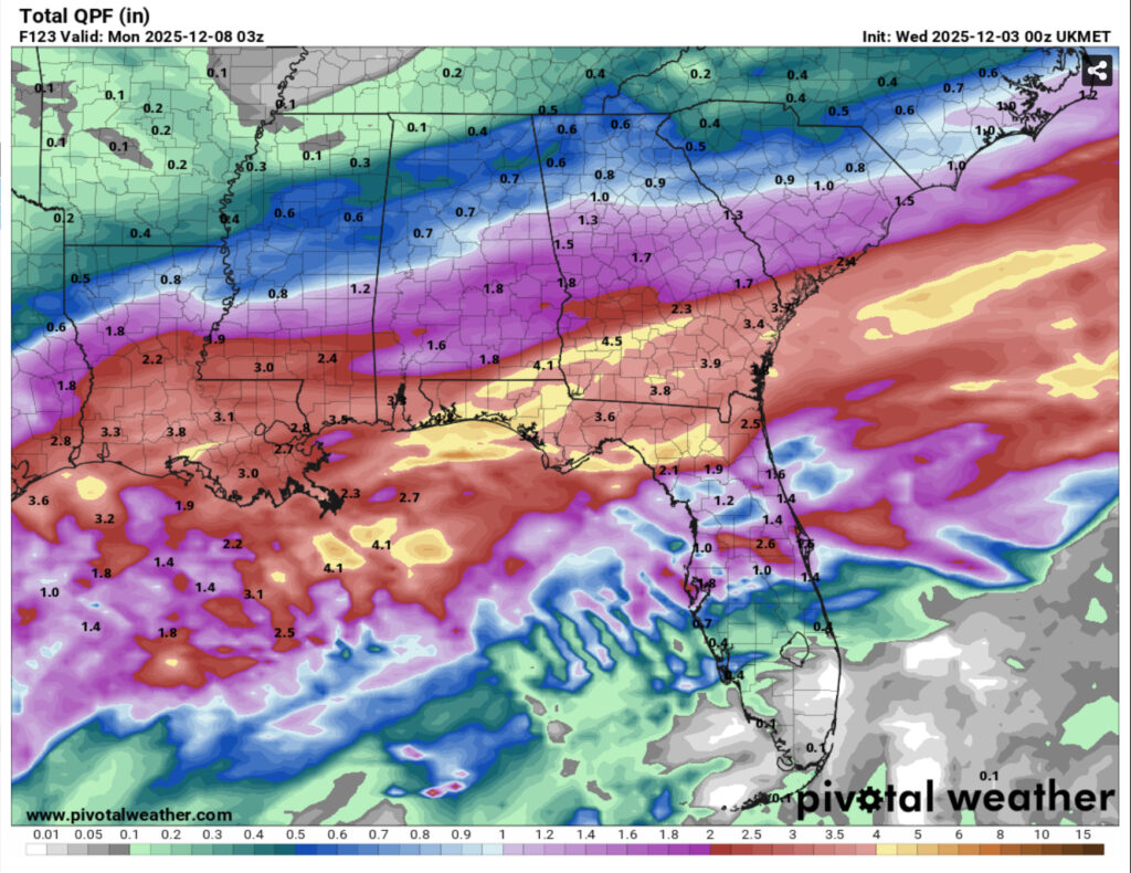
We’re just under seasonal norms for temperatures but we’ll have plenty of rain to make up for as well. A Gulf low is slowly moving through the western Gulf coast and will bring a lot of rain along with it. If you’re planning on going outside this weekend, you definitely want some backup plans as it’s going to be cold and rainy for the next several days.

Today
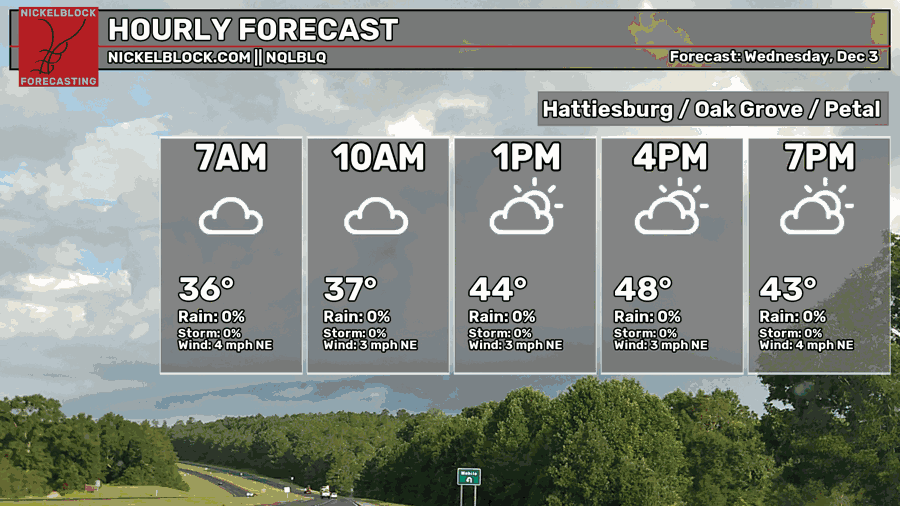
Expect a mix of clouds and sun today with highs just reaching around 50. Northeast winds are possible and lows will fall into the low 40s. Overnight into the early morning hours, expect rain to start in the western end of MS/southeast end of LA and move east.
Tomorrow
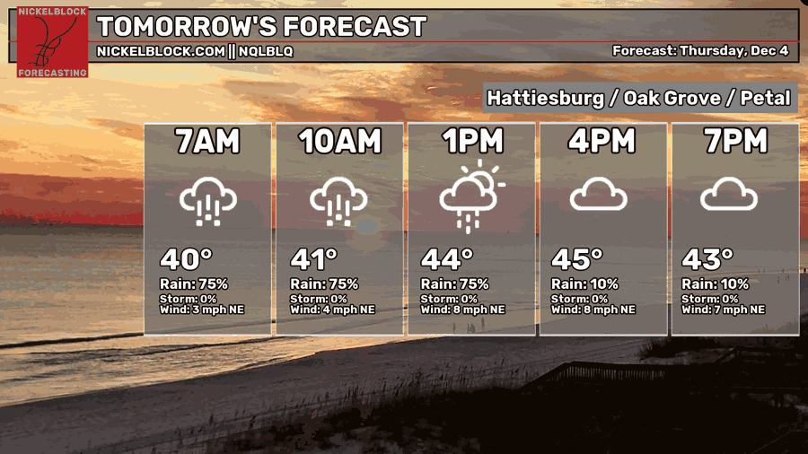
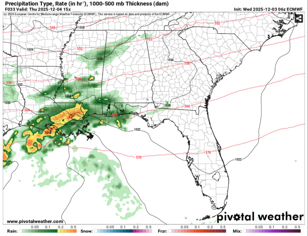
Rain will start around sunrise and continue on through most of the day on Thursday. The heaviest rain will be from the morning to mid-afternoon hours before tapering off with some intermittent showers during the evening. Highs will be in the mid to upper 40s and lows taper off to the low 40s.
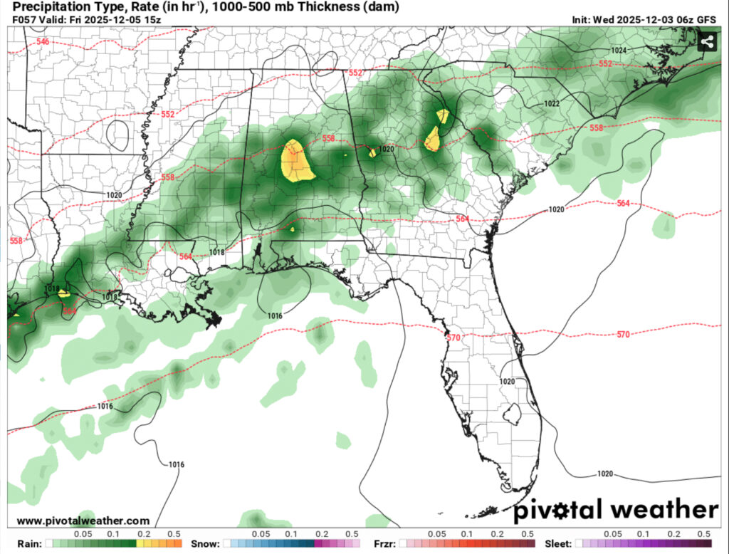
Friday
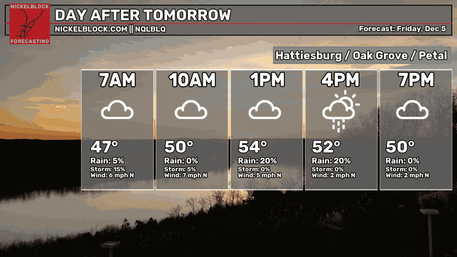
Friday is a bit of a mixed bag with rain chances probable throughout the day. The GFS and ECMWF models differ in rain chances, but I’m going to say there is a decent chance for Friday as the front moves closer to the Alabama coastline. Highs will reach the low 50s during the day and low 40s overnight.
Saturday and Sunday
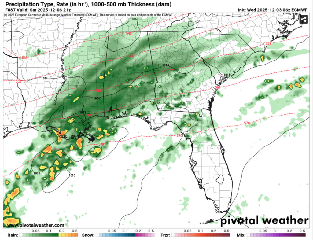
Another chance for rain is likely on Saturday as the coastal low moves out. Expect some moderate rain throughout most of the day with highs in the low 50s and lows in the mid-40s. Rainfall totals for the next few days average around 2 inches for much of the Pine Belt, but if we see more on Friday, that total could ramp up to over 3.
Sunday will be a much brighter day as the front has moved out. Expect sunny skies and temperatures in the low 60s. We’ll have a cool night ahead with temperatures in the mid 30s.