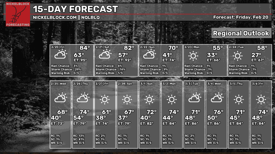
We’re still in a warm and humid pattern as temperatures will once again reach the 80s today. We reached the record high yesterday over 85 degrees in some areas! Thankfully this weather pattern will change by the end of the weekend as a large high pressure zone moves in by Sunday dropping temperatures in the process.
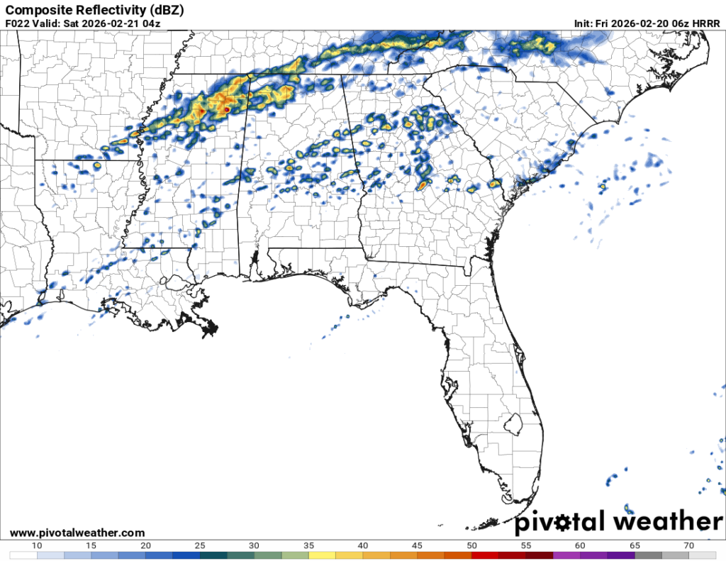
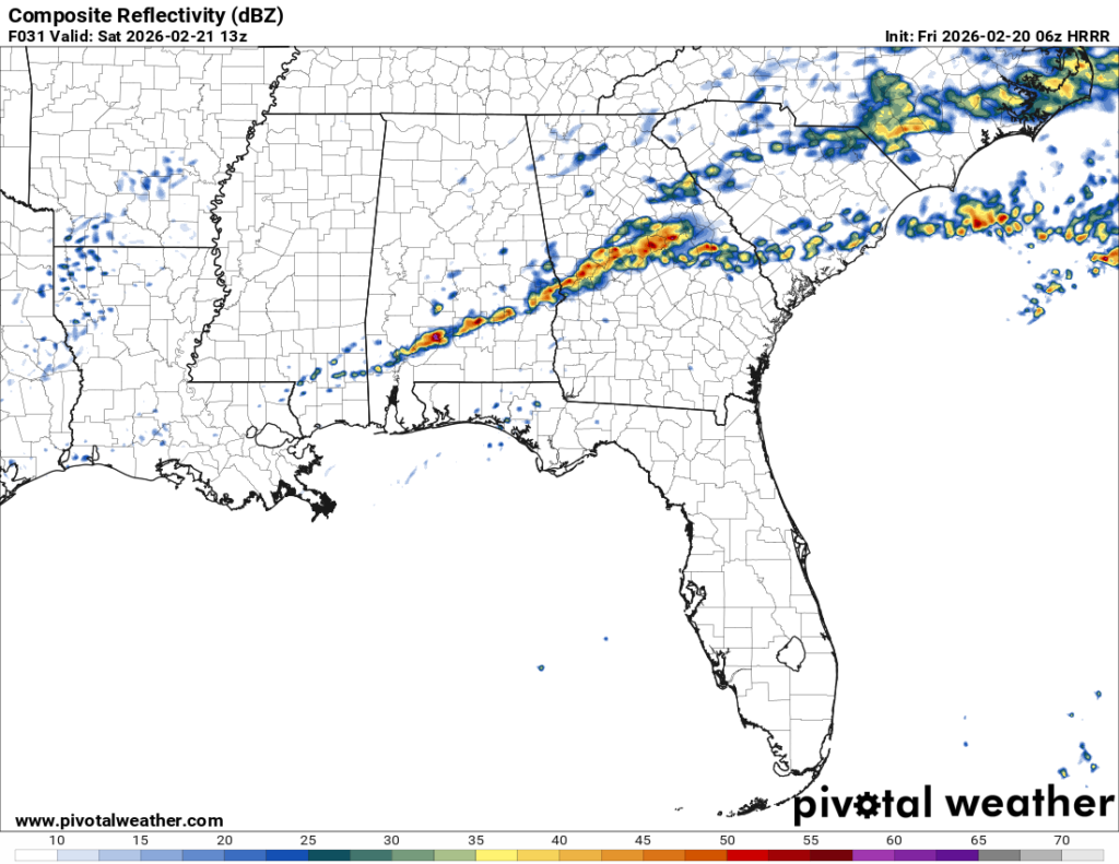
The rain will be on and off for the next 48 hours as the overall system begins to move northward today and eventually east by tomorrow evening. This system isn’t expected to be severe for us, but we may see a few thunderstorms before it moves out.

Today
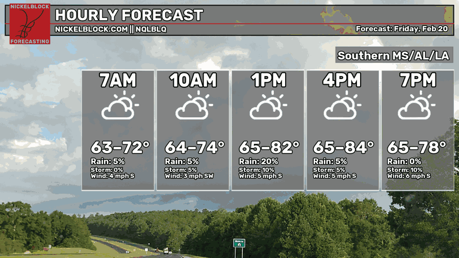
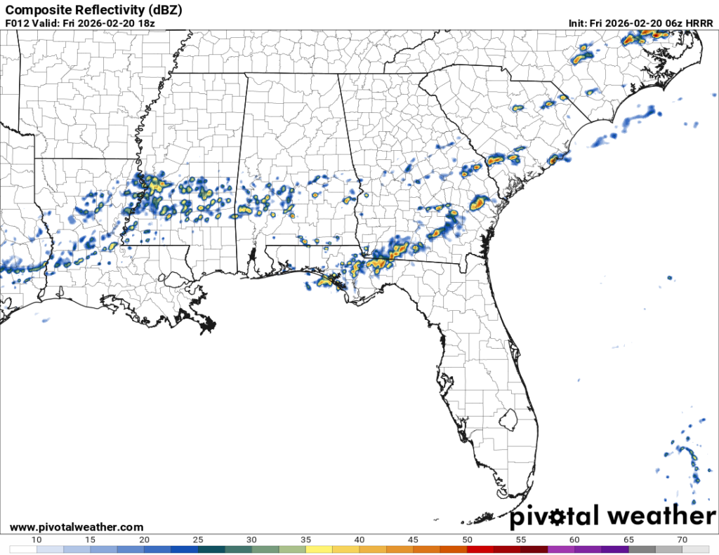
It’s going to be a mixed bag of on and off rain and thunderstorms today as many of the clusters will move further north today. A few are expected to form south towards the Pine Belt tonight and continue into the early morning hours. Overall, mainly just rain and thunderstorms. Otherwise, it’s going to be another warm and humid day with a high in the low 80s and a low in the low 60s.

Tomorrow
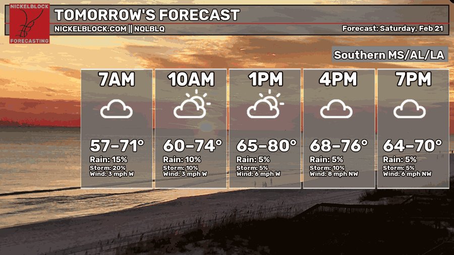
By tomorrow afternoon, most of the showers will have moved towards the coast leaving conditions still warm and humid for most of the day. We won’t feel the cold front move in until the mid-afternoon tomorrow when the winds shift towards the west and eventually the northwest. Highs will be in the low 80s but drop into the mid 40s by Sunday morning.
Sunday will be a drastic change from the past several days with temperatures only reaching the 50s during the day with sunny skies and dry conditions. Winds will pull out of the northwest and gust up to 20mph. Overnight, it’ll fall into the mid 30s.
Next Week
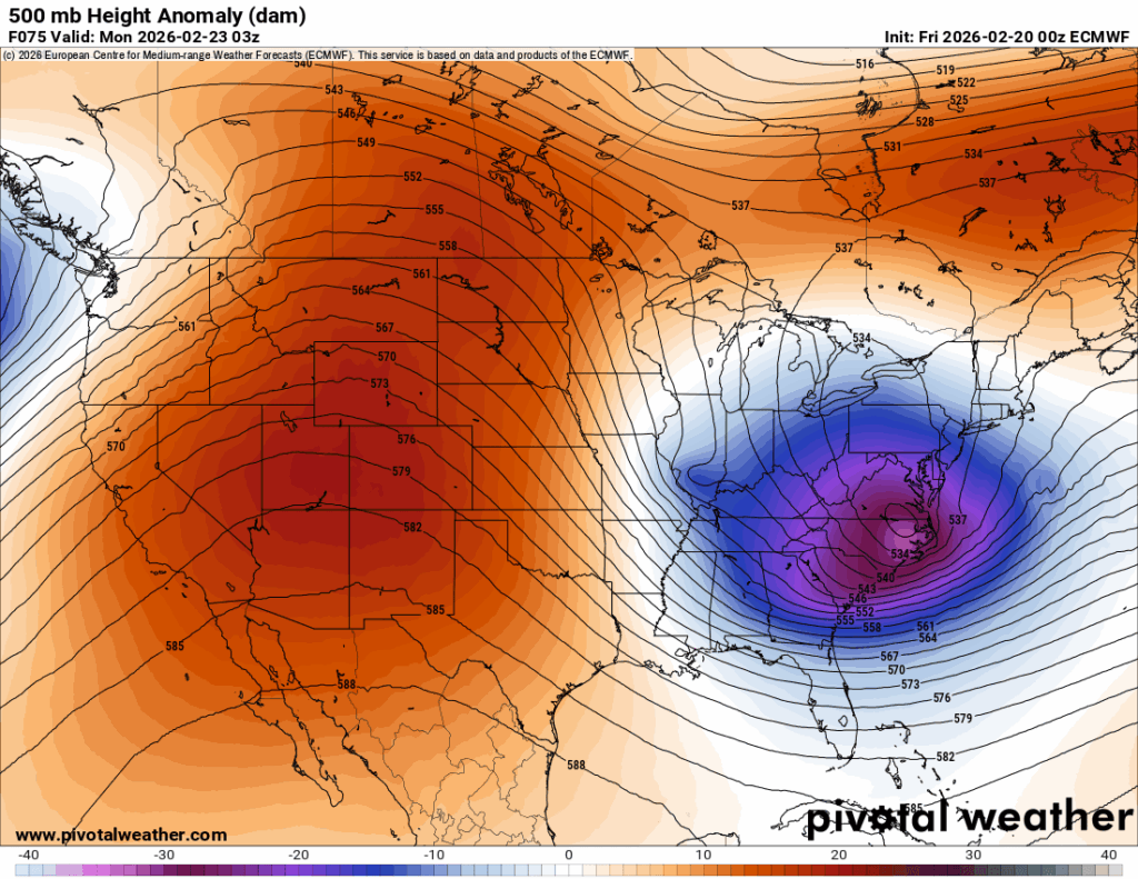
It’s going to be a cooler start to the week with a large high pressure system over the eastern US. For Monday and Tuesday, we’ll see more average temperatures across the Pine Belt with highs in the mid 50s and lows in the low 30s and upper 20s. Temperatures will begin to rise by Wednesday with a high in the mid 60s and a low in the low 40s. Cloud cover will also increase with an incoming cold front.
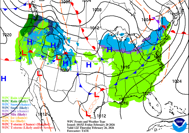
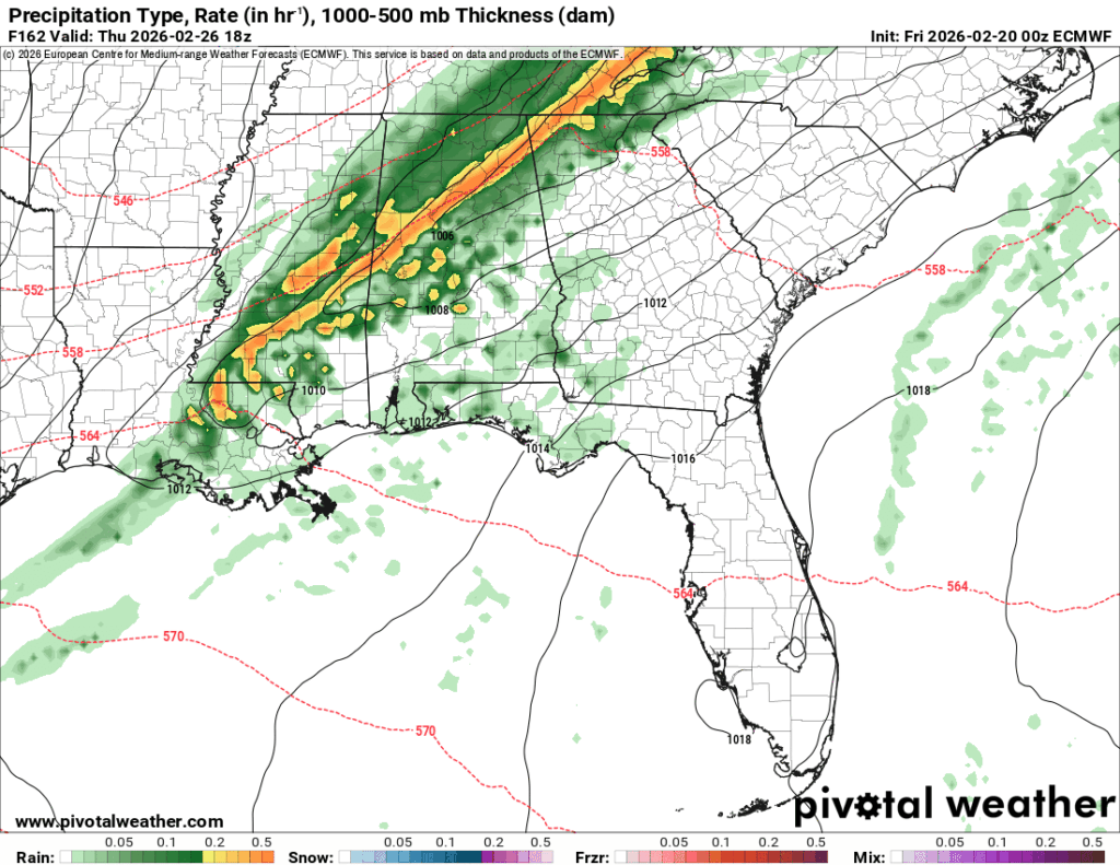
As we roll into Thursday, a cold front is coming in hot. The incoming line looks fairly thin, but with some heavy rain and a few thunderstorms possible. Expect rain during the day on Thursday and a cool-off afterwards. The good news for the upcoming weekend is that it’s going to be a little bit cooler this time and no rain! Hooray! Temperatures will fall back into the low 60s by Friday and upper 30s overnight.