The wind and the cold came in pretty fast yesterday with 20mph wind gusts and temperatures below average for this time of year! The winds won’t let up much today since the high pressure zone is just about over us. By tomorrow, conditions will even out and we’ll have a pleasant day ahead.
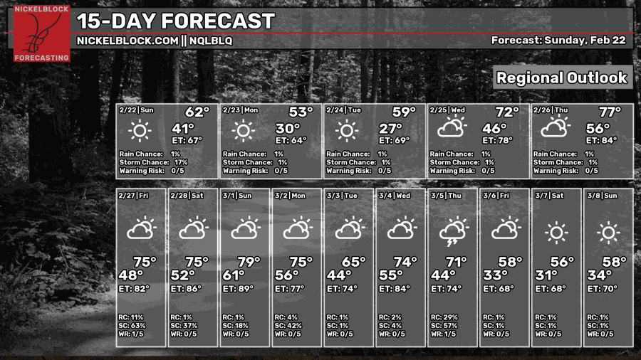
By the end of the week, we can expect a fairly large swath of rain to move in from the north. While it isn’t anything severe, we can expect upwards of 3/4 of an inch of rain when it passes through. Afterwards, we’re back to the warmer temperatures again.

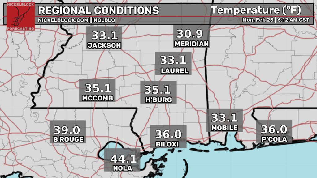
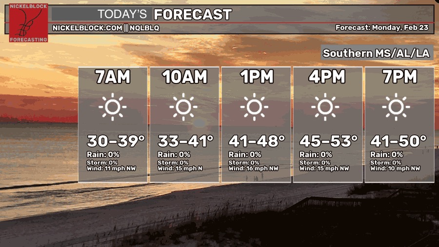
Today, we’ll start off cold and windy with temperatures in the mid 30s to low 40s in the morning. The winds will be blowing out of the northwest the entire day with a high in the mid 40s to low 50s. The sun will be some help with the cold, but the wind will be the factor that cuts through, so keep your jacket with you! Overnight, it’s going to fall below freezing with a low in the mid 20s.
ONE THING TO NOTE: We are under a Red Flag Warning today. That means not to burn anything as there’s high winds. Considering fire fighters are already fighting a fire in the Desoto National Forest, please don’t add to that fuel.

Tomorrow
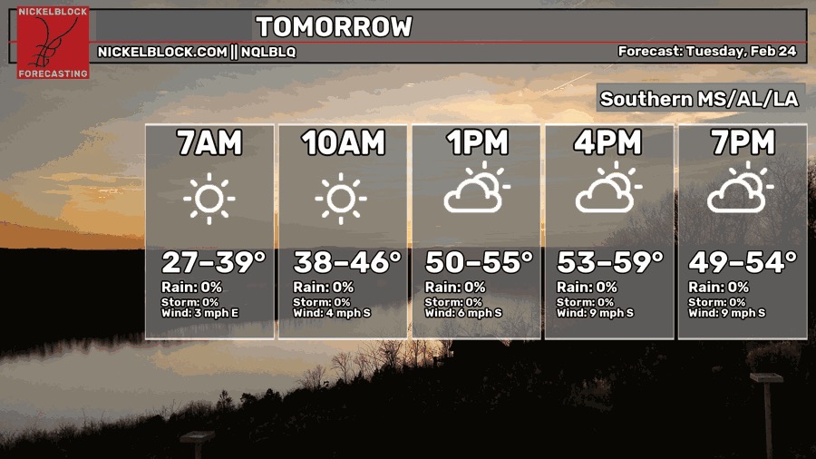
Tomorrow will feel more like your typical late winter day with a high in the mid to upper 50s. Winds will still blow a bit, but not as bad as today. Expect some high clouds to move in during the latter part of the day. Otherwise, a pleasant day! Lows will fall into the upper 30s/low 40s.
Mid-week to the Weekend
Temperatures will begin to stabilize by Wednesday along with more clouds moving in. We’ll reach the 70s again as the high pressure system moves to the east bringing more southerly flow from the Gulf. We’re going to return to our 70s high/50s low pattern for a little while.
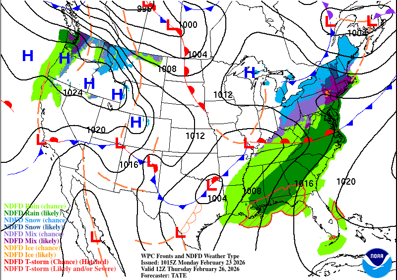
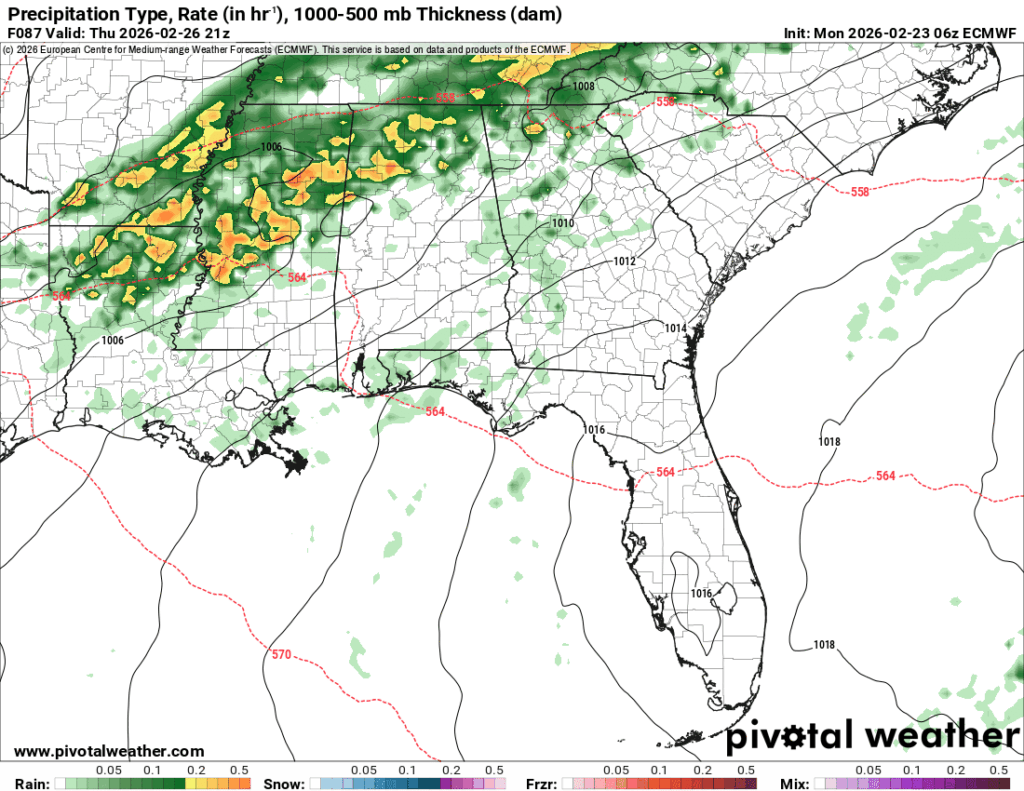
We’ll feel the humidity by Thursday with the incoming front. The mesoscale convective system will move in by the evening hours bringing heavy rain and thunderstorms. The Storm Prediction Center hasn’t placed an outlook on this system yet. The line begins to congeal as it moves further south into the Pine Belt which hopefully means that the severe potential is limited. Otherwise, it’s going to be fairly soggy overnight on Thursday into Friday.
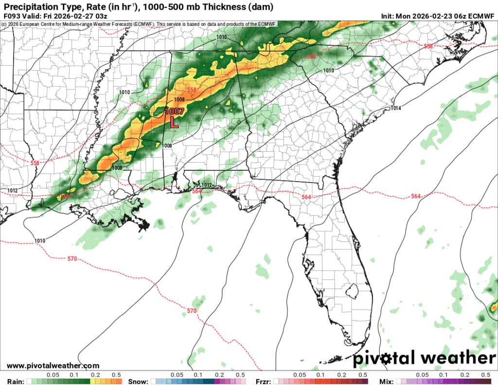
After the rain moves out on Friday, it’ll be a warmer day overall, but a nice one! Temperatures will reach the upper 60s/low 70s after the front passes through. The weekend will follow suit albeit a bit warmer.