It looks like the overall temperatures are staying down for a while after the last cold front came through on Wednesday. A more active weather pattern will move in this coming week, but so far, severe chances are pretty limited for most of Mississippi and Alabama. More than anything, we’re going to see plenty of rain.

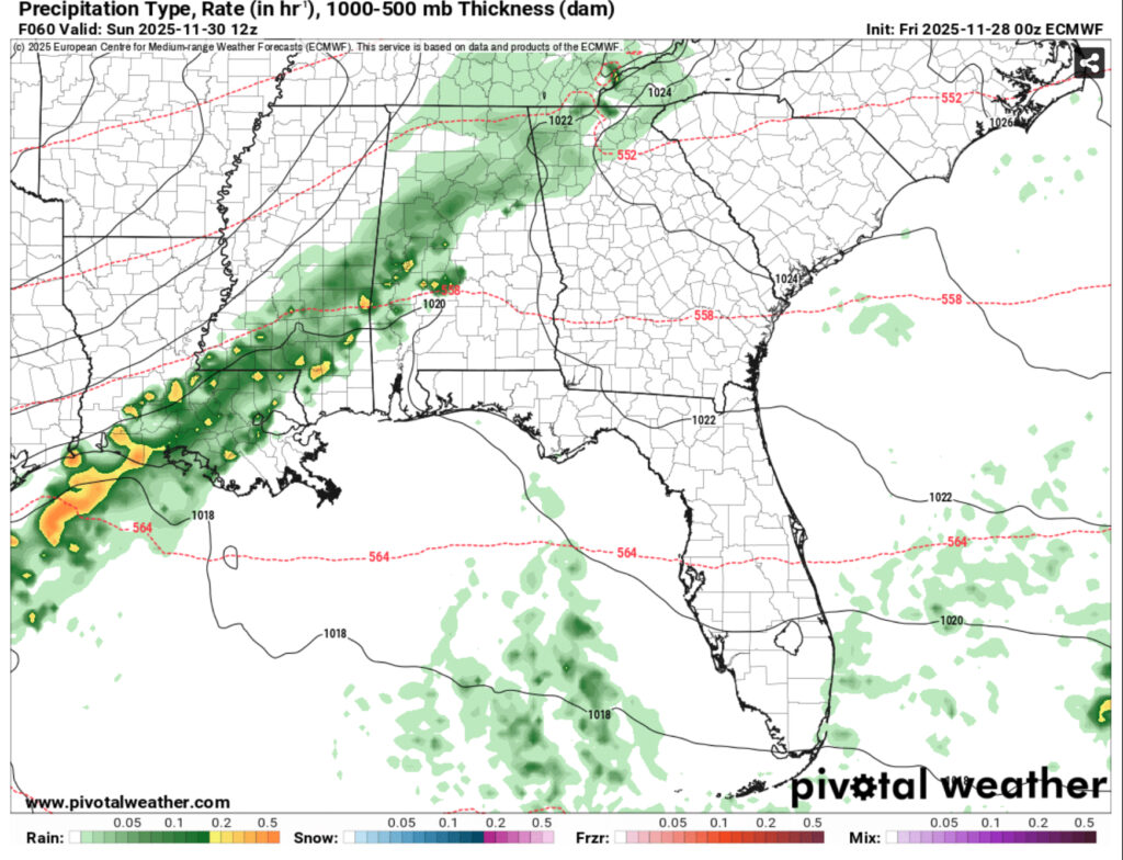
Temperatures will climb from the upper 50s today to the low 60s Saturday and Sunday. Lows will fall into the upper 30s tonight, the low 50s Saturday night and low 40s Sunday night. Rain chances will start in the evening hours for much of Louisiana and around midnight on Sunday morning. The SPC has placed a marginal (1/5) risk for much of western and northern Louisiana and eastern Texas on Saturday. As the line moves further east, the severity of the line dissipates and we’ll likely see some scattered rain and thunderstorms as Sunday progresses. Expect some gusty winds from the incoming cold front.
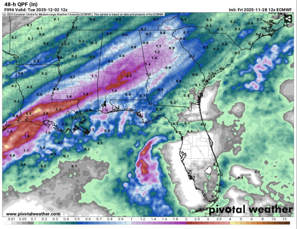
Another front behind the initial one is developing out of the Gulf and forecast to bring rain for the coastal South and winter precip for areas north of the Ohio River valley. Expect some steady to heavy rain Monday evening into Tuesday morning. Temperatures will remain in the mid 50s and fall into the low 40s. Tuesday will be cooler in the low 50s and the low falling around 30. Be aware of a possible freeze watch or warning Tuesday night. Rainfall totals will reach over 1 inch for the 48hr period.
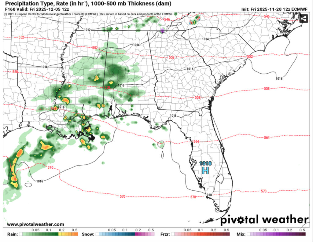
We’ll have a break from the rain Wednesday and Thursday and temperatures will be closer to seasonal norms with highs in the upper 50s. Lows will reach the upper 30s to low 40s. Overnight on Thursday is another chance for scattered rain showers with another front moving in. So far, this looks to be just a rain event with little convection. This will last into the morning hours on Friday. Expect temperatures in the upper 50s and lows in the mid 40s.

Regional Day-to-Day Forecast
This Afternoon – Mostly sunny, with a high in the mid 50s. Northeast wind around 5 mph.
Tonight – Mostly cloudy, with a low in the mid 30s. Calm wind becoming east southeast around 5 mph after midnight.
Saturday – Mostly sunny, with a high in the low to mid 60s. East southeast wind 5 to 10 mph.
Saturday Night – A 40 percent chance of showers, mainly after midnight. Mostly cloudy, with a low in the low 50s. Southeast wind around 5 mph becoming calm after midnight.
Sunday – Showers likely, mainly before noon. Cloudy, with a high in the low 60s. Light and variable wind becoming north 5 to 10 mph in the morning. Winds could gust as high as 20 mph. Chance of precipitation is 70%. New precipitation amounts between a tenth and quarter of an inch possible.
Sunday Night – A 20 percent chance of showers before midnight. Cloudy, with a low in the low 40s. North northeast wind 5 to 10 mph, with gusts as high as 20 mph.
Monday – A 50 percent chance of showers and thunderstorms after noon. Cloudy, with a high in the mid to upper 50s. Northeast wind 5 to 10 mph.
Monday Night – Showers and possibly a thunderstorm. Low in the low 40s. Northeast wind around 5 mph becoming north northwest after midnight. Chance of precipitation is 90%.
Tuesday – A 30 percent chance of showers before noon. Partly sunny, with a high in the low 50s. North northwest wind 5 to 10 mph.
Tuesday Night – Partly cloudy, with a low in the low 30s.
Wednesday – Mostly sunny, with a high in the mid 50s.
Wednesday Night – Mostly cloudy, with a low in the upper 30s.
Thursday – A 30 percent chance of showers. Mostly cloudy, with a high near 60.


