The day started off pretty chilly, but temperatures will reach the low 60s, and with clear skies, it should be a beautiful afternoon! Wednesday will be a mild day with early morning temperatures ranging from the upper-40s to the low-50s, and high temperatures reaching the low 60s, but there is a chance of precipitation.
While I am sure you have all seen the online posts (on TikTok… etc) about snow coming to the Deep South… That is not the case. The temperatures on Wednesday will be too warm for any winter precipitation in this region, but there is a chance for some rain.


Now, the NAM and the HRRR disagree about the coverage of precipitation, but both agree that we will see some rain on Wednesday, possibly sticking around for the day.
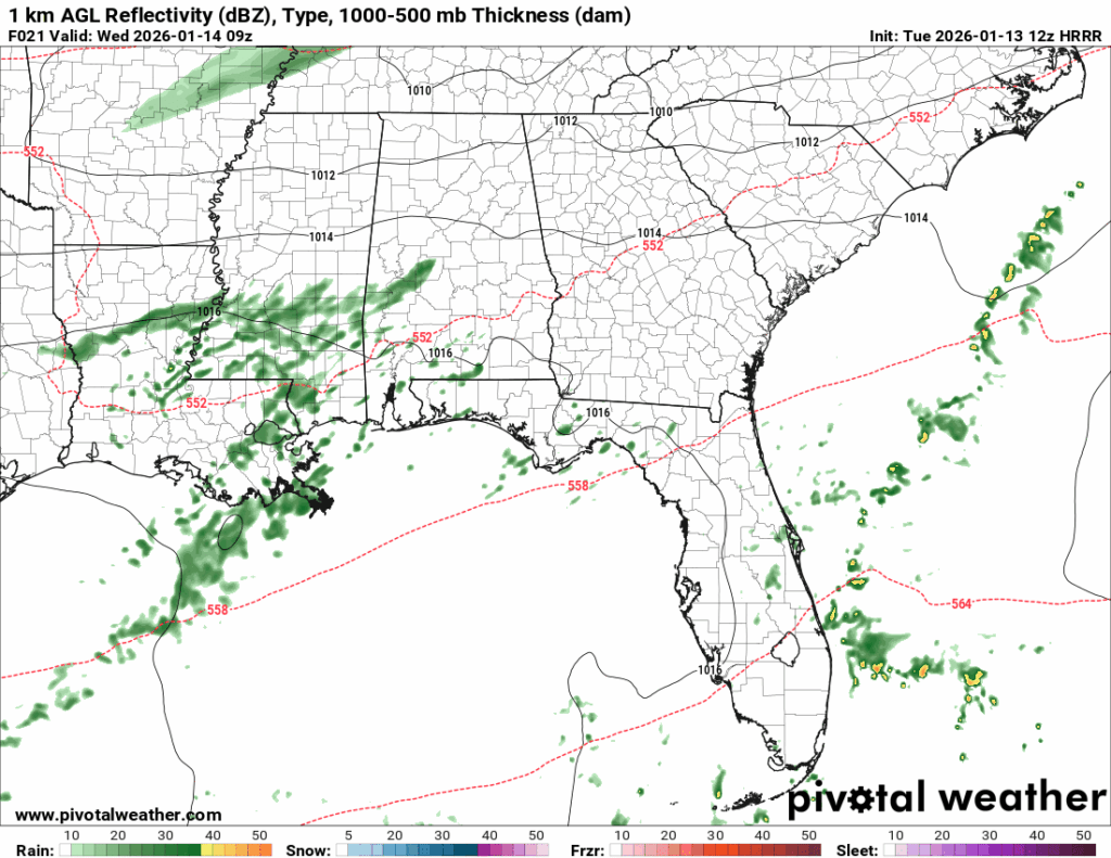
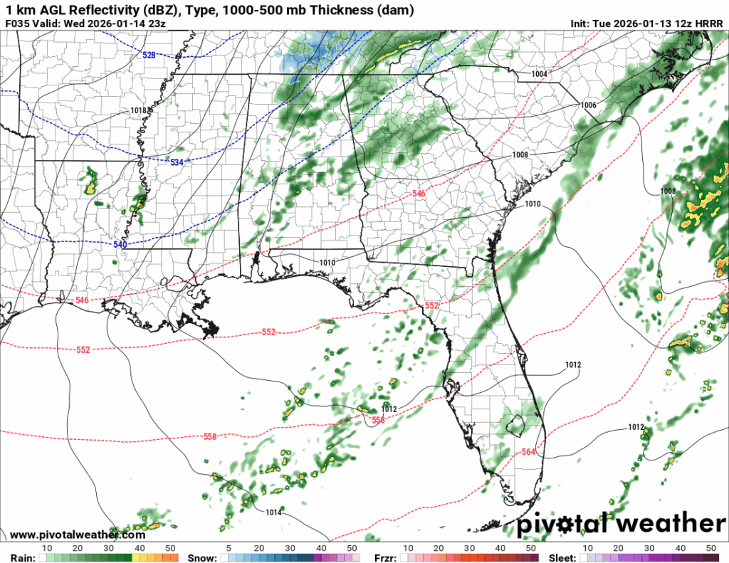
The HRRR has the rain sticking around throughout Wednesday, as well as more widespread coverage, whereas the NAM has some morning showers, and then the precipitation moves out. I favor the NAM in that the precipitation will not linger throughout the day, so have your raincoat ready for the morning.
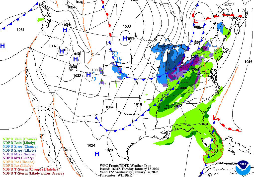
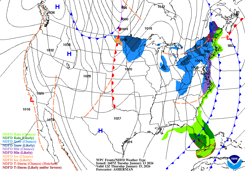
Looking at the surface map above for Wednesday, we can see the precipitation expected as well as two cold fronts that appear to be making their way down. These cold fronts could give us a run for our money with the punch they’re packing.
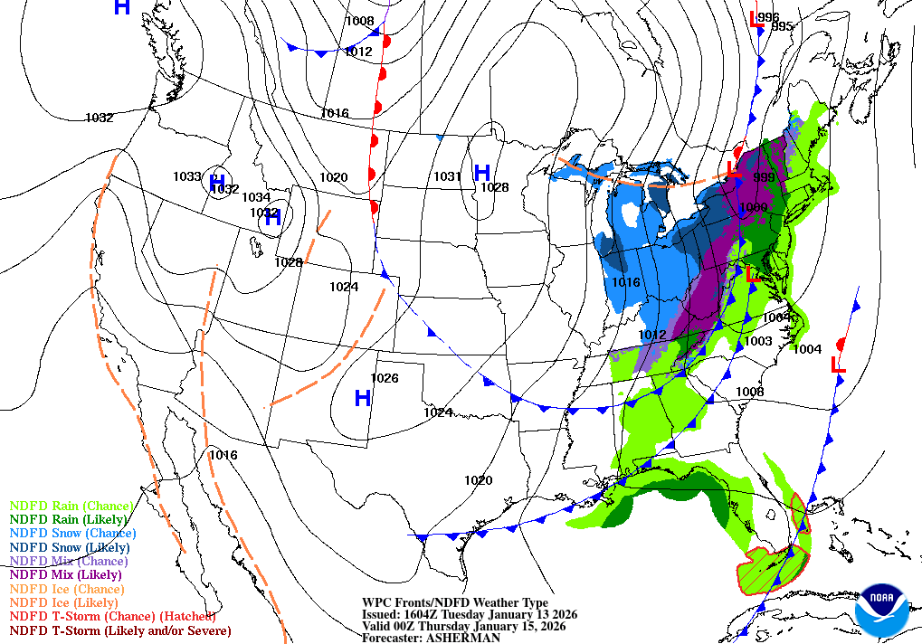
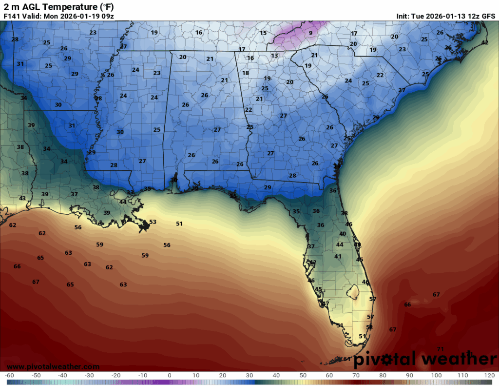
By Thursday, we will have received the cold fronts, leading to much cooler temperatures. Thursday morning temperatures will be in the mid-30s, with some locations possibly seeing freezing temperatures, and the high temperatures for Thursday will only reach the mid-40s.
Friday, the cold fronts are out of the region and temperatures return to the seasonal average, with highs in the low 60s and lows in the mid-40s.
For the rest of the week: Expect mild temperatures and rain tomorrow, but nothing too heavy. Thursday, prepare for those chilly temperatures and clear skies. By Friday, we will be back to the seasonal-average temperatures.
What does the weekend and start of next week look like for you?
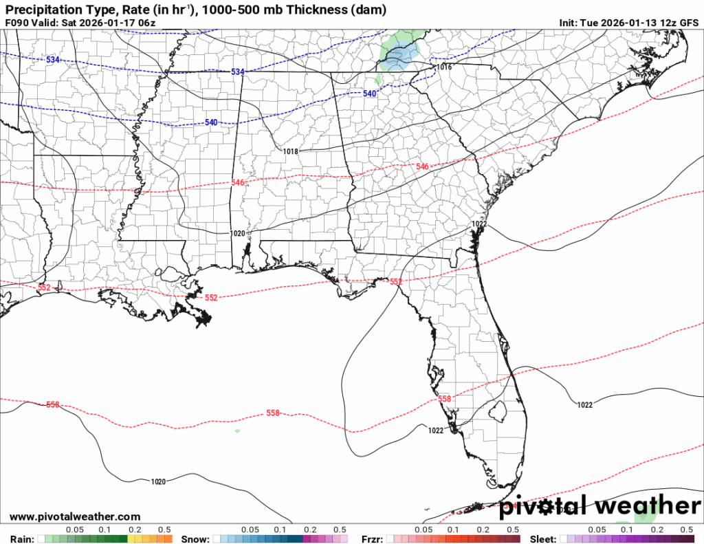
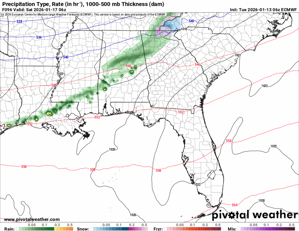
Rain, maybe? The GFS and ECMWF honestly do not like each other at this moment. They are disagreeing about a lot, but who doesn’t these days?
The chance of rain on Saturday is small, but not zero. There could be some scattered showers in the wee hours of the morning, but I would not change your Saturday plans because of it!
The GFS has cold shots of air reaching all the way down into northern Louisiana, while the ECMWF has it inching into north Mississippi and then fleeing, which is just a small disagreement… I am going to go with somewhere in between, so what does that mean?
The cold air that keeps intruding into the south likely will not get into northern Louisiana (sorry GFS), but mid-Mississippi is more plausible. So, we will still get those chilly temperatures, but likely not as cold as the GFS is predicting, or as warm as the ECMWF is predicting.
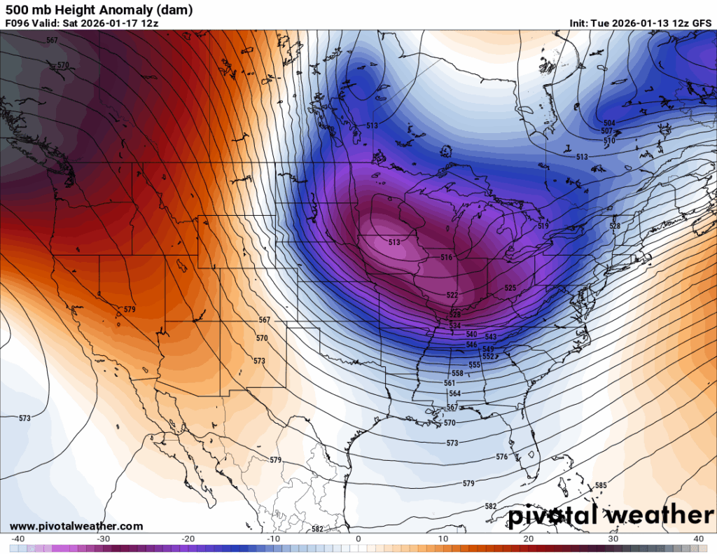
If you were curious as to why we keep getting these cold air shots, this is the 500mb anomaly for Saturday, and this pattern continues until Wednesday. This upper atmospheric setup of this large trough sitting to the north leads to these chilly temperatures we will receive.
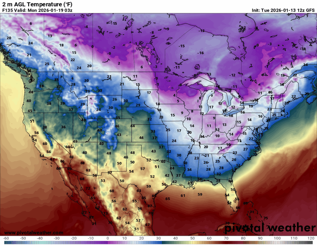
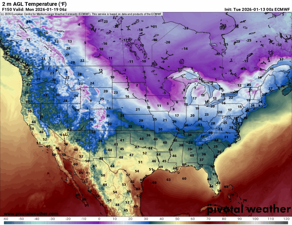
Sunday night and into Monday morning, we are getting a big shot of cold air due to that upper atmosphere setup and a surface low.
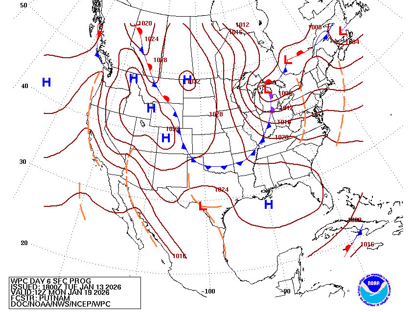
The surface low in Michigan, coupled with the upper atmosphere troughing, is giving us a big cold front.
Though those northerly winds are not super strong, the cold temperatures they are bringing in are. Now, I do think it is going to be freezing, but I also think the GFS is overestimating just how cold it will be. I think a couple of degrees warmer is likely.
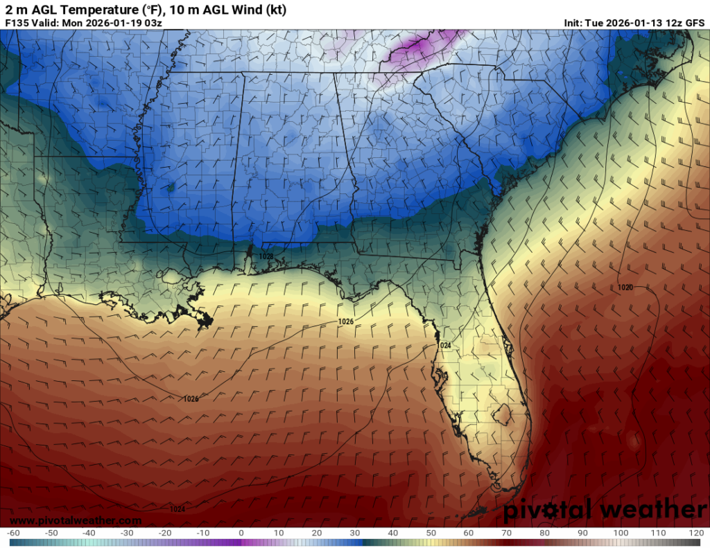
Monday, I would expect high temperatures in the mid-50s with low temperatures in the 30s, with some areas seeing freezing temperatures or slightly lower.
Following this cold front, a shortwave trough originating in the west gives us the chance for more widespread precipitation on Tuesday.
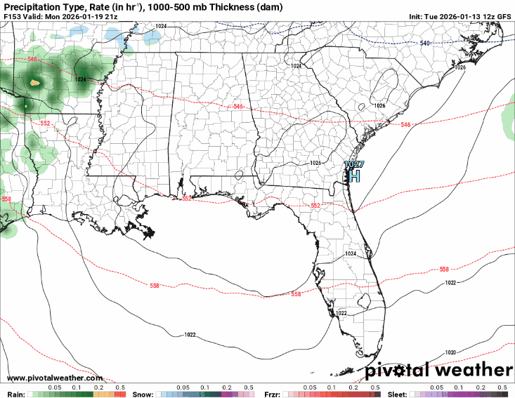
This system has the potential to bring heavy rain and possibly an isolated thunderstorm, since we are still in severe weather season, but for now just keep an eye out for updates as this is a week out and we will know more closer to the date.
To summarize: For the weekend, expect possible scattered showers early Saturday morning with chilly temperatures throughout the weekend. Highs from Saturday until Tuesday will range from the lower 60s to the mid-40s, and low temperatures from the mid-40s to low 30s. Sunday night into Monday will be the coldest temperatures for this period. Tuesday, expect chances for widespread rain and an isolated storm.
Looking past next Tuesday:
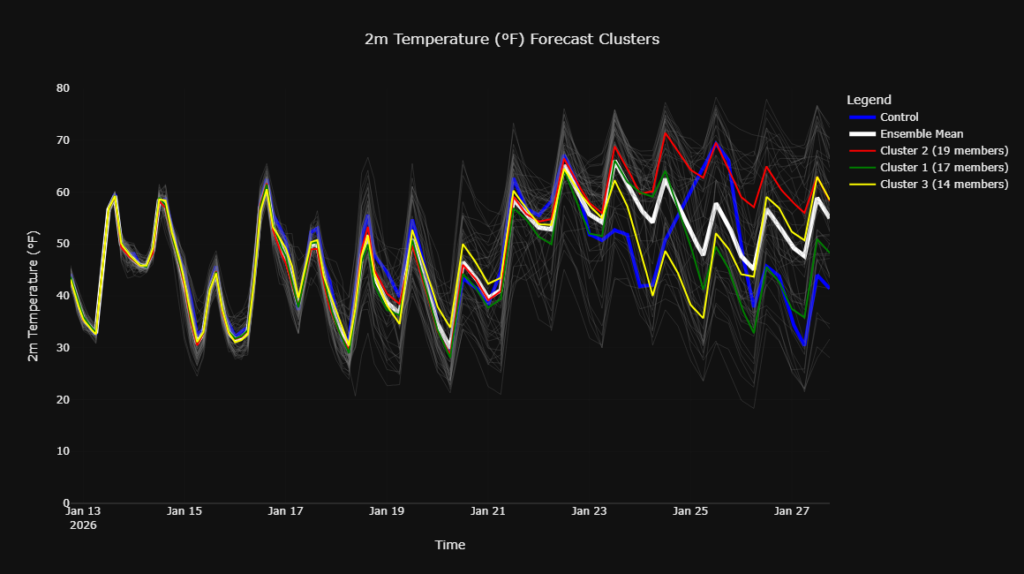
Starting next Wednesday, January 21st, we appear to be in a warming-up trend according to the ensemble clusters, but let’s verify this with some other models.
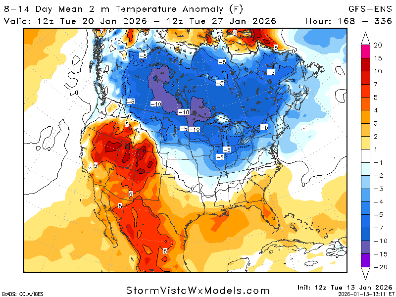
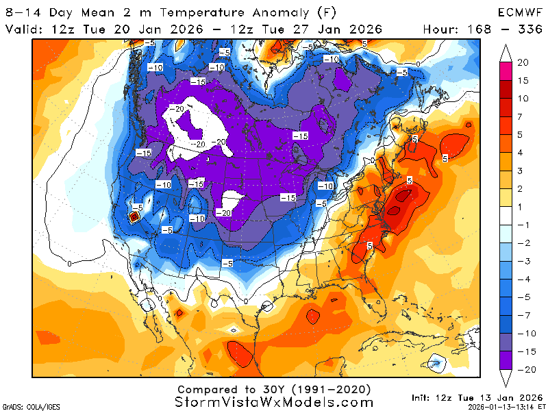
The GFS-ENS and ECMWF also agree with a slight warm-up, anywhere from one to four degrees above average for the region. That cold pocket of air is still prominent in the north and could dip down into the region, but we are likely in a ridge for this period. Let’s check!
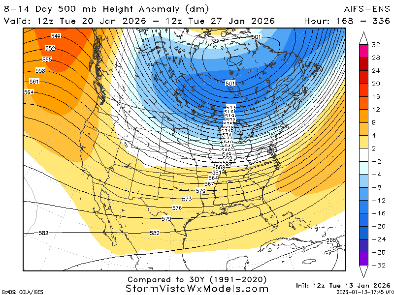
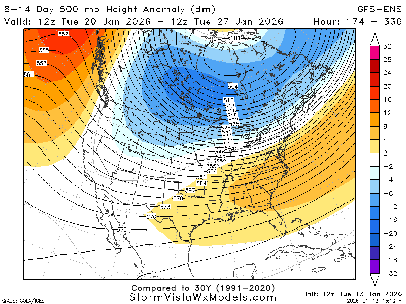
Yep! A ridging environment helps to moderate the temperatures by making conditions warmer during the winter. Almost all the long-range models agree that we will be in this slight ridging environment for this time period. The only difference between models is the strength of the ridge.
Although we are in this ridge, the trough centered north of us is pretty prominent, and if the right setup were to occur, we could have more cold air intrusions and precipitation.
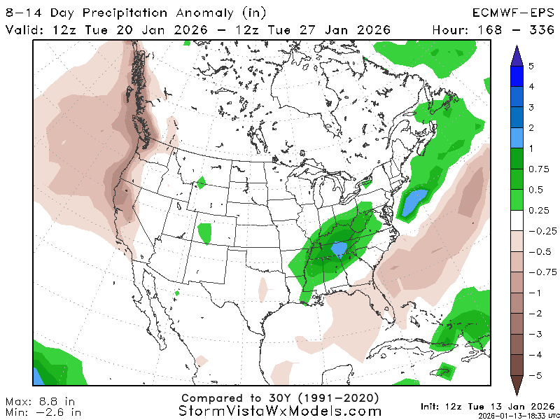
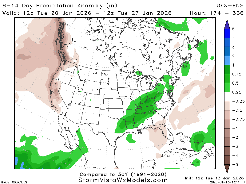
Now, you would typically not see these above-average amounts of precipitation in a ridging type of atmosphere because ridges are associated with high pressure, which is associated with lower-than-average amounts of precipitation, but here we are.
This region is right on the line between above-average amounts and average amounts of precipitation.
The reason for these totals of precipitation is likely due to the trough located to the north, causing low-pressure systems to arise and precipitation in the region.
Also, the ridge is shallow, meaning it is not super strong, and the stronger trough can have an effect on the region. There could also be a front or jet streak setting up in this area, causing instability, leading to precipitation.
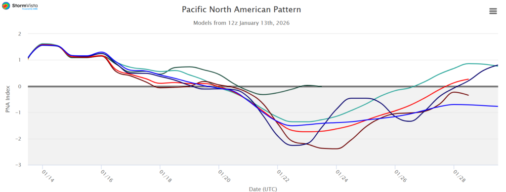
The PNA also agrees that temperatures will be warmer than average for this time frame. A negative PNA means warmer-than-average conditions.
For the week of January 20th through January 27th: Expect temperatures to be slightly warmer-than-average, but with the chance of cold intrusions. Also, be on the lookout for an above-average precipitation week in the surrounding areas that could impact this region. I would anticipate temperatures in the low to mid-60s with higher-than-average rain chances.
From late January into early February:
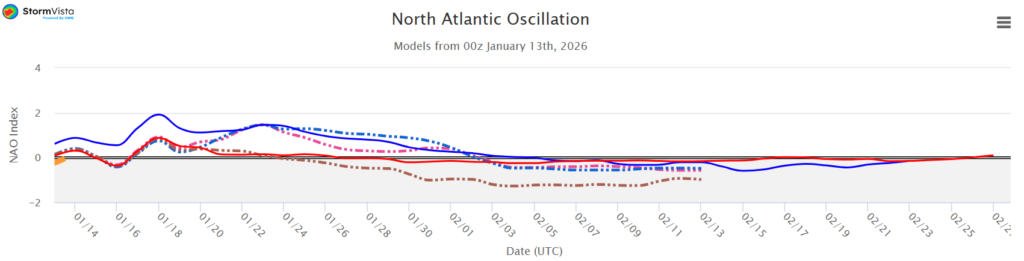
Looking at the NAO from January 28th and beyond, it starts slightly positive and then becomes pretty much neutral or slightly negative. This means we will start a little warmer than usual and then fall back to near average or slightly below average by February 1st.
Remember, this is a teleconnection based on climatological data, which means just because the NAO says it is going to be this temperature does not mean it is fact. There are tons of factors that influence every part of the weather!
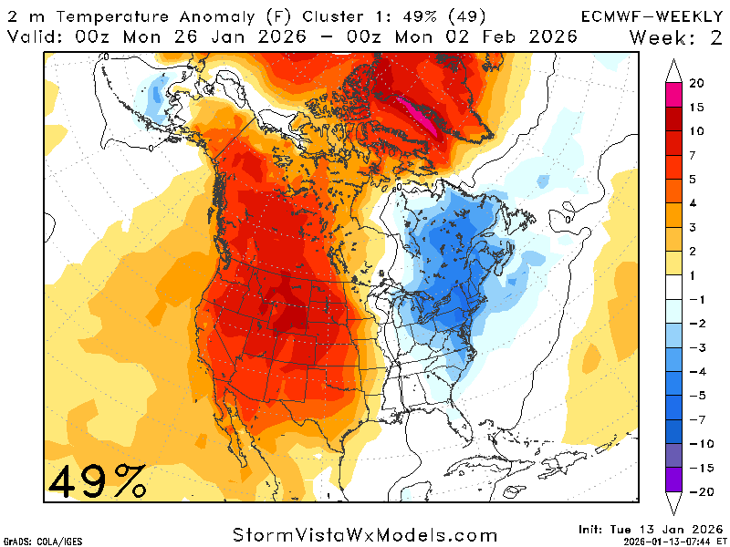
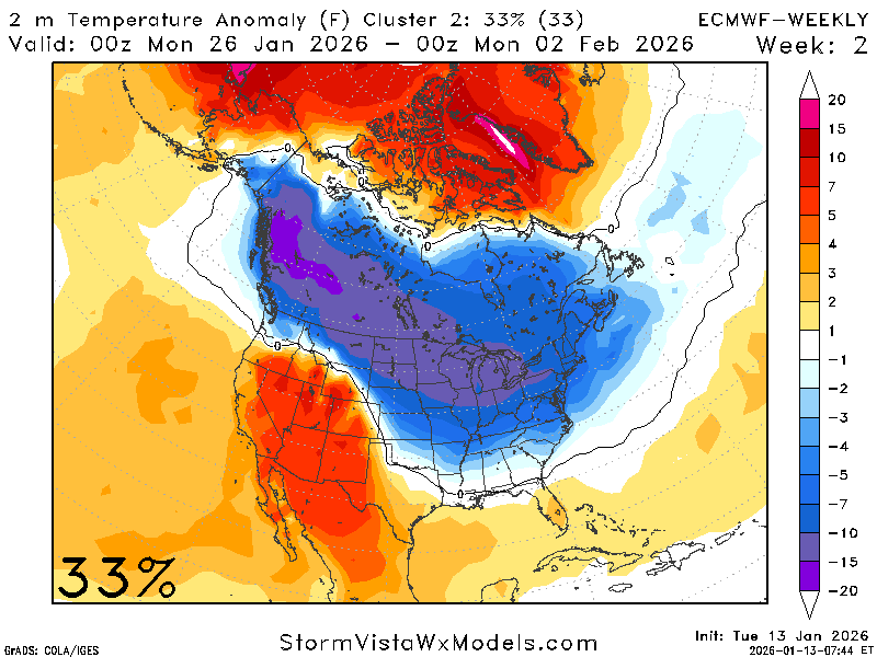
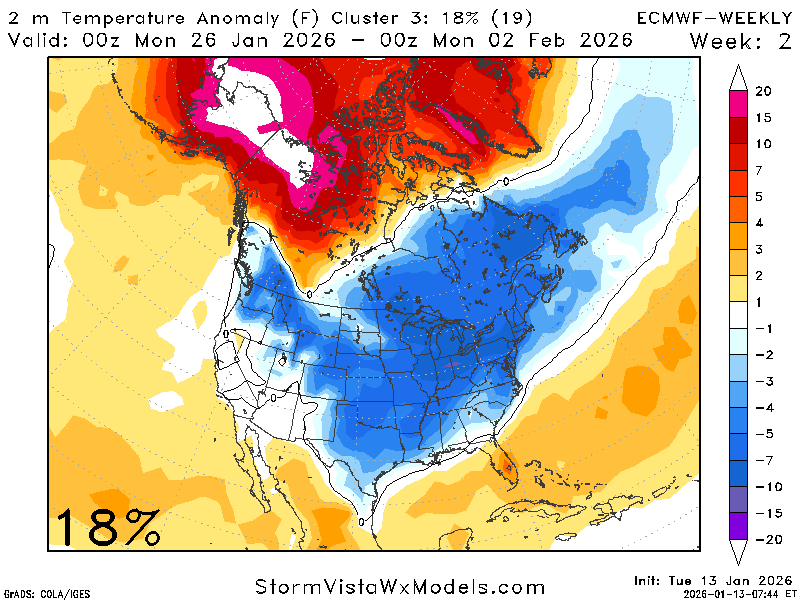
The ECMWF weeklies are in agreement with the NAO. The ECMWF weekly says there is a ~80% chance of average temperatures with a ~20% chance of below average temperatures. The NAO is predicting around the same thing!
My opinion is slightly cooler-than-average temperatures for this period, around 1-2 degrees less-than the average.
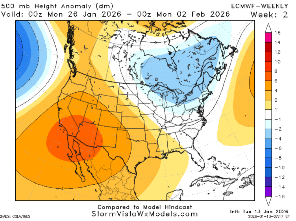
It looks like we are still in that ridging atmosphere, which is why the temperatures are around the average for this period, as high-pressure moderates the temperature. If there are no other forcing mechanisms at play here, we should see average to below-average QPF for this time frame.
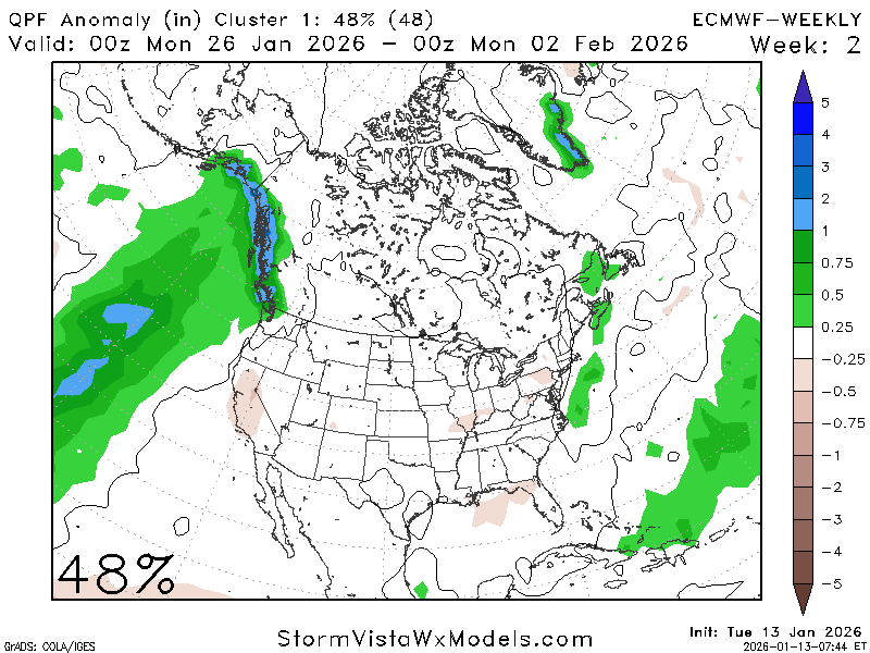
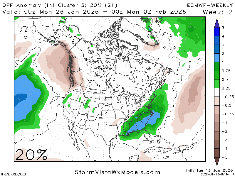
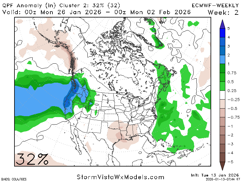
We are again in that 80/20 split like we were for temperature. There is an 80% chance that precipitation will be average to below-average for this time period, and a ~20% chance that it will be significantly above-average. The trough up north is not as prominent as it was before, so the chances for cold air intrusions and precipitation are fewer.
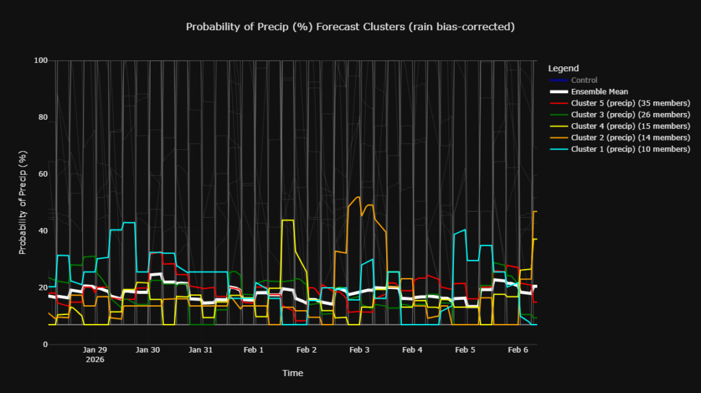
The ensemble cluster for precipitation agrees with the ECMWF weekly; there are average chances for precipitation during this period, with no abnormal spikes or lulls.
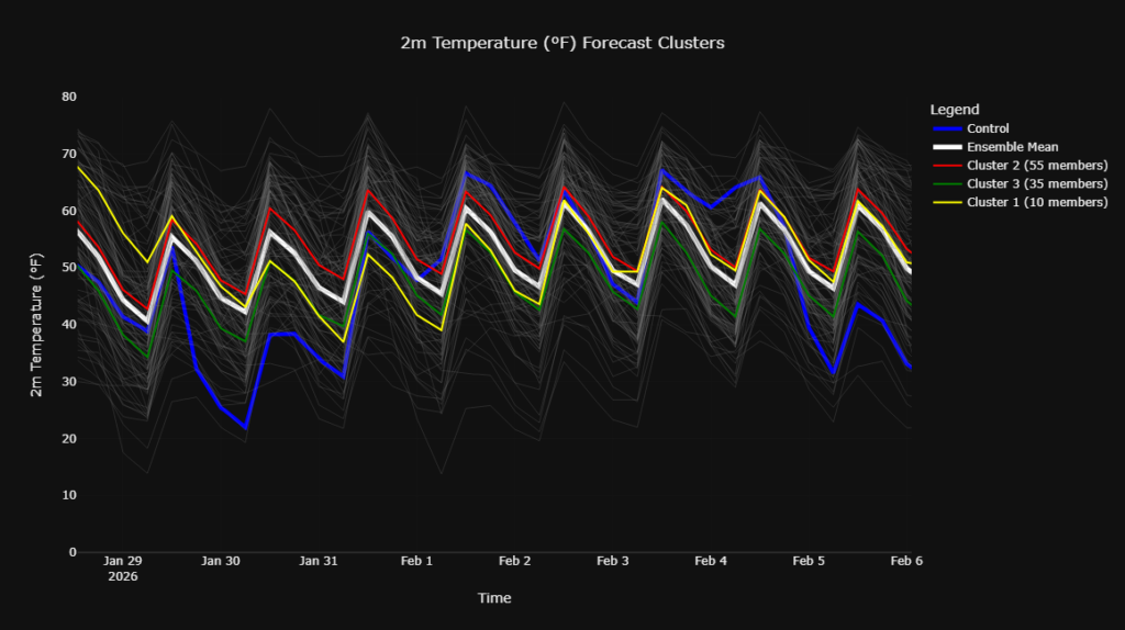
Same story for the ensemble cluster of temperatures, they are trending average, with some members slipping to below or above average.
All in all, for January 28th and beyond: Expect average to below-average temperatures, with below-average chances of precipitation. There does not appear to be any strong chances for winter precipitation or huge shots of cold air at this point, but that could change!


