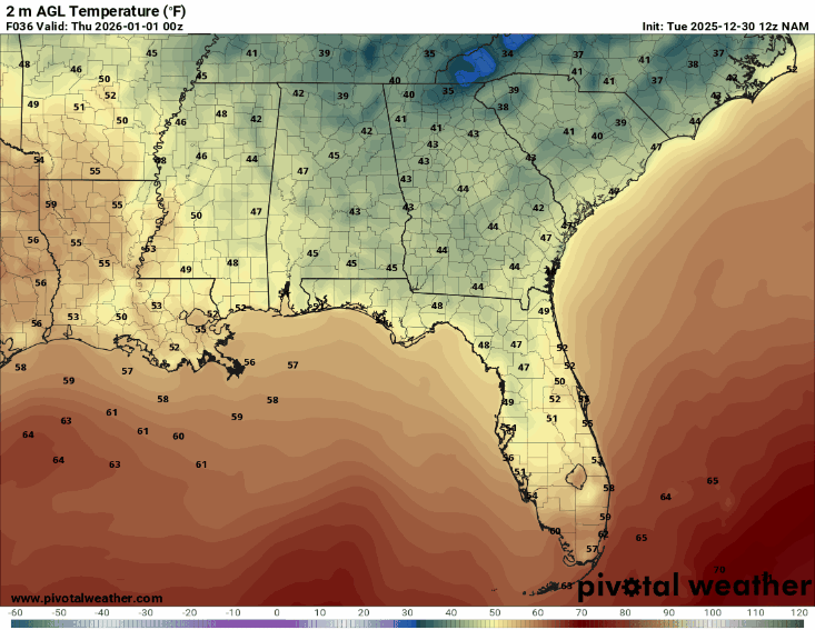
Good Afternoon and a Happy Tuesday to you all! I am sure the cold temperatures this morning woke you up for your commute to work! High temperatures today will range from the mid 40s to low 50s, but temperatures will drop to near or below freezing overnight and into Wednesday morning.


From our 2m temperature map above we can expect near-freezing or freezing temperatures again tomorrow morning, with afternoon highs in the mid-to-upper 50s.
If you have any plans for New Year’s Eve night, bring a coat, as it will dip into the mid-40s. Waking up on the first day of the new year will be chilly, but temperatures will warm quickly into the mid-60s. So, if you have the New Year off, get outside!
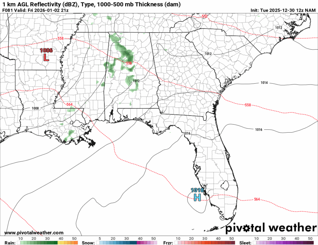
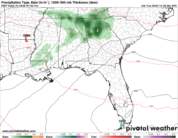
Friday will have warmer temperatures overall, with lows in the upper-50s and highs in the upper 60s. There is a chance of showers on Friday afternoon due to a low-pressure system passing by.
For the next three days, expect chilly mornings with gradually warming afternoon temperatures.
Heading into the weekend:
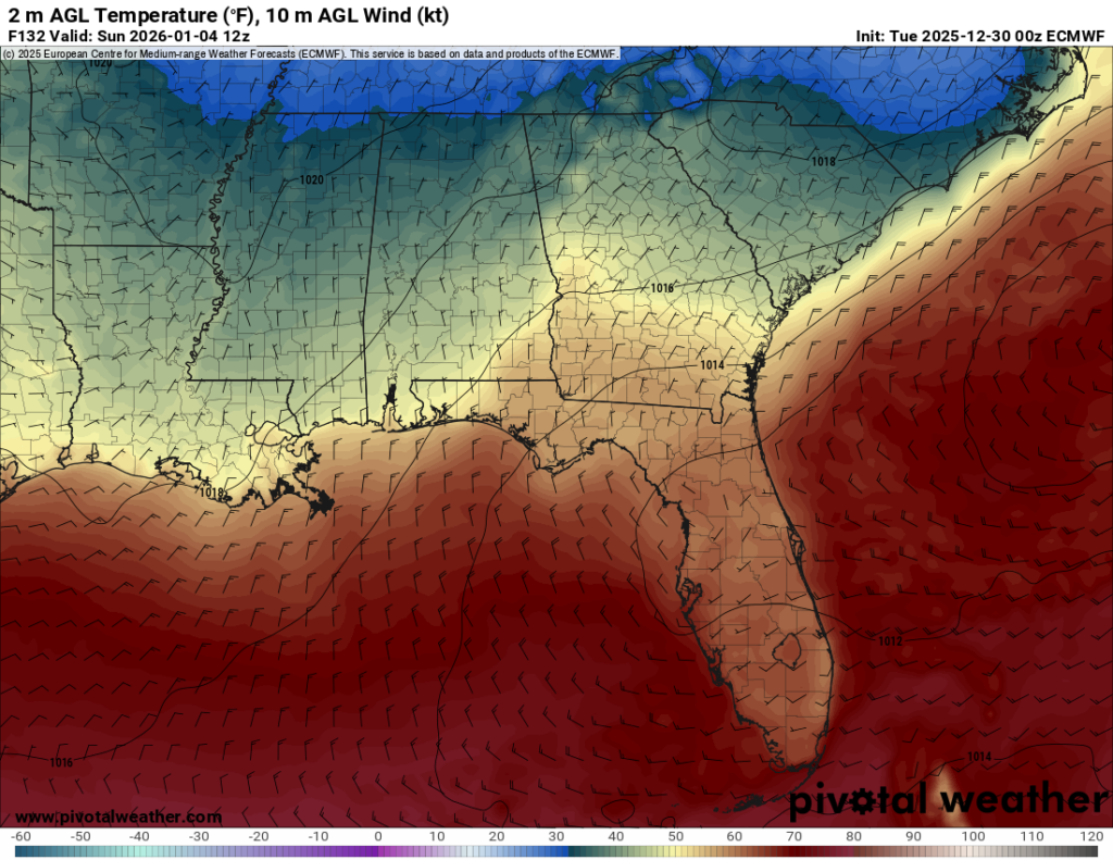
Ahead of the precipitation chances Friday night, we are in the warm sector of the low-pressure system, resulting in Friday afternoon highs ranging from the upper 60s to the low 70s. The chances of showers on Friday will persist throughout the night and into Saturday morning.
While colder air typically follows behind the frontal passage, this is not always the case, and it is not the case in this setup. The air mass behind this cold front is simply not cold. So, little cooling will be expected behind the front.
For the remainder of the weekend, expect high temperatures in the mid-to-upper 60s, and low temperatures in the low-to-mid 50s. Overall it should be a nice weekend, with a high pressure building in the Gulf, giving us moderate temperatures, enjoy the outdoors!
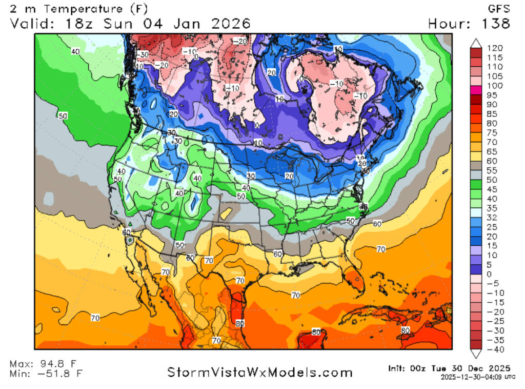
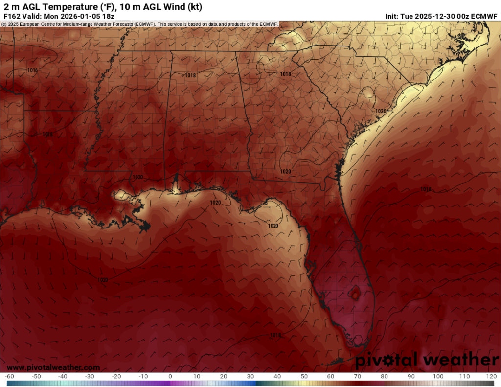
To start the first full work week of the year conditions will remain warm with minimal variability in temperatures. Highs on Monday and Tuesday may reach the low 70s, but will likely remain in the upper 60s, with the overnight lows only falling into the upper 50s to low 60s.
The primary driver for these warm temperatures and lack of variability is due to the shift in the wind. The wind flow will shift from northerly on Sunday to southerly by Monday. A southerly flow brings that warm, moist, Gulf air into our region and moderates the temperatures.
In brief, expect showers from Friday night into Saturday morning, followed by warmer weather throughout the weekend and into the upcoming workweek, with minimal variability due to the southerly winds.
Going into the first full work week of the year:
Looking out toward that first full work week, it is looking warm, but how confident are we with chances of it being warm?
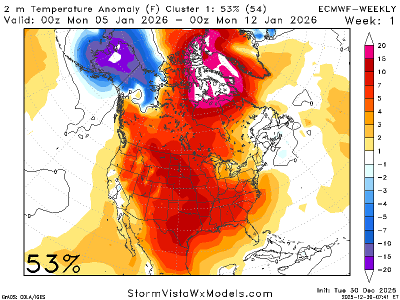
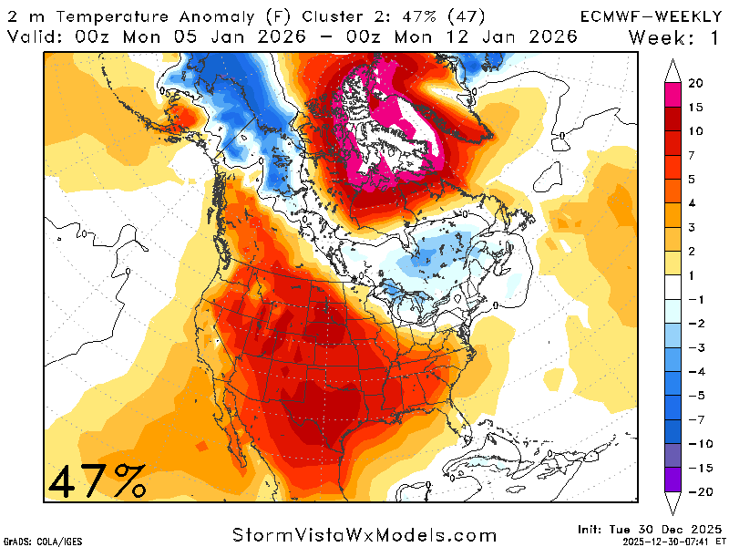
Well… it’s going to be warm, at least according to the ECMWF. We can use additional models and teleconnections to help determine the likelihood of these patterns.
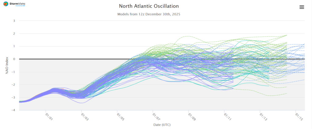
The NAO is trending positive during this time frame, which agrees with the ECMWF regarding warmer conditions. A positive NAO favors the probability of above-average temperatures for our area. Using both the NAO and the ECMWF the confidence is high for above-average temperatures.
We will likely see temperatures about 5-7 degrees above the average for this time of year. So, expect highs in the mid-to-upper 60s with lows in the mid-40s.
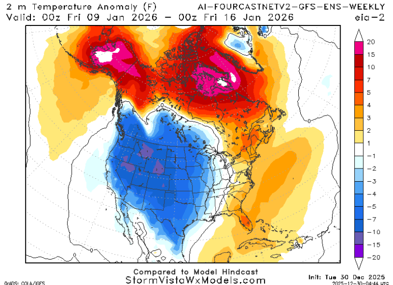
Looking at precipitation, it appears there could be a couple of opportunities for rainfall.
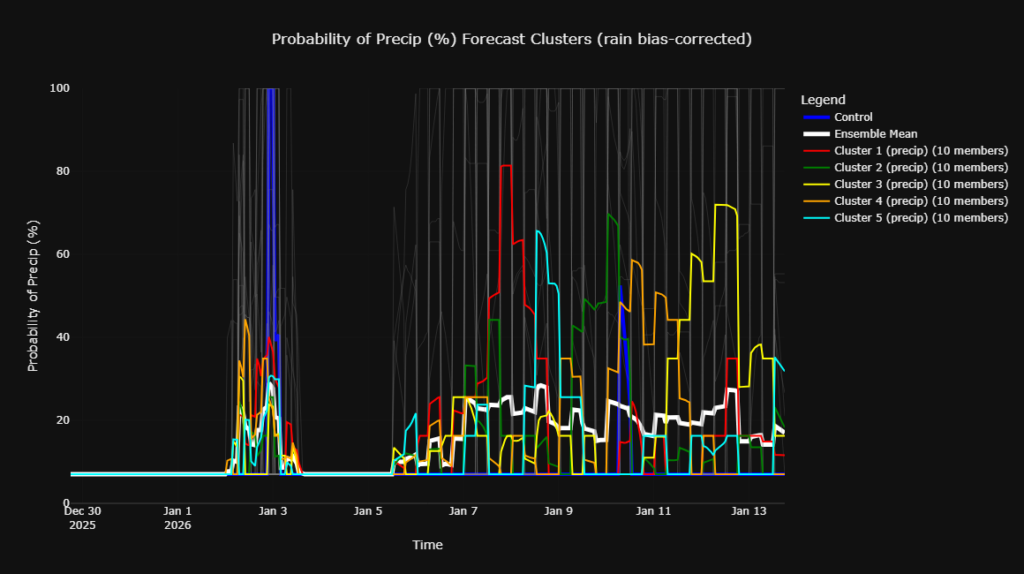
We can see a spike in the majority of members on January 3rd, associated with the front, followed by another increase in members around January 8th. Where a large number of the members increase, indicating a higher-than-normal probability of precipitation.
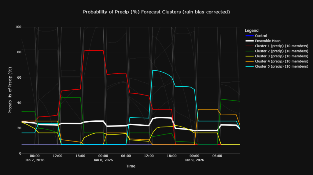
Zooming in, we can see a decent number of models are predicting around a 20-40% chance of precipitation, with a few outliers suggesting probabilities up 80%. I would place the overall odds of precipitation for this three-day timeframe is about 25%.
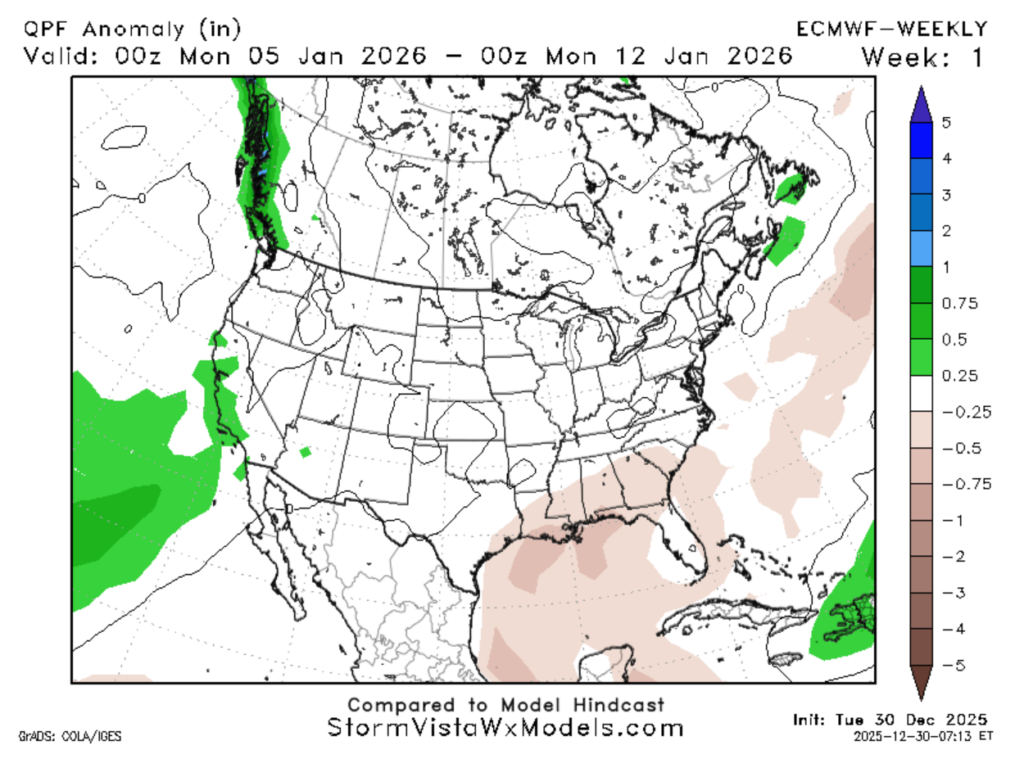
The majority of the models are still forecasting for a below average week of precipitation, though there does remain around a 20% chance of average precipitation. While the confidence is limited in the precipitation forecast, I am favoring a near normal precipitation week.
To recap the next week: expect warmer-than-average temperatures with some chances of precipitation.
Looking out into the second week of January:
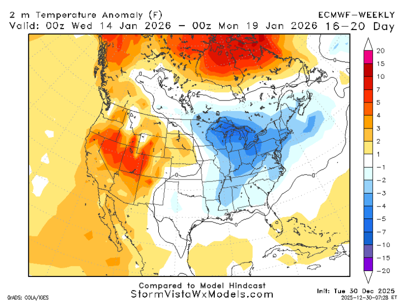
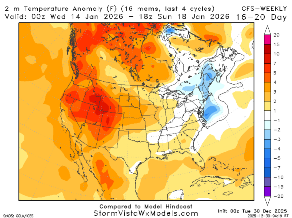
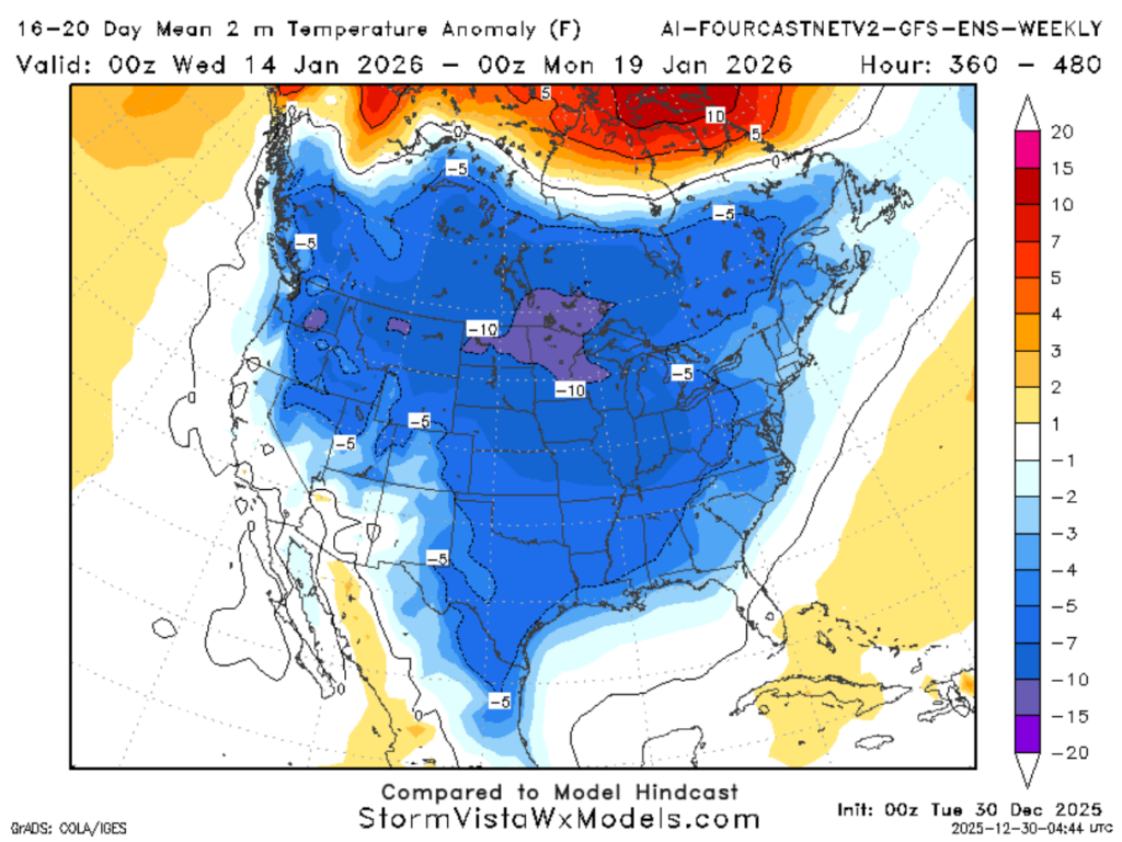
Going out further, there is some disagreement between models regarding temperature trends. We are seeing a wide range of solutions between them, the ECWMF indicating near-average temperatures, the CFS suggesting slightly above-average temperatures, and the GFS is showing much colder-than-average.
Why would this happen? This type of disagreement is likely tied to a pattern that occurs over Alaska, which can play a role in the temperatures in this region.
If we have a colder-than-average Alaska, it will be warmer-than-average in the region. If we have a warmer-than-average Alaska, it will be colder-than-average in the region. Currently, the models are in disagreement about what pattern will take shape in the second week of January.
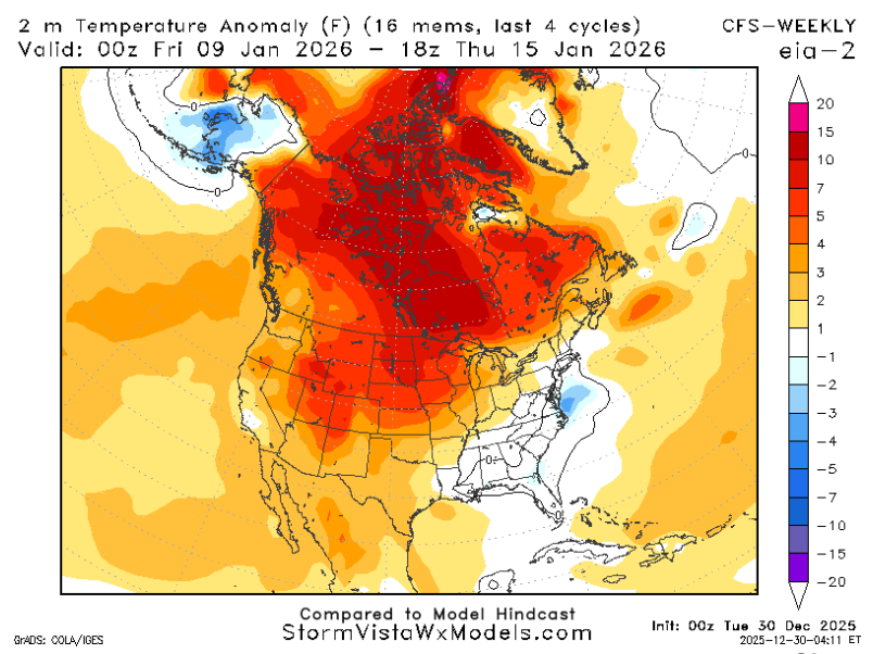
These two models show the disagreement between the temperatures and setup in Alaska. While the CFS has a cold Alaska and average or slightly-warmer-than-average temperatures for our region, the GFS has the opposite.
This set-up has to do with another teleconnection the Pacific North American pattern (PNA). A positive PNA leads to a cooler southeast and a negative PNA leads to a warmer southeast.
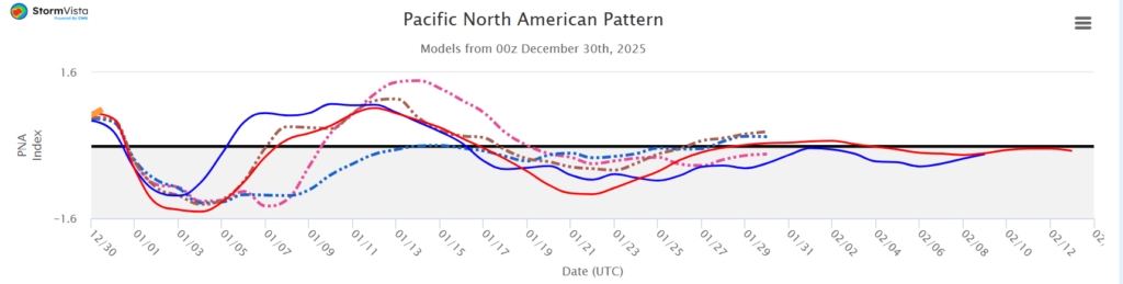
The PNA is trending positive, which leans toward cooler conditions.
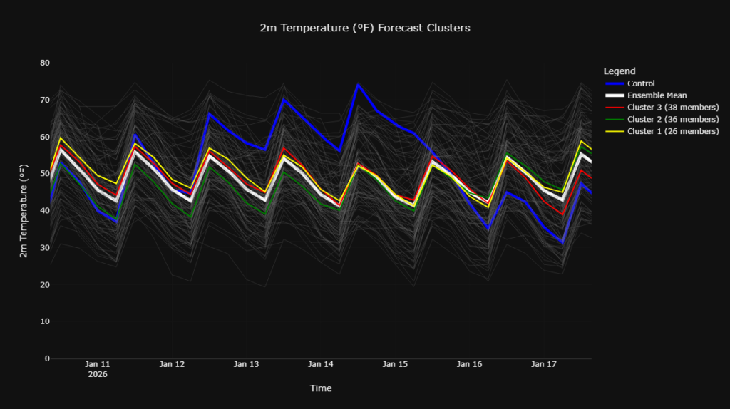
Most members are trending average to cooler-than-average with one anomaly. In my opinion, I think the chances are greater for cooler-than-average temperatures within this time frame.
Chances for precipitation right now are about a 60/40 split with chances favoring above-average precipitation versus below average, I agree with this spilt.
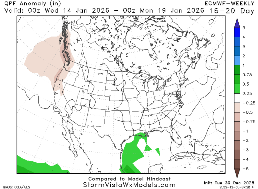
I do not expect either of the absolute extremes to occur where it is crazy cold or crazy warm, unlike some of the models (the GFS-ENS and ECMWF-EPS), that are predicting a big shot of cold air. I am leaning towards slightly cooler-than-average temperatures with higher chances of precipitation. Temperatures within the mid-to-upper 50s with 0.25-.5 inches above-average for precipitation.


