Good afternoon and Happy Friday! High temperatures today will reach the upper 60s, with some areas even seeing the low 70s. There will not be much of an overnight cool-down as we are within the warm sector of a passing low-pressure system. As this system moves through, scattered showers will return this afternoon and continue into Saturday morning.
There is no severe threat expected with these scattered showers. Just periods moderate rain and possibly a rumble of thunder.
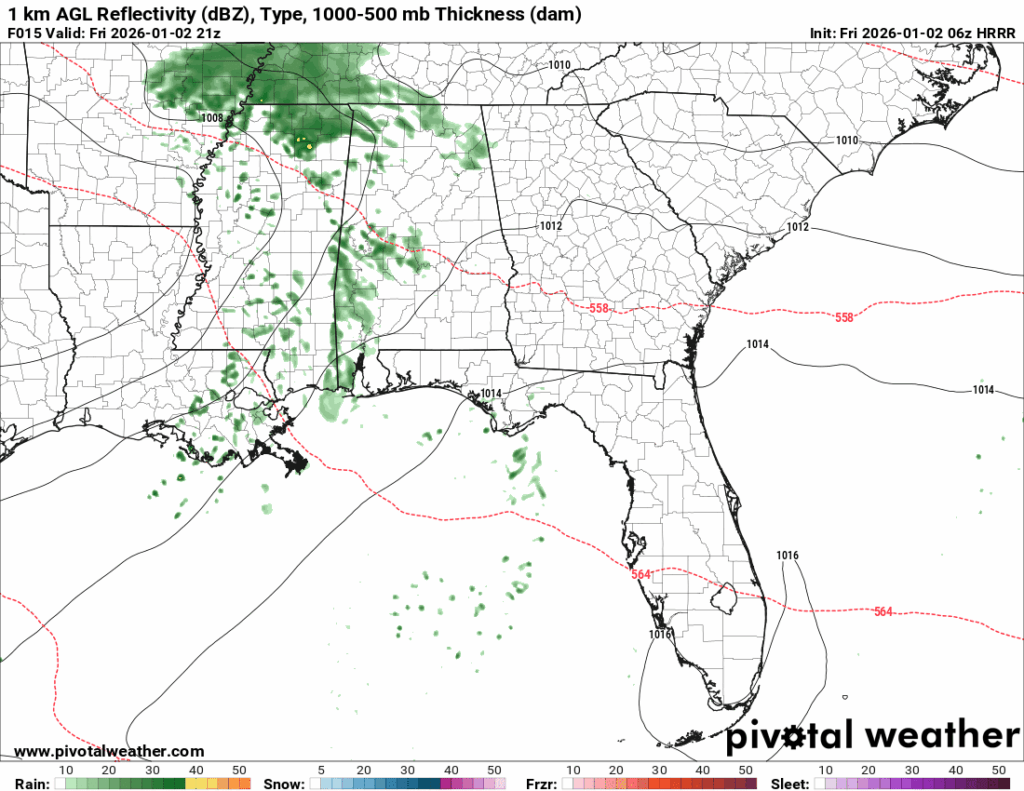
As the system moves through the region, a few showers may linger throughout Saturday. However, the coverage will remain limited. It should not be a total washout tonight or tomorrow, but keep a raincoat handy just in case.
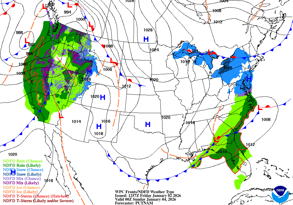
From the surface analysis maps, we can see the low-pressure system moves completely out of the area by Sunday. This explains why a few scattered showers may stick around Saturday, though widespread precipitation chances are slim.
Temperatures on Saturday will be in the mid-to-upper 60s, with an overnight low falling into the low 50s. Sunday will have highs in the upper 50s and lows in the upper 40s to low 50s.
So, for your weekend, expect cloudy conditions with chances of rain lasting throughout Saturday and high temperatures in the upper 60s. By Sunday, expect chilly temperatures with sunny skies.
Starting off next week:
Starting out on Monday, we begin to enter a more ridge dominated atmosphere, and this pattern is going to stick around until Thursday. We also start to see persistent southerly flow off the Gulf, bringing in warm temperatures and moisture.
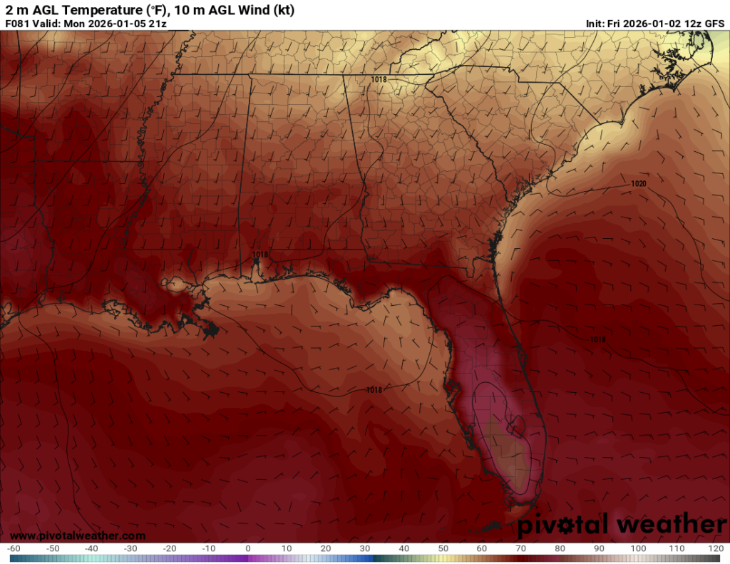
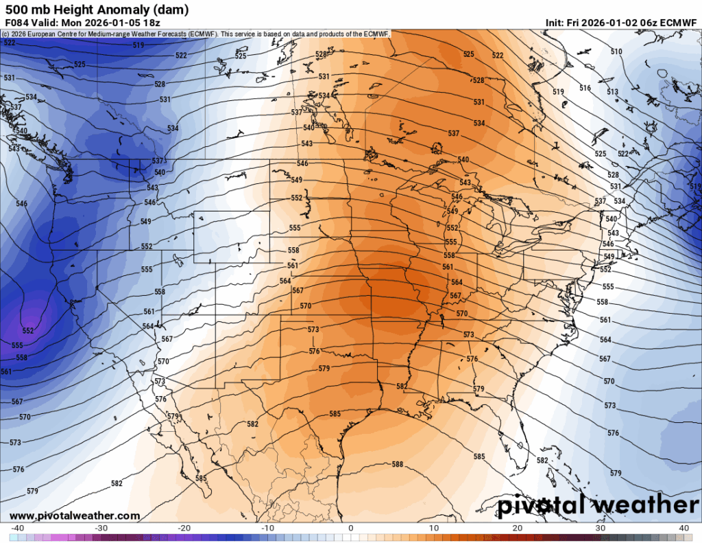
Combining both the southerly flow and the ridging pattern aloft, we will experience much warmer-than-average temperatures, a lack of precipitation, and little variability in temperatures until Thursday.
From Monday through Friday expect high temperatures to be in the upper 60s to low 70s, with low temperatures in the upper 50s to mid 60s, and precipitation chances increasing by Thursday.
Thursday is when the chances for precipitation begin to ramp up. In my last post, I said the models were disagreeing, and they continue to show significant differences in the track of the system.
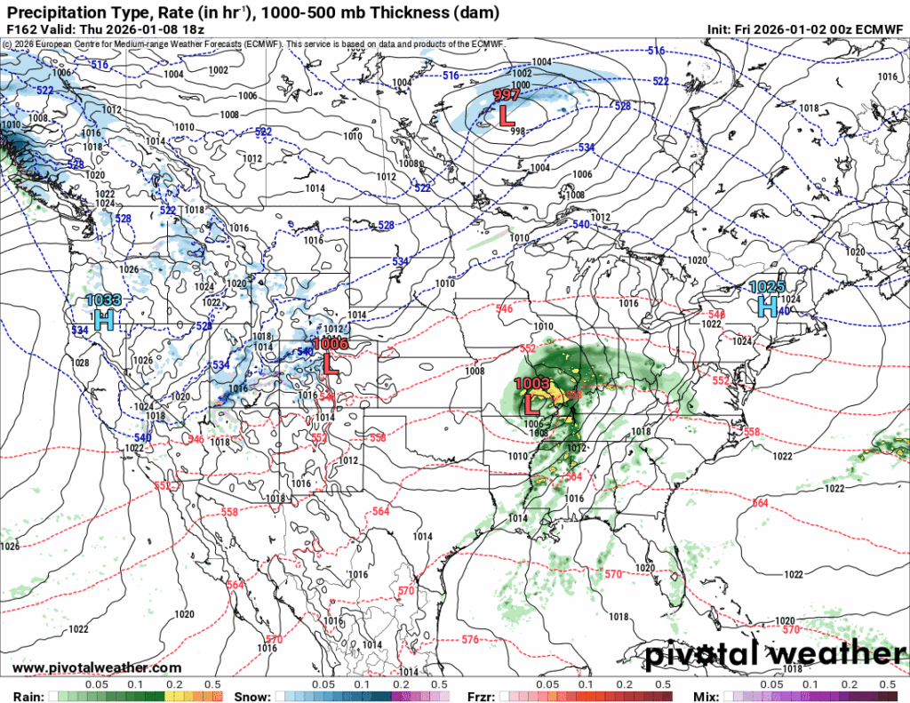
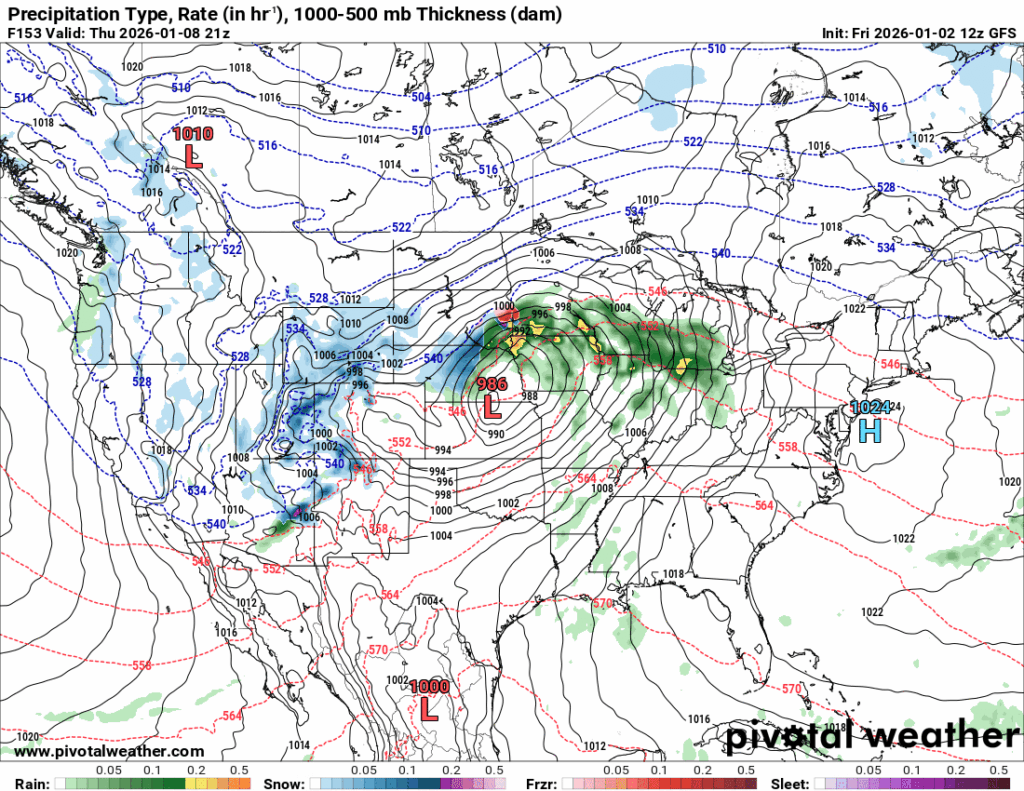
The ECMWF is still tracking the low-pressure through southeast Missouri, while the GFS has the system farther west in Kansas and Nebraska. These difference in track lead to different impacts for this region.
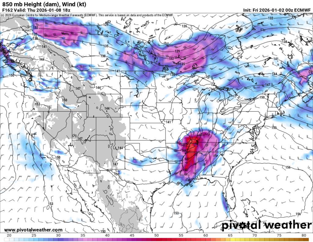
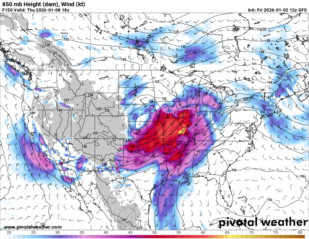
This is the 850mb height and wind map; it is a valuable tool for looking at the low-level jet, which plays a key role in determining system severity. The low-level jet adds moisture, instability, and momentum into the lower levels, which greatly impact weather conditions.
If we look at the map on the left, the ECMWF, the reddish-purple color indicates the strongest winds and place them closer to our region, suggesting a greater impact. Whereas in the map on the right, the GFS, our region is in more of a blueish purple color, suggesting less of an impact.
Now, I am by no means saying we are going to have an extreme severe weather day on Thursday, but I am saying the potential impacts change based on the track of the system, and it is something to continue monitoring.
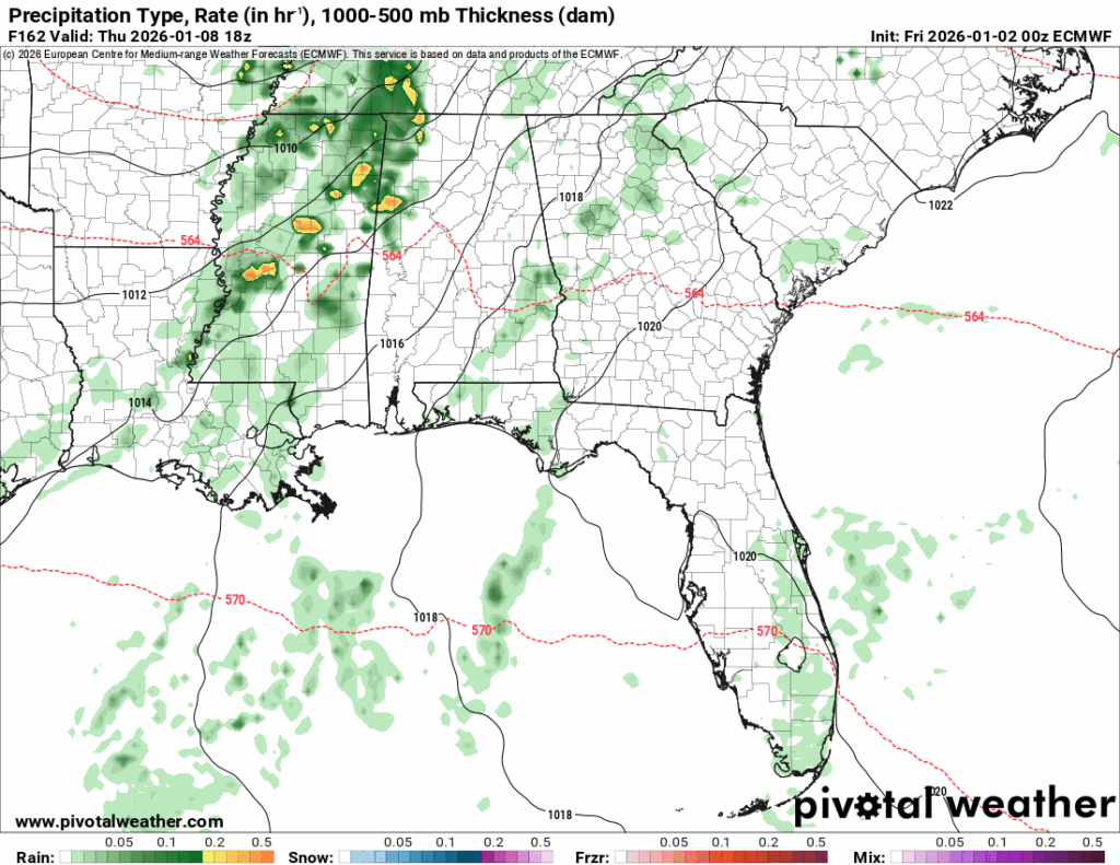
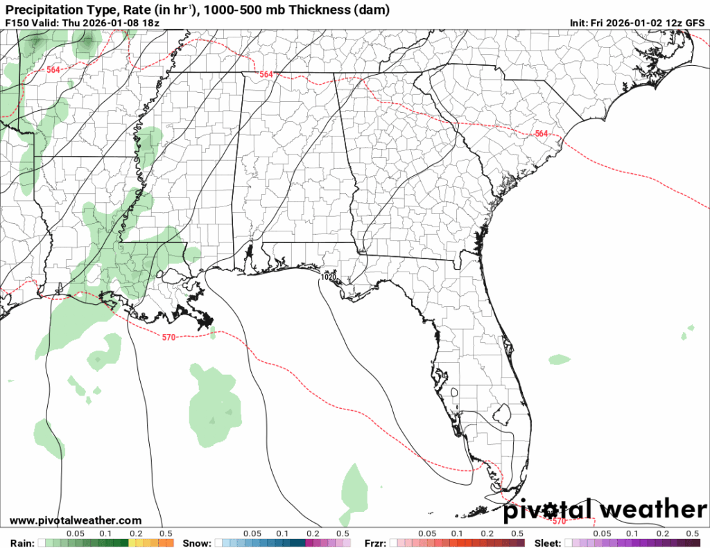
My expectation for Thursday, at this point, is showers with the chance of an isolated thunderstorm or two. I am not expecting storms within severe criteria, but more than just a couple of rain showers. We are still six days out, with models disagreeing, so this could all change. Just keep an eye out for updates!
So, for the week, expect Monday through Wednesday to have generally calm, and mostly clear conditions with above-average temperatures. Thursday will be warm with showers and a chance for an isolated thunderstorm or two. Friday will be warm again, with the chance of showers throughout the afternoon.
Next weekend and into the week:
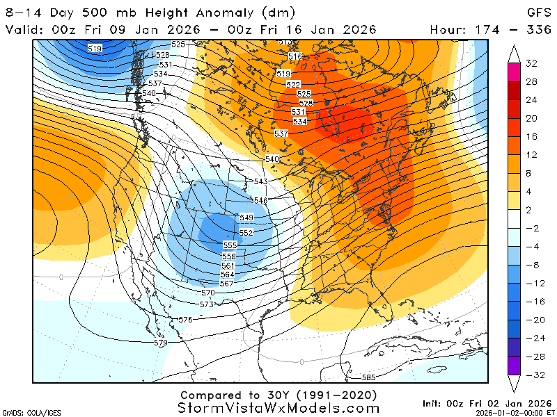
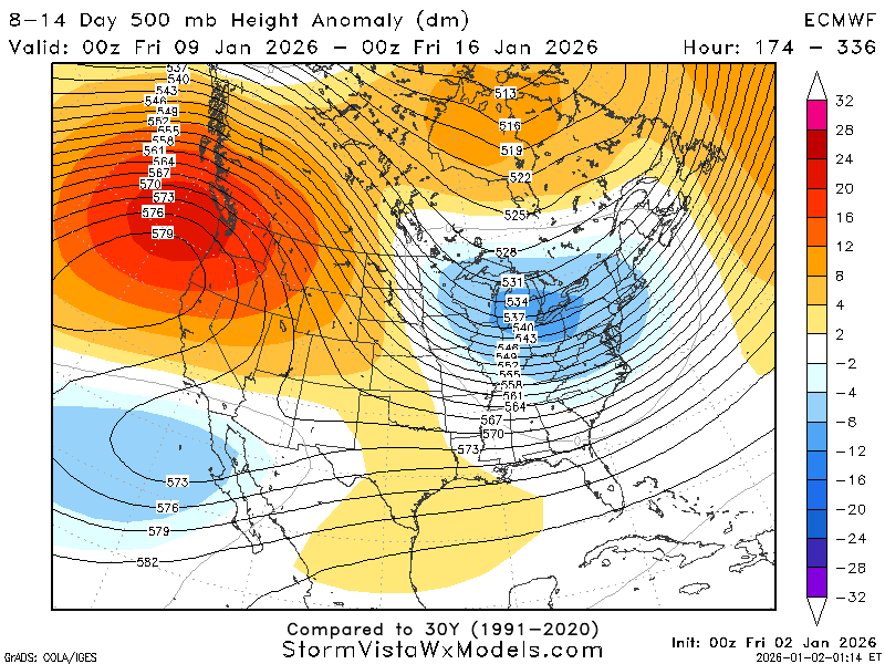
The ECMWF and GFS just are not getting along recently… Looking at our 500mb maps, they are showing opposite setups. While the GFS has us moving into a more trough-dominated atmosphere, the ECMWF has the trough moving out of the area. Since the models are not in agreement, let’s look at the heights in more detail.
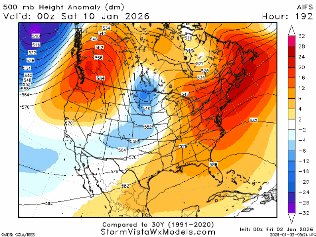
It’s easy to see why they are disagreeing; the pattern is a bit chaotic. It appears a large trough is coming through on Sunday, January 11th, followed by a weaker ridging pattern, but with continued influence from the trough above.
I would expect temperatures to fluctuate during this period due to this big transition. Temperatures will be on the warmer-than-average side until this large trough on the 11th, and then I would expect them to drop to cooler-than-average. This transition will also affect precipitation, with the trough likely bringing precipitation into the area.
Taking a closer look at the trough:

It is located almost directly north of the area on the 11th, meaning precipitation associated with this system is likely on the 10th and 11th as it moves approaches and moves through the region.
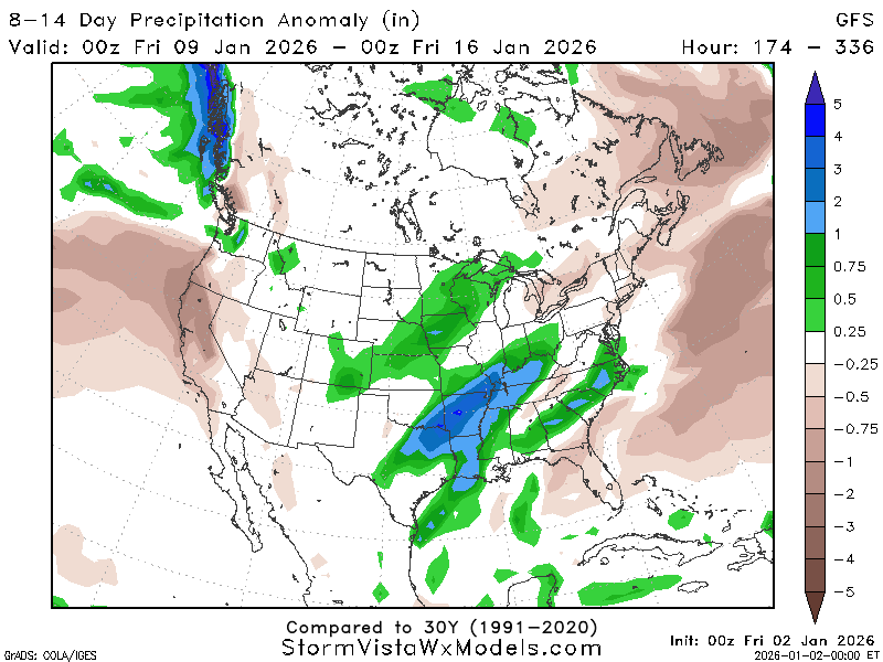
It appears our precipitation for this week is ranging from normal to 1 inch greater than normal for the region. I would expect a significant amount of precipitation to come with this storm based on its current setup, but as always, this can change.
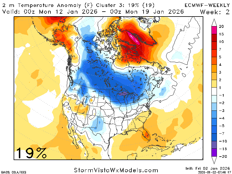
To get a good overall look at things, we can look at the ensemble clusters.
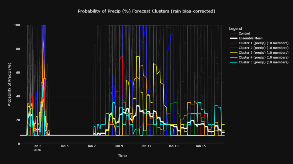
We can see a spike in the ensemble members for the trough around January 10th. Zooming in on January 10th for precipitation chances, I would assign roughly a 40% chance of precipitation according to the clusters and the other data. Precipitation chances through the rest of the period remain around average.
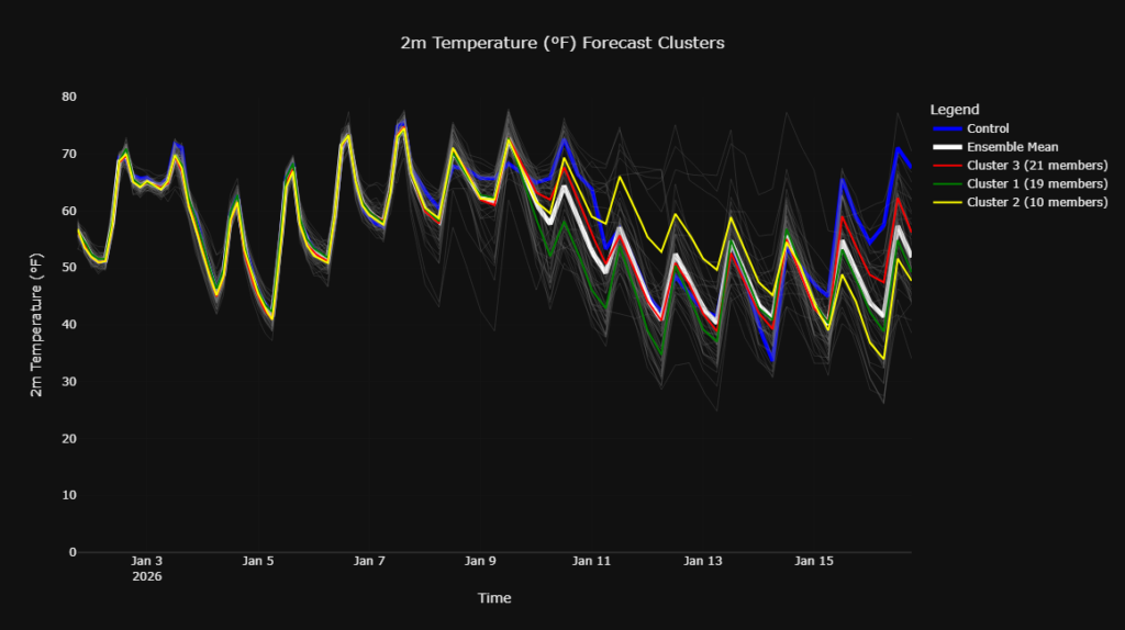
Temperature clusters are also showing a pattern. Warmer than average until the trough passes on January 11th, followed by a cooldown with most the members agreeing on average to below-average temperatures.
In summary, for January 9th through January 16th, expect fluctuations in both precipitation and temperature. Precipitation chances and temperatures will be above-average at the beginning of the time frame, then decrease. By the end of the period, precipitation chances fall to normal, and temperatures fall to slightly cooler-than-average.
Looking out beyond the 16th:
If we take a look out further, we can see a 60/40 split for near-normal to greater-than-normal amounts of precipitation, warmer-than-average temperatures, but chances for cold intrusions cannot be ruled out.
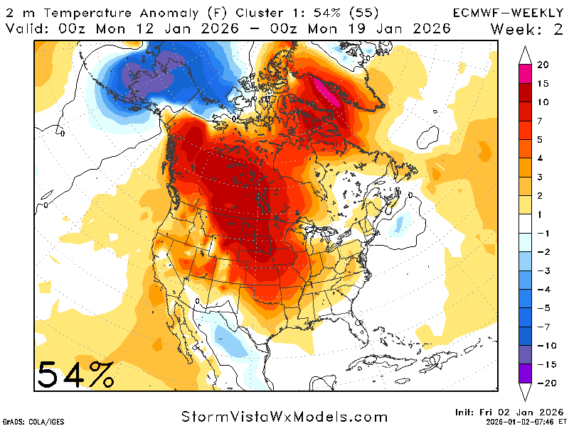
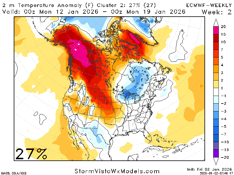
Along with the ECMWF, other models are trending toward average to warmer-than-average temperatures for this period.
Alaska is cold in the first map and warm in the second and third maps. Alaska’s temperatures can have an effect on the conditions here through the PNA, as I have mentioned in a previous post, but it is not always a major player unless the right forcing mechanisms are present.
There are countless forcing mechanisms and local conditions that affect temperatures!
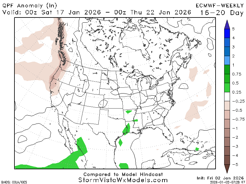
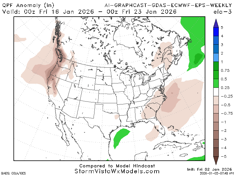
Precipitation is currently showing a 60/40 split favoring above-average amounts, and I agree with this. In the last section, we talked about the atmosphere changing aloft, which can cause precipitation, leading me to favor an above-average precipitation week.
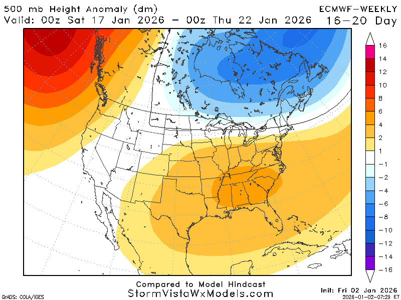
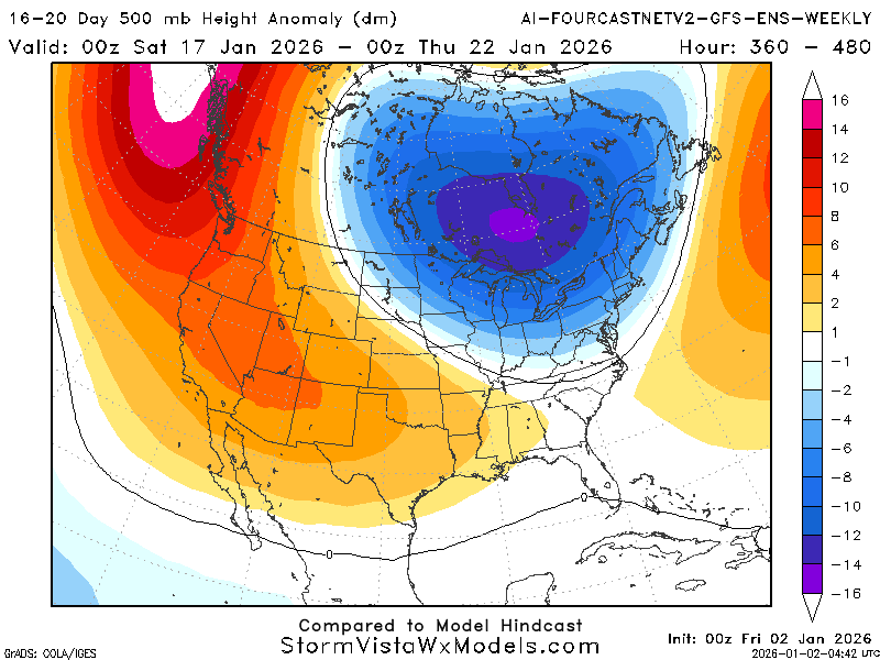
While these models do not exactly agree, they display a similar overall pattern. We are in a weak ridging pattern with a trough north of us that could cause cold air intrusions and possibilities of precipitation.
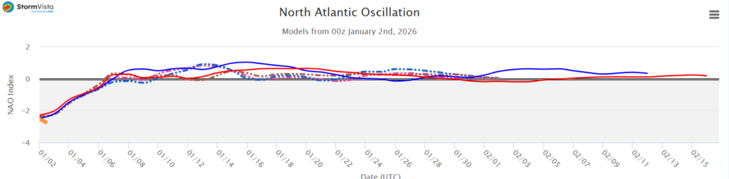
The NAO is trending neutral to slightly positive, favoring slightly warmer temperatures and slightly wetter conditions.
To recap, beyond January 16th, I would expect temperatures to be slightly warmer-than-average (around 5 degrees or so), greater chances for precipitation due to the trough north of us, and would not rule out any potential cold intrusions giving us a break from the warm spells.


