Today we can expect our regular summer weather day of a mostly sunny morning and a possible shower or thunderstorm later in the afternoon or evening. Today’s temperatures and dewpoint will be slightly cooler, with more comfortable “feels like” temperatures for much of the region. Moving into next week, a shortwave trough is forecasted to form over us, increasing our chances for all-day rain and possible storms for the week.
Today’s Setup:
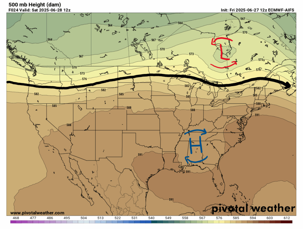
Looking at our 500 mb height chart for this morning, we can see the ridge that we’ve been under start to flatten out, and a trough beginning to form above the Midwest, starting to move toward the Northeast. This shortwave trough will deepen over us early on next week, bringing some soggy weather our way next week.
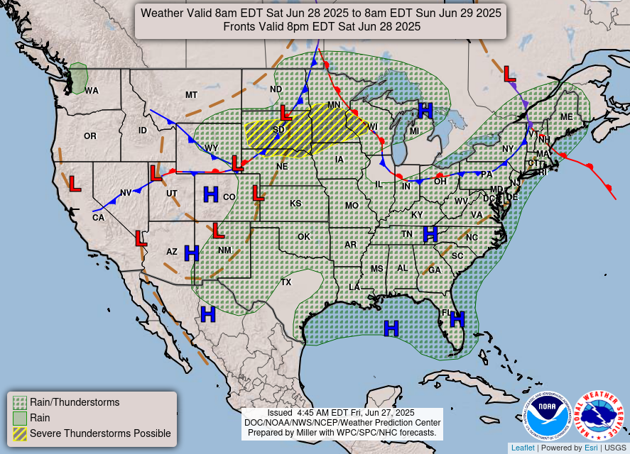
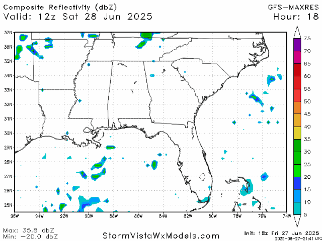
Looking at out surface chart for today, we can see that rain and thunderstorms are forecasted for our entire area, but for now it is unlikely that these storms will be severe.
This Weekend’s Weather:
Luckily, temperatures and dewpoint are cooling down, giving us a much needed break from all of the heat from this past week. Take a look at the experienced temperatures for Saturday and Sunday at noon:
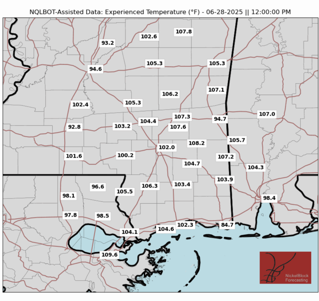
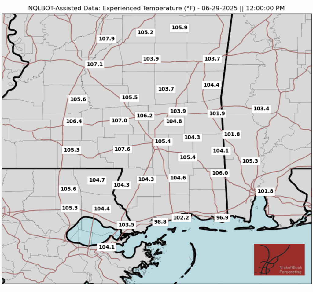
In many places, the experienced temperatures will still be pushing 100 degrees, but not reaching the 110-115 degree mark that we saw earlier this week. Still, it is important to be careful and make an effort to stay safe if you have outside activities!
Today we may have a shower or thunderstorm pop up sporadically throughout the late afternoon and evening, and tomorrow the showers will be a bit more persistent throughout the day. Check out the precipitation for today and Sunday:
Next Week’s Weather:
After the current ridge that we’ve been under flattens out, a shortwave trough will begin to form over us early next week, bringing more wet weather that may be a bit more prolonged. A stationary front is also forecast to park itself over by our area, keeping the wet weather here for a while. This means that we may be seeing more storms throughout the entire day, not just in the afternoon.
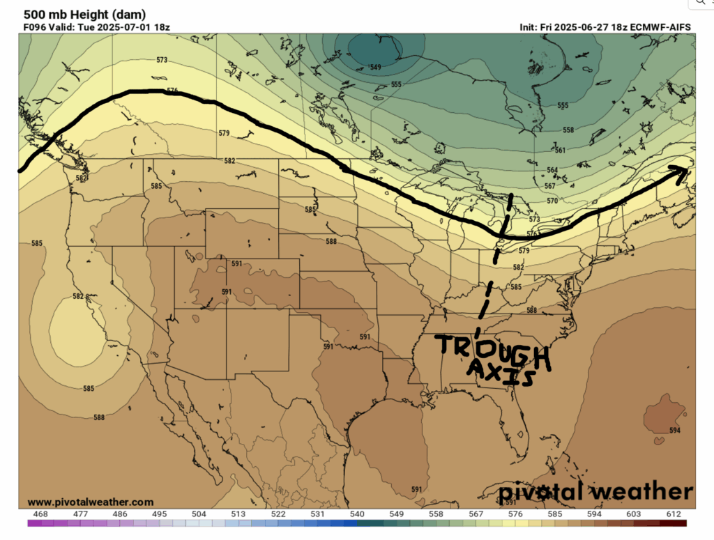
This shortwave will begin to form over the Midwest around Monday evening, and will move over our region and really deepen on Tuesday. This means that there will again most likely be an increase in rainfall and possibly severe storms. It’s hard to say if and when there are severe storms exactly, but will become more clear during the week, so make sure to stay updated on our forecasts and keep an eye out for any severe weather warnings or advisories throughout the week!
Here’s a look at the 15 Day Forecast:

Like I just mentioned, we can expect more showers and thunderstorms to roll in throughout next week, but by the weekend the trough should subside and make way for some clearer weather to move our way the following week.
On the bright side, temperatures will continue to cool off a bit this week, as temperatures and dewpoint are forecasted to decrease a few degrees, helping it feel more bearable outside than it did this past week.
You can also take a look at the Regional Day-to-Day Forecast, and stay tuned to NickelBlock for more local forecast updates!
Regional Day-to-Day Forecast:
Today: Mostly sunny in the morning with a chance of afternoon showers and thunderstorms. Highs reaching 90 degrees. Chance of precipitation 60%.
Tonight: Chance of showers and thunderstorms throughout the evening. Lows in the mid 70s. Chance of precipitation 30%.
Sunday: Chance of showers and thunderstorms throughout the day. Highs reaching 90 during the day, and lows in the low 70s at night. Chance of precipitation 80%.
Monday: Chance of showers and thunderstorms throughout the day. Highs possibly reaching 90 during the day, and lows in the low 70s at night. Chance of precipitation 70%.
Tuesday: Chance of showers and thunderstorms throughout the day. Highs reaching 90 during the day, and lows in the low 70s at night. Chance of precipitation 80%.
Wednesday: Mostly sunny in the morning with a chance of afternoon showers and thunderstorms. Highs in the low 90s during the day and lows in the low 70s at night. Chance of precipitation 70%.
Thursday: Mostly sunny in the morning with a chance of afternoon showers and thunderstorms. Highs in the low 90s during the day and lows in the low 70s at night. Chance of precipitation 50%.
Friday: Mostly sunny in the morning with a chance of afternoon showers and thunderstorms. Highs in the low 90s during the day and lows in the low 70s at night. Chance of precipitation 40%.
Saturday: Mostly sunny in the morning with a slight chance of afternoon showers and thunderstorms. Highs in the low to mid 90s during the day and lows in the low 70s at night. Chance of precipitation 20%.


