Overall Setup
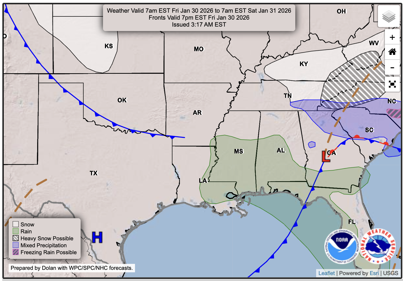
A cold front will move through tomorrow afternoon, dropping temperatures and possibly bringing a bit of rain as it passes. While it’s not impossible to see a few flurries behind the front as colder air moves in and interacts with lingering moisture, any flurries would be limited and most likely farther north.
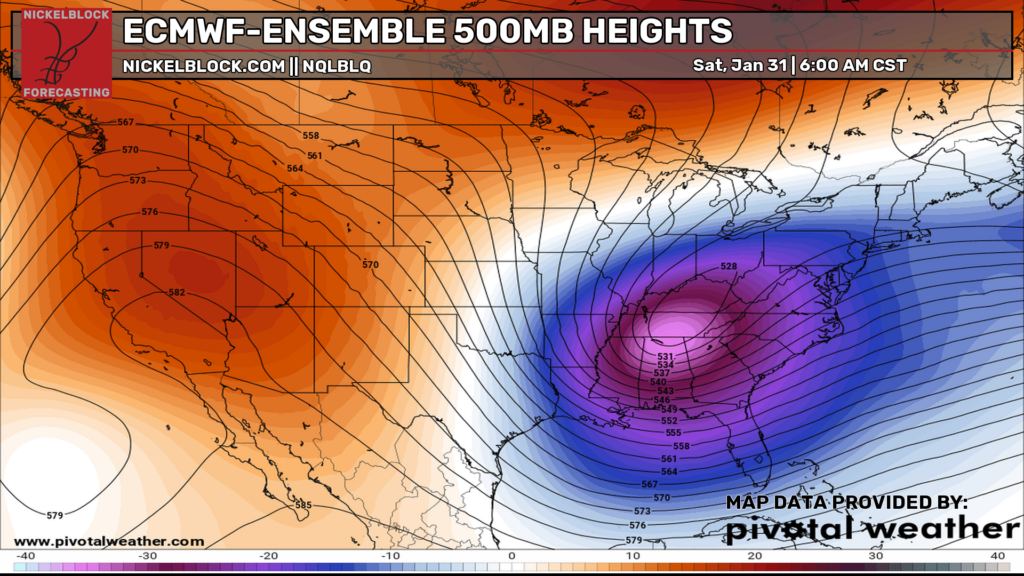
An even colder air mass is en route for Saturday, and highs may not even break freezing in some locations! Just look at how intense that trough is at 500 mb!

Tonight’s Forecast
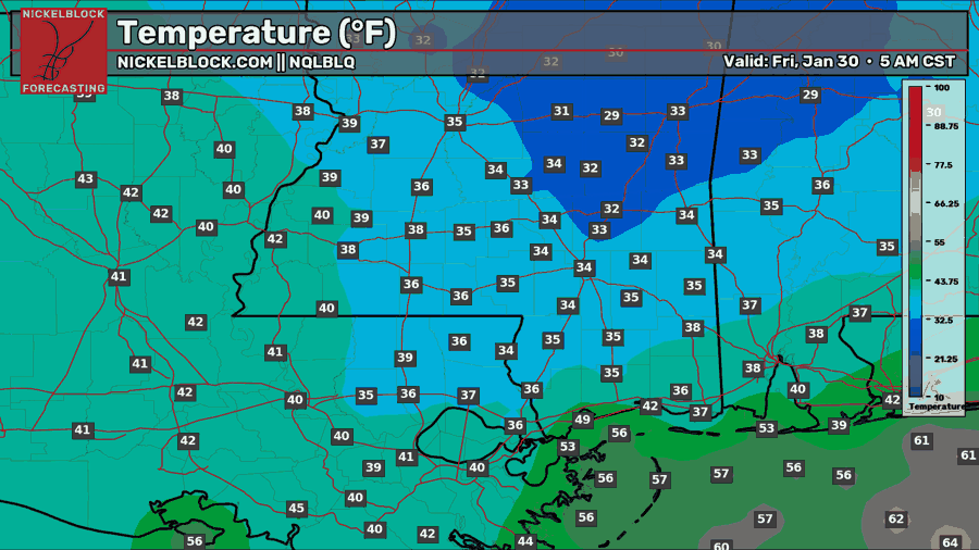
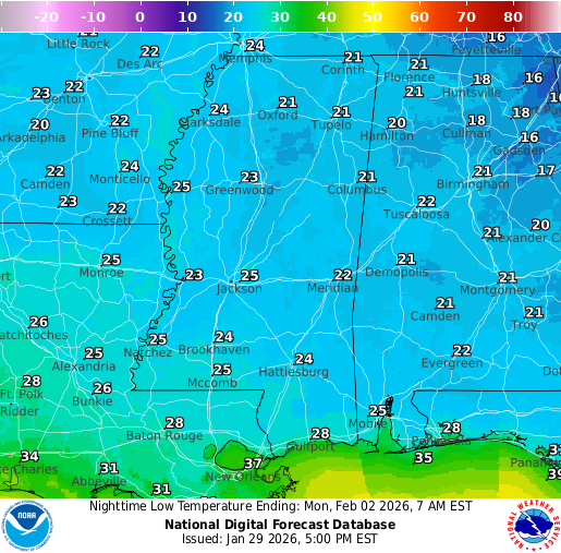
Tonight we remain chilly in the lower 30s further north and up to 40 further south. As you can see in the HRRR future radar for tonight, the squiggly ‘540’ thickness line is pushing down into our area. Usually, when you see this line, it means that very cold air is coming down with it, and wintry precip is possible at or above it. This is also easy to see, since the 540 line is the first blue colored thickness line.
Anyway, we could get some wintry precip (some flurries, mix of rain and a few flurries) tonight at or above the 540 line, as it pushes south, so don’t be surprised if you see a few. I don’t think it’s likely, but definitely possible for those closer to Jackson or further north.
Tomorrow’s Forecast: Friday, January 30
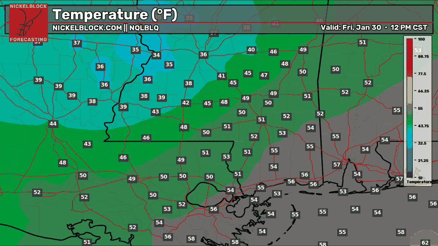

As we head into Friday, some light scattered rain is possible in the morning and afternoon before the front moves in early evening. Again, there is that slight chance of a flurry mixed in the further north you are in the morning and afternoon. High temperatures will vary by location because the front will arrive first from the northwest and then push southeast. Highs will only reach the 30s closer to Jackson, but there will be enough time to warm up before the front pushes through Hattiesburg and other locations further south, so highs there will be in the 40s and 50s!
Once the front does come through, it will come in hard – meaning winds will be gusty and temperatures will drop dramatically. Wind gusts Friday evening into Saturday morning are expected to reach 30-40 mph, so wind chills will make it feel even colder than it already will be.
Brutally Cold Weekend Ahead
Saturday
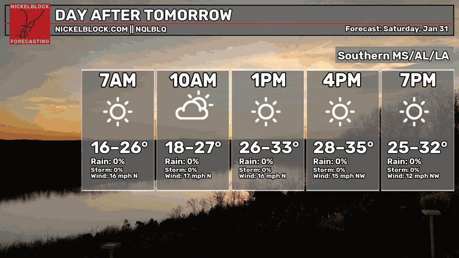

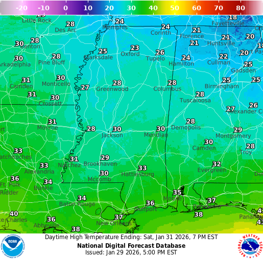
We’re talking extreme cold for Saturday as the trough of very cold air pushes down into our region. It’s hard to believe, but high temperatures will only sit in the 30s or even high 20s! Add the 30-40 mph wind gusts that come with it… experienced temperatures, or the wind chill, could reach below 0 for some locations. This is a dangerous cold that you should not take lightly.
Thankfully, this is on a Saturday morning, so most people should be home. However, if you are going out, you must ensure your body is properly protected, as frostbite and hypothermia are real risks here. The NWS in Jackson has issued an Extreme Cold Warning from 3 AM to 6 PM on Saturday, and a Cold Weather Advisory through Sunday. Stay warm!
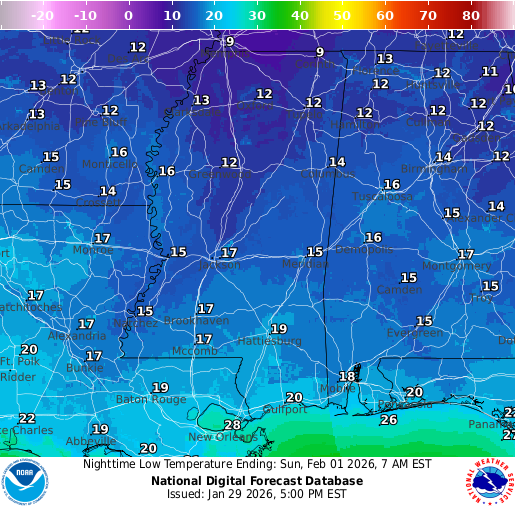
Sunday
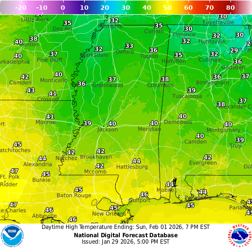
The trough of cold air will push away, and we will warm up on Sunday, but not before another morning of very cold temperatures. Highs will reach near 40 for most, and our low for Sunday night will be in the lower 20s. We are looking dry for all of Sunday.

Extended Local Outlook
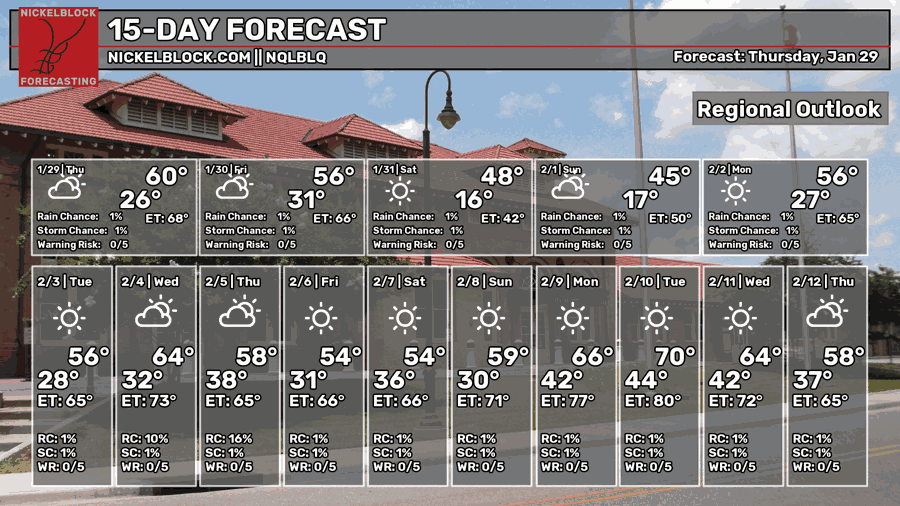
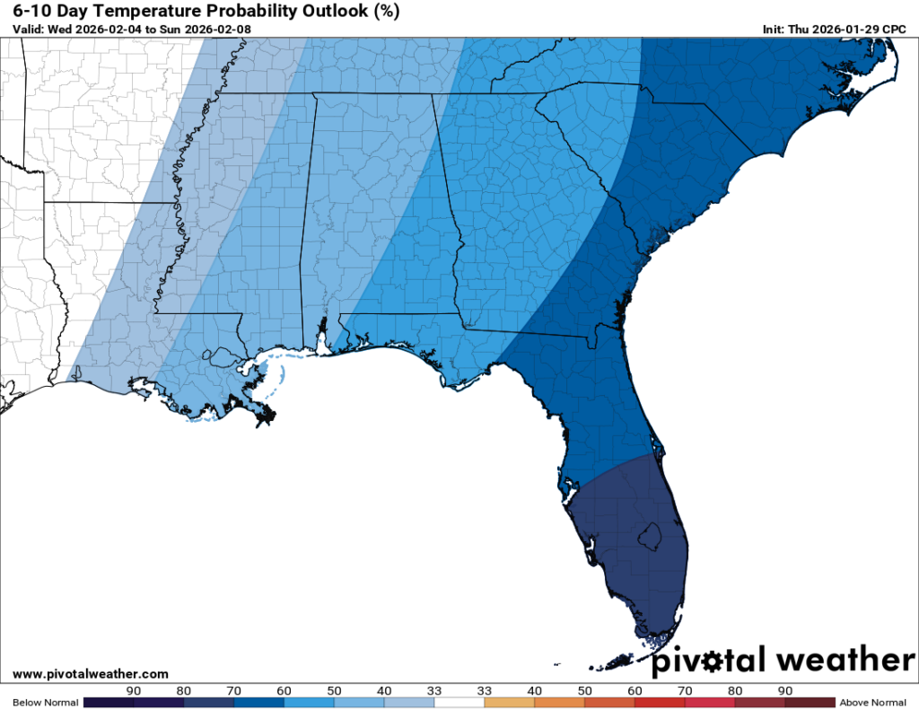
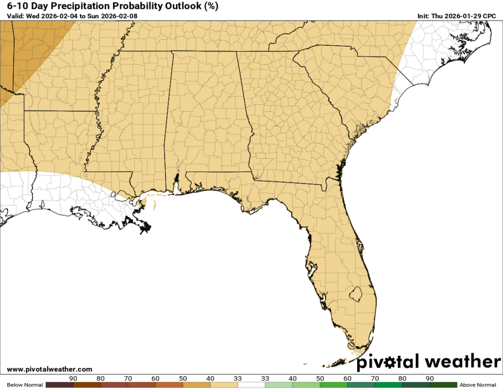
Models are picking up on maybe some rain for Tuesday or Wednesday as another front comes through. Expect our lows to remain below average for the near future, with some chilly nights and mornings throughout next week. While the 6-10 day outlook is showing below average temperatures, we are slowly moving onto the lighter blue colors as I show these maps, so maybe a return to normal or even above average as we get into the second week of February?


