Overall Setup
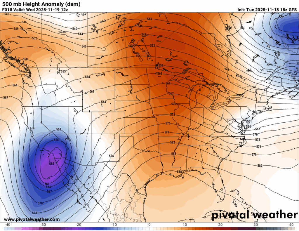

Our overall pattern has not changed much over the last week or so. We are still under a very large ridge at 500 mb and generally under high pressure at the surface. Both of these factors, along with the continued southerly flow, are responsible for the above normal temperatures and the lack of rain.
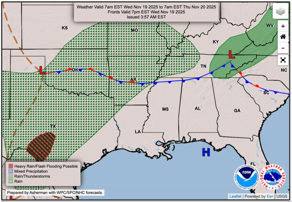
The pattern is expected to change as we get toward the end of the week. By Thursday, a low pressure system and its associated cold front will slide east from Texas, Oklahoma, and Arkansas. It will not arrive just yet on Thursday, but cloud cover will increase, and there will be a small chance for a sprinkle or two.
By Friday, the front will move through our area, but it likely will not do what many of you would hope for, which is to cool things down. Instead, it will bring a round of rain and thunderstorms. Current model guidance shows it arriving very early Friday morning and lasting through the afternoon and possibly into the early evening. Some lingering rain is possible through the rest of the weekend and into next week. I will provide a more detailed update on Thursday once we have more data, but for now, plan for a soggy Friday.

Tonight’s Forecast
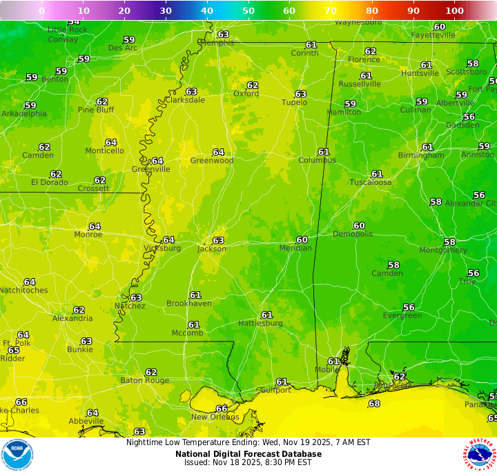
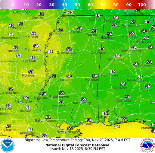
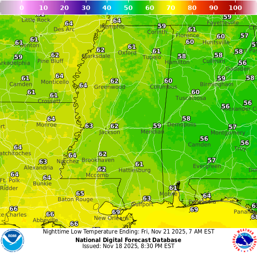
As for tonight, skies will become mostly cloudy and there is the chance of some passing showers well north in northern MS, LA, and GA. We should stay dry in the NickelBlock region (lower MS/AL/LA), but some patchy dense fog is expected to form sometime after 3am until morning. A Dense Fog Advisory is in effect from the NWS for portions of northeast Louisiana and east central, south central, southeast, and southwest Mississippi. Ensure you are driving carefully during the morning commute if the fog is still around! Low’s are a bit mild tonight, settling in the lower 60s.
Tomorrow’s Forecast: Wednesday, November 19
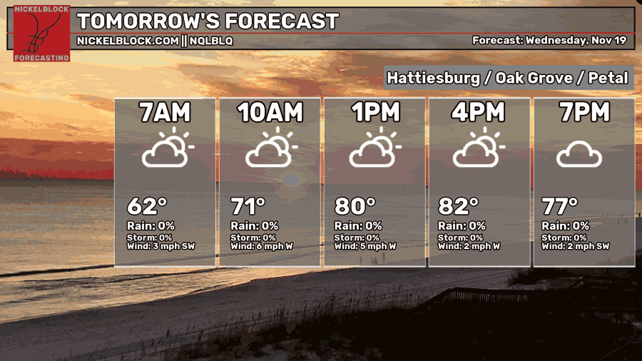
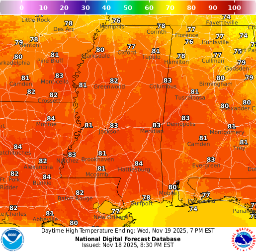
For tomorrow, Wednesday, skies will be mostly cloudy, but we should remain mainly dry, although a passing shower can’t be completely ruled out. Temperatures will stay unseasonably warm ahead of the front, with highs in the low to mid 80s, far too warm for November if you ask me, especially considering it’s 46 degrees right now here in New Jersey!
Thursday’s Forecast: November 20
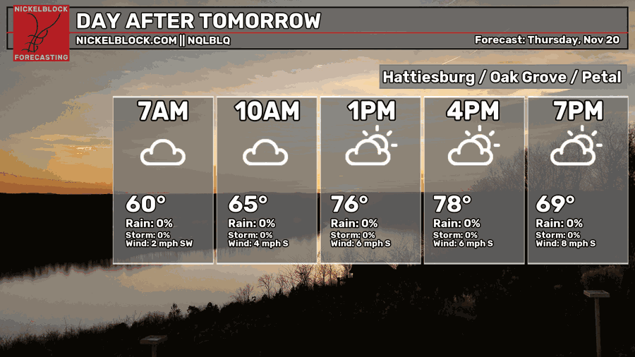
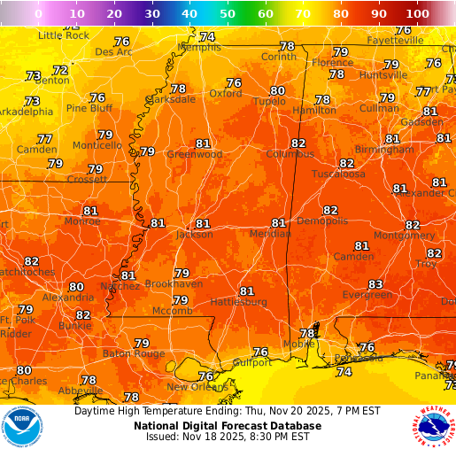
For Thursday, even more cloud cover will move in, with only occasional breaks of sunshine. Highs will reach the upper 70s to around 80. Some rain may begin sneaking into northern Mississippi during the day and continue into Thursday night as the rain is essentially on our doorstep by that point.
Extended Local Outlook
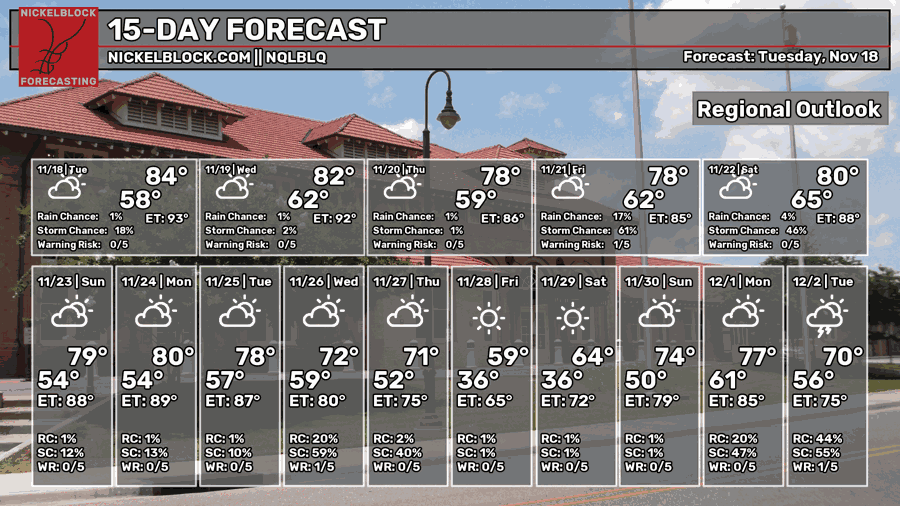
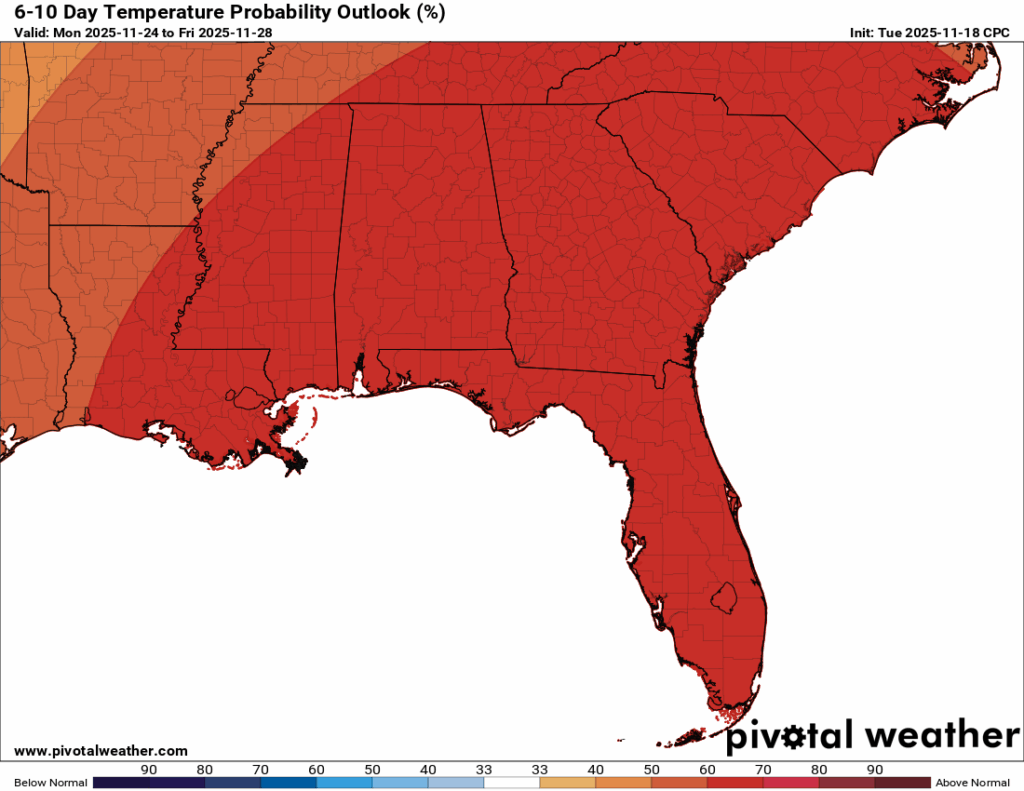
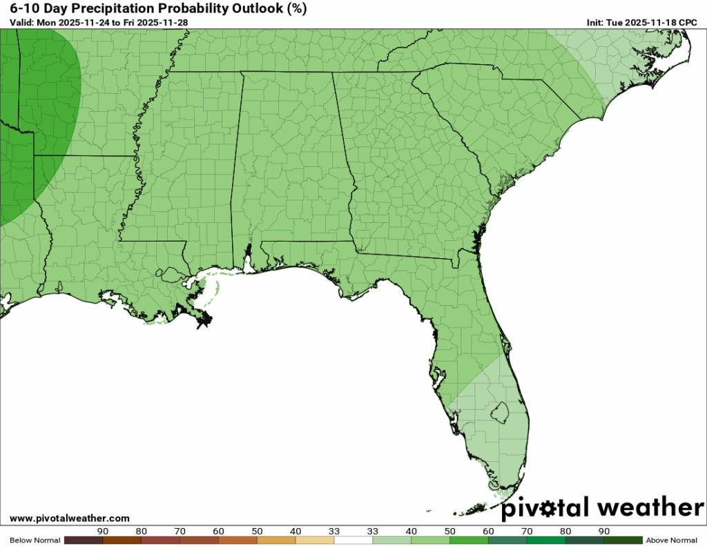
We’ll hold onto a similar temperature pattern through the middle of next week, with a trend toward more seasonable temperatures after that. Rainfall looks to stay near or slightly above average, with several systems being possible to move through as we head into next week.

REGIONAL DAY TO DAY FORECAST
Tonight: Patchy dense fog after 3am, otherwise mostly cloudy. Lows in the lower 60s. South wind around 5 mph becoming calm after midnight.
Wednesday: Areas of dense fog before 9am, otherwise mostly cloudy. Highs in the mid 80s. Calm wind becoming west around 5 mph.
Wednesday Night: Mostly cloudy. Lows in the upper 50s. Calm wind.
Thursday: Mostly cloudy. Highs in the lower 80s. Calm wind becoming south around 5 mph in the afternoon.
Thursday Night: A slight chance of showers after midnight. Mostly cloudy. Lows in the lower 60s. South wind around 5 mph becoming calm in the evening. Chance of rain 20 percent.
Friday: Showers and thunderstorms, then showers likely in the morning into the afternoon and early evening. Mostly cloudy. Highs near 80. South wind 5 to 10 mph. Chance of rain 80 percent. Rainfall between one-quarter and one-half inch possible.
Friday Night: A slight chance of showers before midnight. Mostly cloudy. Lows in the mid 60s. South wind around 5 mph. Chance of rain 20 percent.
Saturday: A chance of showers and thunderstorms after noon. Partly sunny. Highs in the lower 80s. West wind around 5 mph. Chance of rain 30 percent.
Saturday Night: Partly cloudy. Lows in the mid 50s. West-southwest wind around 5 mph becoming calm.
Sunday: Mostly sunny. Highs in the upper 70s.
Sunday Night: Mostly cloudy. Lows in the mid 50s.
Monday: A slight chance of showers. Mostly sunny. Highs in the upper 70s. Chance of rain 20 percent.
Monday Night: A chance of showers. Mostly cloudy. Lows in the upper 50s. Chance of rain 30 percent.
Tuesday: A chance of showers. Partly sunny. Highs in the mid 70s. Chance of rain 40 percent.


