Bad joke, I know, but it’s definitely going to be much hotter for the latter half of May! Temperatures are beginning to ramp up and they’ll likely stay that way for a while. The “heat dome” isn’t exactly here like it is in August to September, but a building high pressure system in the Atlantic will keep the temperatures much hotter along with some upper air influence.
The rest of the week will be warm and gusty thanks to the gradient between the high and low pressure systems. A low pressure system will continue to rotate across Minnesota to the Great Lakes at the surface while the Atlantic high pressure will slowly move west towards the southeastern US. Due to this, we’ll have increasing temperatures and wind gusts up to 20mph during the day. Highs will reach the low 90s tomorrow and lows will increase from the upper 60s to low 70s. Expect some patchy fog Thursday morning.
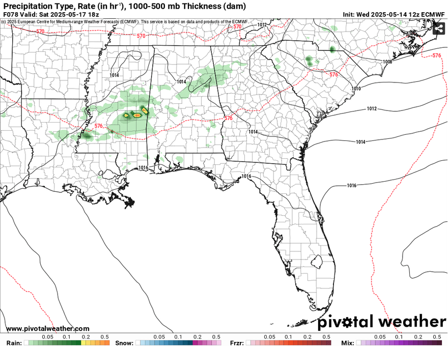
Since the high is moving west, it also decreases rain chances, but that doesn’t mean a few showers and thunderstorms won’t sneak in. The MCS that develops from the front in the mid-South will move southeast, however it will lose most of its strength by the time it passes I-20. A few leftover showers and thunderstorms may be possible during the day, but these look fairly isolated. Another line of storms rolls in from the west overnight and into the afternoon hours, but these look to dissipate by the time they reach us as well. Highs will be in the low to mid 90s and lows in the low 70s.
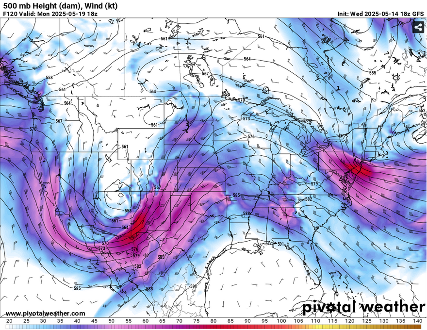
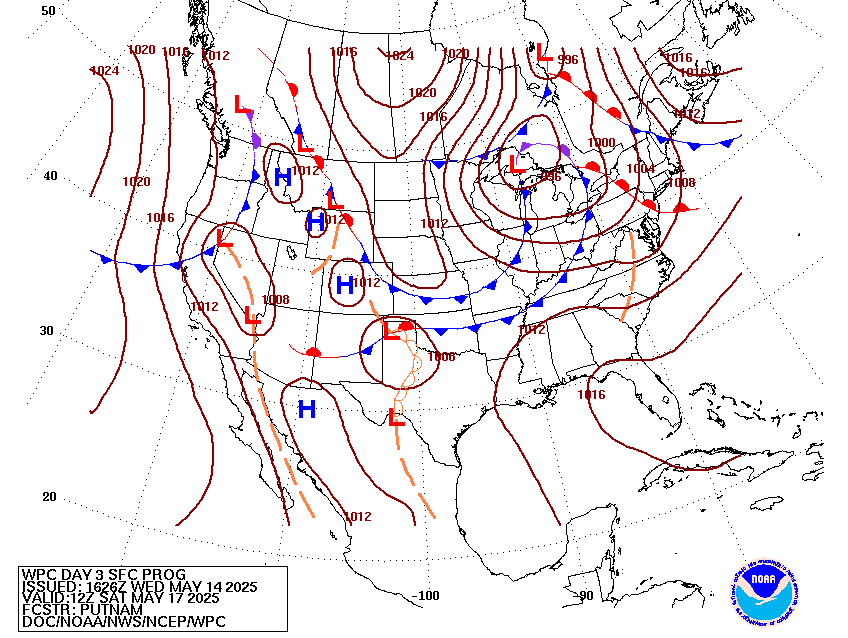
After this, a front that’s located towards the Rockies that tailed the Great Lakes low will stall from the high pressure zone in the Gulf. The upper levels show a ridging pattern that will move more troughs further west and eject them northwards. Monday and Tuesday are much quieter with slim chances of rain, but hot. By Wednesday, we’ll see a slight chance of rain as the trough ejects and the front moves further east. This looks to be a dissipating line, but we will likely see a few showers and thunderstorms.
Select Data Set:

Regional Day-to-Day Forecast
Tonight – Increasing clouds, with a low in the mid 60s. South wind 5 to 10 mph, with gusts as high as 20 mph.
Thursday – Patchy fog before 8am. Otherwise, mostly cloudy, then gradually becoming sunny, with a high in the low 90s. South southwest wind around 10 mph, with gusts as high as 20 mph.
Thursday Night – Mostly cloudy, with a low in the low 70s. South wind around 5 mph.
Friday – Mostly cloudy, then gradually becoming sunny, with a high in the low 90s. South southwest wind 5 to 10 mph, with gusts as high as 20 mph.
Friday Night – Partly cloudy, with a low in the low 70s. South wind 5 to 10 mph, with gusts as high as 20 mph.
Saturday – A 20 percent chance of showers and thunderstorms in the afternoon. Mostly sunny, with a high in the low 90s. Southwest wind 5 to 10 mph.
Saturday Night – Partly cloudy, with a low in the low 70s. South southwest wind around 5 mph.
Sunday – Mostly sunny, with a high in the low 90s. Light south southwest wind increasing to 5 to 10 mph in the morning.
Sunday Night – Partly cloudy, with a low in the low 70s. South wind around 5 mph becoming calm after midnight.
Monday – Mostly sunny, with a high in the low to mid 90s.
Monday Night – Mostly cloudy, with a low around 70.
Tuesday – Mostly sunny, with a high in the low 90s.
Tuesday Night – Partly cloudy, with a low in the low 70s.
Wednesday – A 30 percent chance of showers and thunderstorms. Mostly sunny, with a high in the low 90s.


