General Central/Eastern Kansas Forecast
Short-Term (Wednesday-Thursday)
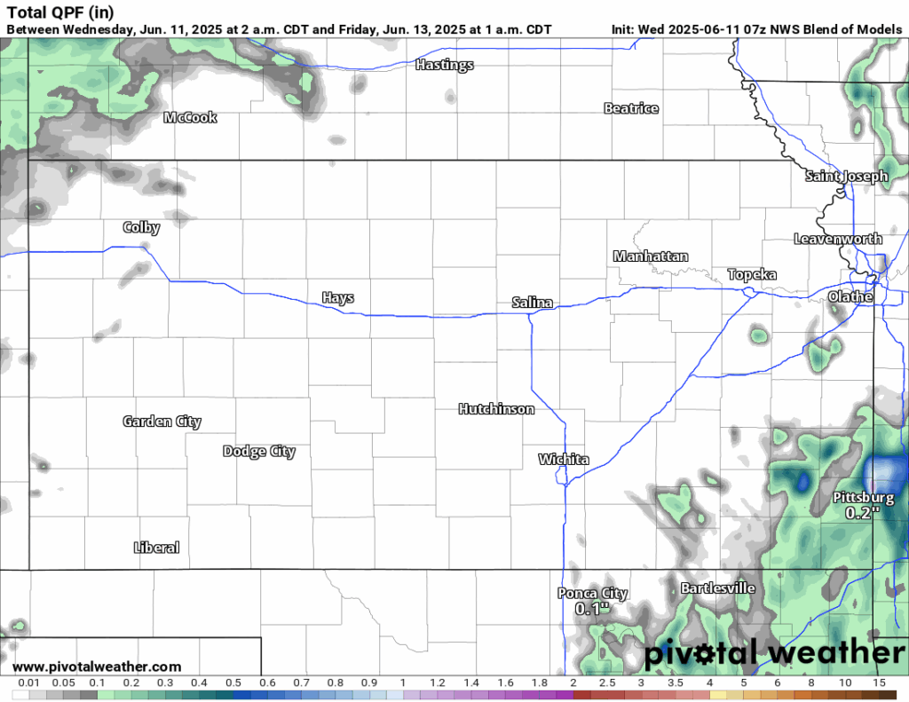
The heat continues to rise through the short-term period, as high-pressure spreads over the state. Temperatures throughout the day today will reach the upper 80s to low 90s, with southerly winds of 5 to 10 mph. These southerlies will also cause the moisture content in the air to increase as gulf moisture streams northward. Relative humidity values in response will increase somewhat to between 30-50%, with drier conditions to the north and west and moister conditions to the south and east. This moisture, and a weak low-pressure system working its way east through northern Oklahoma may provide enough of a bump to trigger isolated showers across portions of southeast Kansas (generally east of US-169). Otherwise, temperatures during the night tonight will cool down to the upper 60s.
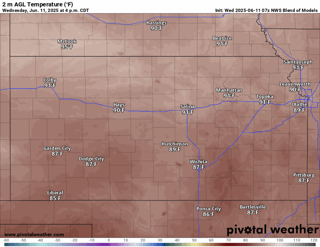
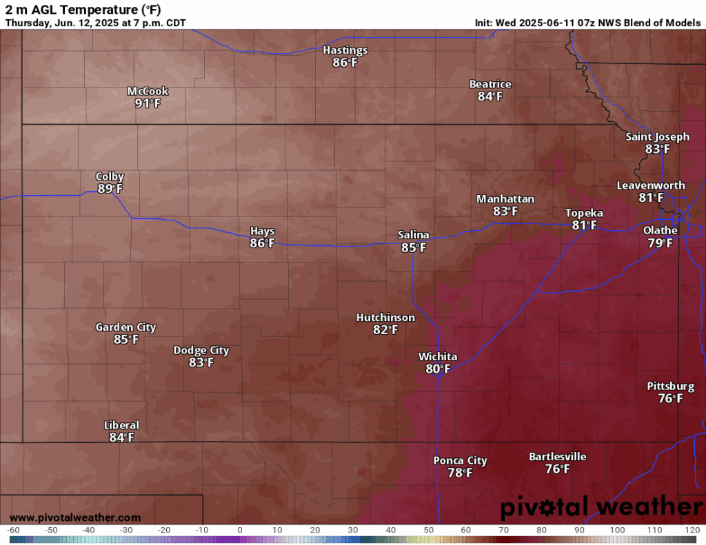
Thursday, stronger ascent from this low-pressure system may trigger more scattered showers across southeast Kansas, especially for areas along and south of US-400 and east of US-75. These scattered showers may last through the afternoon before tapering off by the evening hours. Otherwise, largely dry conditions will remain for the region once again, with high temperatures in the upper 70s to mid 80s (although those in southeast Kansas may only reach the mid 70s due to cloud cover). Winds will remain south southeasterly at 5 to 15 mph. Moisture return will continue and further increase our relative humidity values to between 45-70%.
Long-Term (Friday-Tuesday)
The low-pressure system off to our south will exit our area of influence by Friday and behind it, higher pressure will try to overspread the state. Some lingering showers and thunderstorms may try to enter in behind this system early Friday morning as a weak trough of low pressure enters in from the northwest. Nothing more than light rain showers, if any, would be expected from this little disturbance. Otherwise, Friday will mark the start of another period of warmer temperatures and dry conditions, as highs will regularly reach the upper 80s to low 90s. Heat indices may become more of an issue by the end of the weekend and into next week, with signs of mid 90s possible. By early next week, the high-pressure system looks to break down and allow for more disturbances from the west to approach the Great Plains and potentially increase our rain potential.
Regional Soil Condition Forecast
Around Scranton

Around Burlington
Around Altoona
Around Westmoreland