Not too much has changed for the forecast back on Friday. We’ll still see temperatures steadily increase by mid-week with hardly a cloud in the sky. Conditions will also warm up a bit as the north wind shifts towards the east by the end of the week.
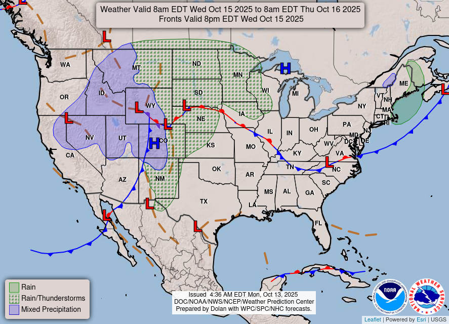
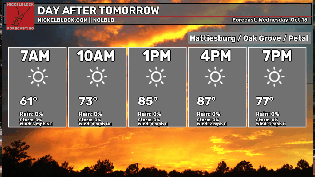
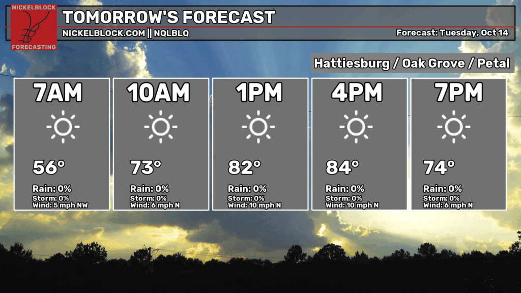
A large dome of high pressure is currently moving towards the south from Canada and will keep things dry for the next several days. Highs will range from the mid 80s tomorrow to the upper 80s by Friday. Lows will also slowly climb from the upper 50s to the low 60s. Winds will shift from the north to the east northeast and eventually the southeast by the weekend.

I’m sure many have already alluded to the possible severe weather on Saturday into Sunday. The SPC has already laid out a 15% severity for much of the middle Mississippi/Ohio/Arkansas River valley area. Most of the severe weather is relegated to that area, however some parts of Mississippi and Louisiana may also see some strong thunderstorms with some possible severe weather as well.
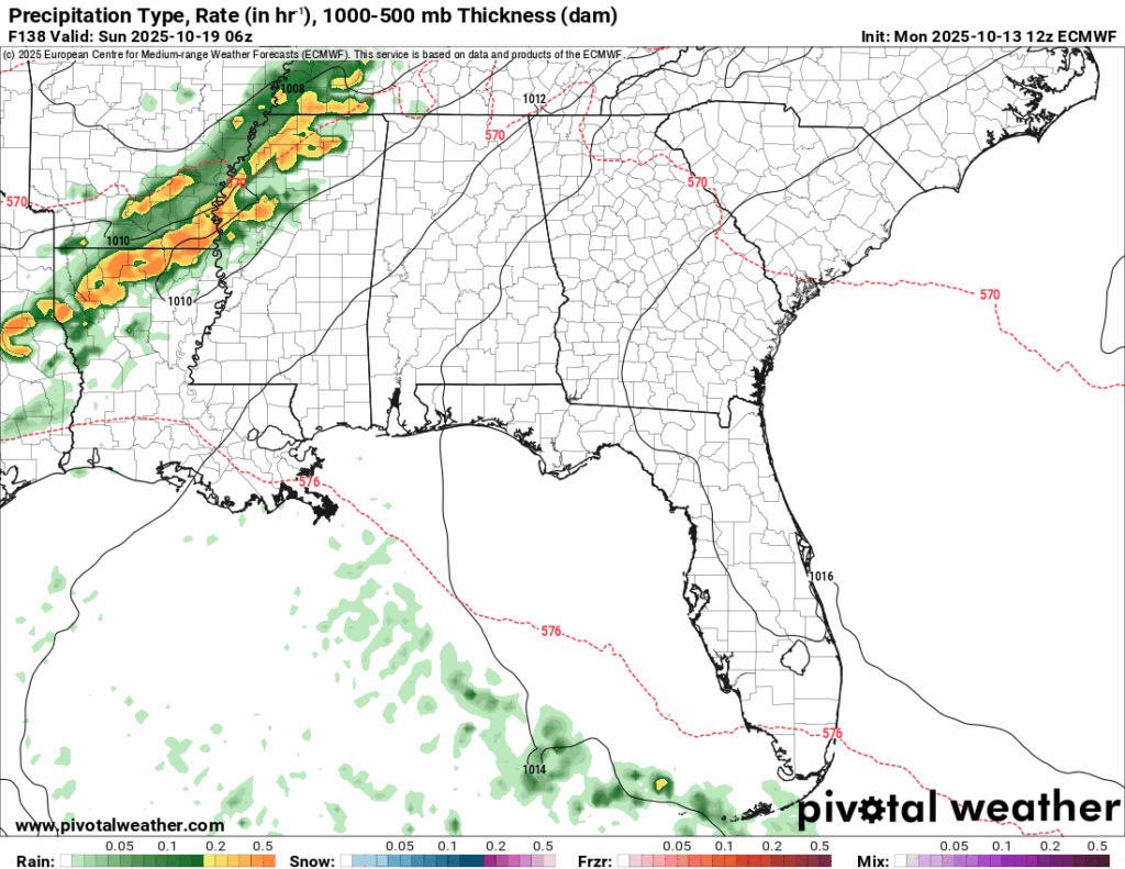
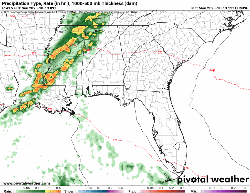
Parameters look fairly modest for now with modest convection and helictite. Dewpoints hover around the upper 60s to low 70s. Some possible good news is that the high pressure system that’s moving east may hinder some of the severe weather development as the main line moves further east. I’ll have an update on it by Wednesday.

Tomorrow’s Forecast
Wednesday’s Forecast