Overall Setup
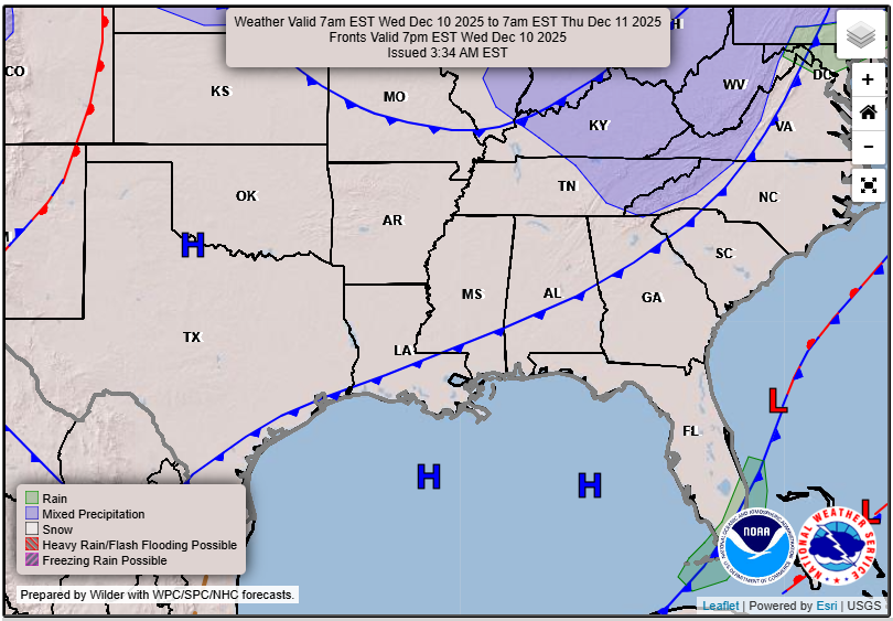
High pressure has moved into our area and has cleared up the skies, leaving us with a pleasant night ahead. Do you see that blue cold front in the surface chart? While it is a dry front and there will be no rain to worry about with it, it will bring in some gusty winds throughout the day tomorrow, gusting as high as 20-30mph at times. Ensure your decorations are secure from the morning through the early evening hours.
Overall, we are expected to stay dry through the middle and end of the week. By Saturday, a piece of energy could bring some scattered showers to our area and limit our sunshine for the day. The models currently have us raining Saturday night into Sunday morning through the early afternoon. This doesn’t look like a complete washout event, but something more scattered in nature.

Tonight’s Forecast
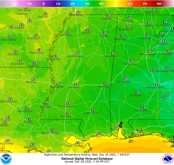
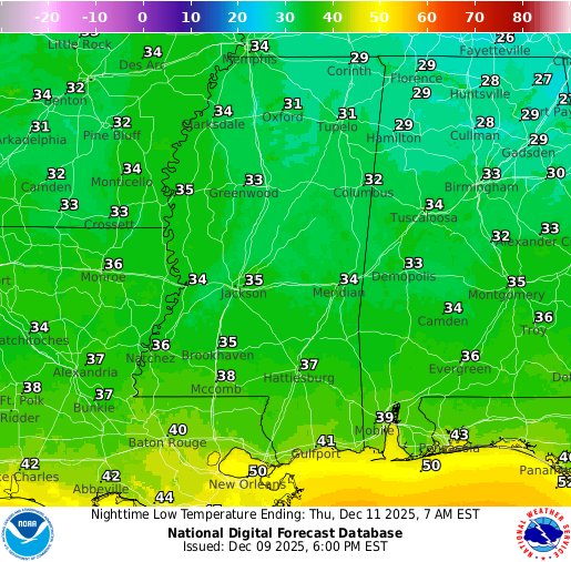
Tonight, we’re expecting a low temperature somewhere in the high 30s for the mainland, and closer to the mid to upper 40s for those near the coast. While we will stay dry, there will be some patchy fog that will be out and about, so be cautious if you will be driving overnight through the area.
Tomorrow’s Forecast: Wednesday, December 10
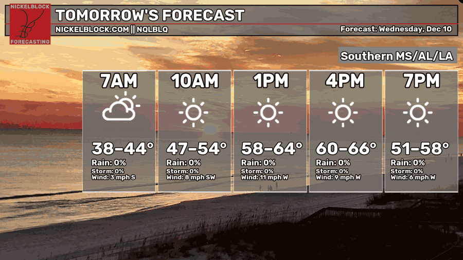
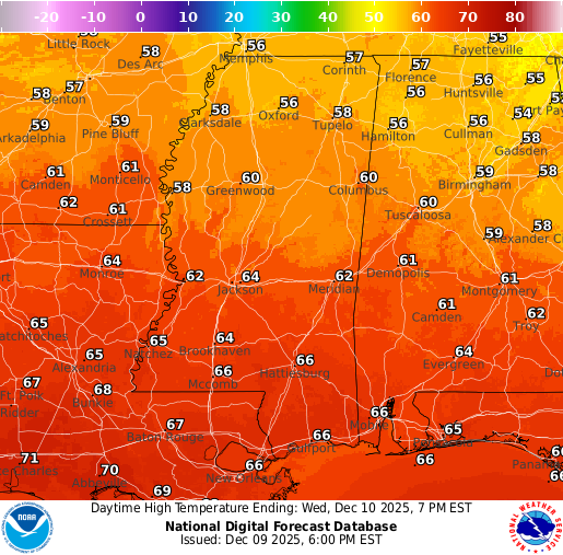
By tomorrow, the fog should burn up by 8am or so, then leaving us with clear skies for the remainder of the day. Temperatures should top out in the low-to-mid 60s for most of us, with that southerly flow. As I mentioned above, we’re expecting a windy morning, afternoon, and early evening. Winds could get quite gusty! We’ll see a similar low temperature for tomorrow night as well.
Thursday’s Forecast: December 11
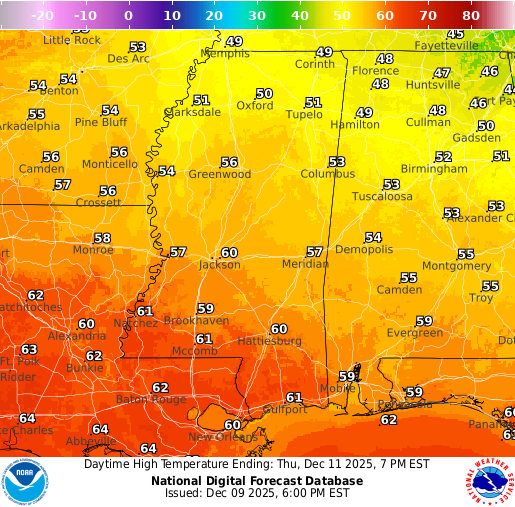
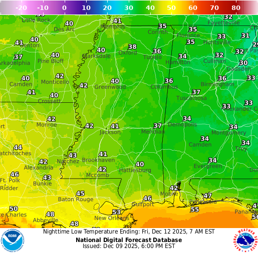
For Thursday, we’ll see temperatures closer to average, in the high 50s and low 60s. This is due to a shift in the wind direction, since we will be behind the front at this point and we will have a northwest flow. We will continue to stay dry with clear skies. Overnight low’s will be in the lower 40s for the mainland, and closer to 50 near the coast.
Extended Local Outlook
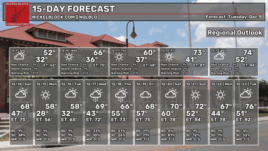
We are warming up a bit for Friday as we return back to a southerly flow, with a high in the low 70s. A similar temperature for Saturday, but maybe slightly warmer as that piece of energy comes into the picture and brings us that chance of rain into Sunday morning.
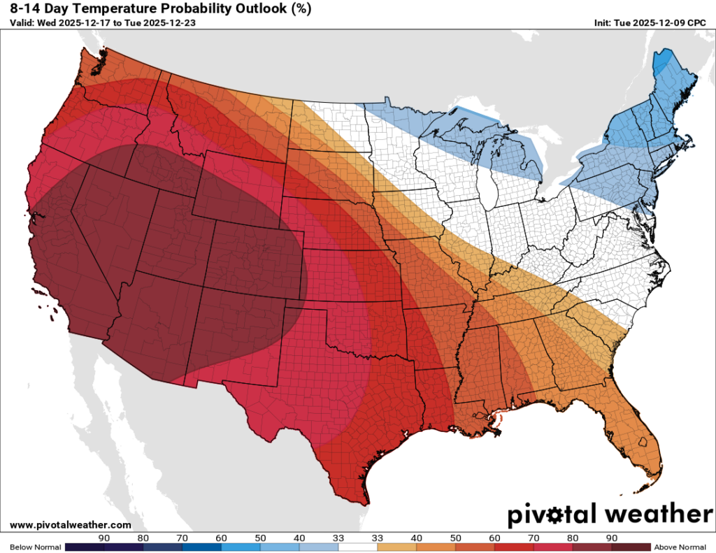
The 6-10 day outlook from the CPC has us near average for our temperature and precipitation, but the 8-14 day outlook is showing that warmup mid-December that we have been mentioning. We’ll see a large ridge forming in the west as the month progresses and we will feel it’s influence – all while the upper midwest and the northeast stay cooler than average and with an active storm track under large-scale troughing.

REGIONAL DAY TO DAY FORECAST
Tonight: Patchy fog after midnight. Mostly clear. Lows in the upper 30s. Calm wind becoming south around 5 mph.
Wednesday: Patchy fog before 8 a.m., then sunny. Highs in the mid 60s. South-southwest wind 5 to 10 mph becoming west in the afternoon. Winds could gust up to 30 mph.
Wednesday Night: Mostly clear. Lows in the upper 30s. West-northwest wind around 5 mph becoming calm in the evening.
Thursday: Sunny. Highs near 60. Calm wind.
Thursday Night: Mostly clear. Lows around 40. Calm wind.
Friday: Mostly sunny. Highs in the lower 70s. Calm wind becoming south-southwest around 5 mph.
Friday Night: Partly cloudy. Lows in the lower 50s. Calm wind.
Saturday: Mostly sunny. Highs in the low-to-mid 70s. Calm wind becoming south around 5 mph in the morning.
Saturday Night: A chance of showers late evening into the overnight. Partly cloudy. Lows in the lower 50s. South wind around 5 mph becoming calm. Chance of rain 40 percent.
Sunday: Chance of showers through the early afternoon, then partly sunny. Highs in the mid 60s. Chance of rain 40 percent.
Sunday Night: Partly cloudy. Lows in the upper 30s.
Monday: Mostly sunny. Highs near 59.
Monday Night: Mostly cloudy. Lows in the lower 40s.
Tuesday: A slight chance of showers. Partly sunny. Highs in the lower 60s. Chance of rain 20 percent.


